| Weather pictures & report of January 13 2010 |
| Snow related to warm occlusion. |
| Synopsis: at 500 hPa, related to a cut-off low south of Iceland, the passage of a relaxing upper trough. At surface this was indicated by an occlusion with behind warmer air making an end on a ten day cold wave which started on January 3 2010 reaching a climax on January 9 2010. All pictures were taken at Kampenhout (central Belgium), hours in local time (CET). |
 |
|
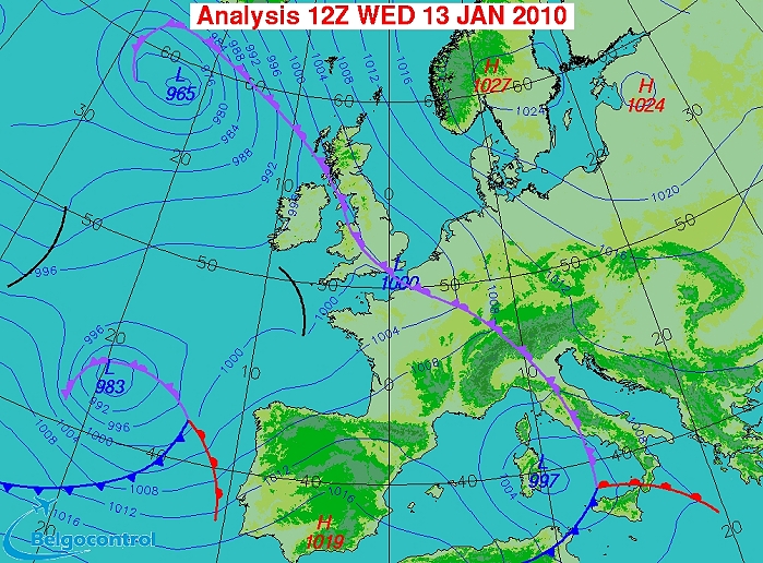
Surface analysis of January13 2010 at 1300 CET. Related to a low south
of Iceland, an incoming occlusion along the French-Belgium border with
behind milder air. (Source chart: Belgocontrol)
|
|
Loop of 8 surface analyses (of 08, 09, 10, 11, 12,13,15 and 17 CET) with weather plots
showing the slow movement of the wintry
precipitation belt towards the northeast with gradually rising temperatures. (Source: meteocentre.com)
|
 |
|
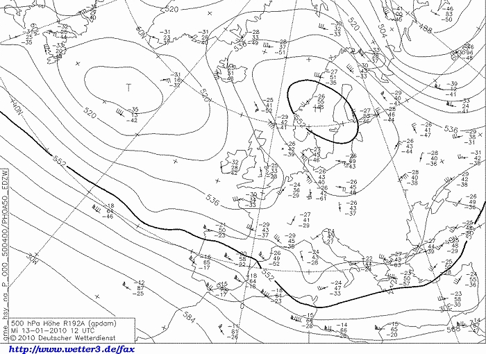
Upper air analysis 500 hPa of January 13 2010 at 1300 CET. Related to a
cut-off low south of Iceland, the axis of a relaxing upper trough
crosses the Low Countries. Its movement was quite slow as blocked by a
high over Scandinavia. The baroclinic band still staying well south, namely
over the Mediterranean area.
(Source chart: DWD via wetter3)
|
 |
|
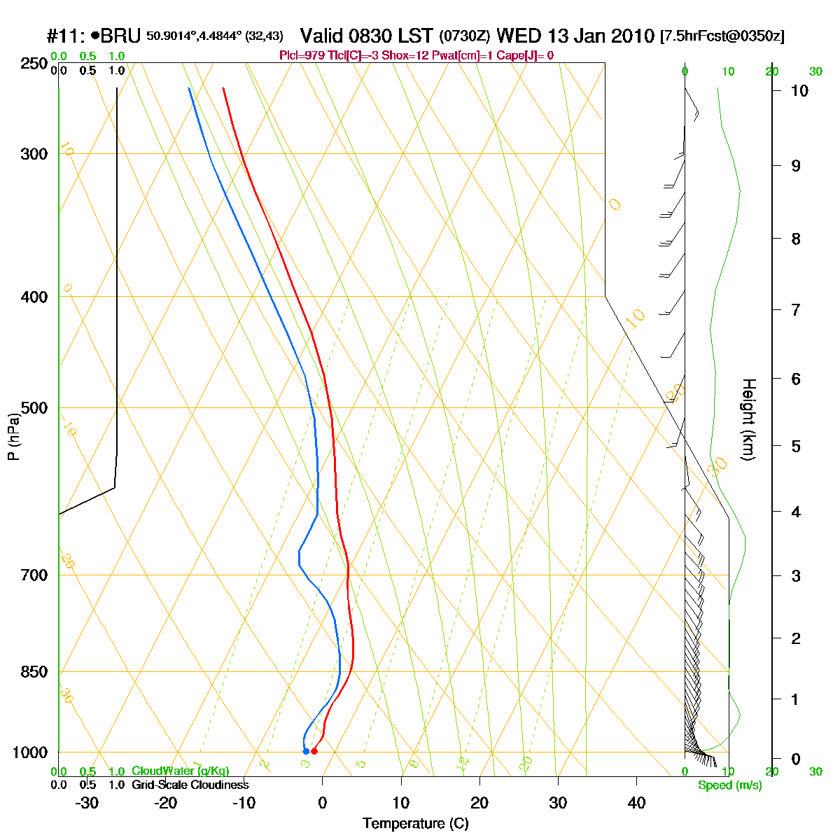
Loop of forecasted soundings for Brussels of January 13 2010 between
0830-1900 CET. At first the entire layer saturated with subzero temperatures, so
possible precipitation is 100% under solid form. From 1300 CET onwards
temperatures at the bottom layer becomes positive (in reality is was a
couple hours delayed). From 1800 CET onwards the entire layer below
1000 m became slightly positive and this was (also in reality) the start of possible
precipitations under liquid form. (Source: RASP)
|
|
Another loop of forecasted soundings for a 24 hours period (in steps of
three hours) of Brussels from January 13 2010, 0400 CET onwards. It gave a
slightly better forecast on how things in reality were between 1300-1900 CET. (Source: weatheronline.co.uk)
|
 |
|
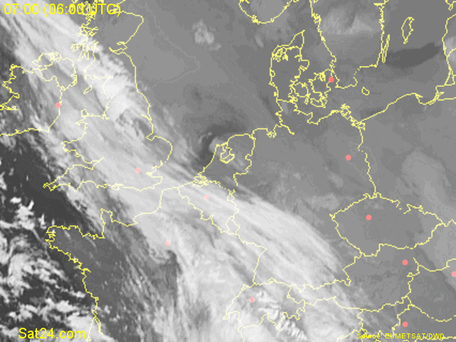
13/01/2010 0700-0845 CET. Satellite loop in the infra-red channel
showing a rather huge cloud canopy coming in over Belgium. (Source sat
picture: Eumetsat via Sat24.com)
|
 |
|
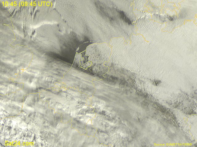
13/01/2010 1045-1230 CET. Satellite loop in the visible channel showing
the incoming mass of stratiform cloudiness over the southern parts of the Benelux.
Northern Holland still cloud free giving a final glimpse on
the snow cover. (Source sat picture: Eumetsat via
Sat24.com)
|
Radar loop (rainfall rate in mm/hr) of January 13 2010 between 0540-1500 CET. A rather scattered and not so intense precipitation belt moved northwards, producing around 1 cm of fresh snow in most parts of Belgium. (Source radar picture: Belgocontrol)
|
Some metars (hours in UTC) of Brussels Airport (EBBR). Translation: copy
paste each obs via
metar-decoder
|
|
Time lapse of webcam images between 0843-1400 CET showing how some light snow added
1 cm to the already present 6 cm. The sun was even briefly present.
|
 |
|
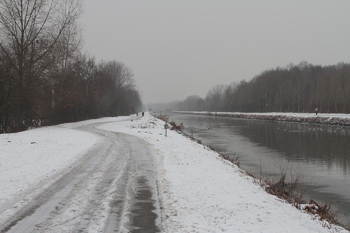
13/01/2010 1045. A small drive to het Kanaal Leuven-Mechelen produced
this shot: no frozen water as the previous four days there was hardly frost.
|
 |
|
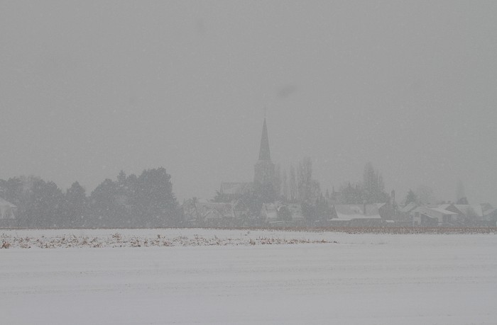
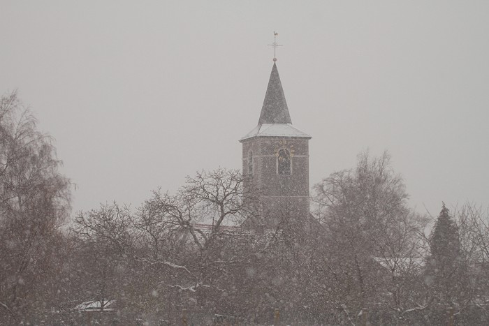
13/01/2010 1119 E. Bit later some thicker snow flakes came down, here a
view from distance on the church of Kampenhout.
|
 |
|
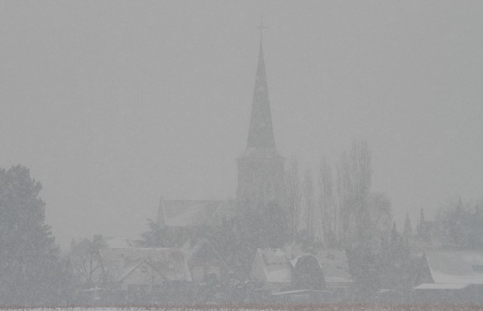
13/01/2010 1120 E. Closer inspection as telezoomed.
|
 |
|
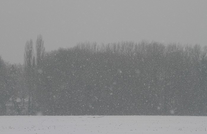
13/01/2010 1125. Another church: this one is located at Berg (Kampenhout).
|
 |
|
13/01/2010 1130.
|
 |
|
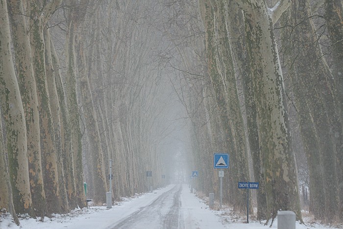
13/01/2010 1136. Telezoomed view into "den Dreef", to bad of all these
disturbing road signs.
|
 |
|
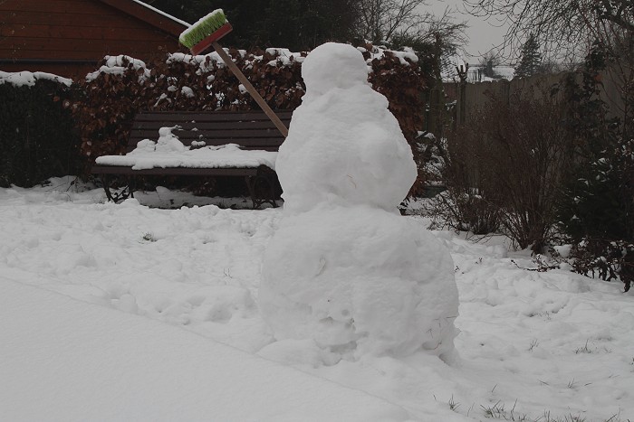
13/01/2010 1312. Created by the children on January 10 2010, it gave his
spirit one week later. The final witness of an interesting 10 day cold
wave.
|