| Weather pictures & report of June 18 2012 |
| MCS (squall line) thunderstorm along wave top of cold front. |
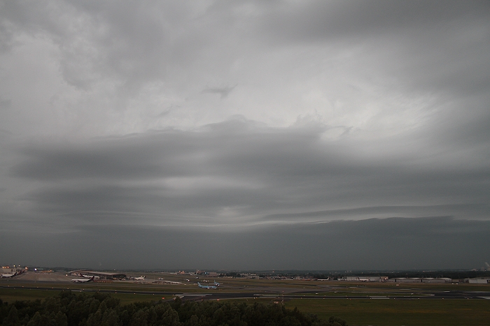
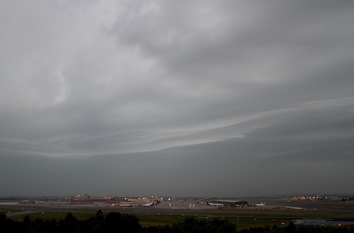
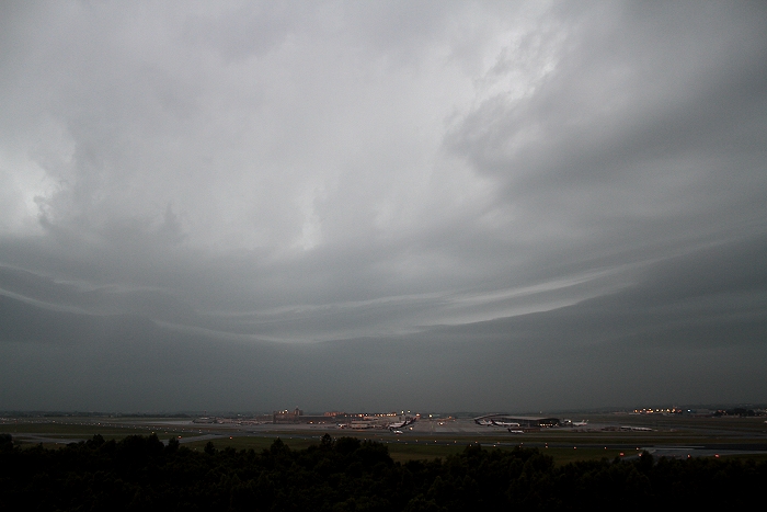
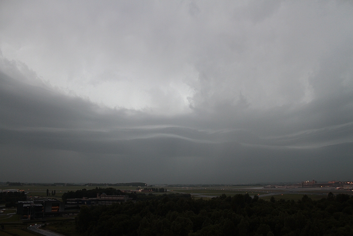
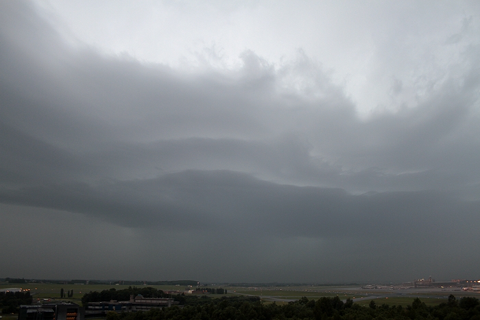
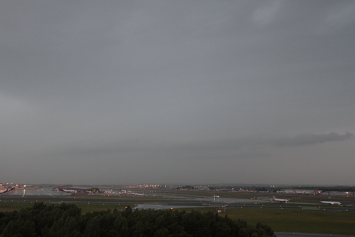
| Synopsis: at 500 hPa, Belgium east of an long wave upper trough. During the morning, a a stro,g SW'ly flow, a wave on the polar cold front crossed central parts of Belgium. East of it advection of warm, moist and potentially unstable air. In this system an MCS (squall line) did form and when moving over the eastern parts of Belgium it took the shape of a bow echo. It resulted locally in wind damage due to some downbursts, highest wind speed detected by the official weather stations was even 59 kt at Florennes. At my location, a heavy shower passed (rain rate 94 mm/h) with weak to moderate thundery activity and gusts not exceeding 25 kt. Also a shelf cloud could be detected just ahead of the system. All pics taken at Steenokkerzeel (central Belgium), hours in local time (CET). |
 |
|
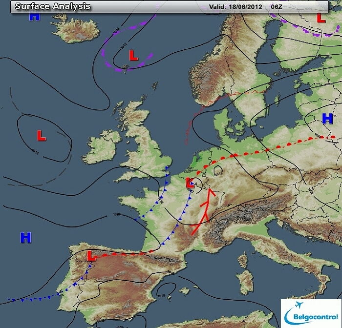
Surface analysis of June 18 2012 at 0800 CET. In a SW'ly flow, a wave on
the polar front was crossing over the center of Belgium. (Source chart: Belgocontrol)
|
 |
|
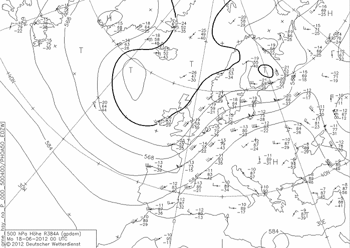
Upper air analysis 500 hPa of June 18 2012 at 0200 CET. Major trough
between Scotland and Iceland. A weak mobile ridge crossed Belgium early
night in a
strengthening SW flow. A short wave trough over SW France was
approaching fast, reaching Belgium in the morning (Source chart: DWD via wetter3)
|
 |
|
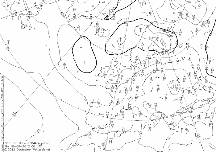
Upper air analysis 850 hPa of June 18 2012 at 0200 CET. Recognizable
again the major trough north of the British Isles with a smaller one extending towards
the Bay of Bisaye. Belgium in a moderate S'ly flow advecting warm air
over the eastern parts
(13°C). (Source chart: DWD via wetter3)
|
|
Loop of forecasted soundings for a 12 hours period (in steps of
three hours) of Brussels from June 17 2012, 2300 CET onwards. Included
are some thunderstorms indices: most unstable surface based CAPE went up
to almost 170 J/kg, KI
30, TT 49, LI -0. It meant a rather weak convective potential but with a dynamical
trigger it still could lead to scattered
thunderstorms. SREH up to 300 m²/s², in combi with the rather weak CAPE, the environment would be favorable for multicell
thunderstorms. (Source: weatheronline.co.uk)
|
 |
|
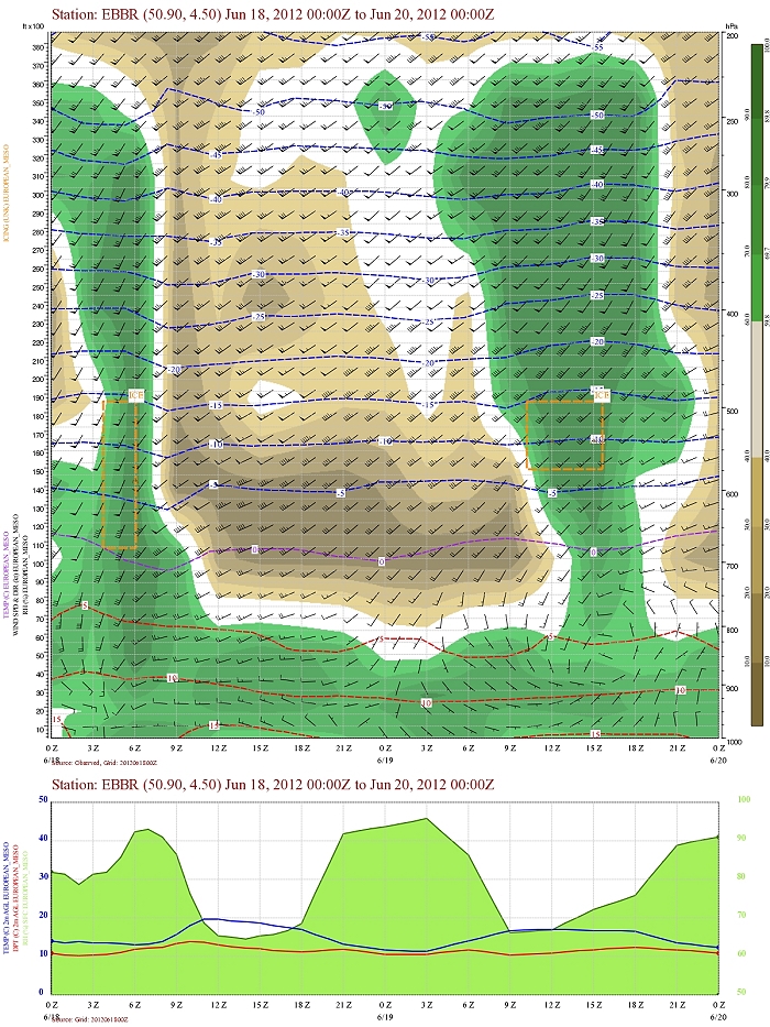
Forecasted vertical profile and surface temperature for Brussels Airport
of June 18 from 0200 CET and the following 48 hours. Legend of upper map: green-brown-white
is humidity in steps of 10% with darkest green being 90% or more, wind
in kt, temperatures each 5°C. At the begin, between 0500-0700UTC,
passage of a saturated layer extending from 4000 ft to 31000 ft. The shear in speed was
quite strong, also in direction moderate. (Source: Belgocontrol)
|
 |
|
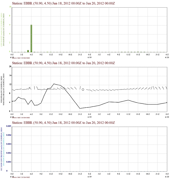
Forecasted precipitation, 2 meter temperature for Brussels Airport of
June 18 from 0200 CET and the following 48 hours. Legend: precipitation
darkest green = dynamical rain, light green is convective rain. Wind in
kt. A burst of dynamical rain between 0500-0600UTC, but in fact it was
obscuring a convective signal. Note also the radical change in direction
of wind of 180 degrees. (Source: Belgocontrol)
|
|
18/06/2012 0545-0715 CET. Satellite loop in the visual channel.
A massive cloud plume covering Belgium with at the begin also an overshooting top near
province Namur. (Source sat
picture: Eumetsat via Sat24.com)
|
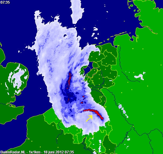
Radar loop (rainfall rate in mm/hr) of June 18 2012 between 0500-0840 CET. Widespreas and some intense echos crossed fast from SW to NE over Belgium. Detectable is also a bow echo over the eastern parts. Precipitation tops up to 12 km. Pictures on the field (see further below) were taken near "BR". (Source radar picture: Belgocontrol)
|
|
|
18/06/2012. Highlighted is the bow echo. (Source picture: Buienradar)
|
|
|
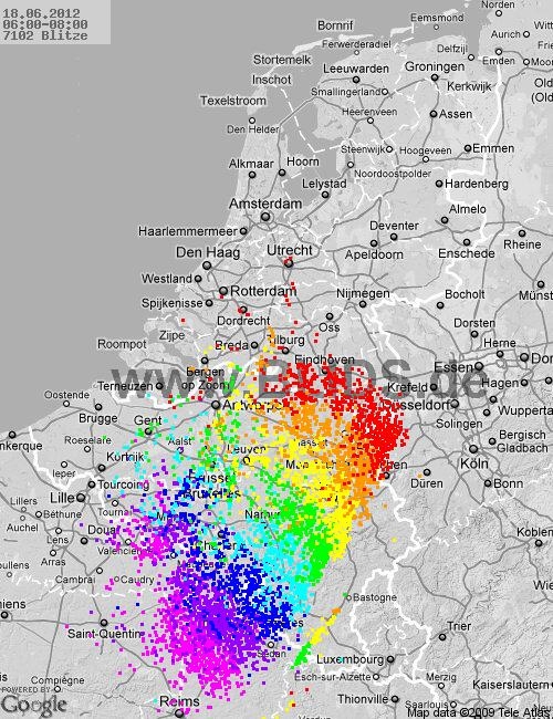
18/06/2012. Amount of discharges over the Benelux over a period of 2
hours from 0600 CET onwards. As can be noted, it was quite active with
over 7000 discharges of which around 5000 over Belgium. (Source picture:
Blids)
|
Some metars (hours in UTC). Translation: copy
paste each obs via
metar-decoder
Charleroi
Diest |
 |
|
18/06/2012 0636 WNW. A shelf cloud in the far distance could be detected
(which moved from the left to the right).
|
 |
|
18/06/2012 0644 W. Bit later.
|
 |
|
18/06/2012 0645 W. Wider view.
|
 |
|
18/06/2012 0645 SSW. View more towards the south from where the cloudiness was
coming from.
|
 |
|
18/06/2012 0648 SSW. Bit later, the shelf was a so called "stacked plate
shelf".
|
|
Between 0638-0650, direction west afterwards south, these events were
also captured in a time lapse showing the movement of a so called "stacked
plate shelf".
|
 |
|
18/06/2012 0654 W. Beneath the shelf, things were less exciting.
|
 |
|
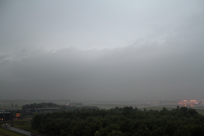
18/06/2012 0701 SSW. Pouring rain.
|
 |
|
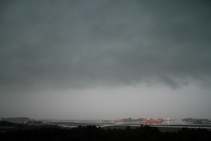
18/06/2012 0704 SW. With a low Stratus band preceding more heavy rain. A
total of 18 mm was collected within an hour.
|
