| Weather pictures & report of May 20 2012 |
| Multicell thunderstorm (MCS alike) along convergence line. |
| Synopsis: at 500 hPa, Belgium north of a cut off low which approached a bit on its movement eastwards. The air became moister and warmer in the lower levels, while becoming colder in the upper levels. It lead to instabililty mainly due to diurnal heating and most showers did form along a weak convergence line. At my location hardly 2 mm rain was collected with for an hour or so not too close rumbles of thunder. All pictures were taken at Kampenhout (central Belgium), hours in local time (CET). |
 |
|
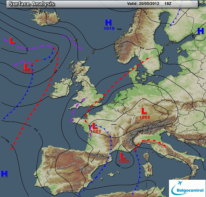
Surface analysis of May 20 2012 at 2000 CET. Complex depression with
centers over mid France and southern Germany with Belgium in a weak
NE'ly flow. Previous night a warm front passed Belgium with behind
warmer moister potentially unstable air. A weak convergence
line could be detected over the Benelux enhancing the instability. (Source chart: Belgocontrol)
|
|
Loop of 9 surface analyses of May 20 2012 (of each hour between 1400 - 2200 CET) with
weather plots. (Source: meteocentre.com)
|
 |
|
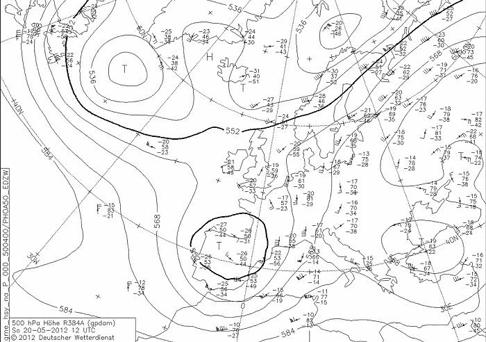
Upper air analysis 500 hPa of May 20 2012 at 1400 CET. Cut off low over
Spain, ridge over Russia extending towards the Northsea. Belgium in a
weak SE'ly flow. (Source chart: DWD via wetter3)
|
 |
|
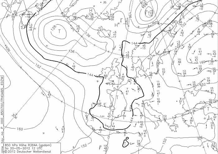
Upper air analysis 850 hPa of May 20 2012 at 1400 CET. Recognizable
again the cut off low, but a bit more north (over France) and the ridge
over Russia extending towards the Northsea. Also here over Belgium a
weak flow from the SE advecting some warmer air present over Germany
(11°C). (Source chart: DWD via wetter3)
|
 |
|
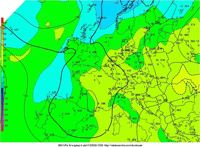
Upper air analysis 850 hPa of May 20 2012 at 1400 CET. Here we take a
look at Tw at 850 hPa which was around 13°C. (Belgium was lying in the
class zone of 12-16°C) (Source chart: Meteocentre.com)
|
 |
|
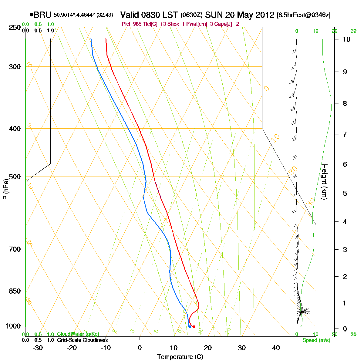
Loop of forecasted soundings for Brussels of May 20 2012 between
0830-2000 CET. Instability is present from around 900 hPa upwards,
initially an inversion was present till early afternoon, cleared by the
rising surface temperature. (Source: RASP)
|
|
Another loop of forecasted soundings for a 12 hours period (in steps of
three hours) of Brussels from May 20 2012, 1100 CET onwards. Included
are some thunderstorms indices: surface based CAPE went up to around 1400 J/kg, KI
27, TT
50, LI -5 = moderate convective potential which may lead to scattered
thunderstorms. SREH was rather weak < 50 m²/s², in combi with the not
too strong CAPE, the environment would be favorable for multicell
thunderstorms.(Source: weatheronline.co.uk)
|
|
20/05/2012 1630-2030 CET. Satellite loop in the visual channel.
Exploding multicell thunderstorms over the Ardennes moving NW-awards.
Several times overshooting tops can be detected. (Source sat
picture: Eumetsat via Sat24.com)
|
Radar loop (rainfall rate in mm/hr) of May 20 2012 between 1400-2310 CET. Developing storms moving from SE to NW with the most intense cores holding a lot of rain or even large hail. Precipitation tops went up to 12 km. (Source radar picture: Belgocontrol)
|
 |
|
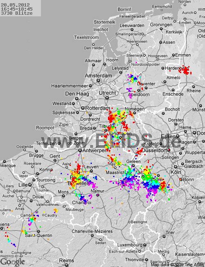
20/05/2012. Amount of discharges between 1645-1845 over the Benelux with
the most recent ones in red dots. (Source picture: Blids)
|
Some metars (hours in UTC). Translation: copy
paste each obs via
metar-decoder
Brussels
Charleroi |
 |
|
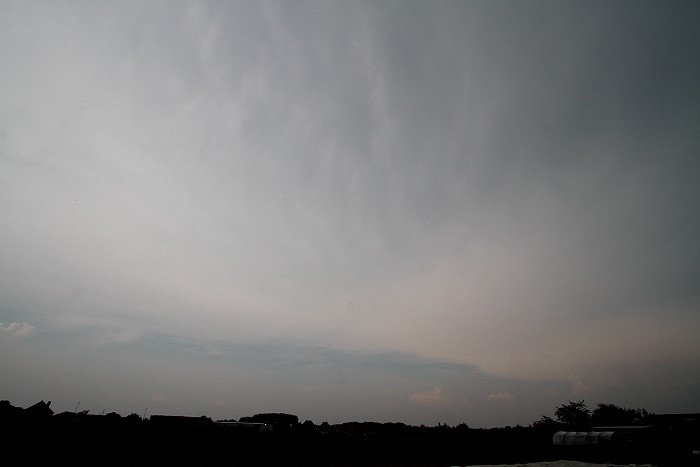
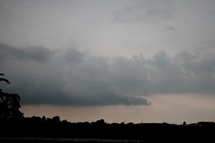
20/05/2012 1702 NNE. The huge anvil came slowly in from the south with
the last breaks over the far north.
|
 |
|
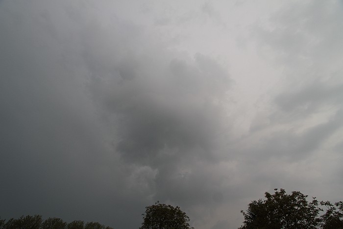
20/05/2012 1807 S. Some rumbles were heard these non exciting clouds.
|
 |
|
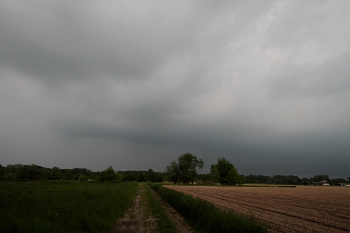
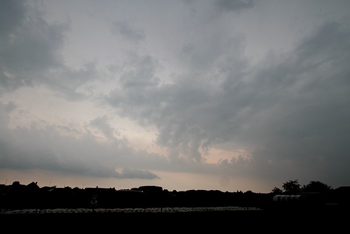
20/05/2012 1829 SW. The rain shaft was arriving, still nothing exciting.
|
 |
|
20/05/2012 1830 NNW. Some Cu cloudiness forming in rows on opposite side.
|
 |
|
20/05/2012 1839 NE. Perhaps a more interesting part of the shower?
|
 |
|
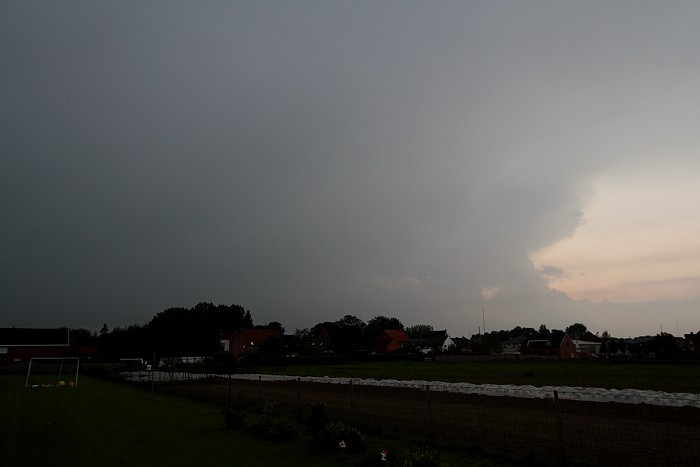
20/05/2012 1927 NW. Or is this view the most exciting of all with a
building Cu in a massive dark Cb without much structure? Anyhow, the
first significant thundery situation of the season was a rather boring
show. Things can only be better next time...hopefully.
|