| Weather pictures & report of June 28 2011 |
| Large multi-cell (MCS alike) thunderstorms along convergence line. |
| Synopsis: at 500 hPa, east of a relaxing trough west of the British Isles, our area in a rather weak SW'ly flow of warm and humid potentially unstable air. At surface passage of thermal depression and related convergence line enhanced the instability which started late afternoon with formation of large multi-cell (MCS alike) thunderstorms, mainly over central and eastern parts of the Benelux.. Locally, it lead to downbursts and large hail, also at my location with all pictures taken at Kampenhout (central Belgium), hours in local time (CET). |
 |
|
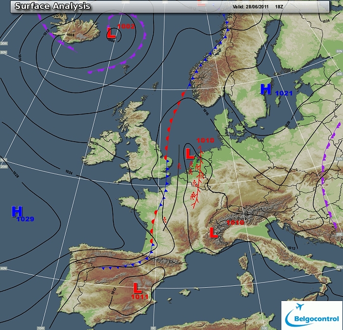
Surface analysis of June 28 2011 at 2000 CET. Related to a thermal
depression extending from the Alps towards the Northsea, a convergence
line over central-eastern Benelux. (Source chart: Belgocontrol)
|
|
Loop of 16 surface analyses (of each hour between 28/1400 - 29/0200 CET) with
weather plots showing the slow movement of the thermal depression. (Source: meteocentre.com)
|
 |
|
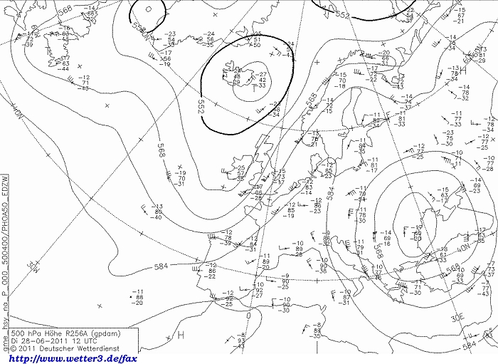
Upper air analysis 500 hPa of June 28 2011 at 1400 CET. Related to a low
near Iceland, a long wave relaxing trough just west of Eire slowly
moving eastwards. On the other hand a collapsing ridge over central
Europe. Our area in a strengthening SW'ly airflow. (Source chart: DWD via wetter3)
|
 |
|
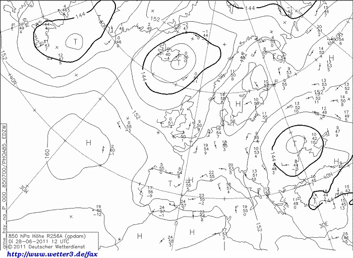
Upper air analysis 850 hPa of June 28 2011 at 1400 CET. Overhead a weak SW'ly
flow advection very warm air. Over England already remarkable cooler air
is present (difference 10 °C) (Source chart: DWD via wetter3)
|
 |
|
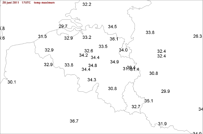
Max temperatures of June 28 2011: as history would tell, this was the warmest
day of 2011
with everywhere in Belgium >30°C.
|
 |
|
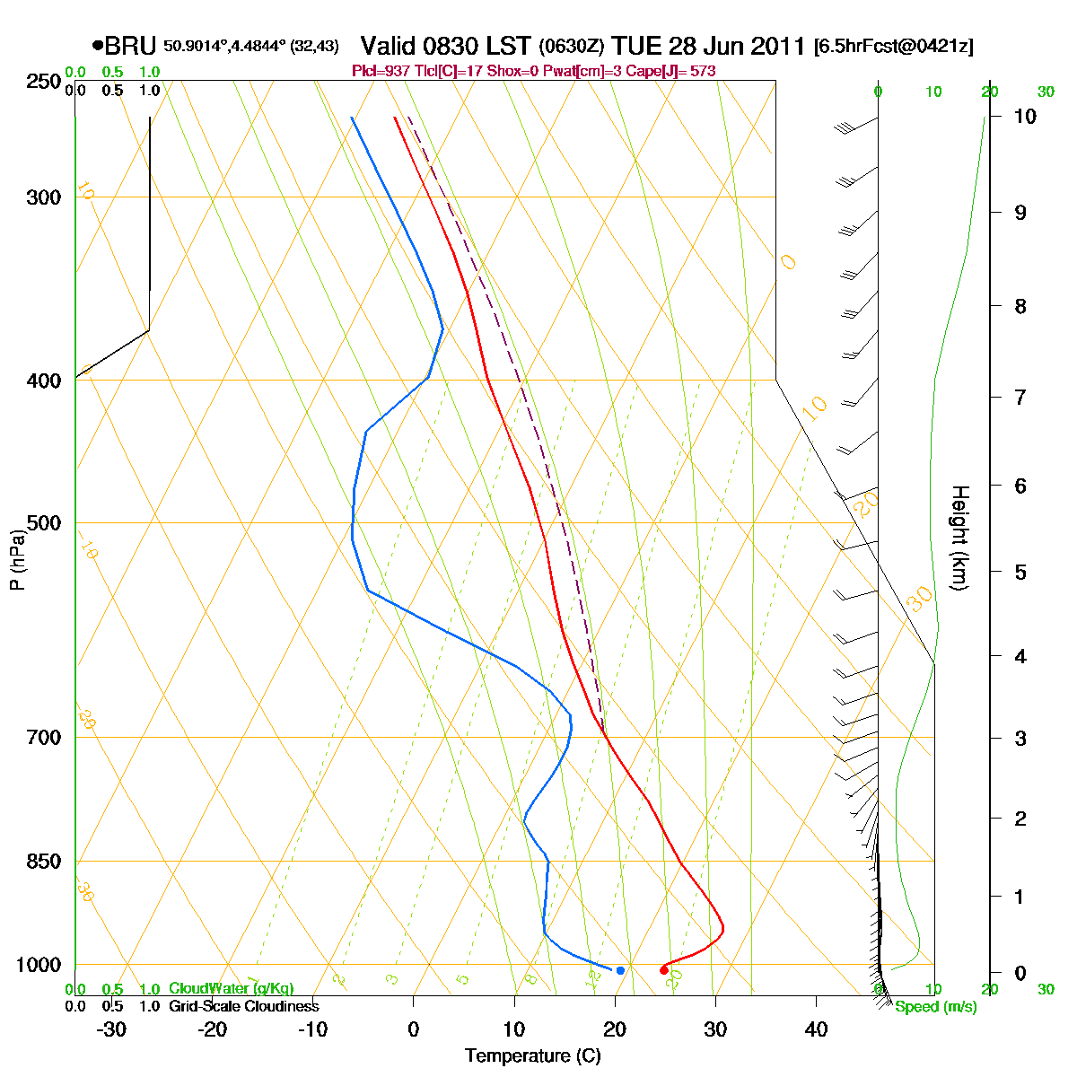
Loop of forecasted soundings for Brussels of June 28 2011 between
0830-2000 CET. In forenoon unstable from 700 hPa upwards with below a so
called CAP (or inversion) clearing from 1600 onwards due to diurnal
heating. Furthermore wind direction seems fluctuates between SE
and SW, but in reality the direction stayed E-SE till the passage of the
thunderstorms in the evening when veering to NW (as calculated). Speed
and directional shear was rather weak, limiting chances for supercells. (Source: RASP)
|
|
Another loop of forecasted soundings for a 21 hours period (in steps of
three hours) of Brussels from June 28 2011, 0500 CET onwards. Included
are some thunderstorms indices: surface based CAPE went up
over 3500 J/kg, KI 39, TT 55, LI -13 = strong convective potential which
may lead to frequent thunderstorms, isolated severe. Due to the high
CAPE large and deep multi-cells could be expected. (Source: weatheronline.co.uk)
|
 |
|
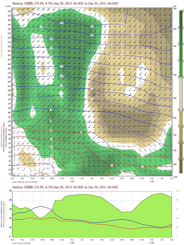
Forecasted vertical profile and surface temperature of June 28 for
Brussels Airport from 0800 CET and the following 48 hours. Legend of upper map: green-brown-white
is humidity in steps of 10% with darkest green being 90% or more, wind
in kt, temperatures each 5°C. Humid air in afternoon well towards the
upper levels (200 hPa). Furthermore evidence of a fall of upper air
temperatures with passage of cold front, and much drier air behind
(above 9000 ft). Wind shear in afternoon of June 28 initially not that
great, strengthening late evening and next night. (Source:
Belgocontrol)
|
|
28/06/2011 1715-2100 CET. Satellite loop in the visual channel.
Exploding large multi-cells (MCS alike) thunderstorms with overshooting
tops. (Source sat
picture: Eumetsat via Sat24.com)
|
 |
|
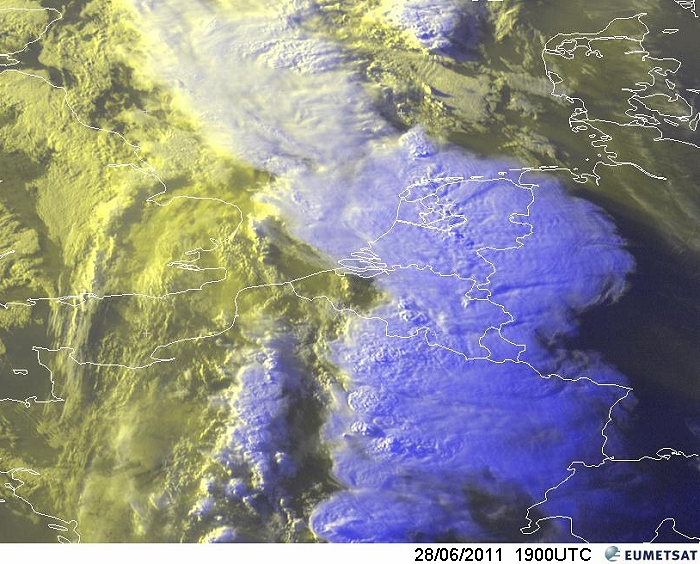
Still image of the late evening in the visual channel (RGB) giving a nice view of the MCS
alike storm extending from eastern France towards the Nortsea. On its
western side, along the cold front, some smaller storms. (Source pic: Eumetsat)
|
Radar loop (rainfall rate in mm/hr) of June 28 2011 between 1630-1850 CET. Along the French border an upcoming deep shower up to 15 km, with on its NE-flank new developing deep storms which produced downbursts and large hail. When the storm reached the radar at Zaventem, lightning struck on it ceasing all activity. Was after repairs fully operational from September 21 onwards! (Source radar picture: Belgocontrol)
|
So from 1900 CET onwards switching to the Dutch radar. Note the sudden decaying phase from 2000 onwards, but 1h30 later reactivating. Further note: the cell over Limbourg (near Genk) was also quite active at 1900 which Belgcontrol radar in its final images didn't show . Apparently, the incoming severe storm "blinded" its beam towards the northeast. (Source radar picture: Buienradar)
|
Corresponding discharges of June 28 2011 between 1515-2300 CET. (Source lightning picture: Blids)
|
 |
|
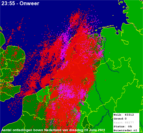
28/06/2011. 24 hour overview of the discharges over the Benelux: the
pink color were some storms of the morning hours. Total amount of
discharges over Belgium over the entire storm period (extending into the
night of June 29) was 73192, of which 9011 cloud-to-ground strikes.
The west and extreme east escaped most of it.
(source picture: Buienradar)
|
 |
|
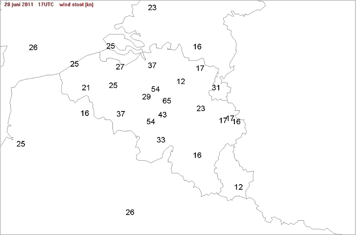
Max gusts (in knot) of June 28 2011 between 1400-2000 CET: Beauvechain
the winner with 65 kt during a downburst, followed by Zaventem and Charleroi
with 54 kt.
|
 |
|
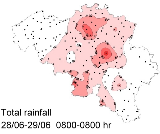
Amount of rainfall over 24 hrs from of June 28 0800 CET onwards. Winner
was Thisnes (Hannut) 84,7 mm followed by Haacht 64 mm, Sivry 57,1 mm,
Waarloos 54,3 mm, Solre-sur-Sambre 52,5 mm. (Source picture: IRM).
|
Some metars (hours in UTC). Translation: copy
paste each obs via
metar-decoder Metars of Brussels Airport (EBBR)
Metars of Beauvechain (EBBE)
Metars of Charleroi (EBCI)
Metars of Bierset (EBLG) .
|
 |
|
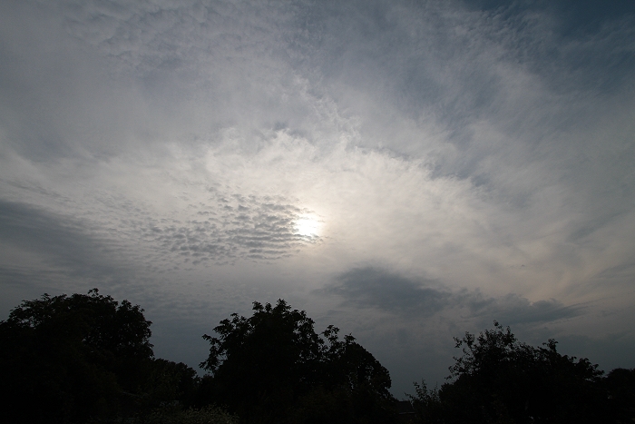
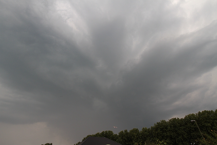
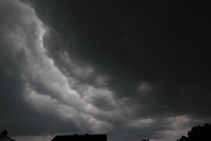
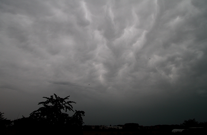
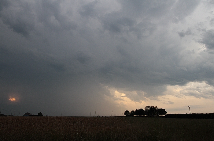
28/06/2011 1803 W. Gradually the sky began to darken as the anvil of a
big thunderstorm (over Hainaut) approached.
|
 |
|
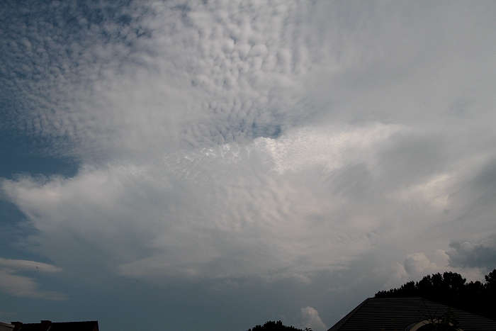
28/06/2011 1804 SSW. With in the south also the building of a new cell.
|
 |
|
28/06/2011 1838 SW. Half an hour later, this new cell approached quite
rapidly while further building.
|
 |
|
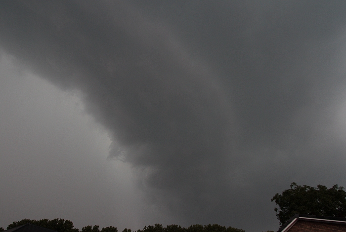
28/06/2011 1846 SW. Also a shelf cloud was forming almost overhead.
|
 |
|
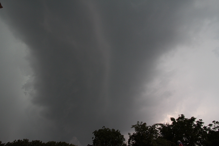
28/06/2011 1846 WSW. And moving quite rapidly to the north.
|
 |
|
28/06/2011 1856 NNW. Bit later stormy winds from the ESE pushing rain and hail down-
and sidewards.
|
 |
|
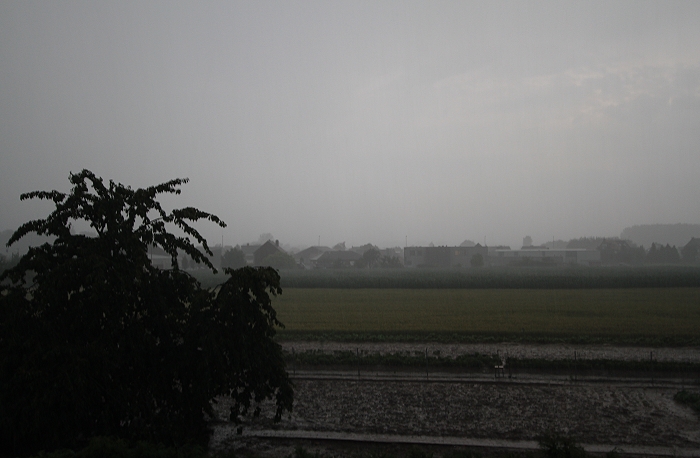
28/06/2011 1904 SE. 10 minutes later the storm temporary eased off with
some chaotic skies.
|
|
28/06/2011 1900-1915. Video shortened to 5 minutes during the hail storm.
|
 |
|
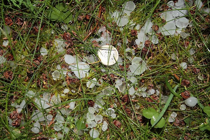
28/06/2011 1937. When the heavy rain ceased, I went outside to check a batch of hailstones compared with 1
Euro (which has a diameter of 2,2 cm).
|
 |
|
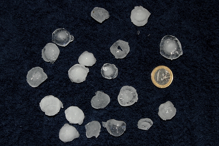
29/06/2011. Some hail stones collected and preserved in the freezer.
Compared with 1 Euro, the largest one measured 2,7 cm.
|
 |
|
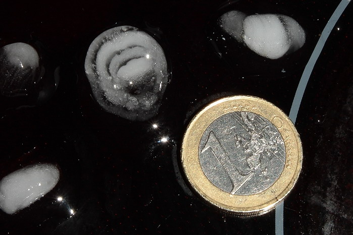
29/06/2011. One of the larger stones for further examination: it showed
melting and freezing process at least three times.
|
 |
|
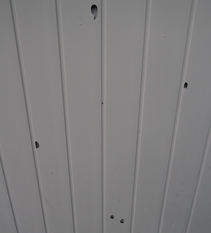
28/06/2011 2033. Car port with holes of the hail.
|
 |
|
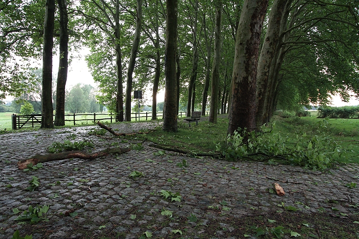
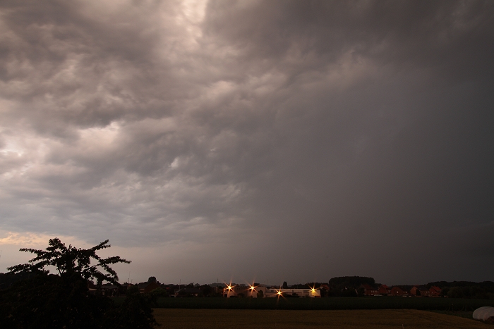
28/06/2011 2055 SW. "De Dreef" showed signs of the damaging wind.
|
 |
|
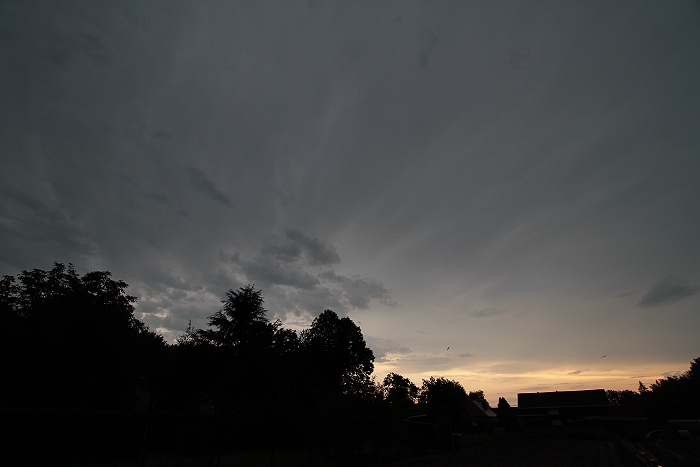
28/06/2011 2006 NNE. On the backside of the storm, mammatus appeared.
|
 |
|
28/06/2011 2026 W. On the opposite side breaking cloudiness.
|
 |
|
28/06/2011 2104 S. More thundery showers began to form in the south.
|
 |
|
28/06/2011 2155 N. Backside of a passing weak thundery shower.
|
 |
|
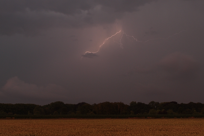
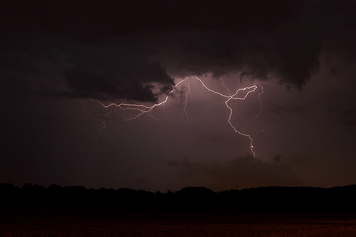
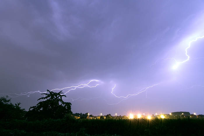
28/06/2011 2221 ESE. First cloud-to-air discharge, distance approx 14 km
(over Holsbeek).
|
 |
|
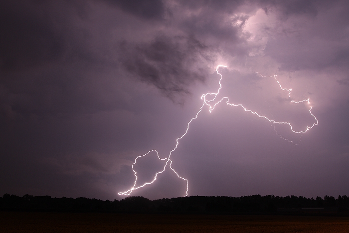
28/06/2011 2227 ESE. Far distant cloud-to-gound discharge at approx 22
km (over Lubbeek)
|
 |
|
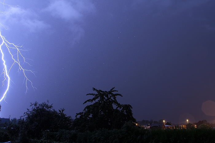
28/06/2011 2237 ESE. Distance approx 13km (over Leuven).
|
 |
|
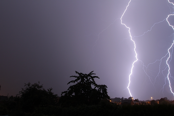
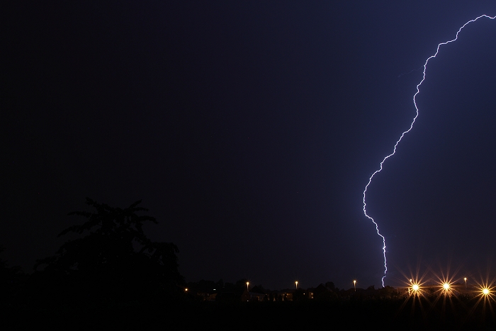
28/06/2011 2240 ESE. One of the better ones, distance approx 8 km (over
Herent).
|
 |
|
28/06/2011 2327 NW. The storm moved in with overhead some near by
discharges. This one, sadly on the edge of the frame, had an impact over Kampenhout
at a distance of 2 km, lightning even the falling droplets.
|
 |
|
28/06/2011 2329 NW. Stationary cams point of view, the next close
discharge was sadly on the other edge of the viewfinder. Impacts over
Weerde and Zemst (distance left one at approx 6 km right one at approx 7 km).
|
 |
|
28/06/2011 2337 NNW. Playing a bit with the aperture, this shot was
slightly underexposed, as the storm moved rather rapidly towards the
north with a discharge over Putte at approx 14 km distance.
|
 |
|
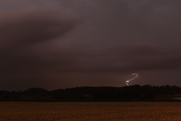
28/06/2011 2358 NNW. The last discharge was again rather close and
bright, giving slightly overexposed result. The bright one on the right
was over Bonheiden (distance approx 8 km) moving leftwards and ending
somewhere over Waarloos (distance 22 km).
|