| Weather pictures & report of December 23-24 2010 |
| Snow related to trailing warm fronts |
| Synopsis: at 500 hPa sharpening upper trough over western Europe. Overhead in the SSW'ly upper flow the approach of several warm fronts related to a depression over Northern Italy. The warm sector trailed for a long time over southeast Belgium, with its wintry precipitation belt affecting 90% of Belgian territory. It produced over the west a few cm, but over the center and east 10 to 20 cm snow giving after 46 year finally way to a beautiful white Christmas. At my location (center of Belgium) 10 cm was added on top of the 6 cm. Pictures taken at Kampenhout and Lovenjoel (20 km SE-wards of Kampenhout). Hours in local time (CET). |
 |
|
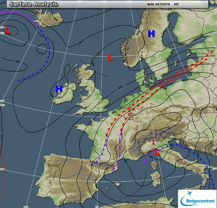
Surface analysis of December 24 2010 at 0100 CET. Depression over
northern Italy moving northeastwards with wrapped around several warm
fronts introducing severe winter weather in large parts of the Low
Countries. (Source chart: Belgocontrol)
|
|
Loop of 25 surface analyses between December 23 1300 CET and December 24
1300 CET
with the weather plots. The snow didn't reach the extreme west of
Belgium, elsewhere light to moderate falls of snow lasting almost 24
hours. (Source: meteocentre.com)
|
 |
|
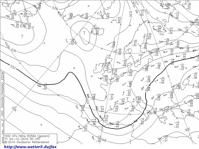
Upper air analysis 500 hPa of December 24 2010 at 0100 CET. Over western
Europe a sharpening trough with over the Low Countries a weak SSW'ly flow. (Source chart: DWD via wetter3)
|
 |
|
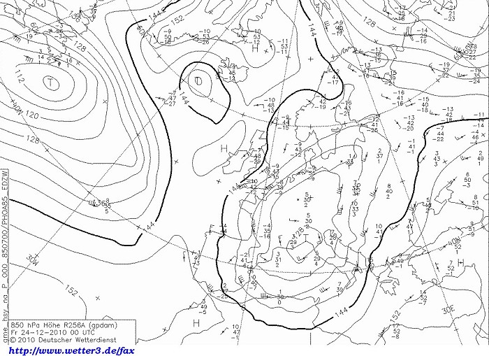
Upper air analysis 850 hPa of December 24 2010 at 0100 CET. Low of
northern Italy recognizable with over the Low Countries advection of
cold
(-8°C) air from the NNE. (Source chart: DWD via wetter3)
|
 |
|
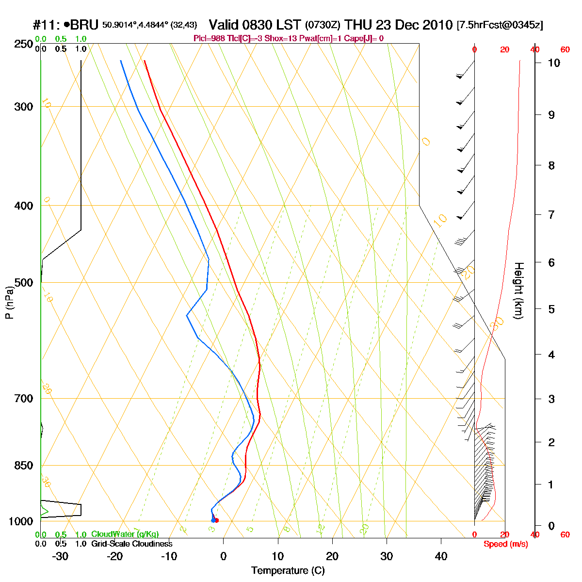
Loop of forecasted soundings for Brussels of December 23 2010 between
0830-1900 CET. Negative
temperatures over the entire layer, becoming in afternoon saturated,
with below 3 km a NE'ly flow and above this height a SW'ly flow. (Source: RASP)
|
|
Loop of forecasted soundings for Brussels between December 23 1000 CET
and December 24 1900 CET. Whole period below freezing over the entire
layer and very moist between Dec. 23 1600 - Dec. 24 1300 CET. Below 700 hPa
winds from the NE slightly backing , above this height SW'ly. (Source: weatheronline.co.uk)
|
|
23-24/12/2010 1300-1300 CET. Satellite loop in the infra-red channel.
High (bright) stratiform cloud canopy moving NNE-wards. (Source sat picture: Eumetsat via Belgocontrol)
|
Radar loop (reflectivity in dBZ) between December 23 1200 CET and December 24 1600 CET. Intensive precipitation belt affecting Belgium, especially during the evening and night over central and eastern parts. (Source radar picture: Belgocontrol).
|
Some metars (hours in UTC) of Brussels Airport (EBBR). Translation: copy paste each obs via
metar-decoder
|
Time lapse webcam images of December 24 between 0817-1317 CET. Most of the 10 cm snow on top of the 6 cm had already fallen. During the night the snow was literally blown onto the wall and when the snow eased off the wind blew it again off the wall. (Source radar picture: Belgocontrol).
|
 |
|
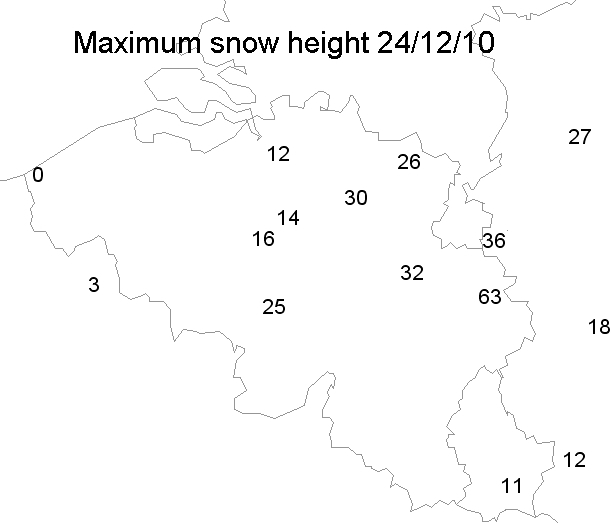
24/12/2010. Max snow height in cm taken from the synops of 0600 & 0900 UTC.
|
 |
|
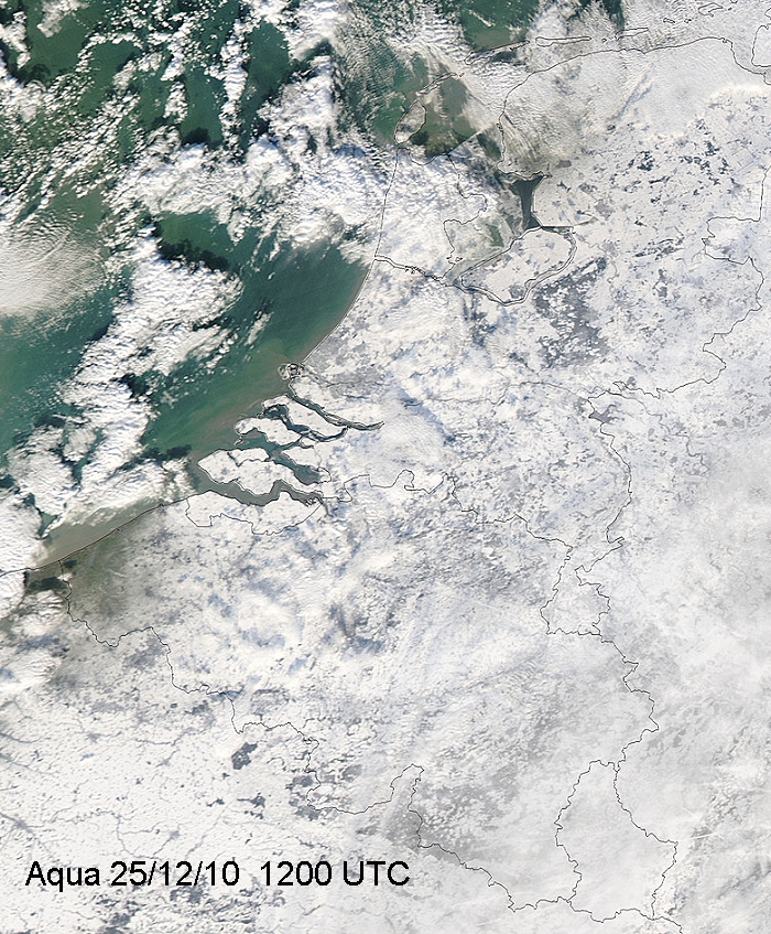
25/12/2010. View over the Low Countries, entirely covered by snow,
except the extreme west of Belgium.
|
 |
|
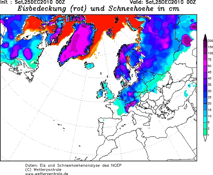
25/12/2010. Snow height map of Europe on Christmas day.
|
 |
|
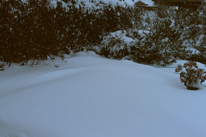
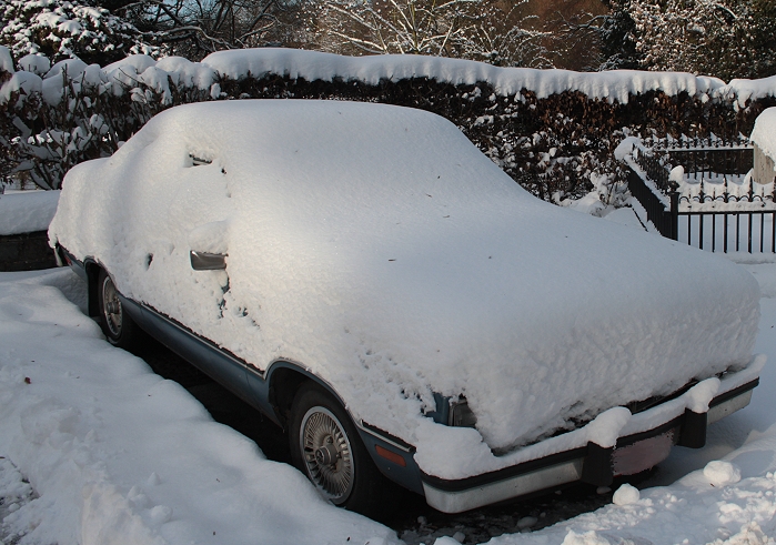
24/12/2010 0832. Conditions in the garden with some snow dunes.
|
 |
|
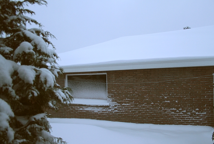
24/12/2010 0836. Blowing snow against the wall and window.
|
 |
|
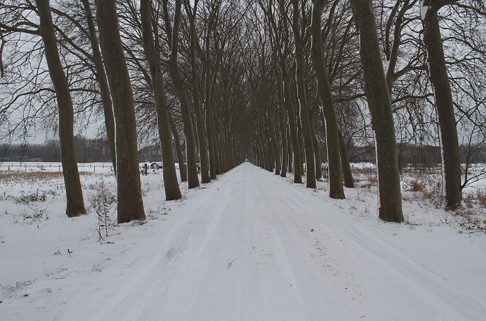
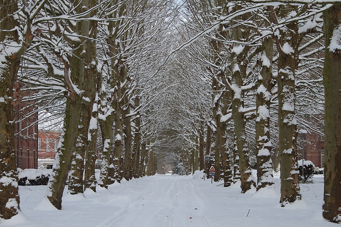
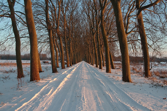
24/12/2010 1532 E. View of the Wilderse Dreef.
|
 |
|
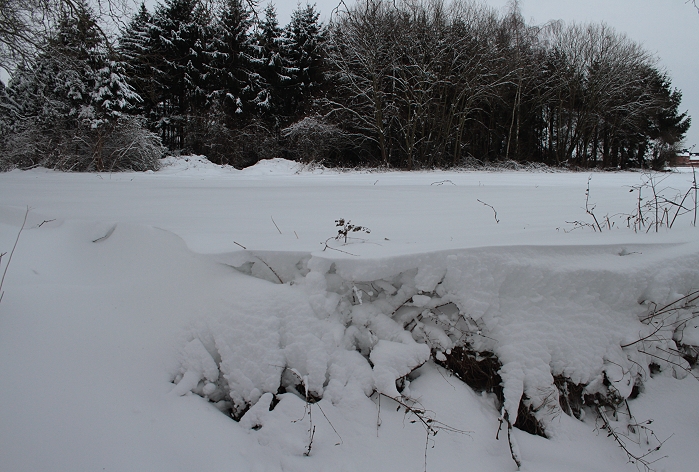
24/12/2010 1534 SW. Snow cover in open spaces was somewhat flattened due
to the rather strong NNE'ly winds.
|
 |
|
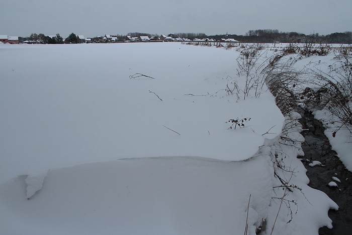
24/12/2010 1535 NE.
|
 |
|
24/12/2010 1606. X-mass eve was on its way.
|
 |
|
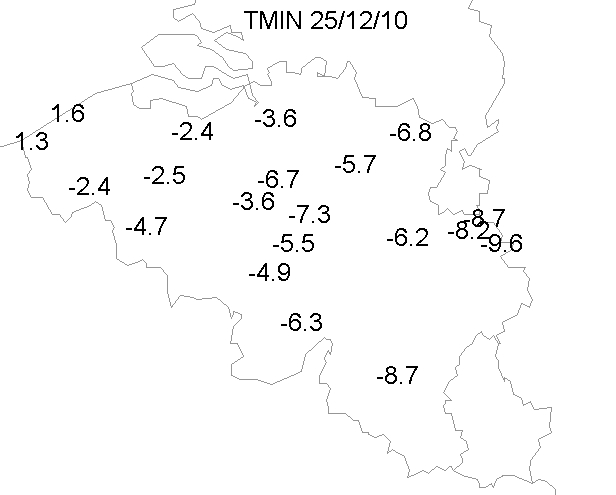
25/12/2010. Min temperatures on X-mass morning.
|
 |
|
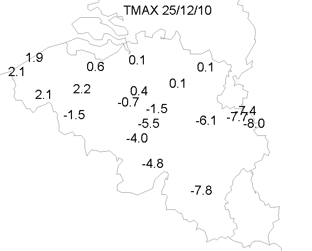
25/12/2010. Max temperatures on X-mass day.
|
 |
|
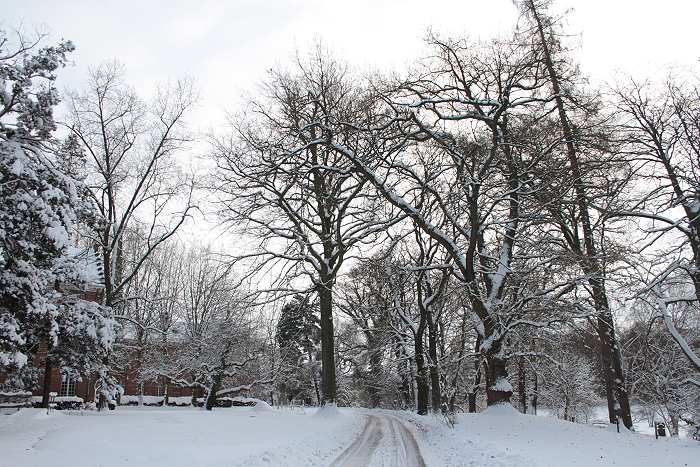
25/12/2010 1102 Lovenjoel. After 46 years finally a wonderful white X-mass.
|
 |
|
25/12/2010 1104 Lovejoel.
|
 |
|
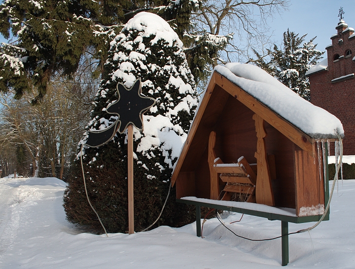
25/12/2010 1113 Lovenjoel.
|
 |
|
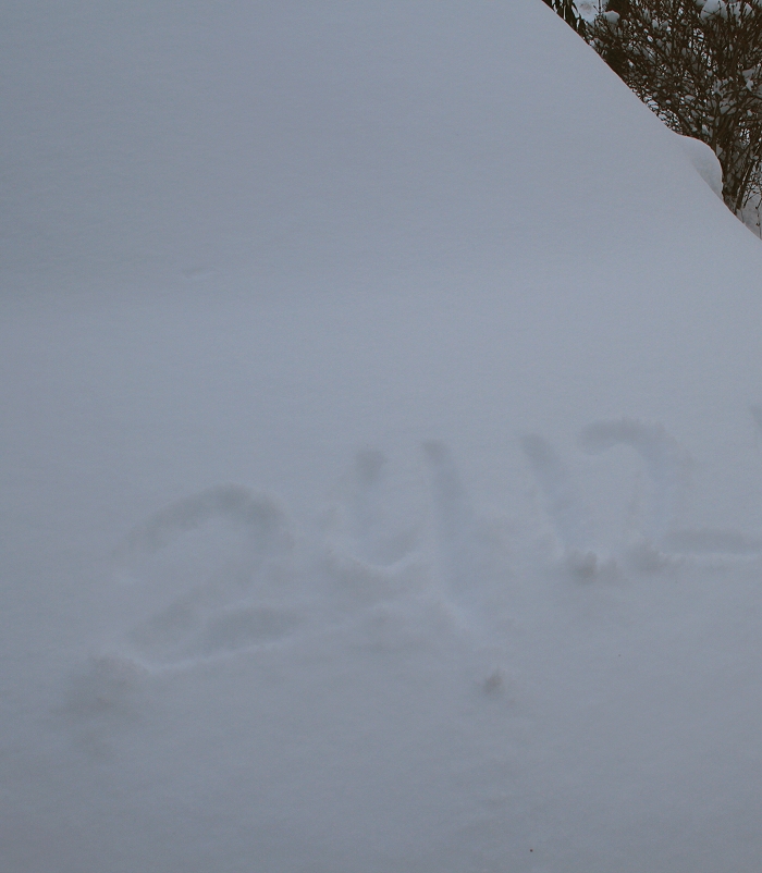
25/12/2010 1118 Lovenjoel. Merry X-mass 2010.
|
 |
|
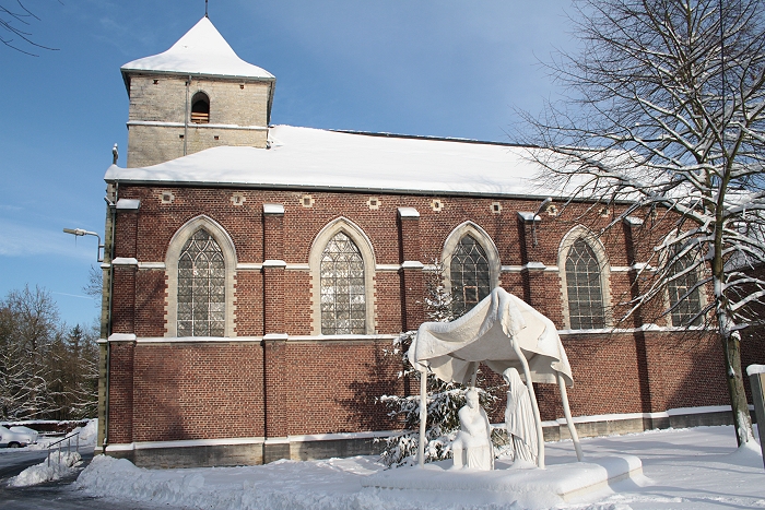
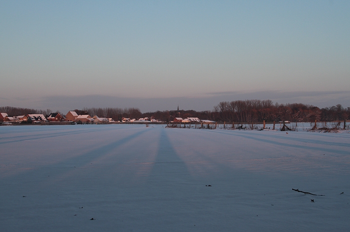
25/12/2010 1127. Church of Lovenjoel.
|
 |
|
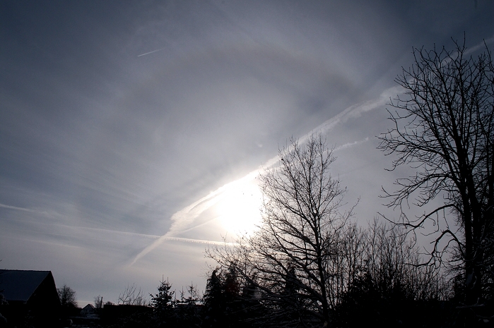
25/12/2010 1145 S. There was also a 22° halo visible.
|
 |
|
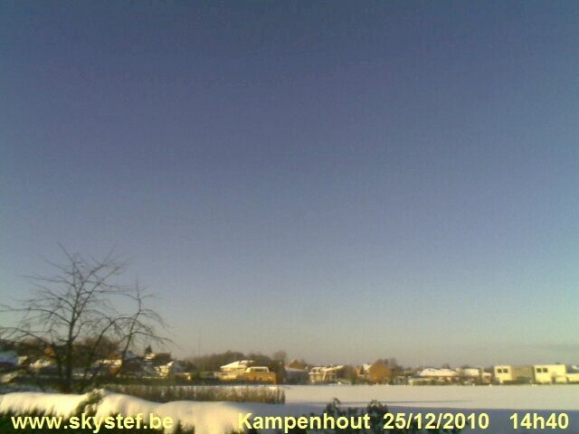
25/12/2010 1440 NW. Webcam
image. White Christmas at Kampenhout.
|
 |
|
25/12/2010 1607 S. Sunset at Kampenhout.
|
 |
|
25/12/2010 1608 E. Wilderse Dreef sunset.
|
 |
|
25/12/2010 1611 S. Sunset with view on the church of Relst.
|
 |
|
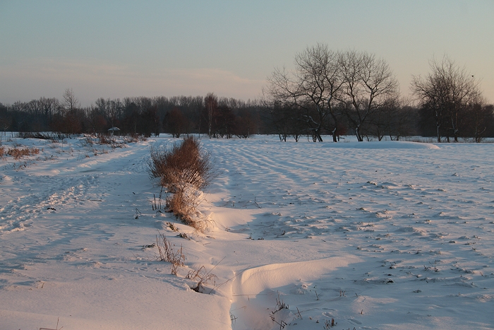
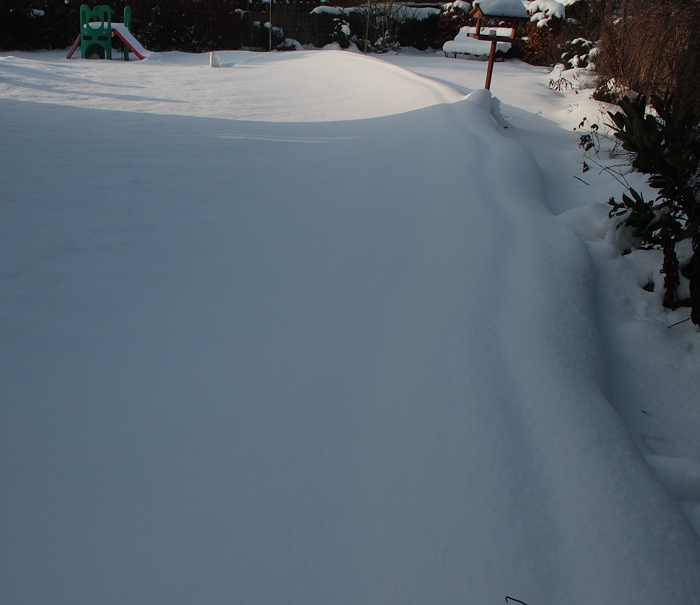
26/12/2010 1231 S. Long snow dune in garden giving salute on a wonderful
X-mass 2010.
|
 |
|
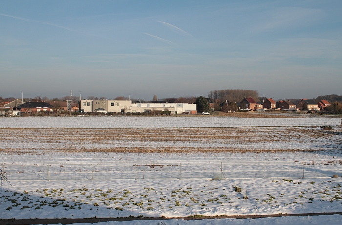
05/01/2011 1055 N. From December 28 onwards, a slow thaw began but
without rain or wind and often with night frost. Thus a couple cm of snow even survived
(locally) on the
fields till January 5 2011.
|
 |
|
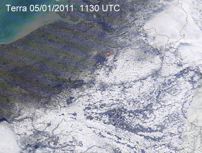
05/01/2011. Terra satellite view how the snow has disappeared west of
the line Mons - Brussels - Antwerp. Red "K" my location Kampenhout.
|
 |
|
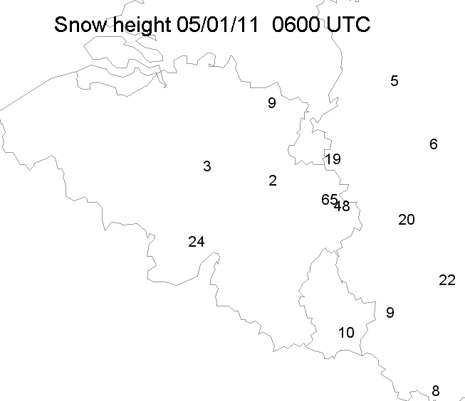
05/01/2011. Corresponding snow heights in cm.
|
 |
|
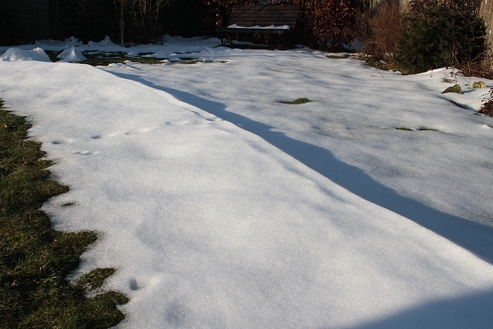
05/01/2011 1132. And in the garden the snow dune survived as well till
January 5 2011. Afterwards the classic thaw began with a lot of rain and
wind.
|