| Weather pictures & report of December 18 2010 |
| Snow related to trough line. |
| Synopsis: at 500 hPa an almost stationary large cold pool over the Northsea. Within several several trough lines were whirling around the clock and one of them edges the northern parts of Belgium in early morning. It gave at my location an additional 2 cm on the already present 3 cm. Locally over the northern parts it was good for 10 cm. All pictures were taken at Kampenhout (central Belgium). Hours in local time (CET). |
 |
|
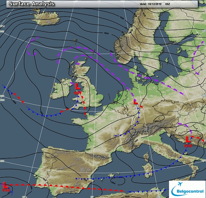
Surface analysis of December 18 2010 at 0700 CET. Black line over
Holland and the north of Belgium concerns the trough line. (Source chart: Belgocontrol)
|
|
Loop of 9 surface analyses of December 18 between 0100-1000 CET
with the weather plots. (Source: meteocentre.com)
|
 |
|
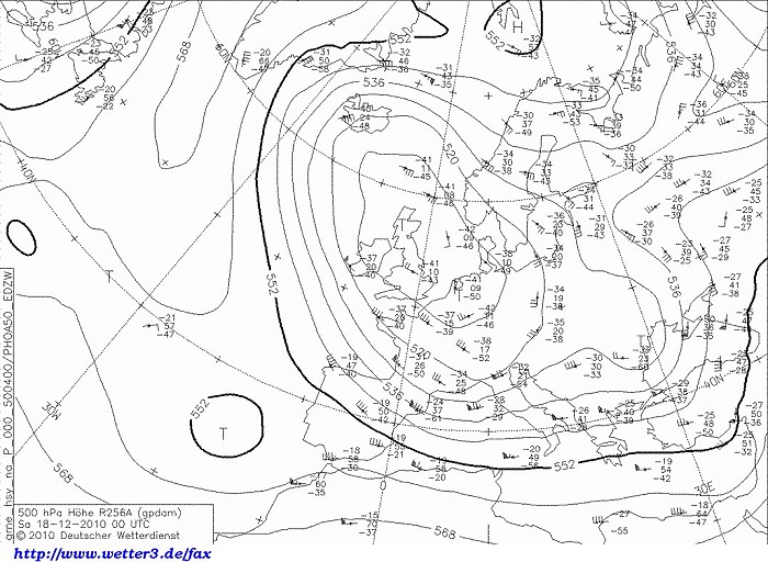
Upper air analysis 500 hPa of December 18 2010 at 0100 CET. Cold pool
over the northern Northsea with temperatures of -41°C. (Source chart: DWD via wetter3)
|
 |
|
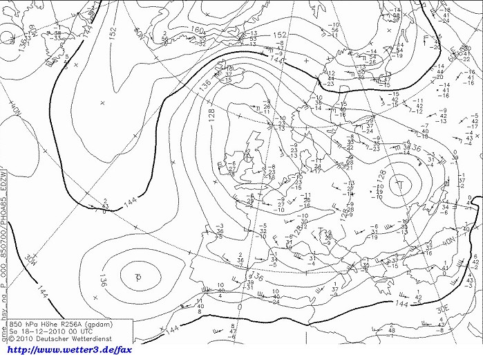
Upper air analysis 850 hPa of December 18 2010 at 0100 CET. Same cold
pool visible in the lower levels with temperatures around -10°C. (Source chart: DWD via wetter3)
|
|
Loop of forecasted soundings for Brussels of December 18 between
0100-1300 CET. Unstable air, entire layer below freezing point, at 0700
CET tempo a bit moister. (Source: weatheronline.co.uk)
|
|
17-18/12/2010 2200-0615 CET. Satellite loop in the infra-red channel.
Bright convective cloudiness over the Northsea with a line entering the
Low Countries. (Source sat picture: Eumetsat via
Sat24.com)
|
Radar loop (reflectivity in dBZ) between December 17-18 between 2210-1110 CET. Intensive precipitation of the trough line over northern parts of Belgium. (Source radar picture: Belgocontrol).
|
Some metars (hours in UTC) of Brussels Airport (EBBR). Translation: copy paste each obs via
metar-decoder
|
 |
|
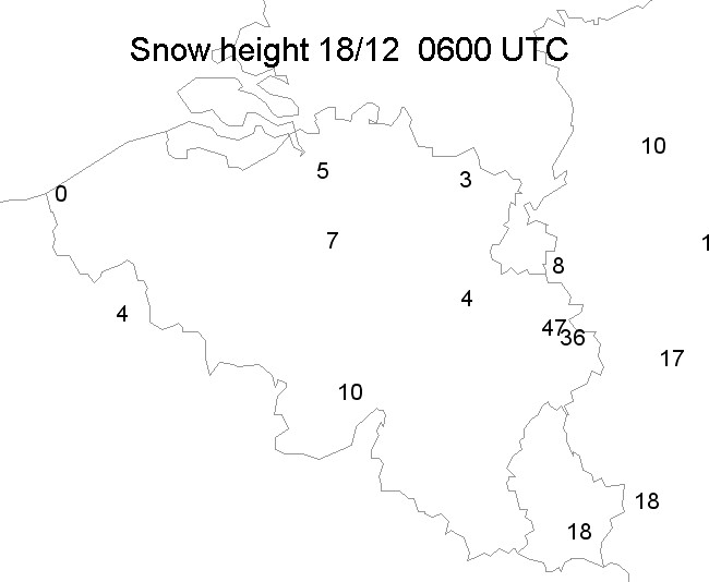
18/12/2010. Snow height in cm taken from the synops of 0600 UTC.
|
 |
|
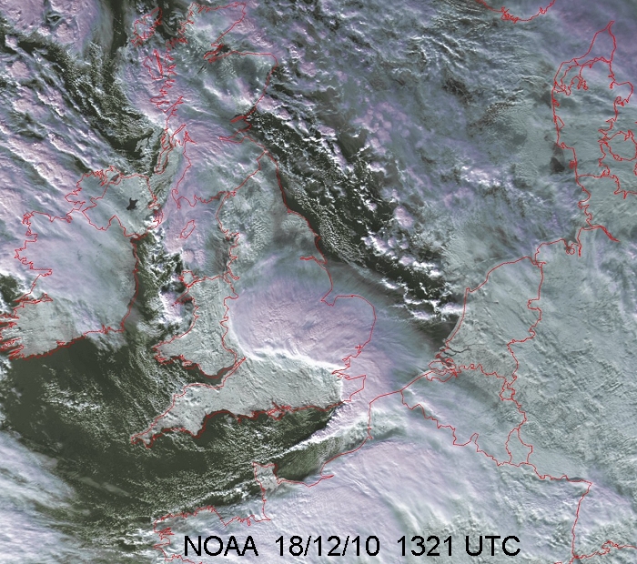
18/12/2010. View on snow deposit over the Low Countries. Over southern
U.K. a heavy convective line which disrupted air traffic for days due to
the large amounts of snow that had fallen.
|
 |
|
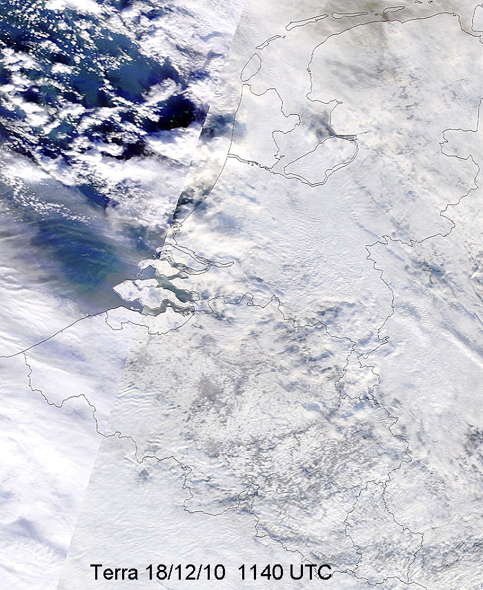
18/12/2010. Closer view on snow deposit over the Low Countries.
|
 |
|
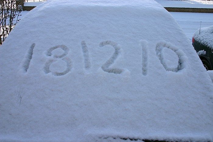
18/12/2010 1026. Proof of the date in freshly 2 cm of snow.
|
 |
|
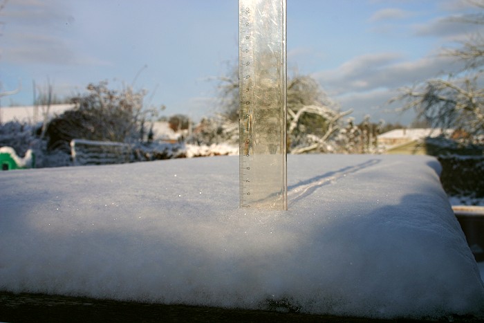
18/12/2010 1022. Proof of 5 cm
|
 |
|
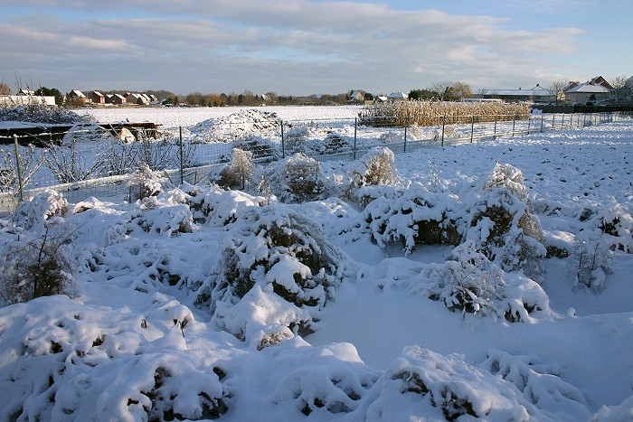
18/12/2010 1031 NE. View into a field.
|
 |
|
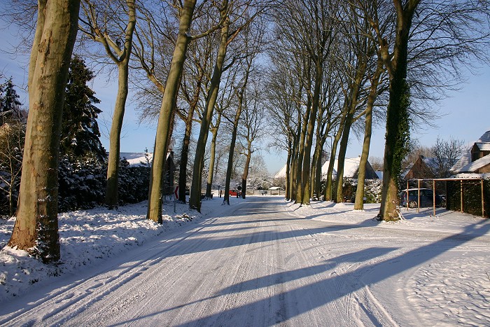
18/12/2010 1036. View of the Wilderse Dreef.
|
 |
|
18/12/2010 1440 SW. View of another field.
|