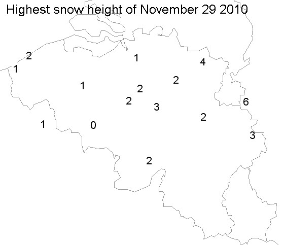
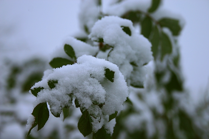
Snow along cold occlusion
introducing a five day coldwave.
Synopsis: at 500 hPa sharpening upper trough crossed
our area. Related occlusion produced some light snow and was followed by
very cold continental air introducing a 5 day cold wave. All
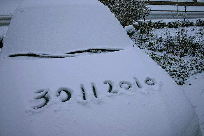
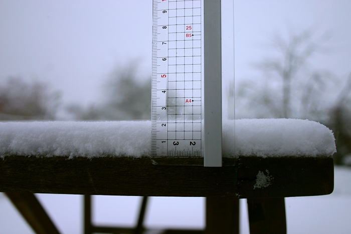
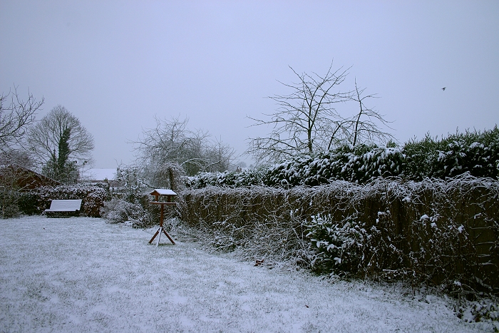
pictures were taken at Kampenhout
(central Belgium). Hours in local time (CET).
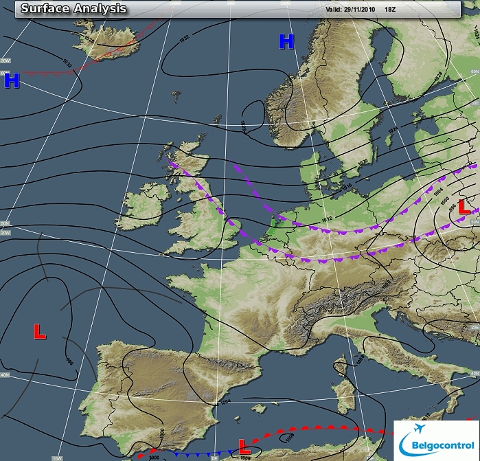
Surface analysis of November 29 2010 at 1900 CET. Two cccluded frontal
systems entering the Low Countries and moving west-southwestwards. (Source chart: Belgocontrol)
Loop of 22 surface analyses (from Nov. 29 1600 CET till Nov. 30 1300 CET)
with weather plots. (Source: meteocentre.com)
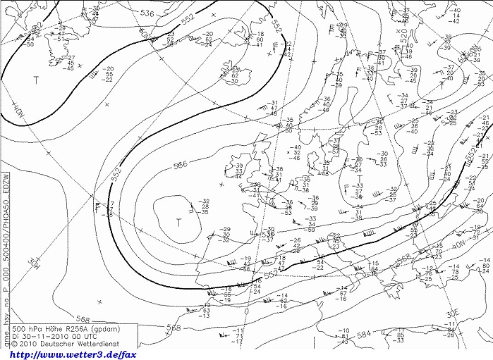
Upper air analysis 500 hPa of November 30 2010 at 0100 CET. Axis of
sharpening upper trough (containing severeal cold pools) positioned
overhead the Low Countries. (Source chart: DWD via wetter3)
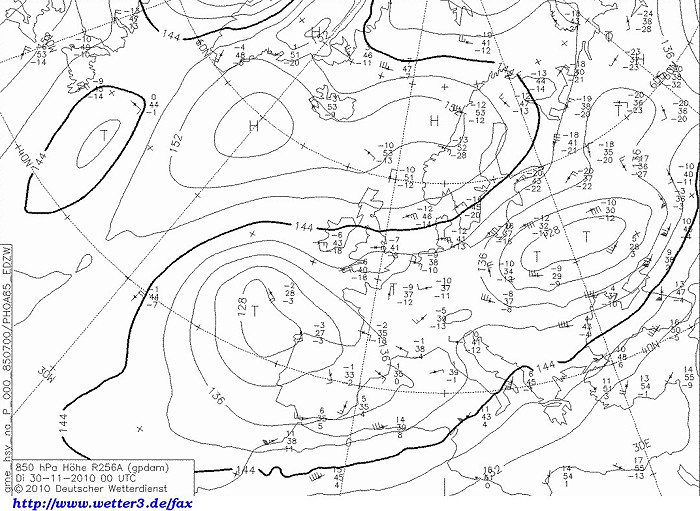
Upper air analysis 850 hPa of November 30 2010 at 0100 CET. The minus 9
degrees is overhead the Low Countries. (Source chart: DWD via wetter3)
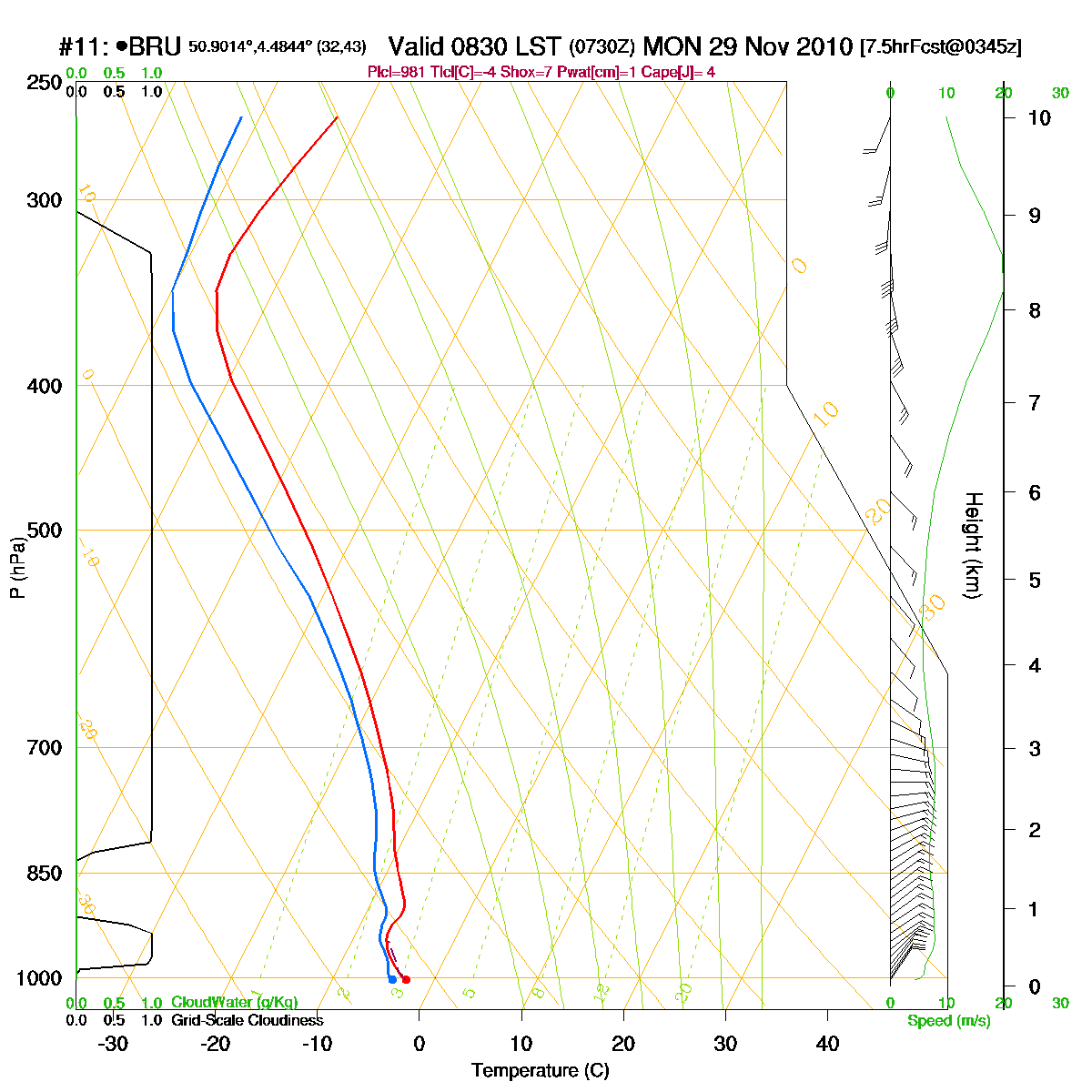
Loop of forecasted soundings for Brussels of November 29 2010 between
0830-1900 CET. Temperature over the entire layer is negative and from
1600 CET onwards also saturated. (Source: RASP)
Another loop of forecasted soundings for Brussels between November 29
0100 CET and November 30 1900 CET. (Source: weatheronline.co.uk)
29/11/2010 1600-2230 CET. Satellite loop in the infra-red channel. The
stratiform layer entering the Benelux via the east. (Source sat picture: Eumetsat via
Sat24.com)
Radar loop (reflectivity in dBZ) of
November 29 1300 CET and December 30 0400 CET. A rather weak precipitation belt crossing the
area from east to west. (Source radar picture: Belgocontrol)
Some metars (hours in UTC) of Brussels Airport (EBBR). Translation: copy paste each obs via
metar-decoder