| Weather pictures & report of February 10 2010 |
| Snow related to cold occlusion. |
| Synopsis: at 500 hPa, related to a sharpening upper trough initiating from Scandinavia, a shallow low with wrapped around occlusion crossed western and central parts of Belgium during the morning. It resulted in light to moderate snow (showers) producing a deposit of 1 to 7 cm and introduced also a cold wave lasting for one week. All pictures were taken at Kampenhout (central Belgium), hours in local time (CET). |
 |
|
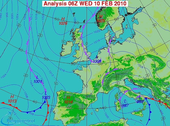
Surface analysis of February 10 2010 at 0700 CET. In a NE'ly airflow a
small low with wrapped around tail of occlusion crossed Belgium during the morning. (Source chart: Belgocontrol)
|
|
Loop of 10 surface analyses (from 03 CET till 1200 CET in steps of one hour) with
weather plots. Small low initially west of Holland moving via
the west of Belgium further southwards. Most intense snow was to be
found over northwestern parts of Belgium. (Source: meteocentre.com)
|
 |
|
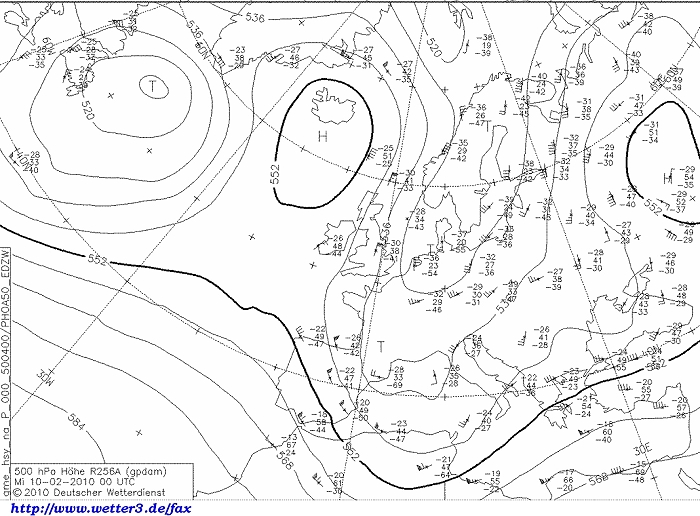
Upper air analysis 500 hPa of February 10 2010 at 0100 CET. Omega pattern
with ridge west of the U.K. extending to Iceland and a sharpening trough from
Scandinavia towards the north of the Low Countries.
(Source chart: wetter3.de)
|
|
Loop of forecasted soundings for a 24 hours period (in steps of three
hours) of Brussels for February 10 2010 from 0100 CET onwards. Read off
are: at all levels subzero temperatures ( =100% risk for snow), during
the morning a saturated layer till 700 hPa, from noon onwards unstable
(incoming colder air of upper trough), in the bottom layer between
0300-0600 CET temporary a change of wind to NW ahead occlusion / small
surface low. (Source: weatheronline.co.uk)
|
|
10/02/2010 0545-0815 CET. Satellite loop in the infra-red channel
showing the scattered cloud band, with some intense stratiform part over mid
Belgium and a more cumuliform part west of it, all moving S-wards. (Source sat
picture: Eumetsat via Sat24.com)
|
|
10/02/2010 0900-1445 CET. Satellite loop in the visible channel showing
a first glimpse on the snow cover which affected northwest Belgium. (Source sat
picture: Eumetsat via Sat24.com)
|
Radar loop (rainfall rate in mm/hr) of February 10 2010 between 0440-1450 CET. The scattered but locally quite intense precipitation belt moved S-wards, producing 1 to 7 cm of fresh snow over the northwestern-western & central parts of Belgium. Highest accumulation did occur over the center where the precipitation belt trailed for quite a long time. Later in afternoon some light snow (showers) came in from the northeast adding one (to a few) extra cm between the evening and early night. (Source radar picture: Belgocontrol)
|
Some metars (hours in UTC) of Brussels Airport (EBBR). Translation: copy
paste each obs via
metar-decoder |
|
Time lapse of webcam images between 0803-1358 CET. Most of the 7 cm snow
had already fallen before sunrise. After 1000 CET , it became dry for a
while, with even a few rays of sunshine.
|
 |
|
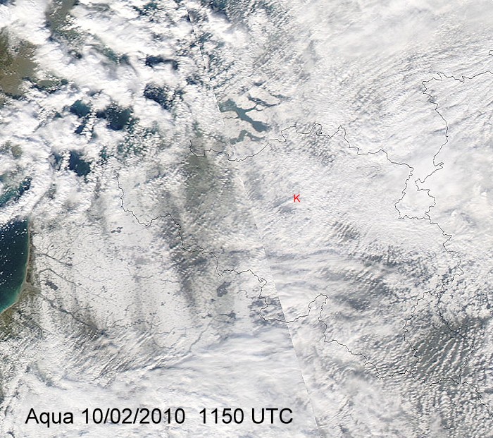
Remote sense satellite Aqua with a view in the visible channel on the
snow in
Belgium. Especially SW of Brugge-Kortrijk and further southwards over
France, and in the triangle St-Niklaas-Anwerp-Brussels (this is sadly
not very clear due to a lot of cloudiness) a significant snow cover was
present. Pics further below were taken
from location red "K". (Source: Image courtesy of MODIS Rapid
Response Project at NASA/GSFC)
|
 |
|
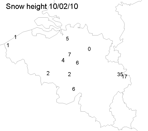
Maximal snow height in cm of some official stations taken from synops of
different hours.
|
 |
|
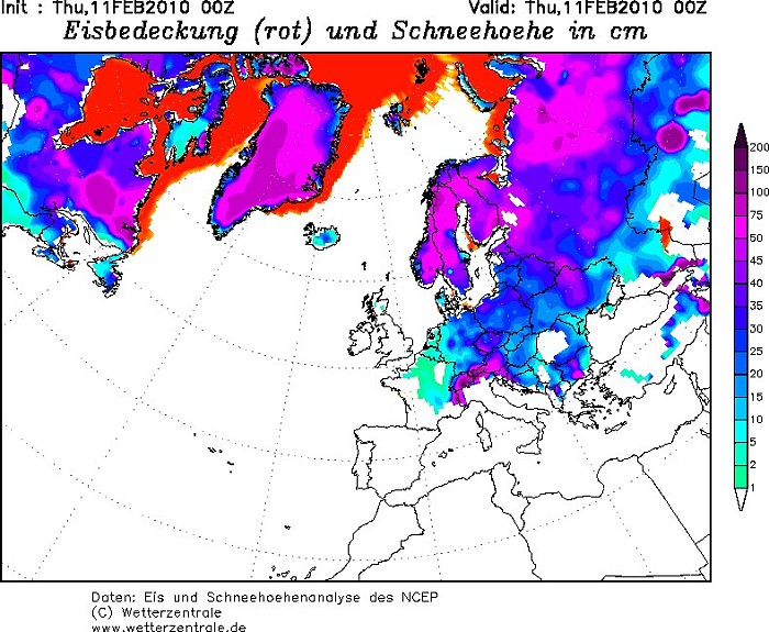
Snow height of Europe. (Source: wetterzentrale)
|
 |
|
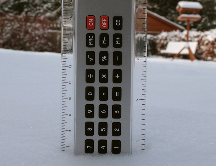
10/02/2010. Proof of 7 cm of snow.
|
 |
|
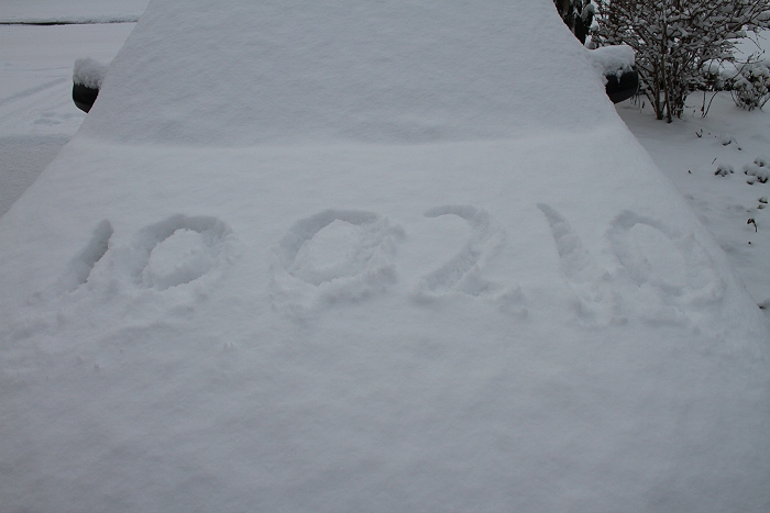
10/02/2010. Proof of the date.
|
 |
|
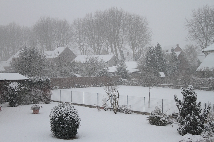
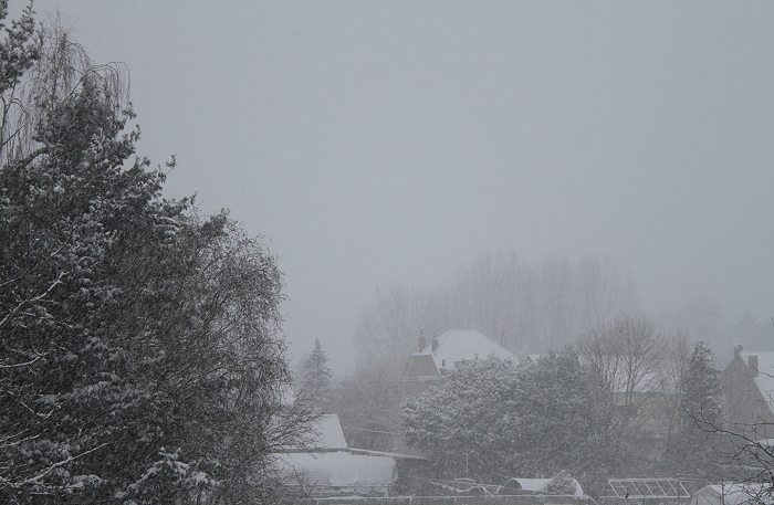
10/02/2010 0844 S. Still some light falls of snow.
|
 |
|
10/02/2010 0847 NW.
|
 |
|
10/02/2010 0954 SSE. Bit later the sun tried to break through.
|
 |
|
10/02/2010 1008 NW. Opposite side with weak sun.
|
 |
|
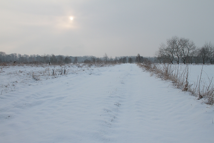
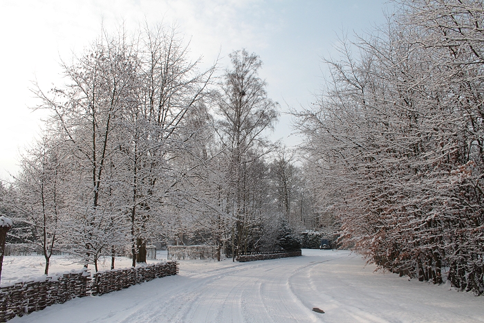
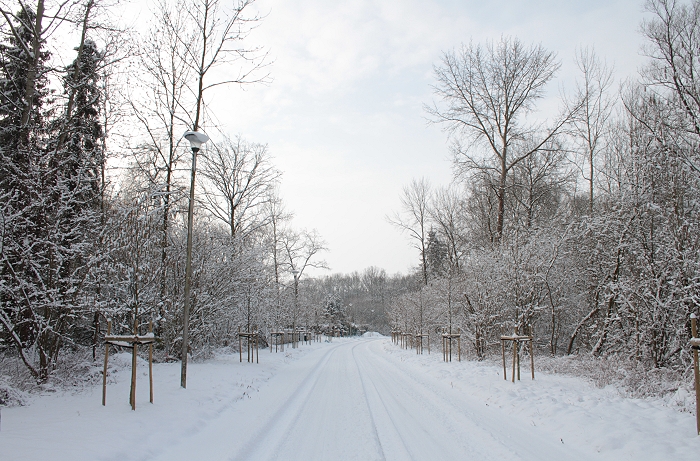
10/02/2010 1020 SW. Back on the snowy road again
|
 |
|
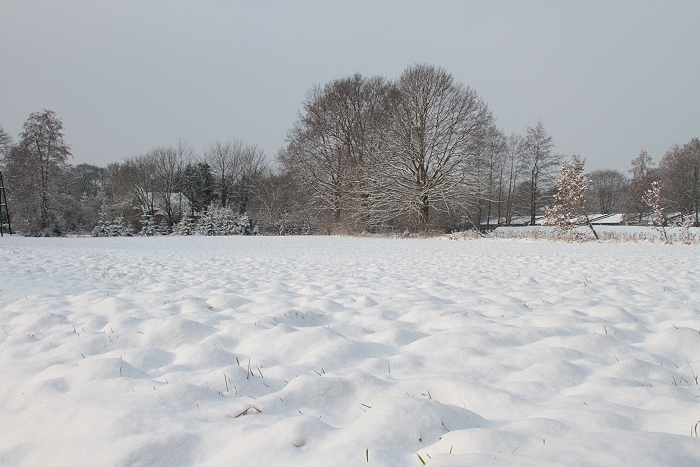
10/02/2010 1022 W. View into a grass field.
|
 |
|
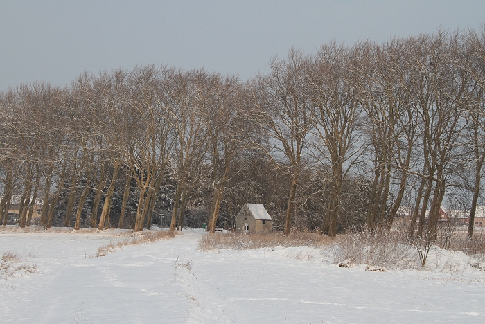
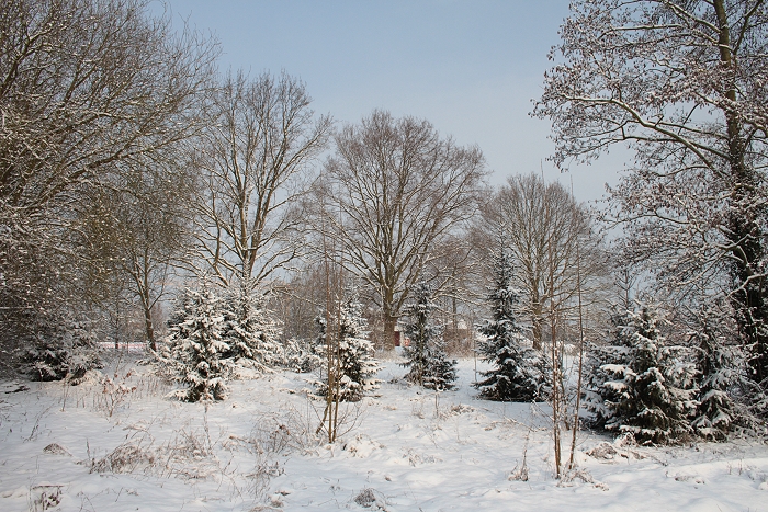
10/02/2010 1024 N. View into a wooded area.
|
 |
|
10/02/2010 1029 WSW.
|
 |
|
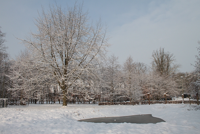
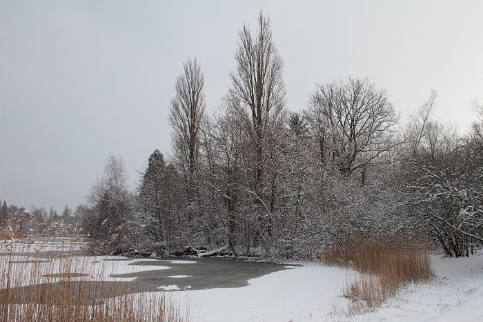
10/02/2010 1030 NNW. Small pool not frozen yet.
|
 |
|
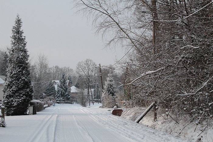
10/02/2010 1035 WNW. A pleasure for the eye seeing these roads not
cleaned of snow.
|
 |
|
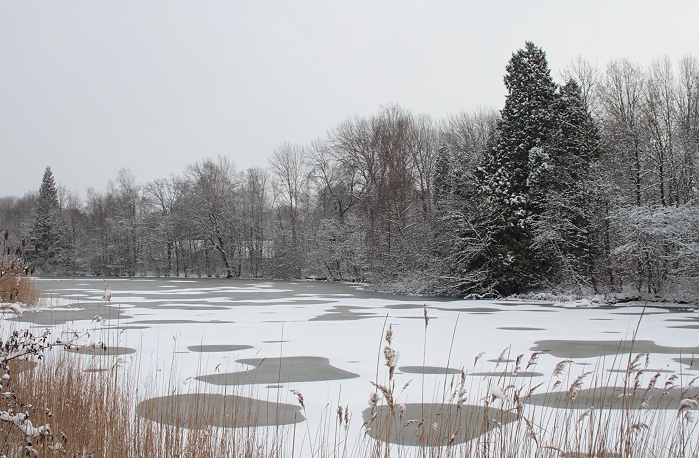
10/02/2010 1041 E. Another pool, this time bit larger and partly frozen.
|
 |
|
10/02/2010 1042 ESE.
|
 |
|
10/02/2010 1044 ESE.
|
 |
|
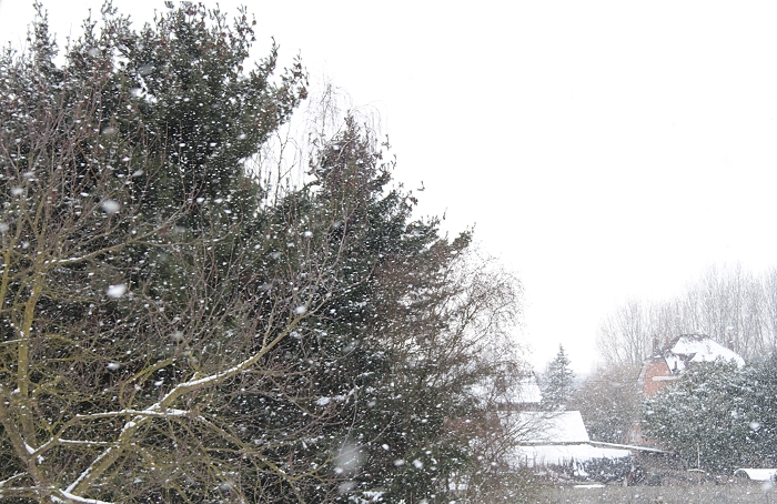
10/02/2010 1513 W. In the afternoon some light snow showers did occur.
|
 |
|
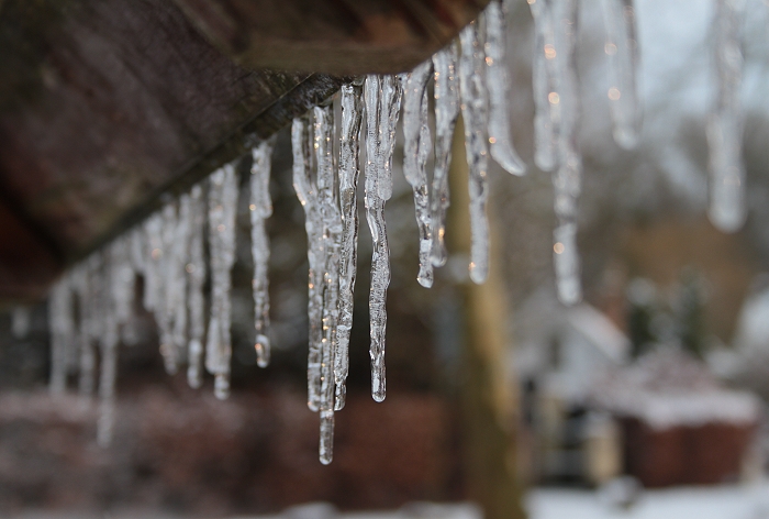
10/02/2010 1608. A row of small stalactites...
|
 |
|
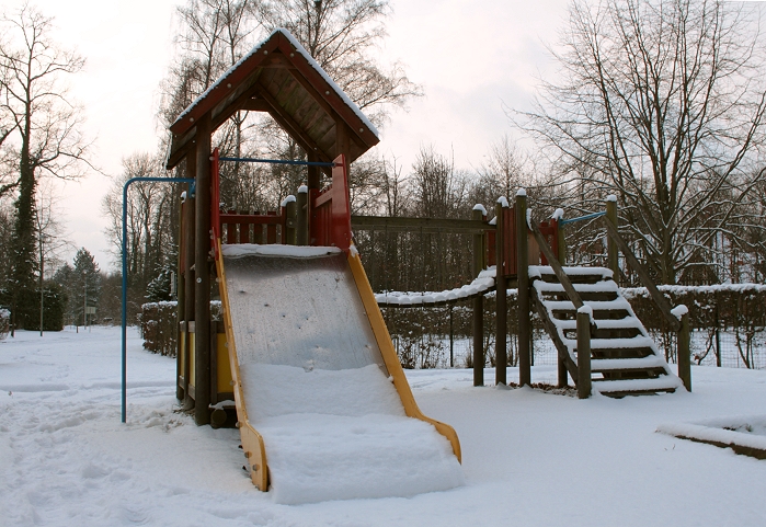
10/02/2010 1615. ... taken from this children toy giving way to a final
salute to the winter season of 2009-2010.
|