| Weather pictures & report of August 25 2009 |
| Multi-cell thunderstorms in unstable air between thermal trough and cold front. |
| Synopsis: at 500 hPa an approaching relaxing upper trough from the west. Ahead advection of warm potentially unstable air over the continent. A thermal trough passed Belgium in the late evening of August 24 with no significant activity as too dry in the boundary layer. Ahead the cold front air became a bit more saturated in the lower levels, still potentially unstable some small multi-cell storms were triggered over central and eastern parts of Belgium. All pictures were taken at Steenokkerzeel (central Belgium), hours in local time (CET). |
 |
|
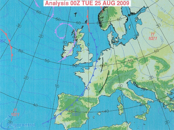
Surface analysis of August 25 at 0200 CET. Cold front near Belgian
coast, ahead over east Belgium a thermal trough, all slowly moving
eastwards. (Source chart: Belgocontrol)
|
 |
|
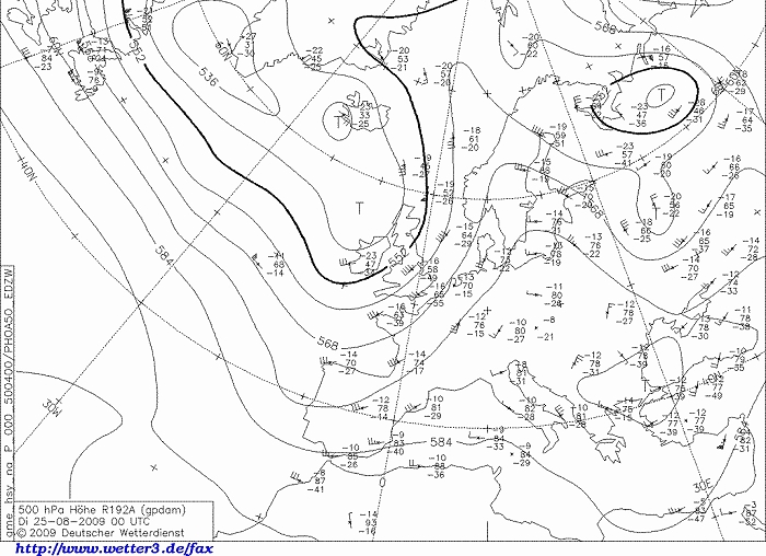
Upper air analysis 500 hPa of August 25 at 0200 CET. Approaching relaxing upper trough west
of the British Isles. (Source chart: DWD via wetter3)
|
|
Loop of forecasted soundings for Maastricht of August 24-25 between 2000-0800 CET.
On passage of thermal trough, there is a remarkable wind shift in the
boundary layer which happened between 2000-2300 CET, but it was also too
dry below 800 hPa to trigger significant showers. Between 2300-0200 it became
moister in these lower levels, air was still potentially unstable till a
height of around 6 to 7 km (500 hPa). Quite strong shear in speed and more or less
uni-directional, favorable for development of multi-cells. (Source:
Weeronline)
|
25/08/2009 0045-0415 CET. Satellite loop in the infra-red channel. The showers over Belgium were too small to reveal much detail. On other hand, the MCS cells over mid and eastern France were quite impressive. (Source sat picture: Eumetsat via Sat24.com)
|
Radar loop between 0030-0520 CET. Tops of showers went up to around 8 km. The cells pointed with the pink arrows have been captured on a digital sensor, location "BR" on this map. (Source radar picture: Belgocontrol)
|
 |
|
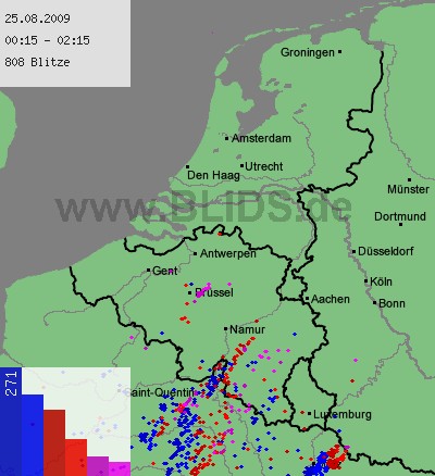
25/08/2009. Lightning sequence between 0015-0215. Near Brussels,
one cell became suddenly active. (Source: blids)
|
 |
|
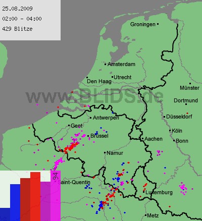
25/08/2009. Lightning sequence between 0200-0400. Second cell a bit
further SW of Brussels was quite active for a moment. (Source: blids)
|
 |
|
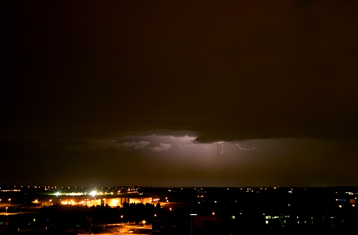
25/08/2009 0137 SSW. First attempt, a cloud-to-air discharge at a
distance of approx 23 km.
|
 |
|
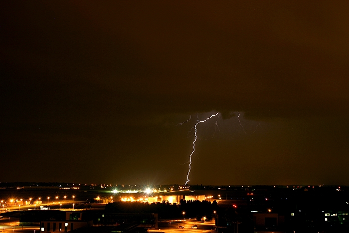
25/08/2009 0144 SSW. Cloud-to-ground strike at distance of approx 15 km.
|
 |
|
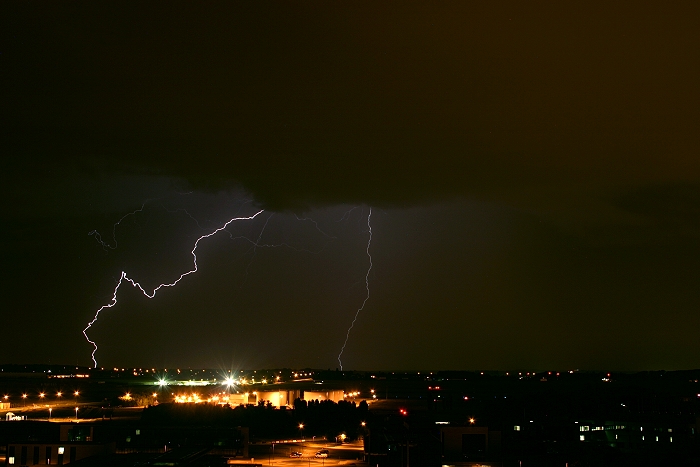
25/08/2009 0148 SSW. Double cloud-to-ground strike, left one approx 15
km, right one approx 20 km diastance.
|
 |
|
25/08/2009 0150 SSW. Very nice double cloud-to-ground strike, left one
approx 15 km, right one 9 km distance.
|
 |
|
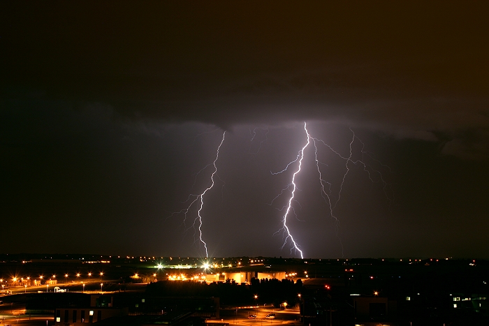
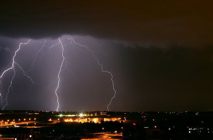
25/08/2009 0152 SSW. Very nice triple cloud-to-ground strike. Afterwards
the rain shaft entered the area but also no significant discharges took
place. The strokes had their impacts at a distance between 12-16 km.
|
 |
|
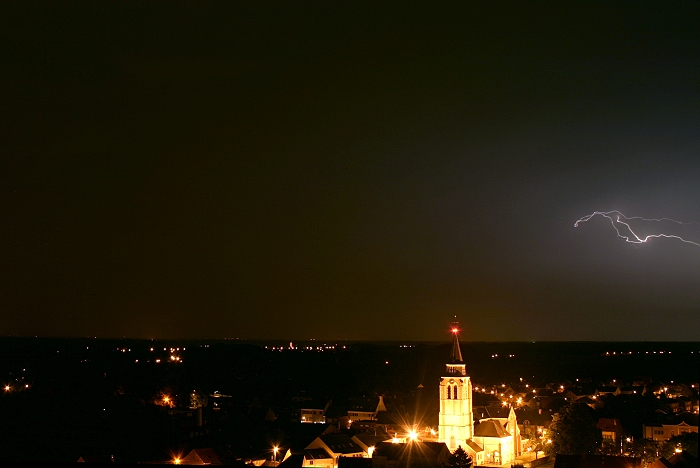
25/08/2009 0228 E. This was the last discharge of this cell,
cloud-to-air at a distance of 30 km.
|
 |
|
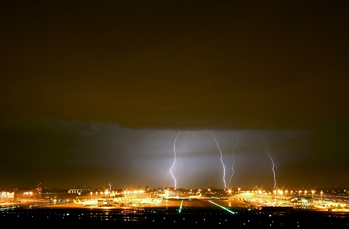
25/08/2009 0346 W. A second cell bringing some very nice discharges,
here a quadruple cloud-to-ground strike at a distance of approx 25 km.
|
 |
|
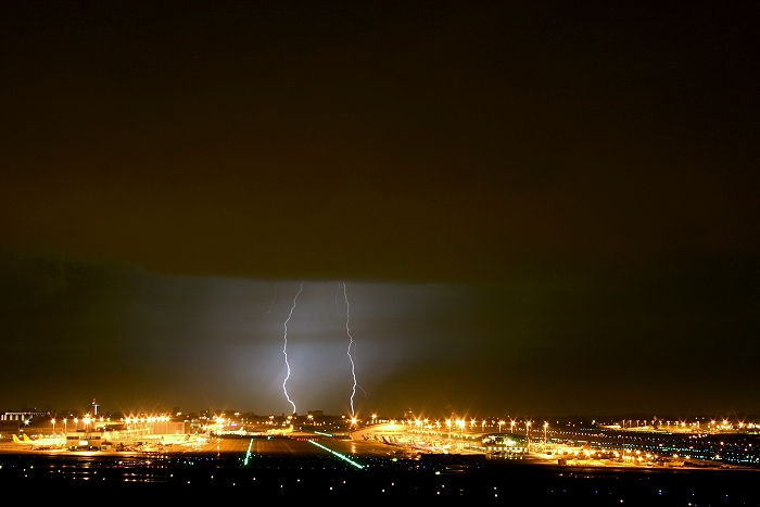
25/08/2009 0347 W. Double cloud-to-ground strike, also at a distance of
approx 25 km. Things looked really
promising to capture more fantastic pictures, however... not a single
discharge took place afterwards.
|