| Weather pictures & report of February 2 2009 |
| Snow related to warm front |
| Synopsis: at 500 hPa a high over low configuration in which the high was centered over Scandinavia and south of it the low migrating retrograde through the Low Countries. Once positioned over England, the related frontal system passed Belgium from south to north. Prefrontal, air was at all levels cold enough to give (a couple of cm) fresh snow. Postfrontal, gradually warmer air was advected and the precipitation turned into liquid form, temporary freezing. Below a pictorial report, all pics have been taken at Steenokkerzeel in local time (CET). |
|
|
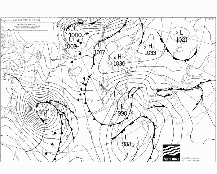
Analysis of the mean sea level pressure with fronts of 02/02/2009 at 0700 CET: a warm front is coming up from France. (Source chart: Met Office - UKMO)
|
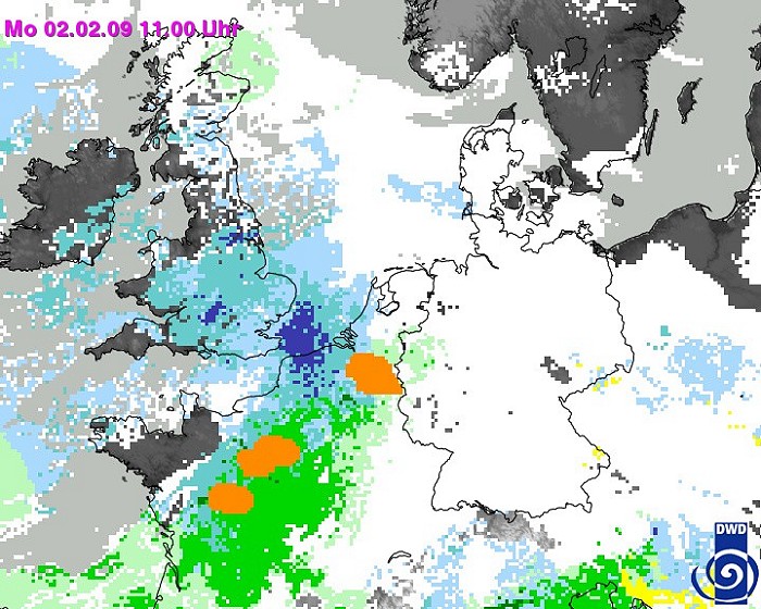
Radar sequence between 0600-1020 CET. It shows the movement of the belt of wintry precipitation. (Source radar picture: Belgocontrol)
|
|
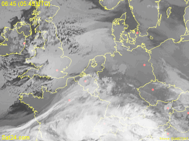
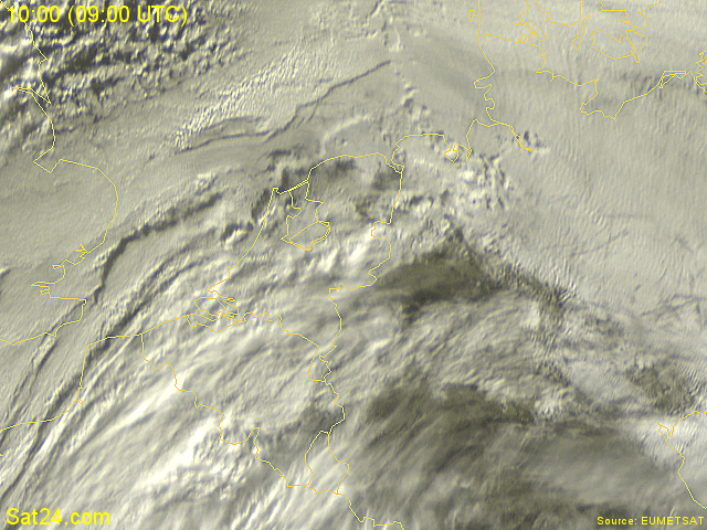
Satellite sequence (infra-red channel) between 0645-0830 CET. Belgium, and a large area south of it, covered by a white cloud canopy. (Source: Meteosat via Sat24.com)
|
 |
|
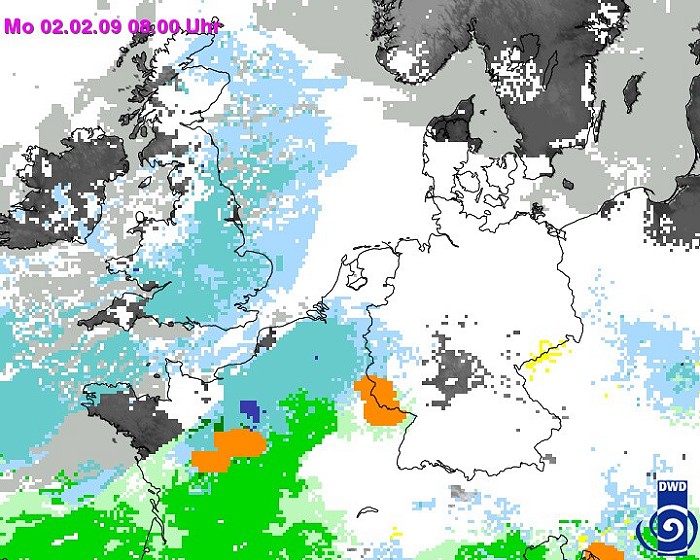
Satellite combined with radar images of 0800 CET, with calculation of type of precipitation. Over a large part of Belgium light snow, with south of it precipitation under liquid form. (Source: DWD)
|
 |
|
Satellite combined with radar images of 1100 CET, with calculation of type of precipitation. The zone with freezing liquid precipitation has moved to central parts of Belgium. (Source: DWD)
|
|
Satellite sequence in the visual spectrum between 1000-1200 CET. (Source: Meteosat via Sat24.com)
|
 |
|
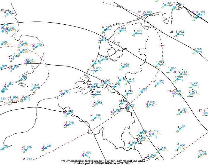
Observed mean sea level surface chart of 1000 CET with the so called
'plots': in Belgium, south of Samber and Meuse, precipitation was
falling as freezing rain, north of it as snow.
(Source map: Meteocentre).
|
 |
|
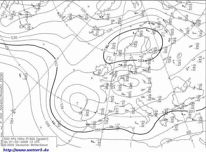
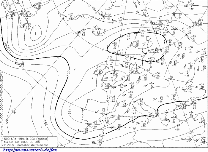
Observed upper air chart (01/02/2009) at 500 hPa of 1300 CET: low (or cold pool)
just east of the Low Countries.
(Source map: DWD).
|
 |
|
Observed upper air chart (02/02/2009) at 500 hPa of 0100 CET: cold pool
has arrived over SE England. (Source map: DWD).
|
 |
|
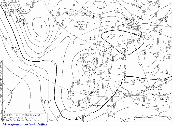
Observed upper air chart (02/02/2009) at 500 hPa of 1300 CET: cold pool
now over SW England, overhead the airflow further backed to the south.
(Source map: DWD).
|
 |
|
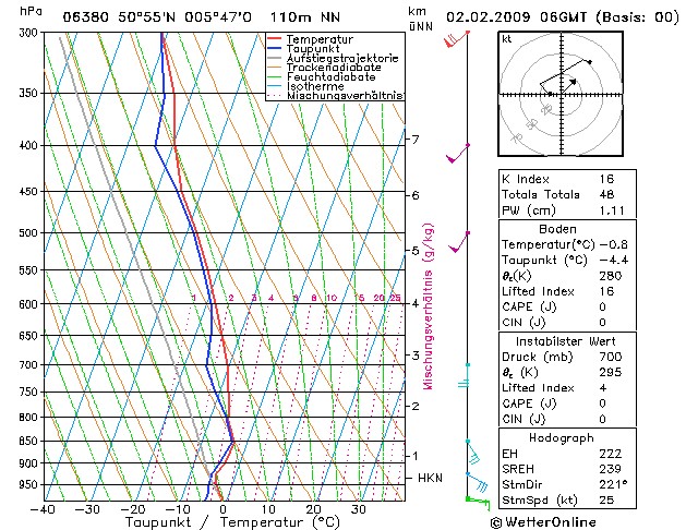
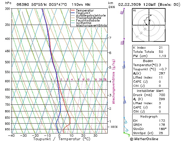
Forecasted sounding of Maastricht at 0700 CET. This was the best
representative sounding to describe the vertical profile of the
prefrontal air: an (almost) saturated layer starting from a height of
around 900 m (= 950 hPa), reaching to around 2,5 km (= 750 hPa), and
between 3,5 km (650 hPa) reaching up to 6 km (450 hPa). Attention
must be paid to the fact that the temperature was in the
entire sounding below zero, so 100% chance of the occurrence of snow. (Source sounding: WetterOnline).
|
 |
|
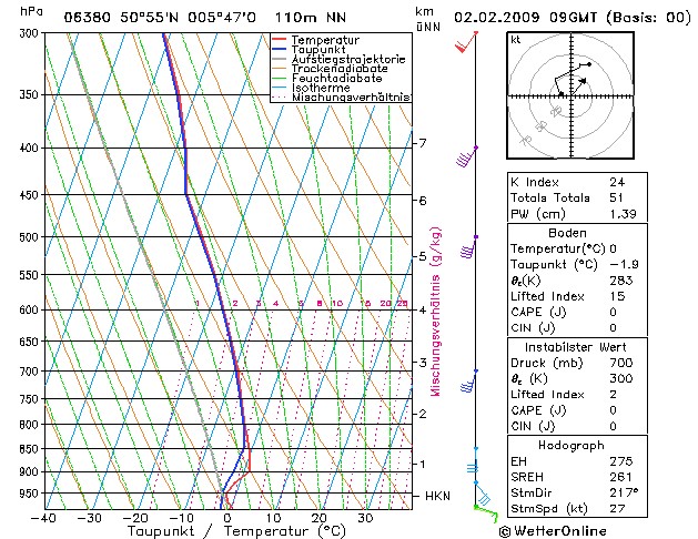
Forecasted sounding of Maastricht at 1000 CET. Still well saturated layer,
now starting from 1,5 km (= 850 hPa) up to 10 km (300 hPa). Most
important fact is that there is a small layer (between 970-850 hPa) were
the temperature is >0°C. At surface still <0°C, so freezing
precipitation (ice pellets or freezing rain) is possible. (Source sounding: WetterOnline).
|
 |
|
Forecasted sounding of Maastricht at 1300 CET. A saturated layer from
700 hPa onwards. At surface now also a temperature >0°C, freezing levels starts
even at 800 hPa, so theoretically only non freezing liquid
precipitation is possible. (Source sounding: WetterOnline).
|
 |
|
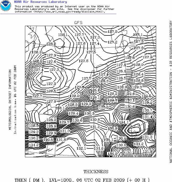
Forecasted thickness map (in dam) between 1000-500 hPa of 02/02/2009 at
0700 CET. This calculation (or measurement) gives one of the best
ideas on the kind of precipitation. Using the snow predictor of Boyden,
which takes account of pressure and height, this tool gives an idea
about the expectations of solid precipitation. In this case, with a
pressure of 995 hPa at height of 50 m, values of 131,0 dam or higher
give a probability of snow of 50 % or
less. (Source map: NOAA web
server).
|
 |
|
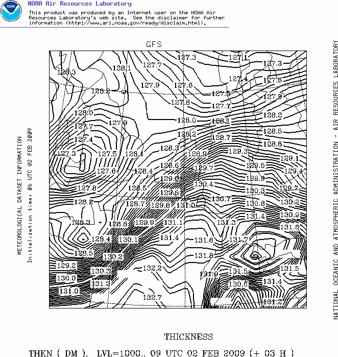
Forecasted thickness map (in dam) between 1000-500 hPa of 05/01/2009 at
1000 CET. Warmer air steaming NW-wards, thus de 131,0 dam line is also
migrating NW-wards. (Source map:
NOAA web server).
|
 |
|
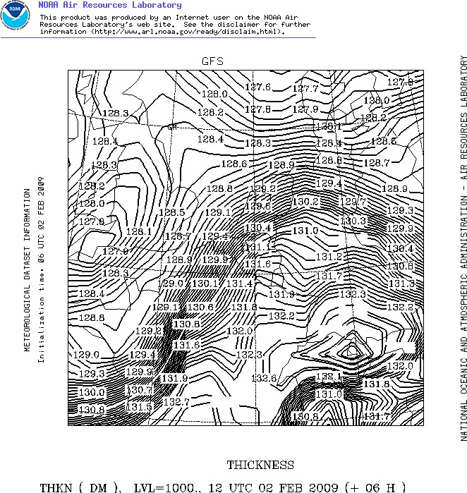
Forecasted thickness map (in dam) between 1000-500 hPa of 05/01/2009 at
1300 CET. Only the NW-ern parts of Belgium in cold enough air to let it
snow, over the rest of the country precipitation is under liquid form,
and this warmer air reached the coast in the afternoon. (Source map: NOAA web server).
|
 |
|
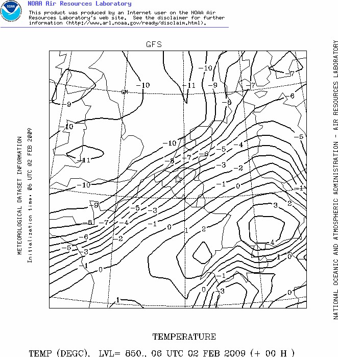
Forecasted upper air map (850 hPa ) of temperatures (in °C) at 0700 CET.
Gives another idea how the warmer air was advected into our area. (Source map:
NOAA web server).
|
 |
|
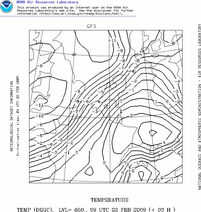
Forecasted upper air map (850 hPa ) of temperatures (in °C) at 1000 CET. (Source map:
NOAA web server).
|
 |
|
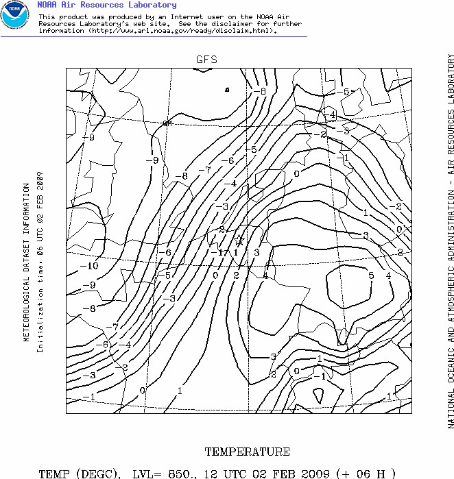
Forecasted upper air map (850 hPa ) of temperatures (in °C) at 1300 CET. (Source map:
NOAA web server).
|
Below the observation sequence at Brussels Airport in UTC between 0550-1420, most recent one on top. Although not reported as such, light freezing rain did occur between 0950Z and 1050Z.
EBBR 021320Z 09008KT 9999 R25L/P1500N R25R/P1500N
R02/1400N FEW036 01/M01 Q0995 R57290095 R02290095 R07290095 NOSIG
|
 |
|
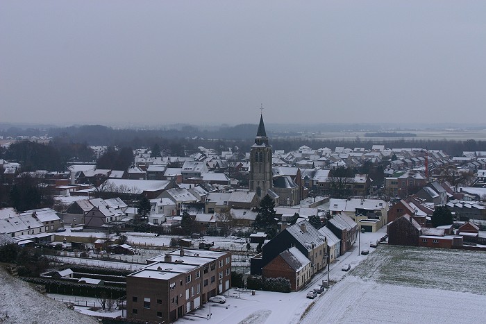
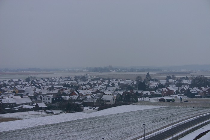
02/02/2009 1025 NE. Village of Steenokkerzeel under a snow "cover" of 1
cm. It remained overcast with at that time some light freezing rain.
|
 |
|
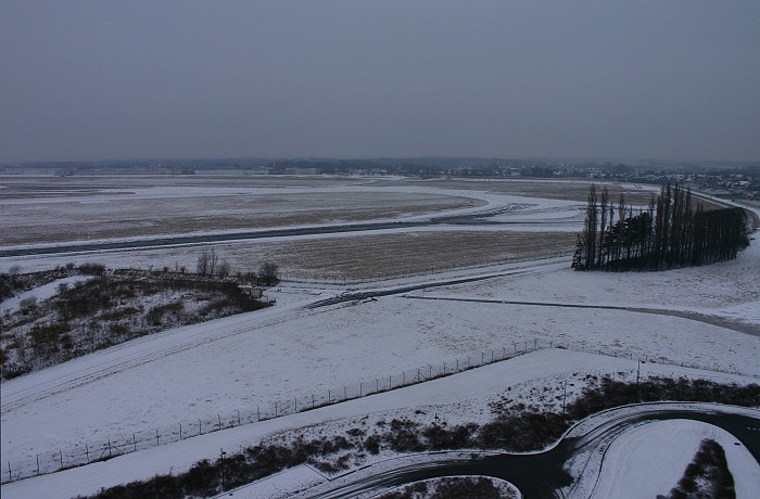
02/02/2009 1027 SE. Other side, the village of Humelgem.
|
 |
|
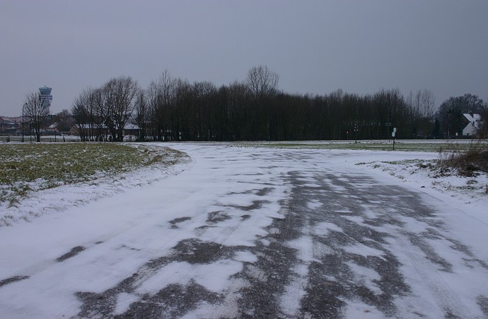
02/02/2009 1029. View of part of the airport.
|
 |
|
02/02/09 1052. On the road, a thin cover of "blowed snow".
|
 |
|
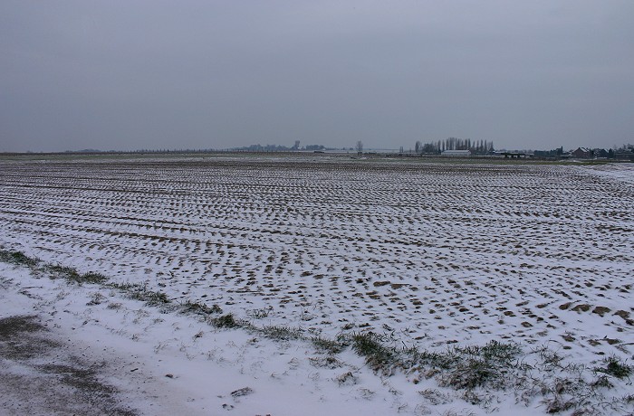
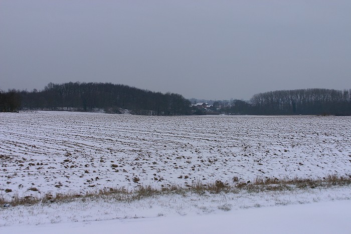
02/02/09 1055. View in the field.
|
 |
|
02/02/09 1101. Another view in the field, by the evening only traces of
snow were left.
|