| Weather pictures & report of November 23 2008 |
| Snow related to occluding frontal system. |
| Synopsis: at 500 hPa a sharpening upper trough over the British Isles of which its axis moved over Belgium during the evening. Related occluding system crossed Belgium in the afternoon & evening producing in the entire country during 4 to 6 hours hours light to moderate falls of snow. It gave a cover of a few cm, on isolated spots even up to around 10 cm. All pics taken at Kampenhout in local time (CET). |
Radar sequence between 1310-1600 CET. It shows the passage of the precipitation belt from west to east. (Source radar picture: Belgocontrol)
|
|
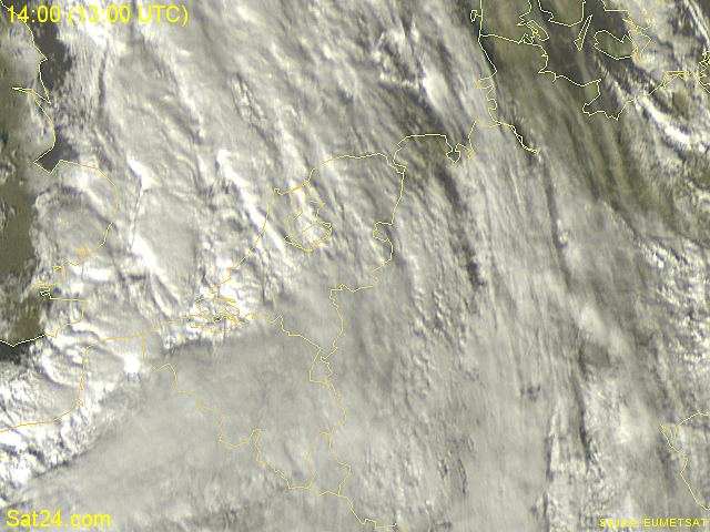
Satellite sequence (visible channel) between 1400-1545 CET. The entire country covered by thick cloudiness. (Meteosat via Sat24.com)
|
|
|
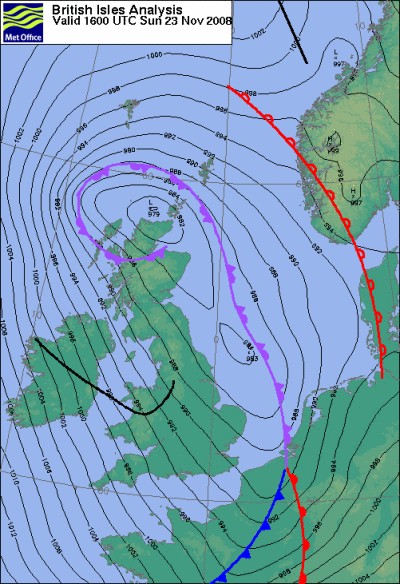
Analysis of the mean sea level pressure with fronts of 23/11/2008 at 1700 LT. Prefrontal air was cold enough to produce solid precipitation, postfrontal air had dewpoints above zero degree, so with thawing conditions. (Source chart: Met Office - UKMO)
|
 |
|
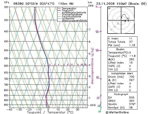
Forecasted sounding of Maastricht at 1600 CET. This was the best
representative sounding to describe the vertical profile of the
prefrontal air: a saturated layer starting from a height of
around 800 m (= 950 hPa), reaching up around 8 km (= 350 hPa). Attention
must be paid to the fact that the temperature was in the
entire sounding below zero, so 100% chance of the occurrence of snow. (Source sounding: wetterOnline).
|
 |
|
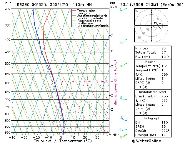
Forecasted sounding of Maastricht at 2200 CET. This was the best
representative sounding to describe the vertical profile of the
postfrontal air: still a
saturated layer, this time starting from a height of
around 300 m (= 970 hPa), reaching up around 5 km (= 500 hPa). Import
difference is the fact that below 1000 m (900 hPa), the
temperature is slightly positive, so any precipitation would occur under a
liquid form. Moreover, temperature and dewpoint are well above the
freezing point, thus resulting in a positive wetbulb and thaw. (Source sounding: wetterOnline).
|
 |
|
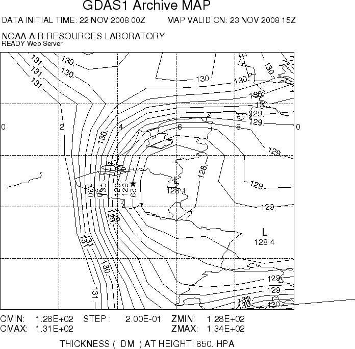
Forecasted thickness map (in dam) between 1000-850 hPa of 23/11/2008 at
1600 CET. This calculation (or measurement) gives one of the best ideas
on the kind of precipitation, as this is done below 1500 m so the
maritime component in the boundary layer is well weighted. Using the
snow predictor of Boyden, which takes account of pressure and height,
this tool gives an idea about the expectations of solid
precipitation. In this case, with a pressure of 990 hPa at height of 50
m, values of 129,7 dam or less give a probability of snow of 50 % or
higher, on the other hand values of 129,8 and higher give a probability
of snow of less than 50 %. Clearly visible: over the western parts
chances on having snow dwindle significant and this zone moved slowly eastwards. (Source map: NOAA web server).
|
 |
|
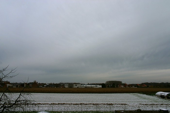
23/11/2008 1137 N. Incoming medium level cloudiness, the snow already present on
the ground was the result of some showers the day before.
|
23/11/2008 1527-1715 N. Motion picture of 1,5 hours of webcam images taken at each minute, shortened to a time-lapse of 15 seconds, shows the the accumulation of the snowfall. By the end, a total of 5 cm was measured. Below the observation sequence at Brussels Airport in UTC between 1120-1820. EBBR 231120Z 19012KT
9999 FEW010 01/M02 Q1002 R25R/290075 R25L/290078 TEMPO BKN010
|
 |
|
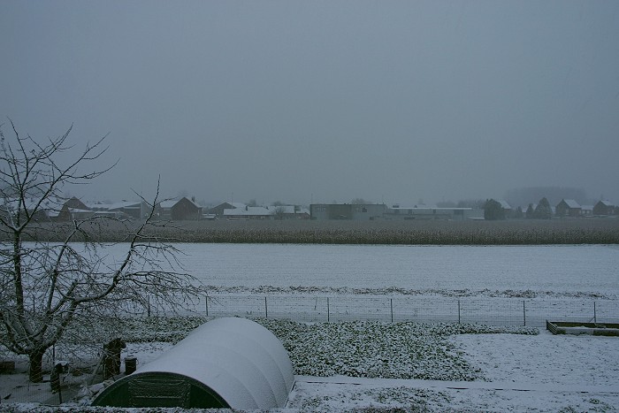
23/11/2008 1614 NNW. After 45 minutes of dry snowfall, the landscape
became white.
|
 |
|
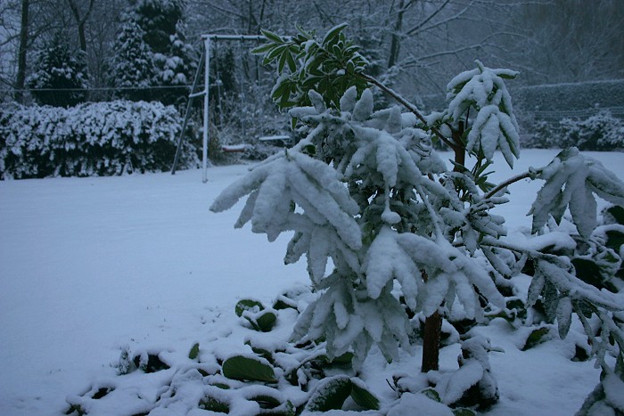
23/11/2008 1645. In the garden.
|
 |
|
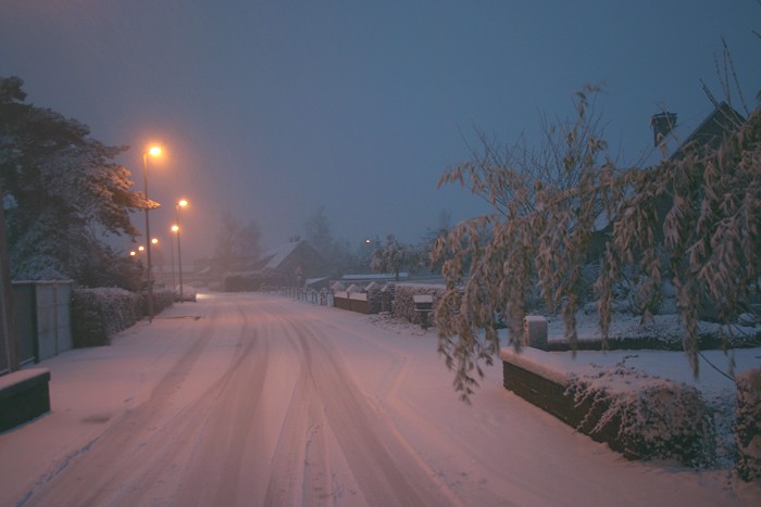
23/11/2008 1658. On the street, lucky no saltspraying vehicles were
seen, accentuation this wonderful scenery.
|
 |
|
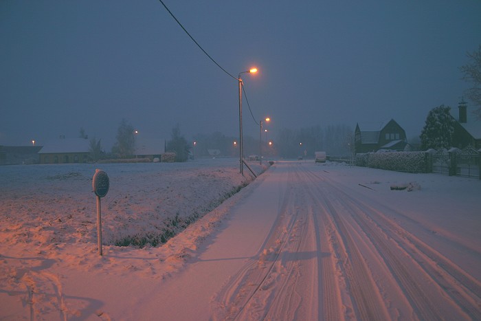
23/11/2008 1701. Same comment.
|
 |
|
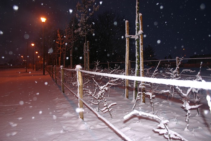
23/11/2008 1704. Still some large snow flakes coming down.
|
 |
|
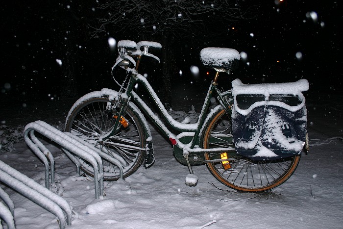
23/11/2008 1719. This bike proved to be an interesting object.
|
 |
|
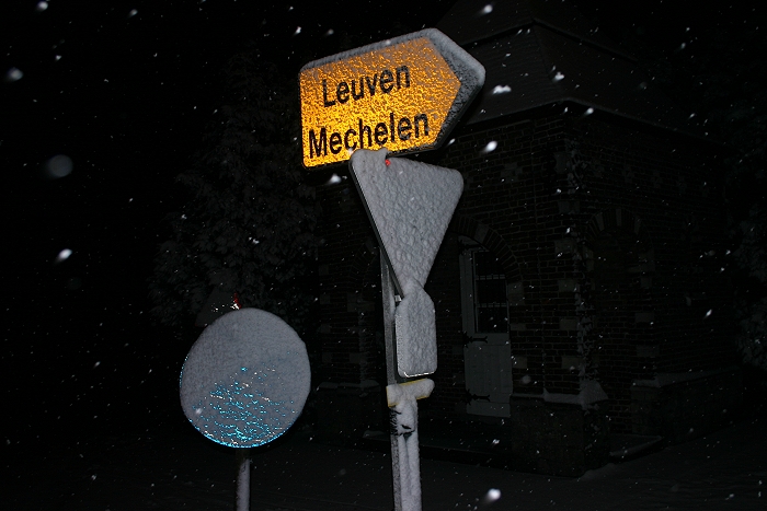
23/11/2008 1722. And what about the visibility of these road signs?
|
 |
|
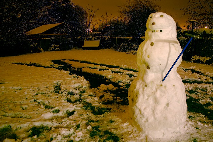
23/11/2008 1934. As so often with these kind of winter situations, it
could be expected that most of the snow wouldn't hold till the next day.
So the bold idea came to help mother nature a bit: the snow was of good
(wet) quality and this snowman did survive for at least 4 days !
|