| Weather pictures & report of November 22 2008 |
| Wintry showers. |
| Synopsis: at 500 hPa an Omega pattern with a ridge over the Atlantic and a sharp upper trough over the continent. At surface near the Baltic States a complex deepening low around 980 hPa and north of the Açores a high pressure cell of 1043 hPa with a ridge of 1029 hPa towards Iceland. Thus, in between, Belgium at all levels in a NW'ly cyclonic airflow of unstable air. Postfrontal, during a period of 24 hours, wintry showers were advected into the Low Countries, good enough for the first snow(pellets) of the new winter season. All pics taken at Kampenhout in local time (CET). |
Radar sequence between 1130-1340 CET. It shows the passing of two showers at my location near "BR". Precipitation tops went up to 4 km. (Source radar picture: Belgocontrol)
|
Satellite sequence (visible channel) between 1115-1415 CET. My location in the center of Belgium. Lots of (wintry) showers were advented from the Northsea.(Source satellite picture: Meteosat via Sat24.com)
|
|
|
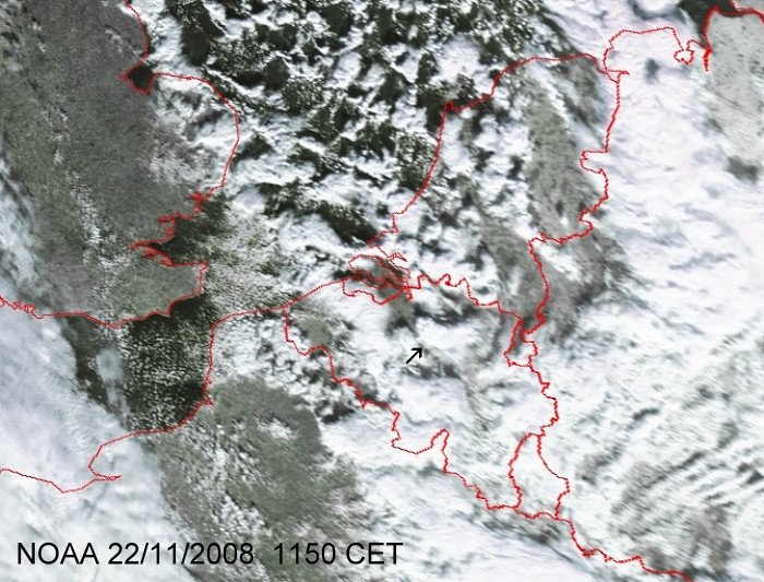
Satellite picture (wisible) of 22/11/2008 at 1150 LT. The black arrow points to a shower which is described with a time-lapse below. (Source satpicture: NOAA and University of Bern)
|
|
|
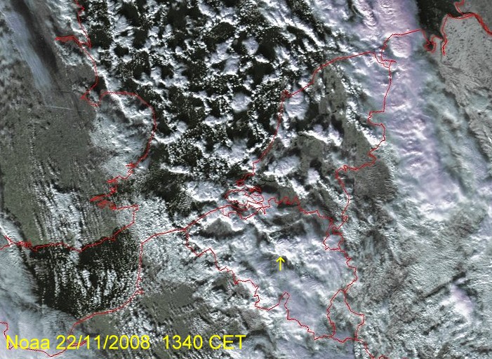
Satellite picture (visible) of 22/11/2008 at 1340 LT. The yellow arrow points to a shower which is described by some pictures below. It gave the first wintry precipitation with small accumulation on the ground. (Source satpicture: NOAA and University of Bern)
|
|
|
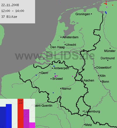
22/11/2008 1200-1400 CET. My location near "Brüssel". Cloud-to-ground discharges over a two hour period. The pointed shower in the above satellite picture gave a few rumbles of thunder which were quite close to my home. (Source picture: Blids)
|
 |
|
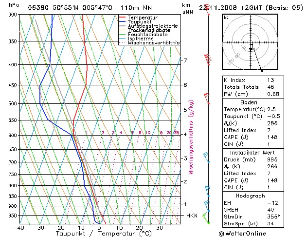
Forecasted sounding of Maastricht at 1300 CET. This was the best
representative sounding to describe the vertical profile: an unstable
saturated layer starting from a height of
around 800 m (= 950 hPa), reaching up around 4 km (= 600 hPa) were
the temperature was around -30C. (Source sounding: wetterOnline).
|
 |
|
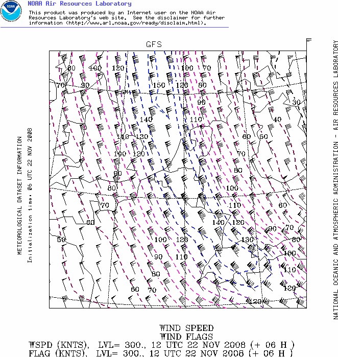
Forecasted wind speed map (in kt) at 300 hPa of 1300 CET. The axis of the jetstream with a wind speed of 150 kt was situated over the center of
Belgium. (Source map: NOAA web server).
|
 |
|
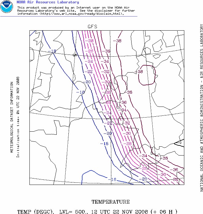
Forecasted temperature map (in °C) at 500 hPa of 1300 CET. This gives an idea
were the coldest air was situated, namely on the eastern side (left
side) of the jetstream. (Source map: NOAA web server).
|
 |
|
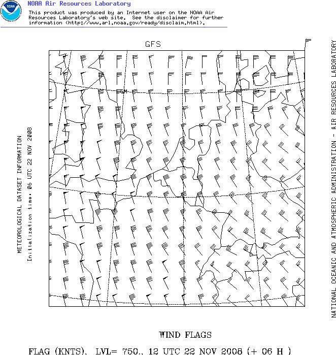
Forecasted windspeed map (in kt) at 750 hPa of 1300 CET. This gives an
indication how the showers moved. (Source map: NOAA web server).
|
 |
|
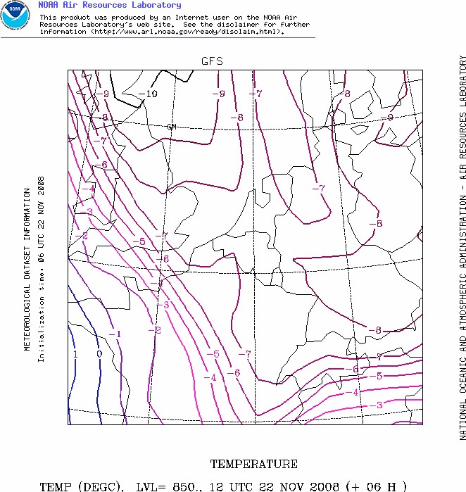
Forecasted temperature map (in °C) at 850 hPa of 1300 CET. This gives a
first idea on the type of eventual precipitation: with a maritime
airflow solid precipitation starts in the lower parts of the Benelux
usually from -7°C on . (Source map: NOAA web server).
|
 |
|
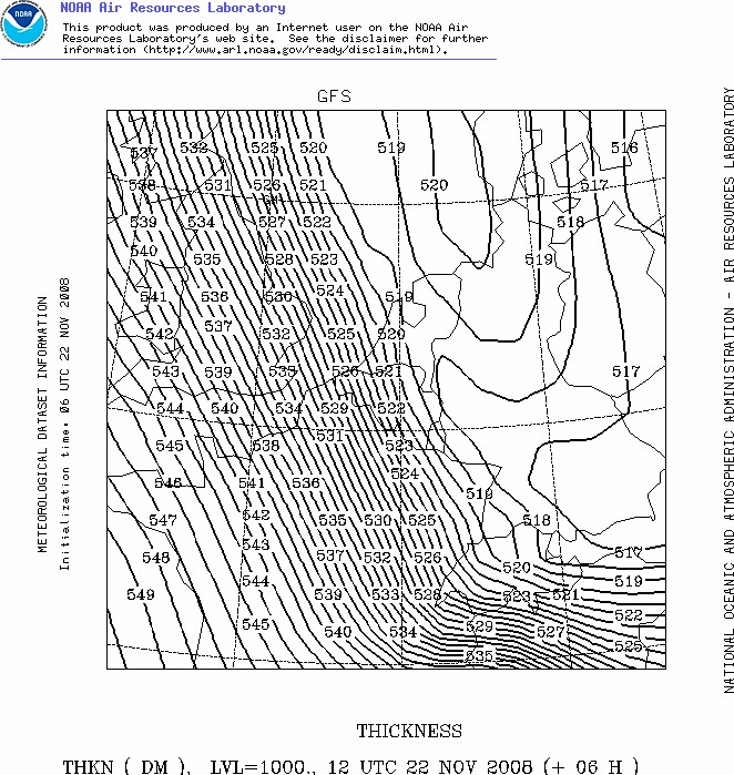
Forecasted thickness map (in dam) between 1000-500 hPa of 1300 CET. This
gives a better idea on the kind of precipitation: in a maritime airflow
wet snow usually occurs over the lower parts of the Benelux from values
528 dam or lower, if 522 dam or lower dry snow can be expected. This
shows clearly that central and eastern parts of Belgium had the better
chances of having dry snow. (Source map: NOAA web server).
|
 |
|
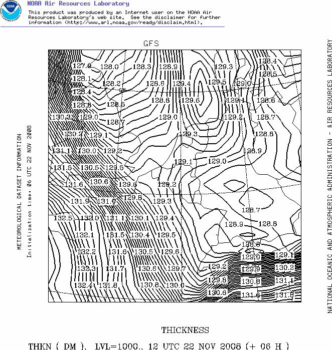
Forecasted thickness map (in dam) between 1000-850 hPa of 1300 CET. This
calculation (or measurement) gives one of the best ideas on the kind of precipitation,
as this is done below 1500 m so the maritime component in the boundary
layer is well weighted. Using the snow predictor of Boyden, which takes
account of pressure and height, this tool gives at 50 m height and the
observed pressure of 1010 hPa a 90% probability of having snow, of
course assuming precipitation is expected. (Source map: NOAA web server).
|
 |
|
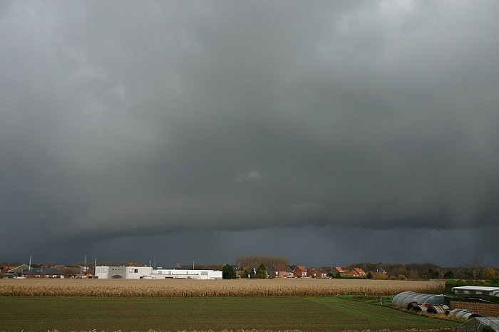
22/11/2008 1157 N. First significant shower of the day with some snow
pellets and one rumble of thunder. It gave as a kind of warning also
this nice arcus cloud.
|
22/11/2008 1159-1203 N. Motion picture of 4 minutes shortened to a time-lapse of 6 seconds showing this approaching shower. The arcus was soon hidden behind a curtain of precipitation.
|
 |
|
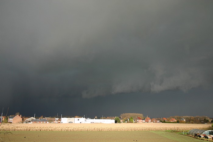
22/11/2008 1327 N. Next shower, this time reasonable significant giving
a quite frightening appearance on its approach. A few minutes later
heavy precipitation in form of snow pellets came down accompanied by a
handful of very close discharges and roaring thunders.
|
 |
|
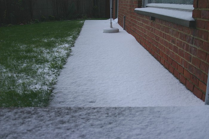
22/11/2008 1335. Eight minutes later, skies began to clear. Especially
against the wind, significant accumulation of these pellets took place.
|
 |
|
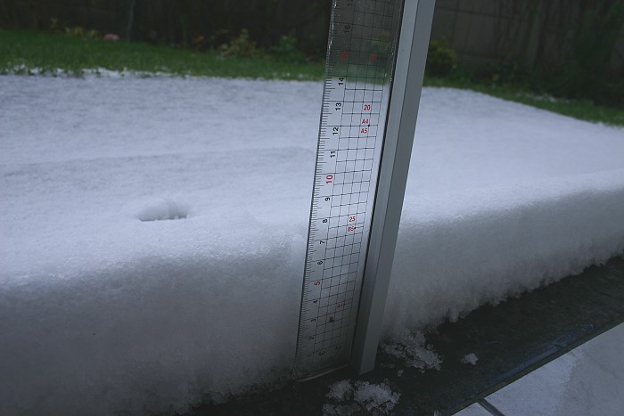
22/11/2008 1341. Measurements at my homes doorstep gave even a depth of
7 cm.
|
 |
|
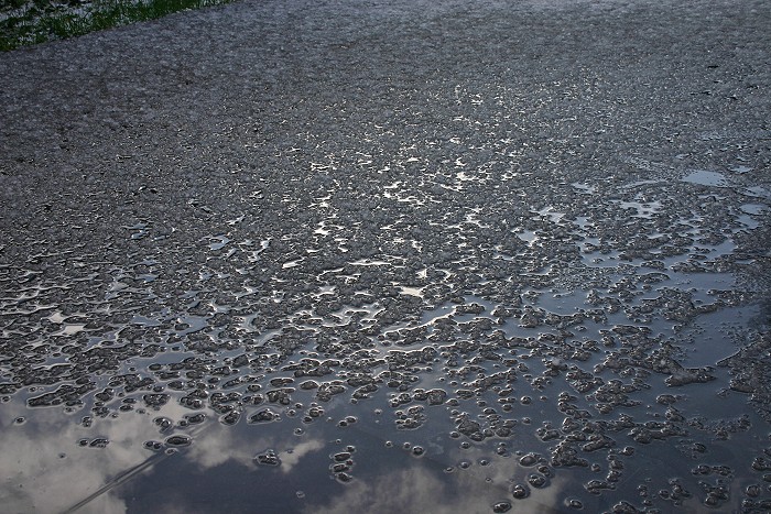
22/11/2008 1344. The sun came out, the snow began to melt on paved
surfaces.
|
 |
|
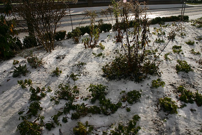
22/11/2008 1346. On the soil this cover survived even the day after.
|
 |
|
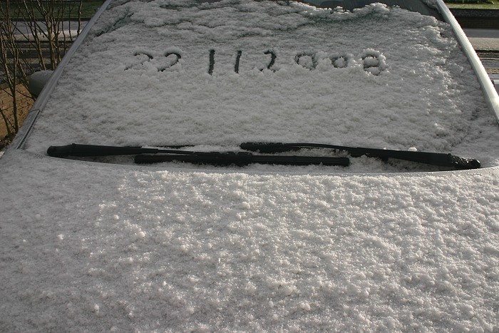
22/11/2008 1349. Proof of the first snow cover of the new winter season.
|