| Weather pictures & report of August 7 2008 |
| MCS thunderstorms along prefrontal thermal trough & multi-cell thunderstorms along postfrontal trough lines. |
| Synopsis: at 500 hPa a sharpening upper trough over the U.K. The Low Countries in a SSW'ly airflow in which consecutive a thermal trough, a weak cold front and a trough line crossed the area. During the night, two MCS thunderstorm were formed along the thermal trough over France. In the late night & early morning, the first one did affect mainly the western parts of Belgium. Later during the forenoon, the second one crossed our region but was already evolved into an inactive MCV. In the afternoon & evening, smaller multi-cell thunderstorms did form along some postfrontal troughlines. All pics taken at Kampenhout and Steenokkerzeel in local time (CET). |
 |
|
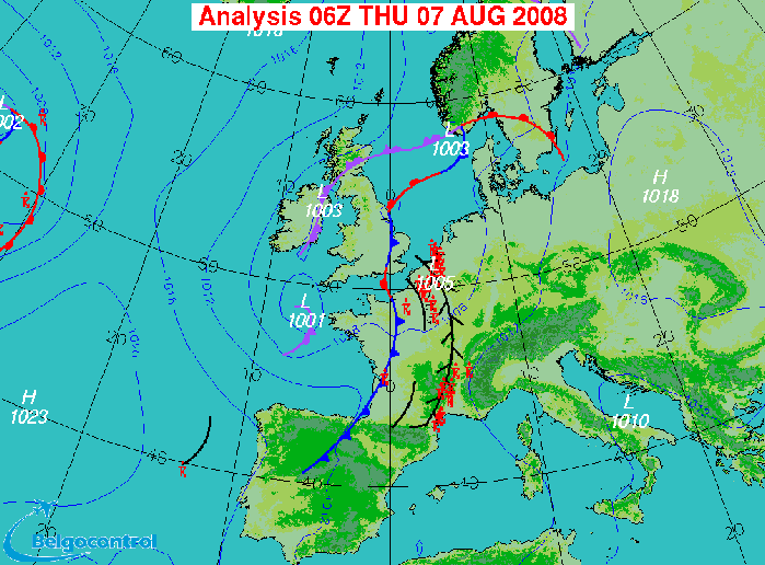
Surface analysis at 0800 CET. Ahead the cold front, a thermal trough was
migrating through Belgium.
(Source chart: Belgocontrol)
|
 |
|
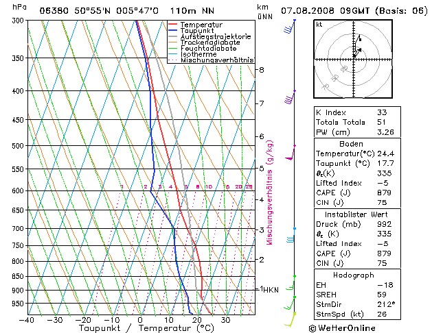
Forecasted sounding of Lille at 1100 CET. This was the best representative sounding to describe
the vertical profile: a very unstable layer starting from an altitude of
around 2500 m (= 750 hPa), below a stable layer with a significant
so-called CAP (= positive CIN of 75 J/kg). So instability should need a
trigger to get started, in this case the dynamical force of thermal
trough was sufficient. Furthermore the shear and CAPE would suggest the
formation of multi-cell thunderstorms, the indices show that these
storms would have a coverage of scattered to numerous. (Source sounding: wofrance)
|
Radar sequence between 0520-0840 CET. My location was near "BR". Over the west the first echo's were from the MCS, at the end of this sequence from the SW echo's from the MCV. MCS and MCV formed a continuous rainbelt. Some precipitation tops went up to 15 km. (Source radar picture: Belgocontrol)
|
 |
|
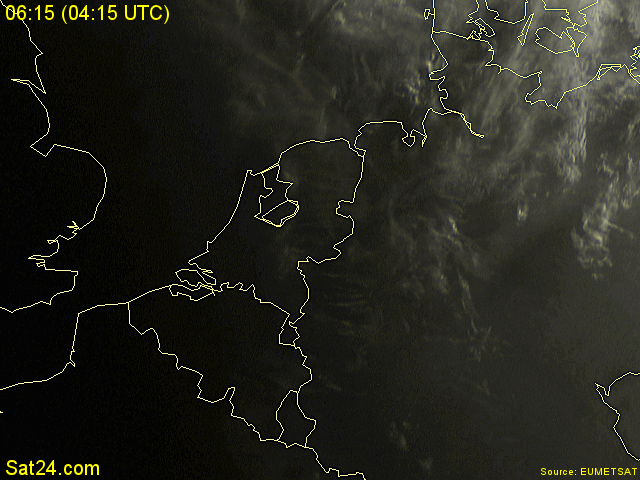
07/08/2008 0615-0800 CET. My location in the center of Belgium. The picture in the visible spectrum shows the enormous anvil
with two cores.
(Source sat picture: Eumetsat via Sat24.com)
|
 |
|
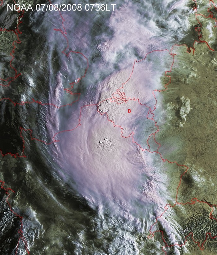
07/08/2008 0736 CET. My location in the center of Belgium, near the
red B. The picture in the visible spectrum gives another view on the enormous anvil
with two cores: one over western Belgium and another just northeast of
Paris which clearly holds also two overshooting tops.
(Source sat picture: NOAA & University of Bern)
|
 |
|
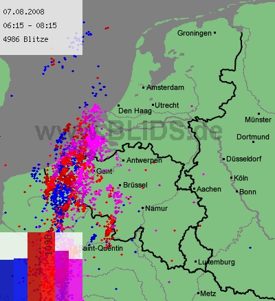
07/08/2008 0615-0815 CET. My location near "Brüssel". Cloud-to-ground discharges over a two
hour period with main activity over the west but a weaker cell was also
approaching the centre of Belgium. Latter one is described below with a
couple of pictures and a time-lapse. (Source picture: Blids)
|
 |
|
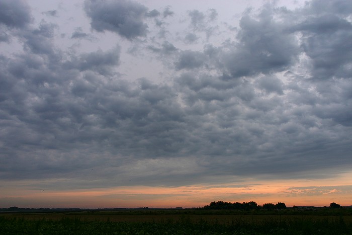
07/08/2008 0736 ESE. A couple of shots at Steenokkerzeel: at the edge of
the anvil, a field of Altocumulus floccus.
|
 |
|
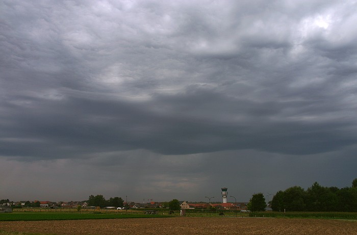
07/08/2008 0744 SW. An approaching weak shower (with stripes) gave some nice
waving structures in the cloudbase at a height of 2700 m.
|
07/08/2008 0740-0803 SW-S. Motion picture of 23 minutes shortened to a time-lapse of 15 seconds showing the structure of the cloudiness with an attempt to form a weak shelf. At the end of this lapse, just in front of the rainshaft, a couple CG strikes did occur but none were captured on sensor.
|
 |
|
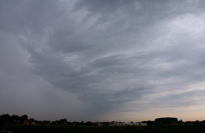
07/08/2008 0814 N. At Kampenhout, the same shower was further moving
NNE-wards, with sometimes a few (not photographable) CG strikes. Afterwards,
nothing interesting happened, thus making an end of the first part of
this pictorial report.
|
 |
|
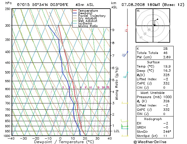
Forecasted sounding of Lille at 2000 CET. This was the best representative sounding to describe
the vertical profile of the postfrontal air. Instability started from an altitude of
around 700 m (= 930 hPa). Shear and CAPE would suggest the formation of multi-cell thunderstorms,
the indices show that these storms would have a coverage of scattered.
In comparison with the sounding of the morning, the Cb tops would go
less higher. (Source sounding: wofrance)
|
Radar sequence between 1650-2120 CET. My location was near "BR". A rather large multi-cell thunderstorm (but not MCS) was crossing the entire area, with some precipitation tops up to 11 km. (Source radar picture: Belgocontrol)
|
 |
|
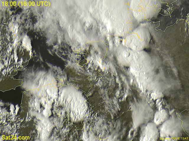
07/08/2008 1800-1945 CET. My location in the center of Belgium. The
picture in the visible spectrum shows the the large anvils of several multi-cells.
(Source sat picture: Eumetsat via Sat24.com)
|
 |
|
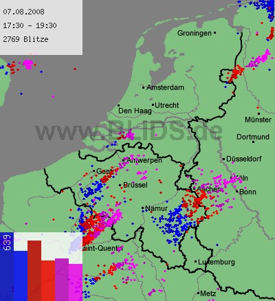
07/08/2008 1730-1930 CET. My location near "Brüssel".
Cloud-to-ground discharges over a two hour period with main activity
over the center and east. (Source picture: Blids)
|
 |
|
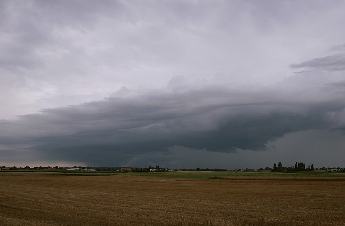
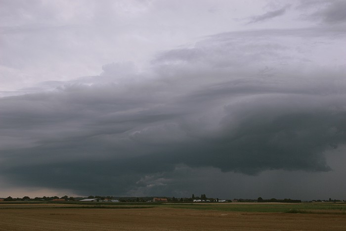
07/08/2008 1838 SW. Some shots taken at Kampenhout: approaching shower which was thundery, but not
on its passage over my area. Again visible is an attempt of a formation of a weak
shelf.
|
 |
|
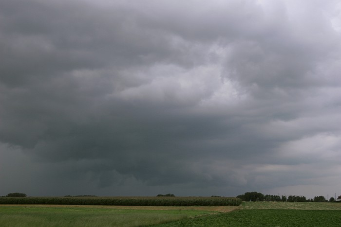
07/08/2008 1839 SW. Further closing, with in the middle below (in the far distance), a
sort of whales mouth structure.
|
 |
|
07/08/2008 1848 NW. Other side with again a very faint attempt of a shelf
cloud. Shortly afterwards the rain shaft took full control ending this
photo session
|
07/08/2008 1833-1848 SW-S. Motion picture of 15 minutes shortened to a time-lapse of 10 seconds showing the sometimes interesting cloud structure on the approach of this shower.
|
 |
|
07/08/2008 2059 ESE. Back at Steenokkerzeel, after a couple of hours of
rain fall, the cell cleared northeastwards with at its back an almost
cloud free sky. This gave the opportunity to shoot some shots in "the
warm light" of sunset.
|
 |
|
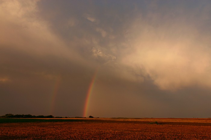
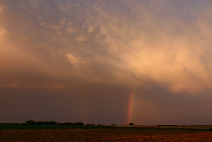
07/08/2008 2102 ESE. Piece of double rainbow with mamma structure in the
clouds..
|
 |
|
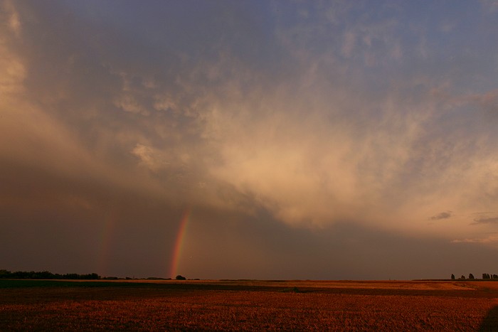
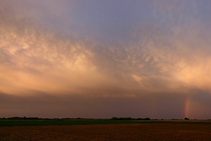
07/08/2008 2105 ESE. Same view, but telezoomed.
|
 |
|
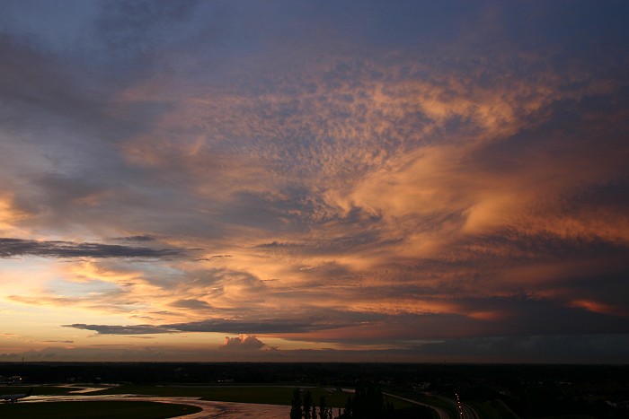
07/08/2008 2106 ESE. Wide angle shot.
|
 |
|
07/08/2008 2117 NNW. The view towards the north was also magnificent.
|
 |
|
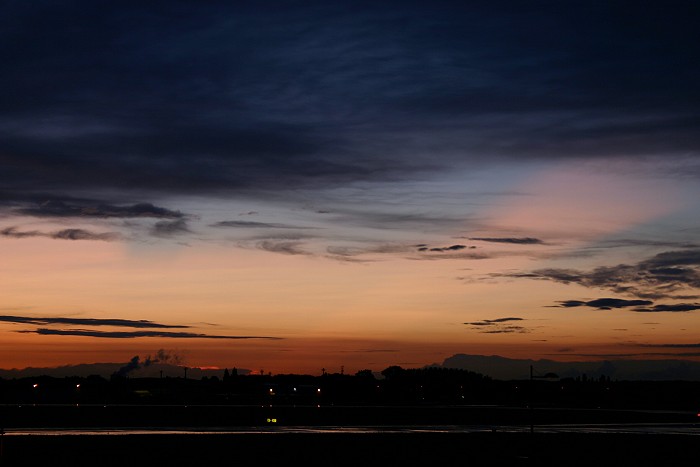
07/08/2008 2141 NW. Taken half an hour after sunset: bright
crepuscular rays and this was the effect of a couple of Cb anvils
positioned just off the eastern coast of England, so at a distance of more than 250 km. A nice moment to close this interesting day.
|