| Weather pictures & report of July 31-August 1 2008 |
| Multi-cell thunderstorms along convergence line. |
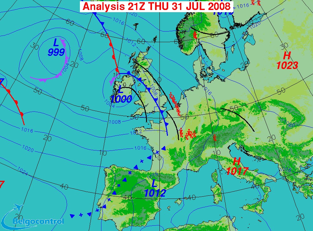
| Synopsis: at 500 hPa a relaxing upper trough over the Atlantic extending towards NW France and a collapsing ridge over Central-Europe extending towards Iceland. The Low Countries in a strengthening SSW'ly airflow in which towards midnight a weak cold front, and ahead, a convergence line did enter Belgium. Along this convergence line weak to moderate thunderstorms were advected from France or did form over our area. Main activity was over western parts and later also southeastern parts. Entire amount of discharges was almost 12.000 (of which 6.700 cloud-to-ground strikes). My location was on the edge of the the western cells with the closest discharges at a distance of around 5 km. All pics taken at Kampenhout in local time (CET). |
 |
|
Surface analysis at 2300 CET. Ahead the cold front, two convergence
lines were moving towards Belgium.
(Source chart: Belgocontrol)
|
 |
|
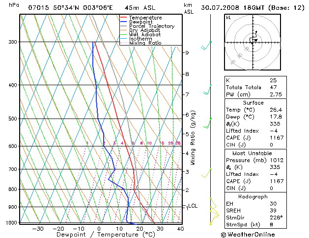
Forecasted sounding of Lille at 2000 CET. An unstable (at first rather
dry but later very moist) profile in which the shear and CAPE would suggest the
formation of multi-cell thunderstorms with a cloudbase of around 5000 ft.
Checking the indices these storms would have a coverage of scattered. (Source picture:
wofrance)
|
Radar sequence between 2100-0140 CET. My location was near "BR". Some precipitation tops went up to 12 km. (Source radar picture: Belgocontrol)
|
 |
|
31/07/2008 2315-0100 CET. My location in the center of Belgium, near the
red dot. On this infra-red picture, in the mass of medium and high level
clouds (white), a rather small exploding cell is recognizable over the
provinces Hainaut & Oost-Vlaanderen.
(Source sat picture: Eumetsat via Sat24.com)
|
 |
|
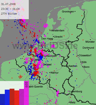
31/07-01/08/2008 2330-0130 CET. Cloud-to-ground discharges over a two
hour period. Main activity did occur over western parts, with also some weaker cells over
the central parts. Source picture: Blids.
|
 |
|
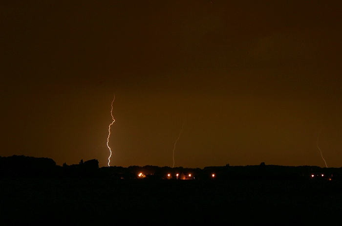
31/07/2008 2355 NNW. Passage of a first active cell, distance of
discharges were well over 15 km, hence no better pictures available of
the mainly cloud-to-ground strikes.
|
 |
|
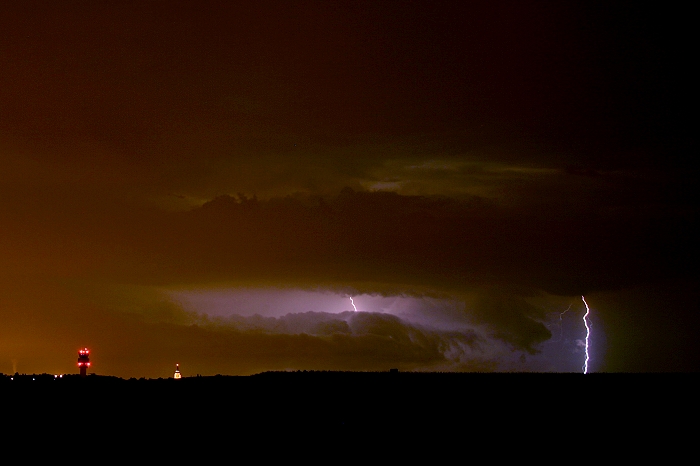
01/08/2008 0113 W. A second cell (the one that can be seen exploding on
the sat picture), produced some better quality pictures. Also here
mainly CG strikes but a also few intra-clouds ones lightning up the
structure of the surrounding cloudiness.
|
 |
|
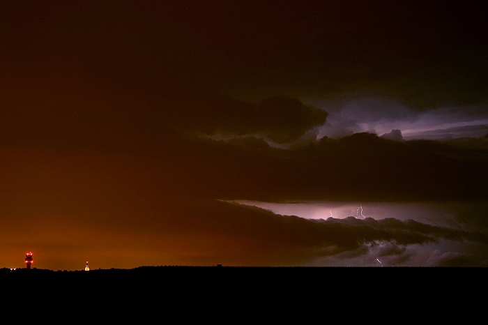
01/08/2008 0117 W. Same comment.
|
 |
|
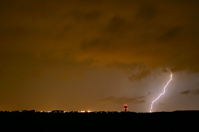
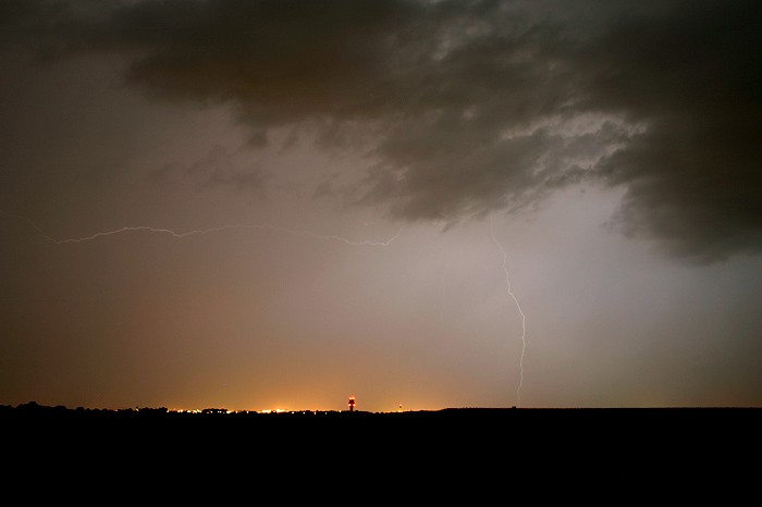
01/08/2008 0126 WSW. This was the closest discharge of the night, a bold
CG strike at a distance of around 5 km.
|
 |
|
01/08/2008 0133 W. Bit later the rain shaft approached, and all
discharges fainted fast. This was in fact the last shot before the rain
arrived at my spot and made further photography impossible.
|