| Weather pictures & report of July 20 2007 |
| Multi-cell thunderstorms (squall-line & MCS) along convergence line |
| Synopsis: in warm sector a prefrontal convergence line passed through Belgium. On the western side of this line, there was development of a squall-line with over SW Belgium briefly severe thunderstorm activity. The edge of this line passed over my observation point giving view to a shelf cloud which is described below. All pics taken at Kampenhout in local time (CET). |
|
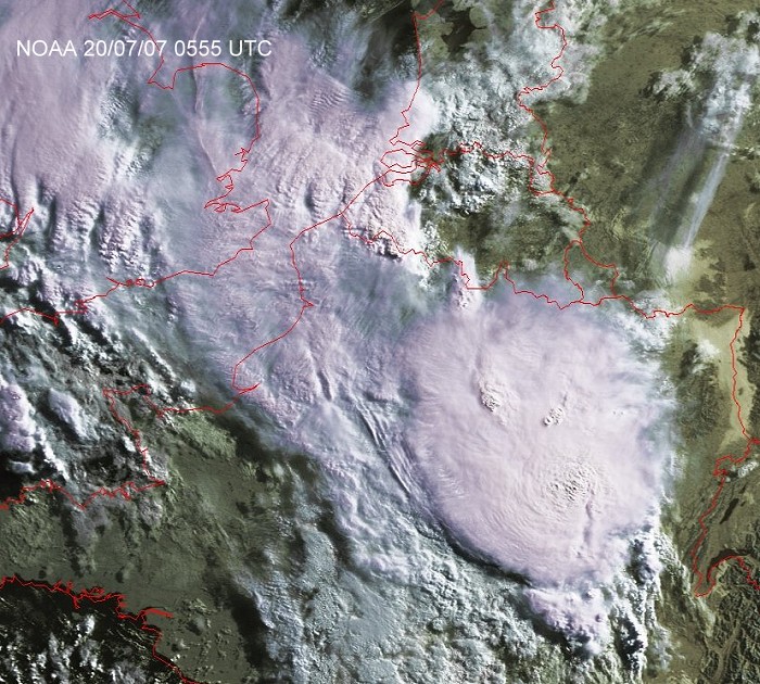
Satellite picture (visual) of 20/07/2007 taken at 0755 CET. Multi-cell thunderstorms (squall-line) over southwestern parts of Belgium and a large muli-cell thunderstorm (MCS) over northeastern France.(Source satpicture: NOAA and University of Bern)
|
Radar sequence between 0750-1150 CET. My location was near "BR". Multi-cell thunderstorm over western Belgium with storm motion of 200° and speed of around 20KT. Precipitation tops went up to 14 km. In this case it was a trailing stratiform squall line and the edge of this line gave at my location a few drops and some distant rumbles of thunders. Shortly afterwards, the MCS thunderstorm came in as well with weak thunderstorm activity and mostly moderate rain. (Source radar picture: Belgocontrol)
|
|
|
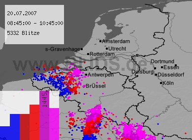
20/07/2007 0845-1045 CET. Lightning sequence of a two hour period. Impacts in west Belgium from the squall-line. The impacts over north France and southeast Belgium from the MCS, which gradually lost its sharp edges when moving northwards. Source picture: Blids.
|
|
|
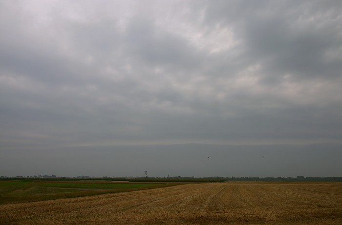
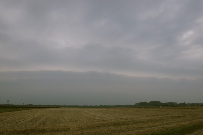
20/07/2007 1007 WSW. In environments with the right amount velocity shear squall-lines may form. When upper airflow is not too strong, trailing stratiform squall-lines may appear in which in front shelf clouds can be visible. And indeed, when this shot was made, the first evidence showed up in far distance.
|
|
|
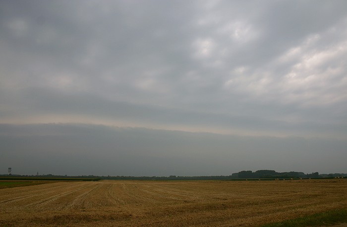
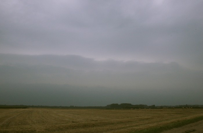
20/07/2007 1013 W. Little later, it appeared to be a so called "stacked plate shelf".
|
 |
|
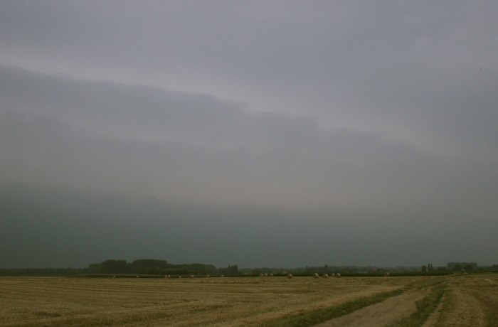
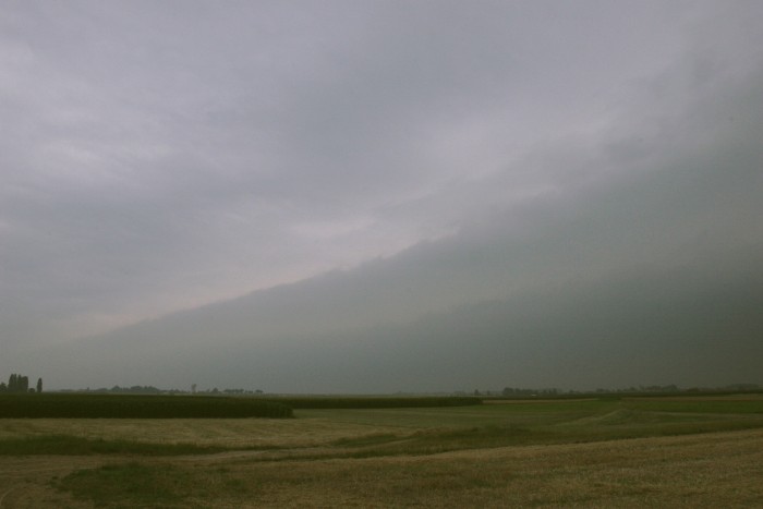
20/07/2007 1017 W. Not everything was on the bright side: in the rather
moist morning air visibility was not that great, and positioned at the edge of a passing squall-line, the cloud began to rag
out in my direction
|
 |
|
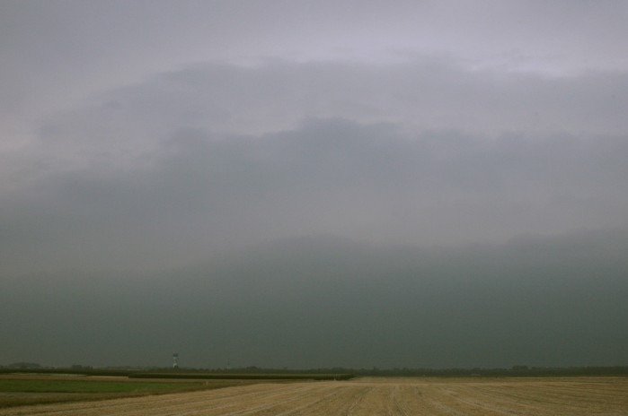
20/07/2007 1022 WNW. Stacked shelf cloud in which vaguely three plates
can be recognized.
|
 |
|
20/07/2007 1025 NW. Northern part of the shelf. The outflow does create
cloud plates in stable warm layers in front which are cooled and
reach the saturation point. When velocity shear is strong enough Kelvin Helmholtz instability waves
can be formed, as
been be seen in the upper one.
|
 |
|
20/07/2007 1027 W. Central part of the shelf. With gradually changing
surface winds, now coming from the shower, the low level air was cooled with
further deteriorating visibilities.
|
 |
|
20/07/2007 1030 SSW. Southern part of the shelf. Bit later this cloud
passed over with lots of non-photogenic clouds and a few
drops.
|
|
20/07/2007 1015-1027 SW. Events of 12 minutes have been shortened in this time-lapse of 11 seconds: approaching shelf with three plates growing forward by the outflow and velocity shear producing briefly some Kelvin Helmholtz instability waves.
|