| Weather pictures & report of October 1 2006 |
| Supercell thunderstorms in unstable maritime air. |
| Synopsis: advection of potentially unstable air from SW. Incoming longwave trough from the U.K., enhancing cyclonic curvature in upper atmosphere and the closeness of a left exit region of a strong jetstreak >100KT caused easy development of a handful supercell thunderstorms during late afternoon. Some of them produced weak tornados: near Braine-le-Comte + (again) Tubize, and another one at Koningshooikt (near Duffel). In these supercells hailstones between 1-3 cm were observed. At my location, I managed to see three of these storms, but none passed close enough to feel or taste their significant weather elements. Reports of Belgian metar and synop in UTC can be found here. All pics taken at Steenokkerzeel in local time (CET). |
|
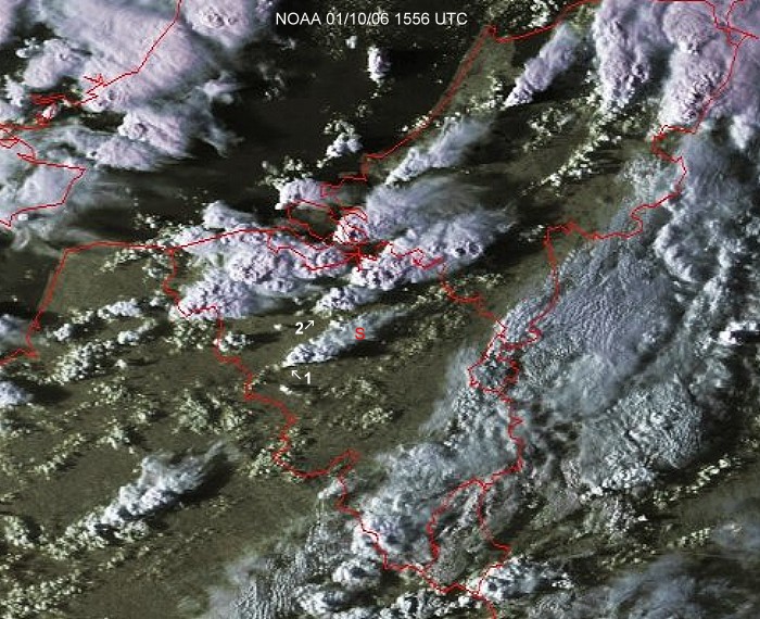
Satellite picture taken around 1800 CET. My location was at the red "S". Supercell 1 caused tornado touchdown near Tubize and Braine-le-Compte. Supercell 2 caused a brief tornado touchdown near Duffel. (Source satpicture: NOAA and University of Bern)
|
|
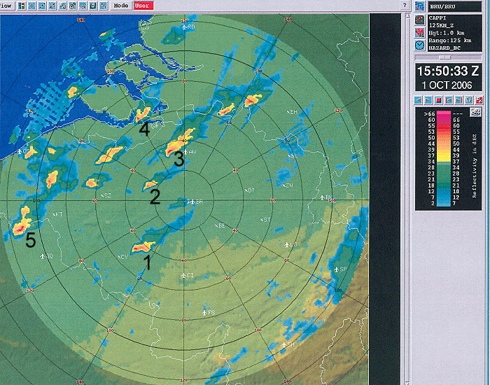
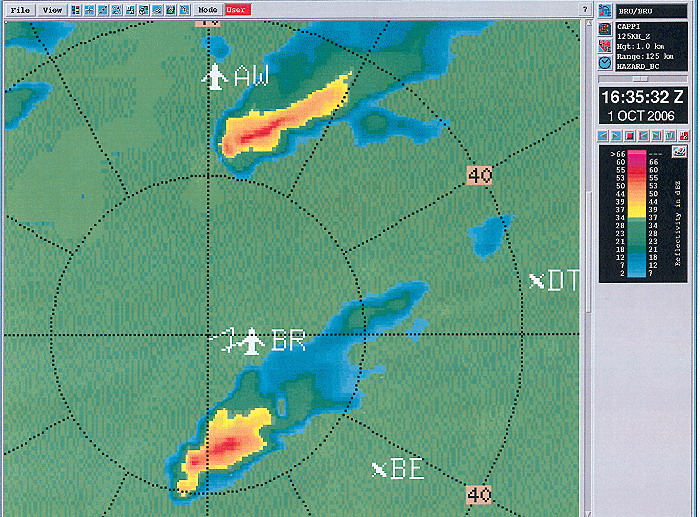
Corresponding radar picture (intensity in dBZ) of 1750 CET. Via the velocity images (some of them are depicted below) of the Doppler radar at Zaventem, five supercells were detected within a time lapse of three hours. Cell 1 caused the tornado touchdown near Tubize and Braine-le-Compte. Cell 2 caused the brief tornado touchdown near Duffel. Cell 3 showed also an hook echo, just like the two previous ones. Cell 4 was a right mover of an earlier split cell over West-Vlaanderen. Cell 5 caused a lightning show at the end of the day just north of my location "BR". (Source radar picture: Belgocontrol)
|
|
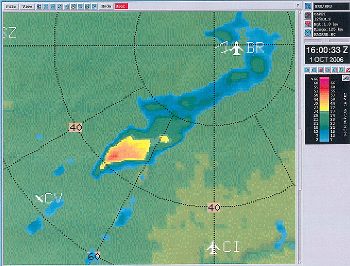
Radar picture (intensity in dBZ) taken at 1800 CET. Zooming in on the supercell which caused tornado touchdown near Tubize and Braine-le-Compte. (Source radar picture: Belgocontrol)
|
|
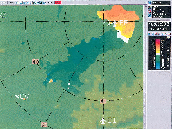
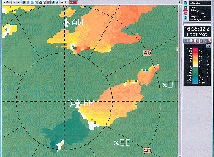
Radar picture (velocity in m/s) taken at 1800 CET. Same cell taken with the velocity image of the radar: yellow to pink are precipitation reflections away, green to blue are precipitation reflections towards the radar, all in meter per second. At the SE quadrant of the cell (as it should be) a mesocyclone structure is visible. (Source radar picture: Belgocontrol)
|
|
Radar picture (velocity in m/s) taken at 1800 CET. Detail of SE quadrant of the cell showing the mesocyclone clearly. (Source radar picture: Belgocontrol)
|
|
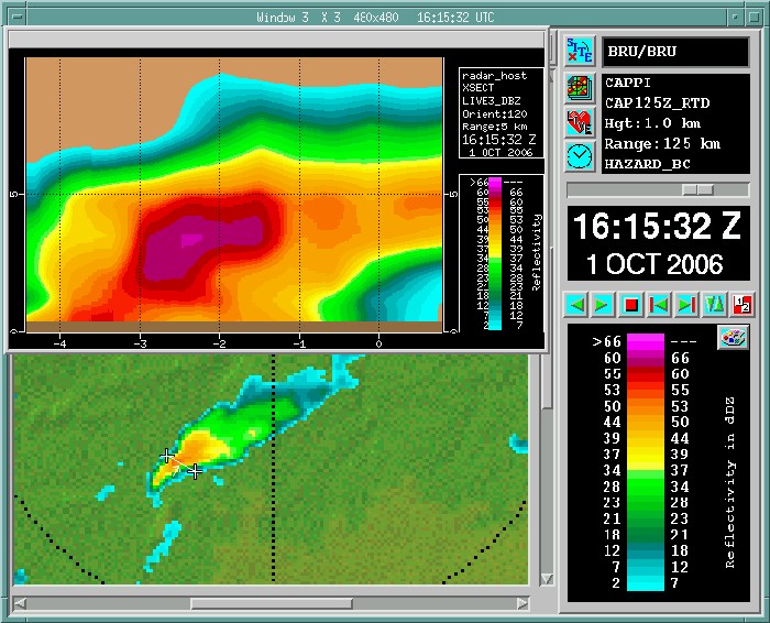
Radar picture (intensity in dBZ) taken at 1815 CET. Vertical cut of the same cell showing a pronounced hail core. (Source radar picture: Belgocontrol)
|
|
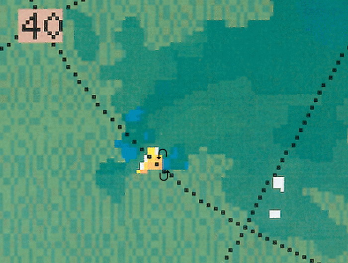
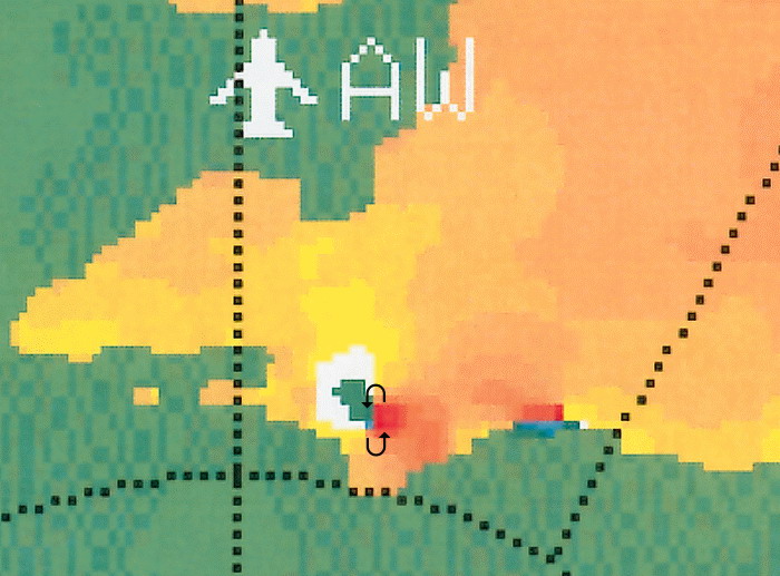
Radar picture (intensity in dBZ) taken around 1835 CET. Zooming in on the supercell just southeast of "AW" (= Antwerp) which caused tornado touchdown near Duffel. The second cell (of Tubize) is also present just southwest of "BR" (Source radar picture: Belgocontrol)
|
|
Radar picture (velocity in m/s) taken at 1835 CET. In the SE quadrant of the cell at Duffel also a mesocyclone structure, and a weakening one in the cell of Tubize. (Source radar picture: Belgocontrol)
|
|
Radar picture (velocity in m/s) taken at 1835 CET. Detail of SE quadrant of the cell at Duffel showing a very pronounced mesocyclone. (Source radar picture: Belgocontrol)
|
|
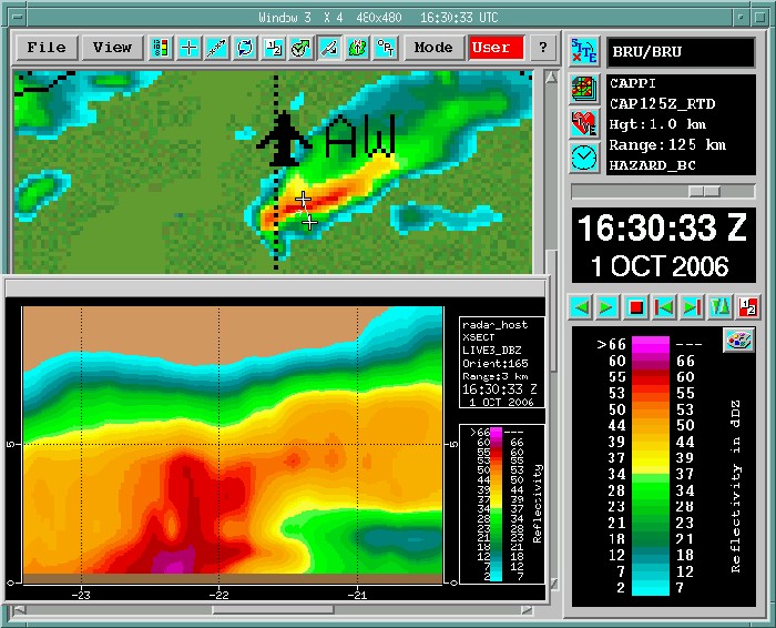
Radar picture (intensity in dBZ) taken at 1830 CET. Vertical cut of this cell which is also showing a pronounced hail core. (Source radar picture: Belgocontrol)
|
|
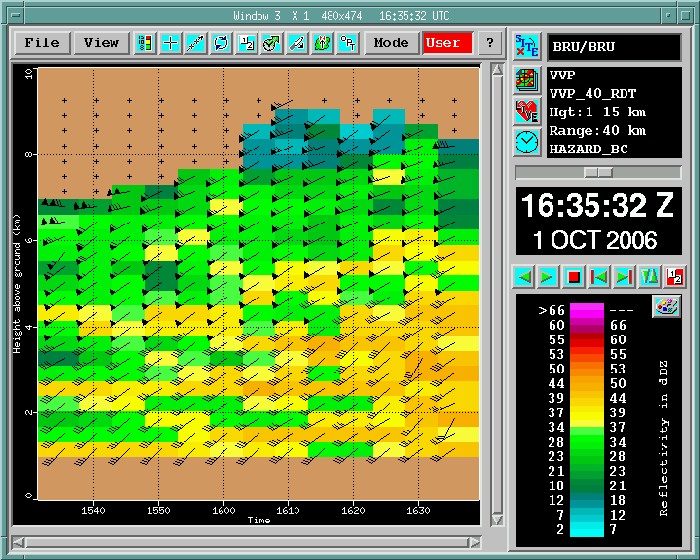
Radar picture (intensity in dBZ) of the measured windspeed profile in the echo's taken between 1735-1835 CET. Observed windspeed at surface was around 13KT: thus windspeed shear 0-1 km was between 17-22KT and windspeed shear 0-6km was between 37-47KT. According a study of Groenmeyer (2005), the median 0-1 km windspeed shear for F1 tornados lies around 18KT (for F2 tornados around 41KT) and the median 0-6km windspeed shear for F1 tornados lies around 30KT (for F2 tornados around 54KT). Forecasted helicity was around 200 m²/s² and the mean for an F1 tornado lies around 105 m²/s². So theoretic, under these circumstances F1 tornados could be possible. (Source radar picture: Belgocontrol)
|
Radar sequence (intensity in mm/h) between 1900-2040 CET. My location was near "BR". The supercell between "AW" and "BR" caused for more than an hour some very intense lightning scenes. Tops of all these showers went up to 10 km. (Source radar picture: Belgocontrol)
|
|
|
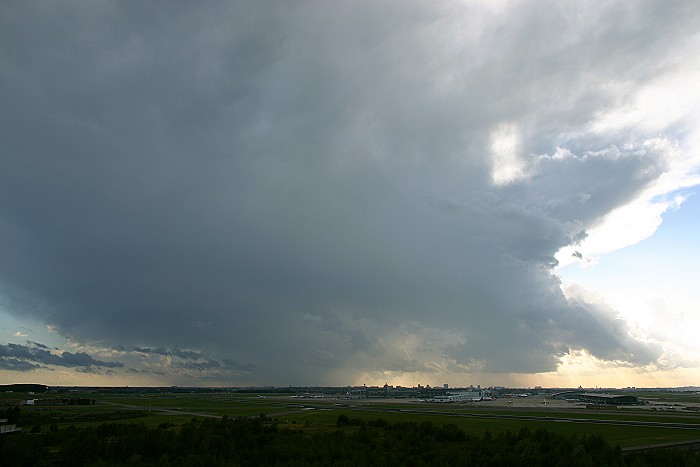
01/10/2006 1732 SW. Vertical stitched picture composed of two pictures: a first fading shower showed up in the SW. Watch the long anvil which was blown away by the strong upper winds.
|
|
|
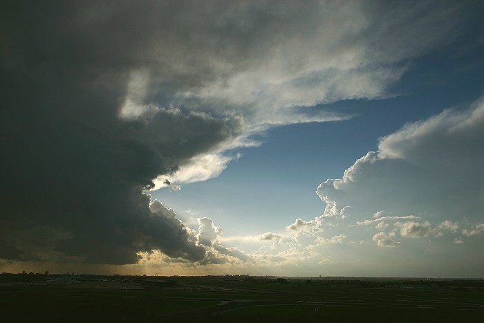
01/10/2006 1745 SW. As the shower approached, it began to dissolve, little did I know that behind this rain curtain a second shower spawned a weak tornado, some 15 minutes later.
|
|
|
01/10/2006 1746 W. On the right of it, building cloudiness of another supercell which spawned another weak tornado near Duffel, some 45 minutes later.
|

|
|
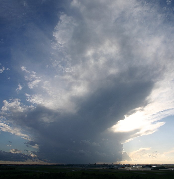
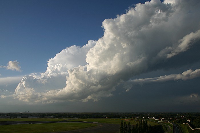
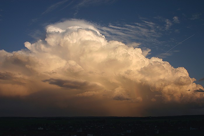
01/10/2006 1747 WNW. Entire view of this cell.
|
|
|
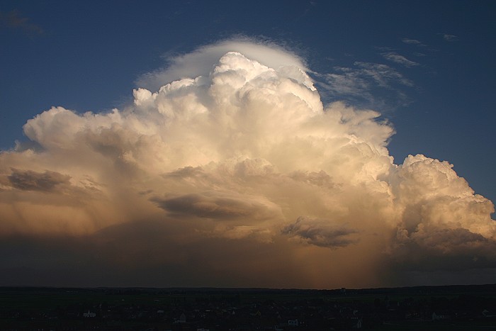
01/10/2006 1811 NNW. Bit later showing its evolution.
|
|
|
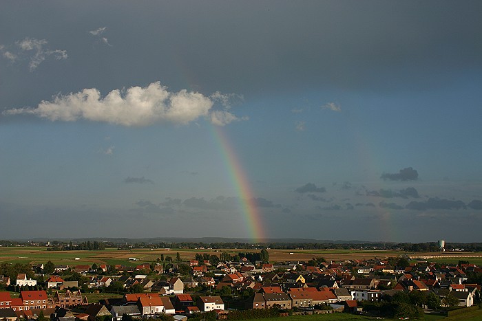
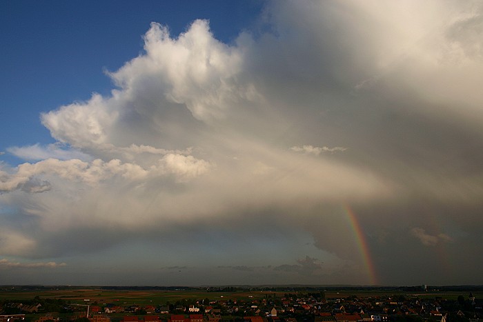
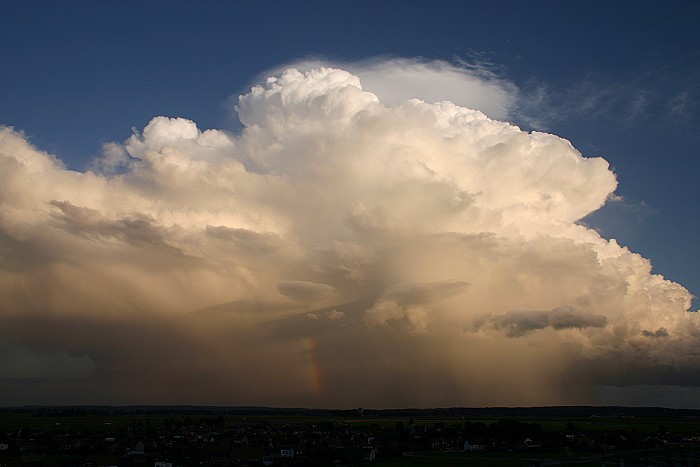
01/10/2006 1814 SE. Meanwhile the fading shower passed overhead giving a piece of a double rainbow.
|
|
|
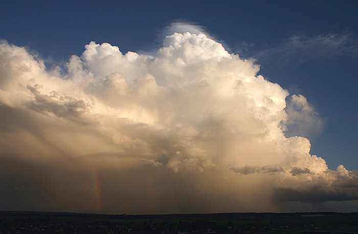
29/08/2006 1814 NNW. On the other side a very nice view of the CB, at this point I decided to make a time lapse.
|
|
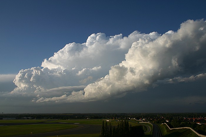
01/10/2006 between 1817-1845 N. Supercell clearly showing a rotating updraft on
its back side.
|
|
|
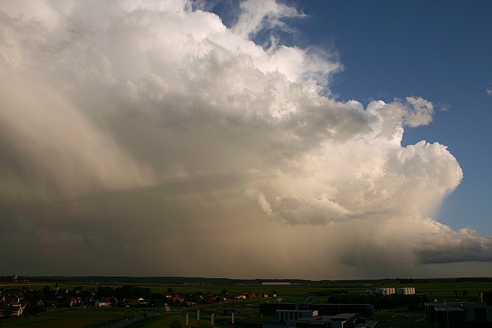
01/10/2006 1846 SE. Bit later, the tornadic supercell of Tubize passed via the near south: view on its front side.
|
|
|
01/10/2006 1848 SSW. View on its back side.
|
|
|
01/10/2006 1851 SSE. Evolution of back side.
|
|
|
01/10/2006 1854 SE. Formation of a pileus on top of the Cb calvus.
|
|
|
01/10/2006 1856 SE. The Cb cloud continued to build itself.
|
|
|
01/10/2006 1901 SE. A new pileus.
|
|
|
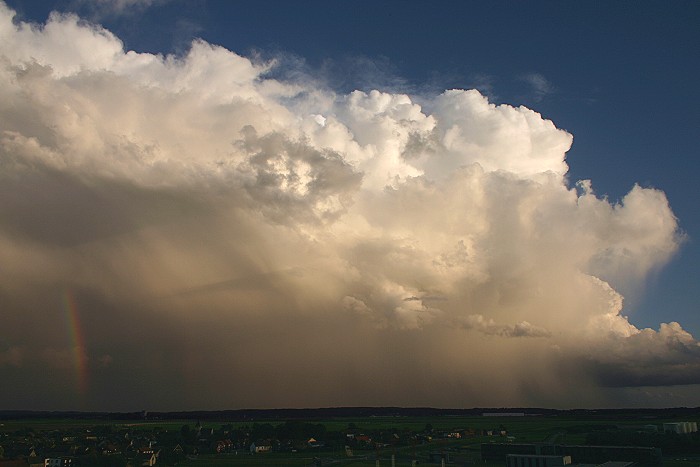
01/10/2006 1903 SE. Last view of a really massive Cb calvus pileus with illuminated precipitation trails and a piece of a rainbow.
|
|
|
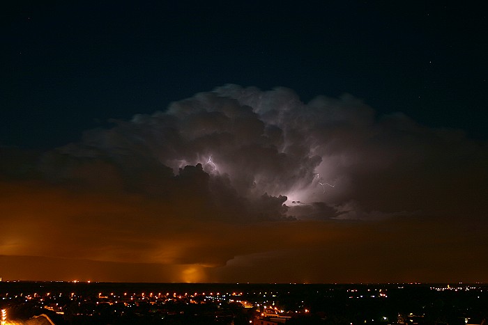
01/10/2006 1954 NNW. The passage of the third supercell in "my neighbourhood", wasn't unnoticed either: for more than an hour continuous lightning, although I had to wait impatient before dark enough to catch them on a digi sensor. The reward turned out to be good.
|
|
|
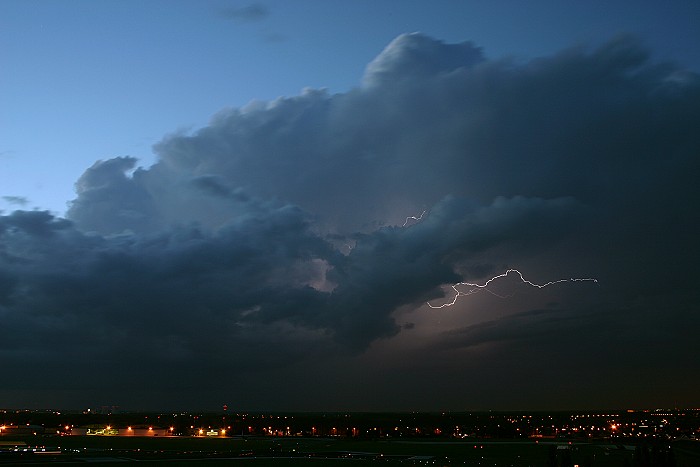
01/10/2006 2008 N.
|
|
|
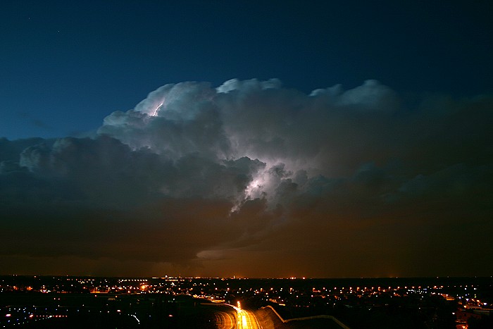
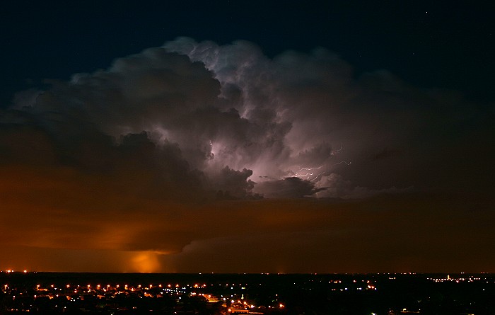
01/10/2006 2010 N.
|
|
|
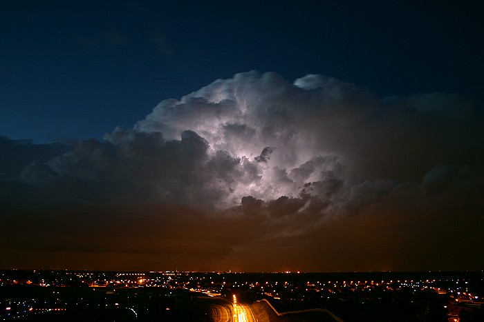
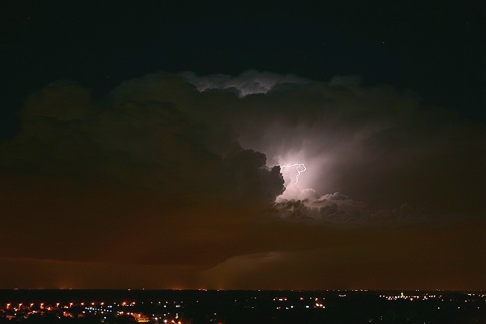
01/10/2006 2015 N.
|
|
|
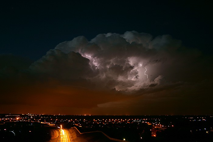
01/10/2006 2121 NNE. Watch also the thick precipitation trail below, illuminated by street lights.
|
|
|
01/10/2006 2021 NNE.
|
|
|
01/10/2006 2026 NNE.
|
|
01/10/2006 between 2006-2010 N. Quite an active shower, this time lapse of 4
minutes tell enough: nice firework above, and yes indeed also some human
firework below the clouds.
|