| Weather pictures & report of July 19 2006 |
| Thunderstorms along thermal convergence line. |
| Synopsis: after an ultra hot summer day on which max temperature reached in most places between 35-38 °C, deep unstable air was advected from SSW. During the evening and early night a thermal convergence line passed western parts of Belgium giving some bright lightning on its backside. Pics taken at Koksijde & Middelkerke in local time (CET). |
|
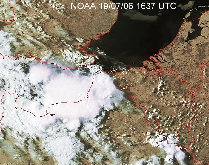
Satellite picture at 1837 CET. Developing multi-cell thunderstorm over NW France, with a rather huge Cirrus shield, was moving towards the NNE. My location was at the coast near the white "Ko". (Source satpicture: NOAA and University of Bern)
|
|
|
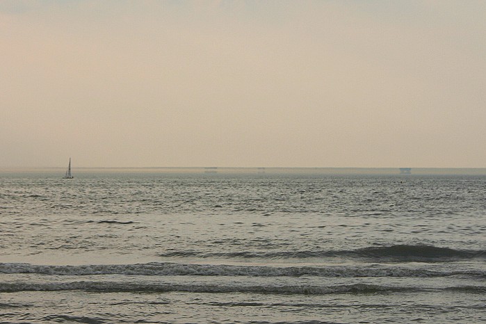
19/07/06 1945 NW. Along the coast temperatures of 36°C were reached
during the afternoon. When checking the sea during in the evening there was
still a superior mirror effect or so-callled "Fata Morgana"
visible. The ships at the horizon are loomed and seem to be upside down.
This is caused by an inversion of temperature: warm air is topped on
colder air just above the sea
|

|
|
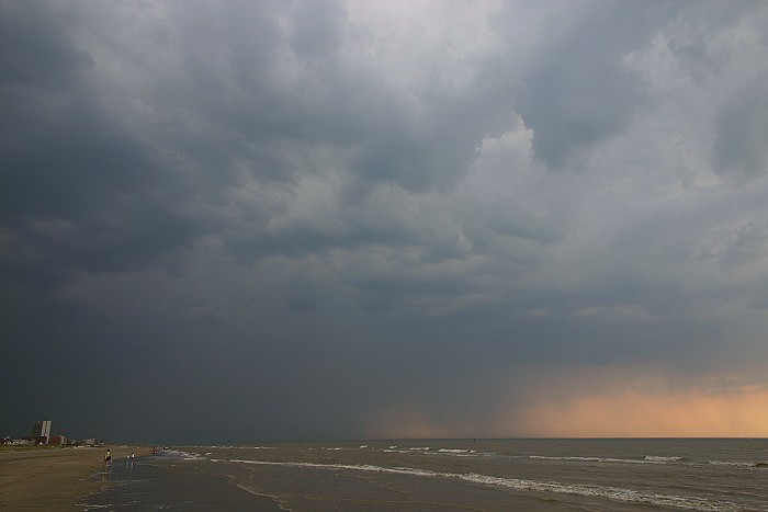
19/07/2006 1938 SW. Approachung thunderstorm, wind was calm and coming from inland.
|
 |
|
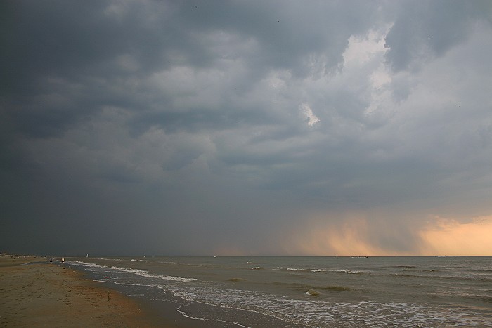
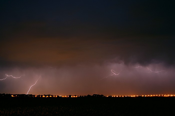
19/07/2006 1946 SW. At certain distance a few CG strikes were
visible over sea.
|
|
|
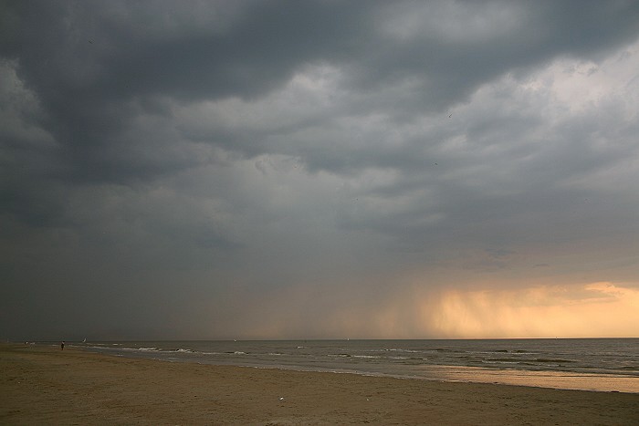
19/07/2006 1950 SW. Falling precipitation.
|
|
|
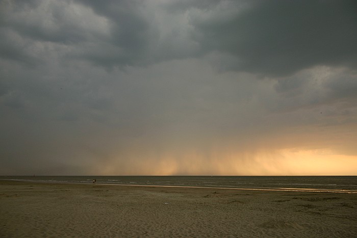
19/07/2006 1958 WSW. Another shot of the precipitation spreading out over the water.
|
 |
|
19/07/2006 2009 WSW. Suddenly winds picked up, even a small dust devil
crossed the beach, and afterwards veered to a W'ly direction with a
notable cooling effect. First drops started to fall and this rain lasted
for three hours, and only afterwards some attempts on lightning shots could
be made.
|
|
|
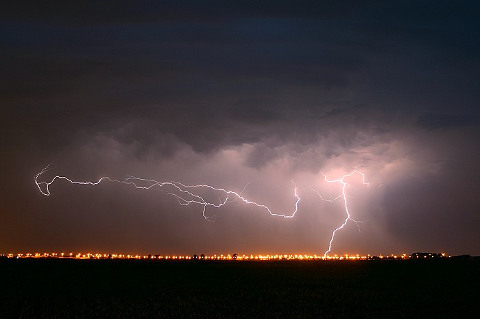
19/07/2006 2302 NE. The tripod & camera was barely operational and this was the first result: CG + CA strikes illuminating the rain shaft. It couldn't be better positioned in the frame.
|
 |
|
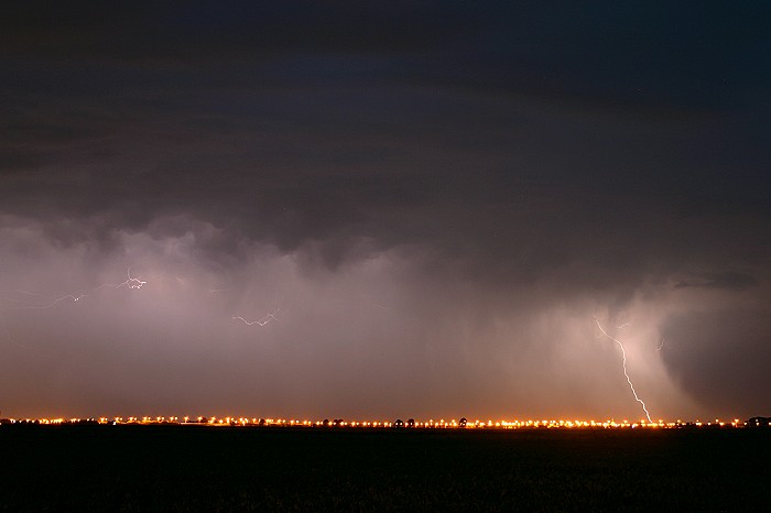
19/07/2006 2304 NE. More CG + CA strikes illuminating the thick rain shaft.
|
|
|
19/07/2006 2309 NE. CG + CA strikes illuminating the rain shaft. As the cell moved towards the sea I decided to take my chances over there.
|
 |
|
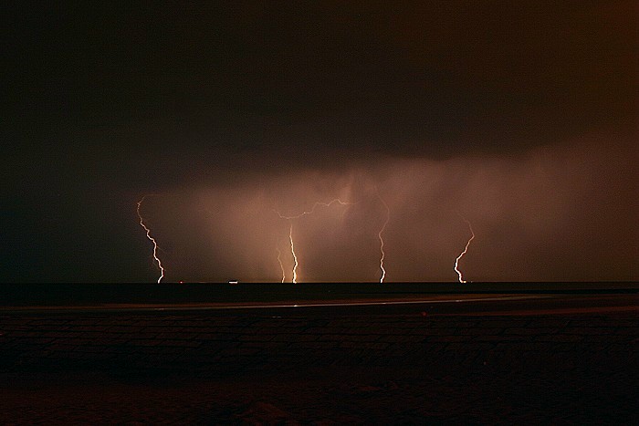
19/07/2006 2335 NNE (Middelkerke). Five CG strikes hitting the sea on the same moment,
although a bit from a distance, this was the
only descent shot as the storm drifted rather quickly away and wasn't very
active either.
|