SkyStef's weather page
|
|
SkyStef's weather page |
Weather picture of the month October 2005
|
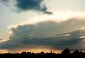
| Picture taken at Kampenhout on September 18 2005. |
Clouds may form in clear air and
their characteristic forms can
be broadly grouped in a classification in terms of "genera", "species" and
"varieties", eventually accompanied by "supplementary
features or accessory clouds". They may also form or grow from other
clouds, called "mother-clouds". Condensation trails or contrails are clouds which form in the wake of aircraft when the atmosphere at flying level is sufficiently cold and humid and they form in three ways: Firstly due to the cooling of exhaust gases of the engines which have a high vapor content, called exhaust contrails, are quite common and occur in all kinds of lengths. The ones that form in far from saturated air tend to dissipate quickly, the ones that form in almost saturated layers may persist for hours and turn into wide bands of Cirrus covering the whole sky. Secondly due to reduction of pressure above airplanes, especially above the wings or at the propeller- and wingtips, called aerodynamic contrails, are less common for creating large clouds but in almost saturated layers it may also produce huge bands of Cirrus, usually in combination with the exhaust contrails. Most aerodynamical contrails are the very short lived vortices (eddies) at the propeller- or wingtips. The third and final form, called instability contrail, is very rare and is produced when an aircraft is flying through an undisturbed layer of moist and unstable air. The picture shows a plane cruising to the East with a sunlit exhaust contrail which dissipated within 2'. More contrail pictures to be found here |