| Weather pictures & report of February 24 2013 |
| Snow related to an occlusion |
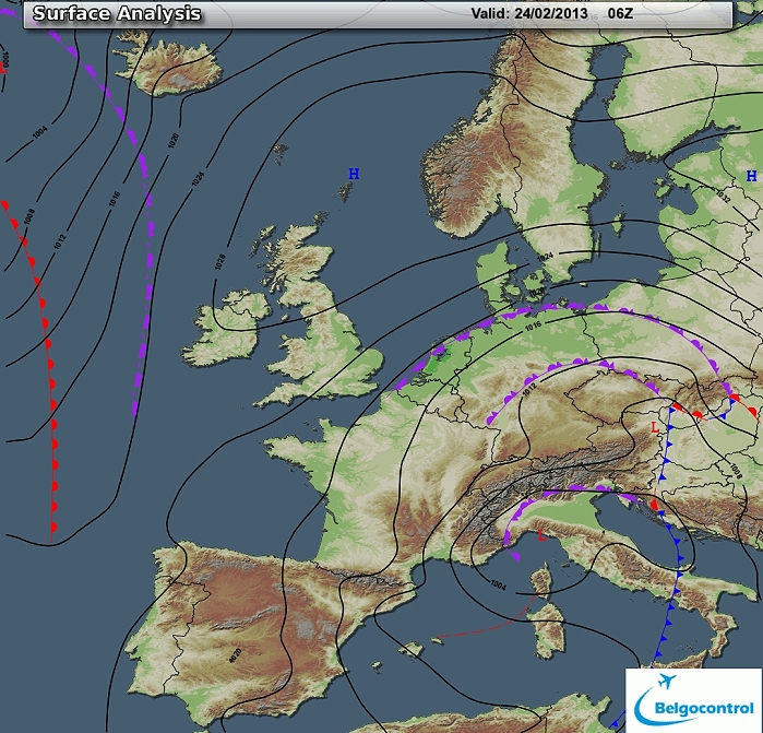
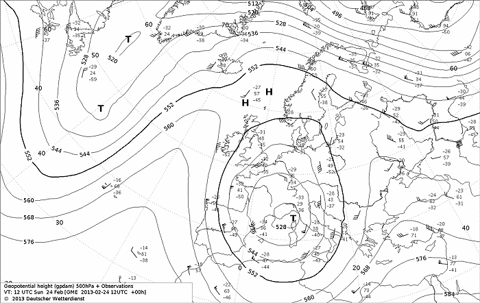
| Synopsis: at 500 hPa a cut-off low over northern Italy moved slowly N-wards. Related ground depression was centered at the same spot but its wrapped around occlusion reached to the Low Countries with some light snow accumulating 1 to 5 cm of fresh snow. It was followed by some milder air, thus the snow didn't last for long time. Pictures taken at Kampenhout. Hours in local time (CET). |
 |
|
Surface analysis of February 24 2013 at 0700 CET. A depression is
centered over northern Italy, but its occlusion reaches to the Benelux
area. (Source chart: Belgocontrol)
|
|
Loop of 8 surface analyses of each 3 hour of February 24 2013
between 0100-2200 CET with the weather plots showing light snow with
temperatures around 0°C. (Source: meteocentre.com)
|
 |
|
Upper air analysis 500 hPa of February 24 2013 at 1300 CET. A cut-off
low near northwest Italy moving slightly NE-wards with its cyclonic
curvature overhead in an E'ly-flow. (Source chart: DWD via wetter3)
|
 |
|
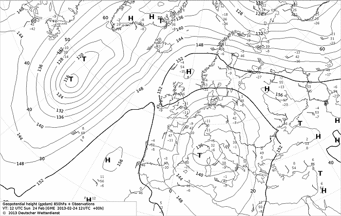
Upper air analysis 850 hPa of February 20 2013 at 1300 CET. Same depression
recognizable over SE-France moving slightly NE-wards.
Isotherm of -11°C was initially overhead. (Source chart: DWD via wetter3)
|
 |
|
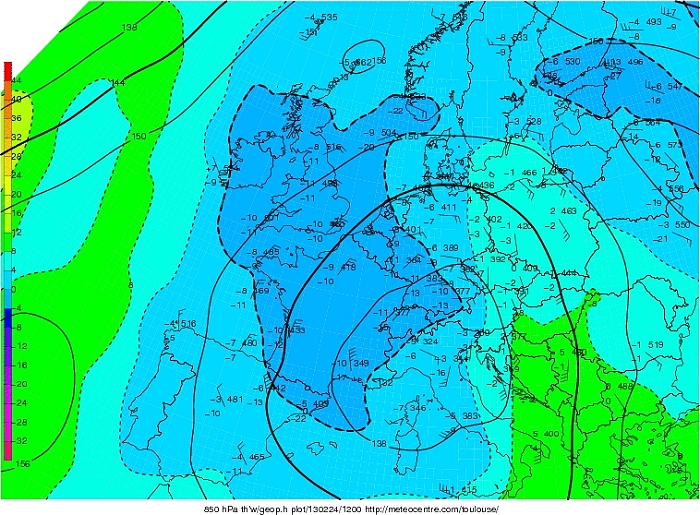
Upper air analysis Theta W 850 hPa of February 24 2013 at 1300 CET. Cold
air with negative values is present over NW Europe, gradually replaced
milder air on the NE-E-ern side of the depression. (Source chart: Meteocentre.com)
|
 |
|
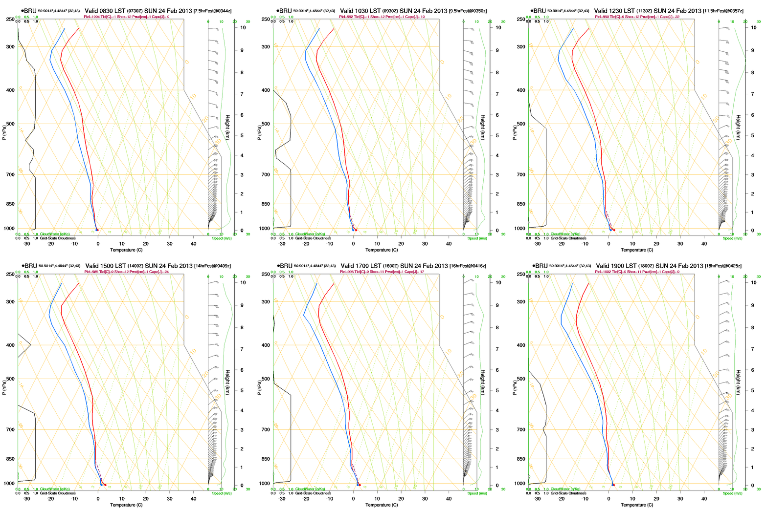
Loop of forecasted soundings for Brussels of February 24 2013 between
0830-1900 CET. At all levels the temperature was negative, except
temporary in the bottom layer. It was also well
saturated below. (Source: RASP)
|
 |
|
Forecasted vertical profile and surface temperature for Brussels of
February 23 2013 from
1500 UTC (=1600 CET) and the following 48 hours in steps of 1 hour. Legend of upper map: green-brown-white
is humidity in steps of 10% with darkest green being 90% or more, wind
in kt, temperatures each 5°C. Whole period saturated conditions below
10000 ft, but with two peaks above it as well, and during the night -
morning negative temperatures becoming 0°C by noon. (Source: Belgocontrol)
|
 |
|
Corresponding precipitation and surface winds. Two peaks is snow,
morning & late afternoon of February 24, but also before in between and
afterwards some slight snow is forecasted. (Source: Belgocontrol)
|
 |
| 24/02/2013 1145 CET. Satellite picture
(visual) with frontal cloudiness over entire NW-Europe. (Source sat
picture: NOAA and University of Bern)f
|
Radar loop (reflectivity in dBZ) from February 23 2013 1900 CET onwards. Green colors represents moderate snow, blue colors is light snow. (Source radar picture: Belgocontrol).
|
Metars (hours in UTC) of Belgian airport EBBR. Translation: copy paste each obs via
metar-decoder
EBBR 231820Z 03007KT 9999 -SN FEW027 BKN036 M01/M05
Q1016 NOSIG= |
 |
|
Snow height in cm taken from the synop of 1200 UTC of February 24 2013.
Top: Mont Rigi with 26 cm (but it came from 23 cm
present earlier), followed by Kleine Brogel with 6 cm, Liège & Florennes
4 cm.
|
 |
|
24/02/2013. Temperature histogram in degrees Celcius in local time (CET)
over 24 hrs taken from an automatic station at Kampenhout. Lowest value
-1,6°C in the early night, it came above 0°C from 1100 CET onwards wit
highest +0,7°C around 1230 CET.
|
 |
|
24/02/2013. From the same auto station at Kampenhout: light wintry
precipitation during the period.
|
 |
|
24/02/2013 1127. Proof of the date.
|
 |
|
24/02/2013 1131. View into the garden.
|
 |
|
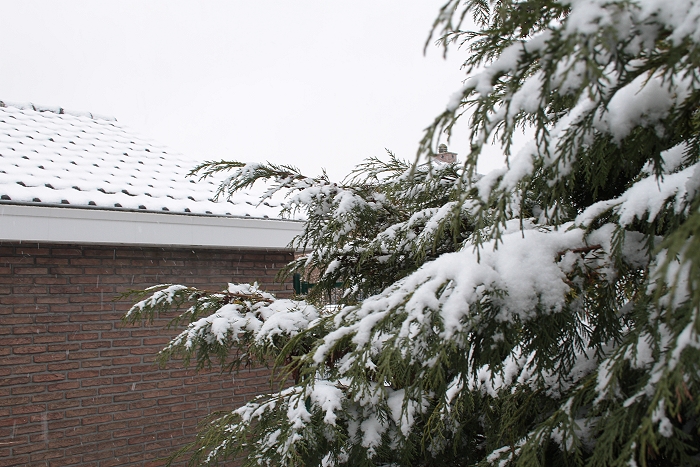
24/02/2013 1132. Trees & roof covered with some snow.
|
 |
|
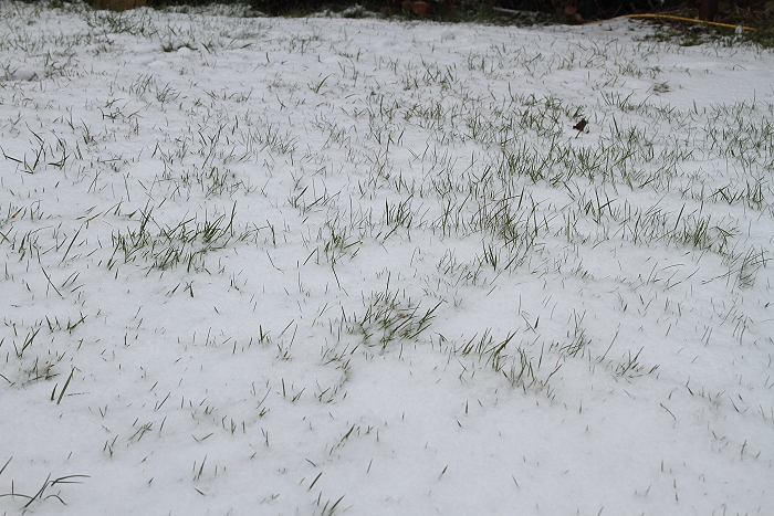
24/02/2013 1133. A rather thin snow cover reached maximum 1 cm.
|