| Weather pictures & report of June 21 2012 |
| Multicell thunderstorms along thermal trough (just ahead cold front). |
| Synopsis: at 500 hPa, Belgium east of a relaxing trough in a rather strong SW flow. During the period consecutive passage of an occluded warm front, thermal trough and a cold front, the last two would amalgamate. Along the thermal trough over northern France frequent thundery showers did develop, moving into Belgium with the most intense ones (on a squall) over the west and east with local wind damage due to downbursts. Over the center of Belgium only weakening or new small building storms could be detected. All pictures were taken at Kampenhout (central Belgium), hours in local time (CET). |
 |
|
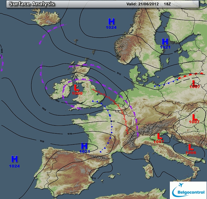
Surface analysis of June 21 2012 at 2000 CET. Steering feature is a
depression centered over Wales. In the SW'ly several associated fronts
and a thermal trough
crossed Belgium during the daylight period, most activity was to be
found on the thermal trough while the cold front was nothing more than
fragmented cloudiness. (Source chart: Belgocontrol)
|
|
Loop of 10 surface analyses of June 21 2012 (of each hour between 1400 -
2300 CET) with
weather plots. (Source: meteocentre.com)
|
 |
|
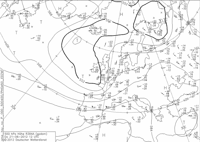
Upper air analysis 500 hPa of June 21 2012 at 1400 CET. Cut off low
between south of Iceland with relaxing trough extending towards NW
France. A mobile ridge over mid Europe retreats towards the northeast. Belgium in a
rather strong, but diffluent SW flow. The relaxing trough crossed
Belgium the next morning. (Source chart: DWD via wetter3)
|
 |
|
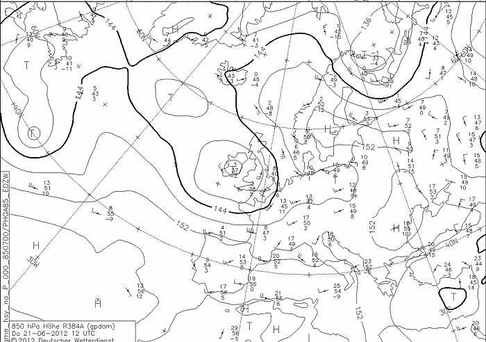
Upper air analysis 850 hPa of June 21 2012 at 1400 CET. Recognizable
a trough (cut off low) over Ireland, Belgium in a moderate to strong
(diffluent) SW flow, advecting warm air
(13°C). (Source chart: DWD via wetter3)
|
 |
|
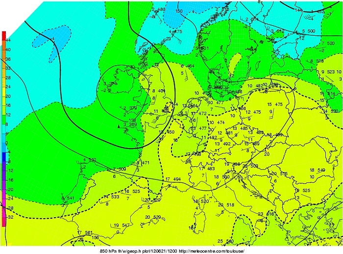
Upper air analysis 850 hPa of June 21 2012 at 1400 CET. Here we take a
look at Tw at 850 hPa, with a tongue of warm moist air moving towards
the centre of Belgium with Tw reaching 16°C. (Source chart: Meteocentre.com)
|
 |
|
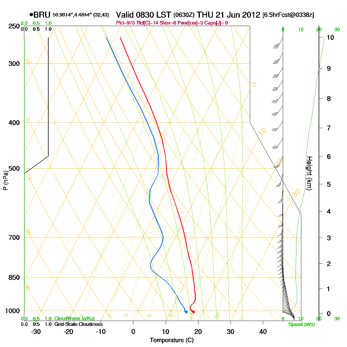
Loop of forecasted soundings for Brussels of June 21 2012 between
0830-2000 CET. From the afternoon onwards instability from 1 km up to
>10 km, but later on also some remarkable drier air around 5 km came in.
Detect also the rather strong shear (speed and directional). (Source: RASP)
|
|
Another loop of forecasted soundings for a 18 hours period (in steps of
three hours) of Brussels from June 21 2012, 0800 CET onwards. Included
are some thunderstorms indices: surface based CAPE went up to almost 1700 J/kg, KI
33, TT
52, LI -6 = moderate to strong convective potential which may lead to scattered
to frequent thunderstorms. The SREH of 70 m²/s², in combi with the
moderate CAPE, the environment would be favorable for multicell
thunderstorms with a slight risk for a supercell. (Source: weatheronline.co.uk)
|
 |
|
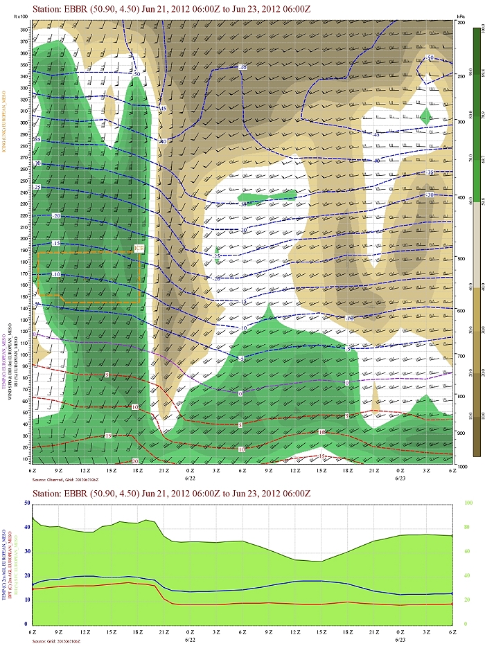
Forecasted vertical profile and surface temperature for Brussels Airport
of June 21 from 1400 CET and the following 48 hours. Legend of upper map: green-brown-white
is humidity in steps of 10% with darkest green being 90% or more, wind
in kt, temperatures each 5°C. Till around 1900 UTC a lot of moist up to
the
upper levels (200 hPa) with a gradual lowering base. Afterwards
temporary very dry air came in, note also the cooling effect. First 12 hours
also a rather significant shear in direction (and speed). (Source: Belgocontrol)
|
 |
|
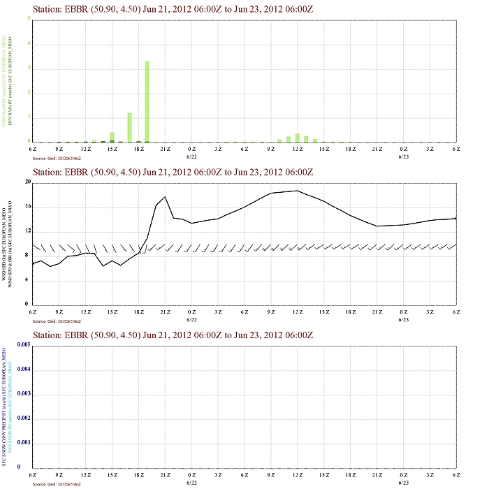
Forecasted precipitation, 2 meter temperature for Brussels Airport of
June 21 from 1400 CET and the following 48 hours. Legend: precipitation
darkest green = dynamical rain, light green is convective rain. Wind in
kt. An intermittent convective rain signal between 1500-1900 UTC,
with at the end remarkable veering winds. (Source: Belgocontrol)
|
|
21/06/2012 1530-2115 CET. Satellite loop in the visual channel.
Multicell storms (in the begin also supercells) are recognizable moving
from northern France towards Holland via Belgium. (Source sat
picture: Eumetsat via Sat24.com)
|
Radar loop (rainfall rate in mm/hr) of June 21 2012 between 1530-2300 CET. The precipitation started as light showery character, bit later a squall line came in over the west but began to break up. Another line could be detected over the southeastern parts, on the other had over the center the echo's temporary weakened, but reactivated to the northeast. (Source radar picture: Belgocontrol)
|
 |
|
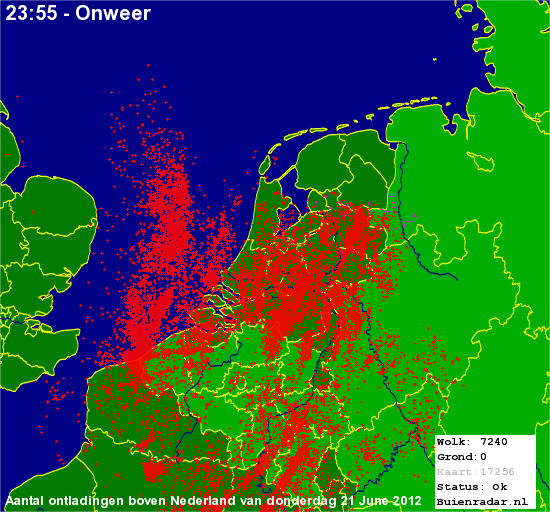
21/06/2012. Amount of discharges over the Benelux with clearly also the
weakest activity over the central part of Belgium. (Source picture: Buienradar)
|
 |
|
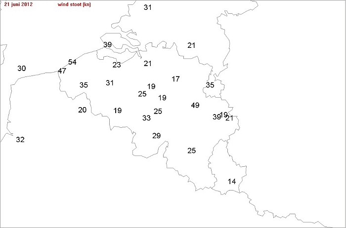
21/06/2012. Wind gusts (in knots) taken from the synops of 1800 UTC. Winner was
Ostend with 54 kt, followed by Liège with 49 kt and Koksijde 47 kt. (Source picture: Buienradar)
|
 |
|
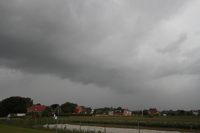
21/06/2012 1908 WNW. Small developing thundery cell producing a weak arcus.
|
 |
|
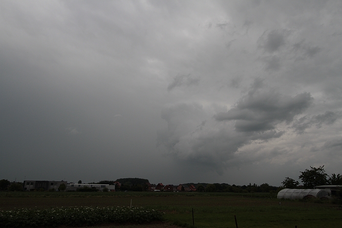
21/06/2012 1912 NNW. Passing by.
|
 |
|
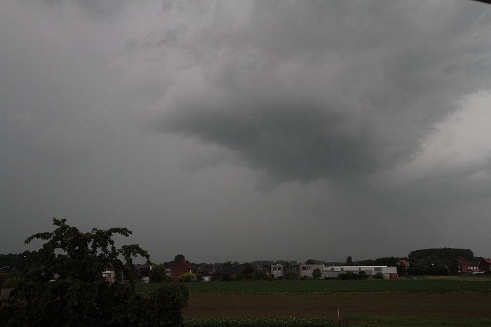
21/06/2012 1919 NNW. Backside revealing a building Cumulus.
|
|
Short time lapse between 1908-1914, direction NW-N, with passage of the
weak thunderstorm.
|
 |
|
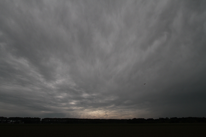
21/06/2012 1945 NE. Bit later some chaotic skies, mammatus alike.
|
 |
|
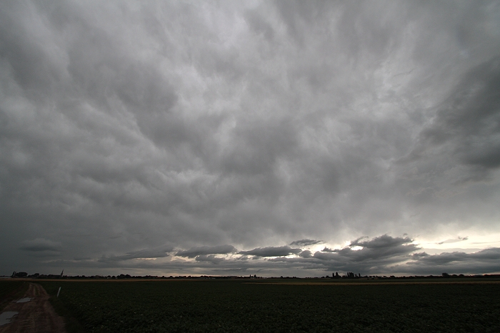
21/06/2012 2005 SW. Opposite direction, more mammatus alike cloudiness
with sometimes even an anvil crawler.
|