| Weather pictures & report of September 10 2011 |
| Supercell thunderstorms between thermal trough and cold front |
| Synopsis: at 500 hPa: between a relaxing upper trough northwest of Ireland and a ridge over the continent, our area in a moderate SW'ly flow of warm and humid potentially unstable air. Between the evening and early night passage of a thermal trough followed by a cold front. Along the thermal trough no activity due to too dry air upper in the lower levels and the presence of a low level inversion. In between the thermal trough and cold front, over the northwest of Belgium, the inversion was cleared by the lift of the upcoming cold front releasing the potentially deep instability in form of supercells (and multicells) with isolated damage due to large hail (up to 5 cm diameter) and strong winds. It gave a nice lightning show at the location where the pictures were made, namely at Kampenhout (central Belgium) with the hours in local time (CET). |
 |
|
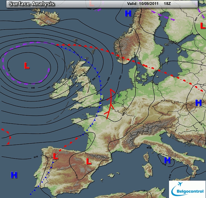
Surface analysis of September 10 2011 at 2000 CET. Related to a deep low
northwest of Ireland a thermal trough followed by cold front crossing
the Low Countries between the evening and early night. (Source chart: Belgocontrol)
|
|
Loop of 9 surface analyses of each hour starting from September 10 at 1700 CET
with weather plots showing the movement of the thermal trough with
behind the thundery outbreaks. (Source: meteocentre.com)
|
 |
|
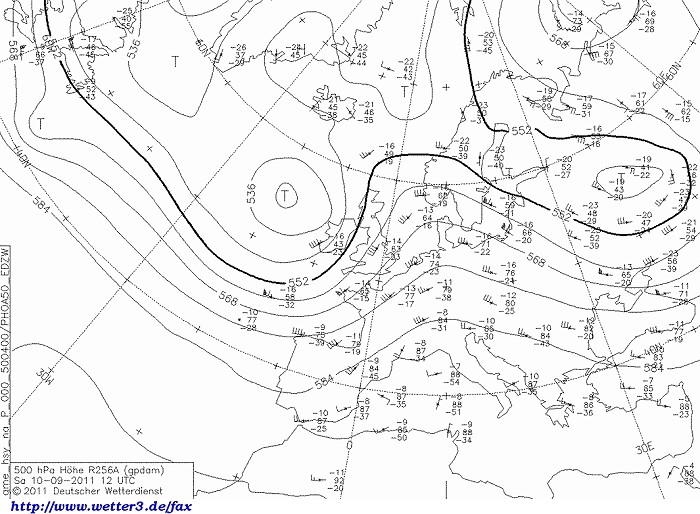
Upper air analysis 500 hPa of September 10 2011 at 1400 CET. Between a
relaxing upper trough northwest of Ireland and a ridge over the
continent, the Low Countries in a moderate SW'ly flow. (Source chart: DWD via wetter3)
|
 |
|
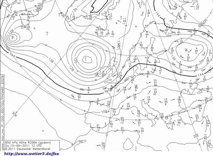
Upper air analysis 850 hPa of September 10 2011 at 1400 CET. Between the
low northwest of Ireland. and and ridge over the continent, the Low
Countries in a
moderate SW'ly flow of warm air. (Source chart: DWD via wetter3)
|
 |
|
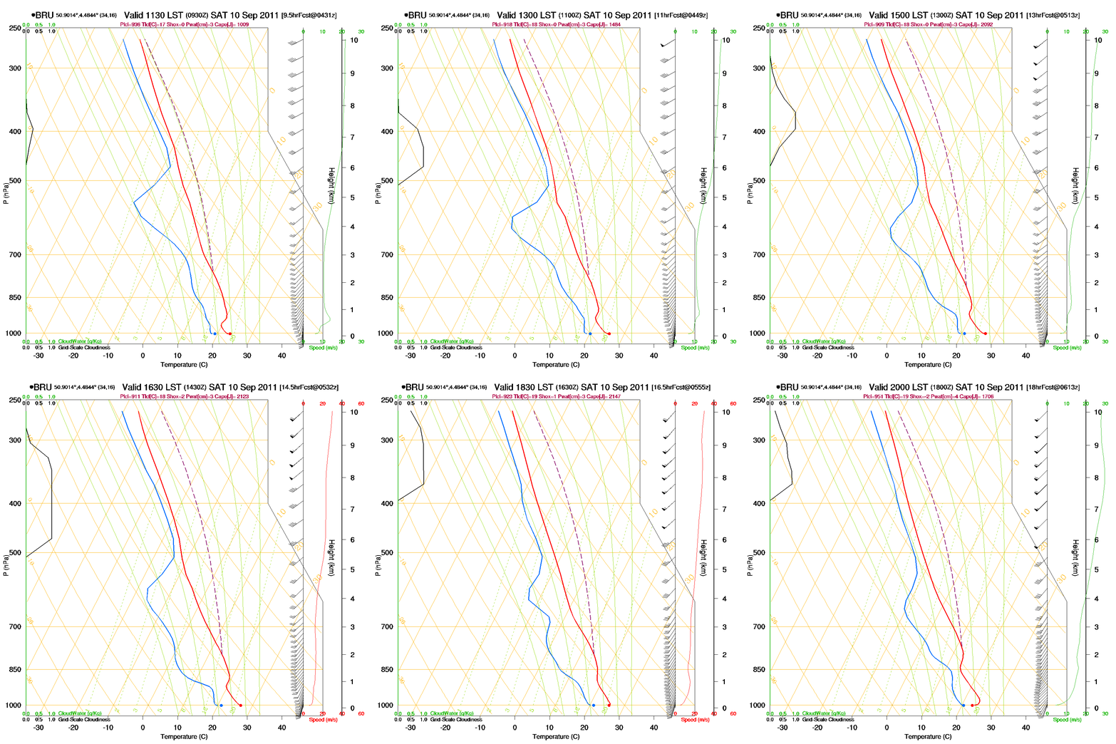
Loop of forecasted soundings for Brussels of September 10 2011 between
1130-2000 CET. An unstable airmass is present above 2 km height but
also too dry below 5 km height to form showers and above all also capped by an inversion around 1 km.
Directional and speed shear were moderate. (Source: RASP)
|
|
Another loop of forecasted soundings for a 12 hours period (in steps of
three hours), but this time of Deurne (Antwerp) from September 10 2011,
1400 CET onwards.
Included are some thunderstorms indices: surface based CAPE was during
the evening still well above 1500 J/kg, dropping fast towards midnight. KI
29, TT 52, LI -10 = moderate to strong convective
potential which may lead to occasional
thunderstorms, isolated severe. Directional shear was moderate with
values of around 115 m²/s², low level shear was 30 kt, deep layer shear 40 kt.
Due
to the moderate CAPE and moderate to strong low level shear / deep layer shear, multicells could be expected
with even risk for some supercells. (Source: weatheronline.co.uk).
|
 |
|
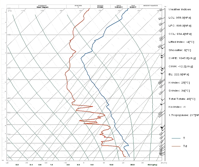
Observed sounding released at Beauvechain on September 11 at 0020CET. It
reveals instability above 800 hPa till the tropopause (at 217 hPa) but also a strong
inversion around 850 hPa which couldn't be cleared, thus no shower activity over
the center and east of Belgium. (Source: Belgocontrol)
|
 |
|
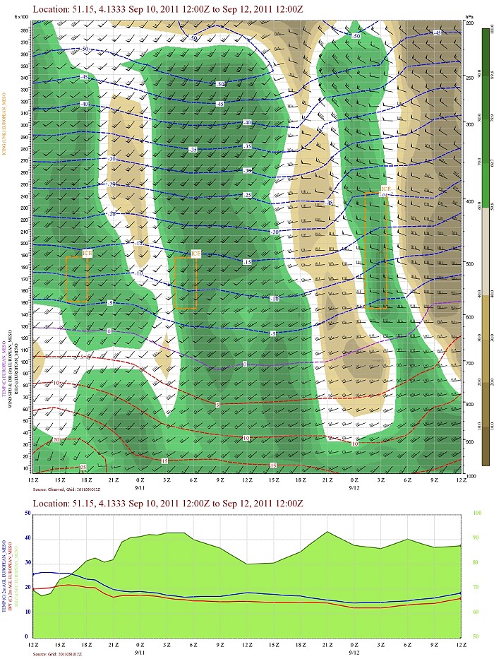
Forecasted vertical profile and surface temperature for St-Niklaas (province Oost-Vlaanderen) of September 10 from
1400 CET and the following 48 hours. Legend of upper map: green-brown-white
is humidity in steps of 10% with darkest green being 90% or more, wind
in kt, temperatures each 5°C. First 6 hours rather dry air below 15000
ft, afterwards humidity increased till the upper levels (38000 ft). Furthermore first 9 hours some directional shear
mainly below
10000 ft. A rise in temperature between 15-18UTC in the lower levels indicating
the passage of the thermal trough (in the warmer airmass). (Source: Belgocontrol)
|
|
10/09/201 1730-2000 CET. Satellite loop in the visual channel. Supercell
thunderstorms forming over the extreme northwest of Belgium as a small feature
this
due to the rather large scale of this images. (Source picture: Eumetsat via
Belgocontrol)
|
|
10/09/201 1730-2400 CET. Satellite loop in the infra-red channel. Supercell
and multicell
thunderstorms forming over the extreme northwest of Belgium and further
exploding over Holland.. (Source picture: Eumetsat via
Belgocontrol)
|
 |
|
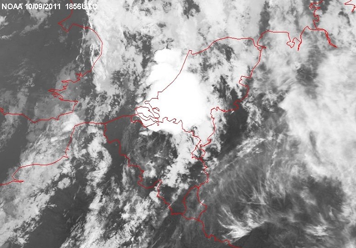
Still image of NOAA at 2056 CET with a closer look on the huge anvil
over southwest Holland holding some supercells and multicells.
|
Radar loop (reflectivity in dBZ) of September 10-11 2011 between 1800-0100 CET. Besides multicells also formation of some supercells, often splitting over the (north)west of Belgium with the pink colors indicating (large) hail. Near Maldegem (north of province Oost-Vlaanderen) stones of 5 cm diameter were reported. (Source radar picture: Belgocontrol)
|
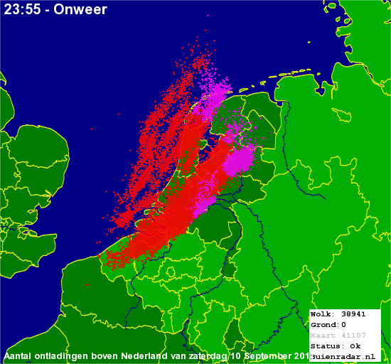 |
Corresponding discharges of September 10 2011 till midnight. All in the last 6 hours of the day, a huge activity of electricity with almost 39000 discharges mainly within clouds. (Source lightning picture: Buienradar)
|
Some metars in UTC. Translation: copy
paste each obs via
metar-decoder
Ostend Airport (EBOS)
|
 |
|
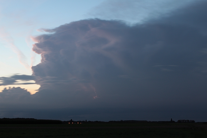
10/09/2011 2045 NW. Cloud-to-cloud discharges at distance somewhere between 30-40 km.
|
 |
|
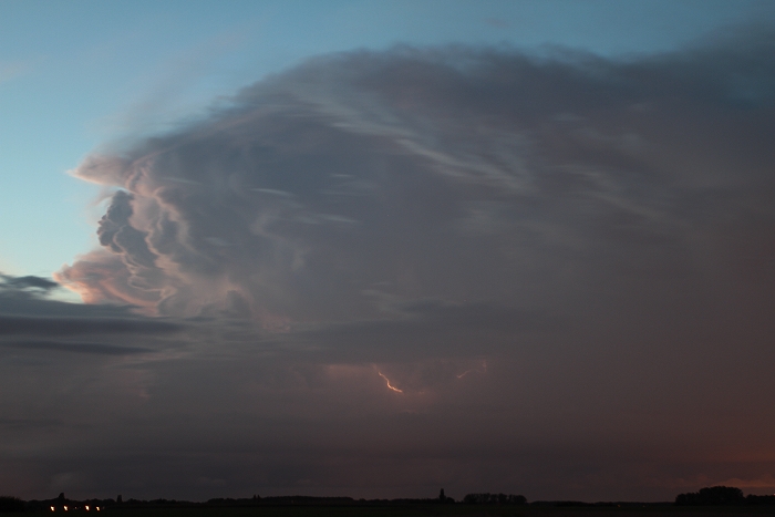
10/09/2011 2053 NNW. Cloud-to-cloud discharge at distance >40 km.
|
 |
|
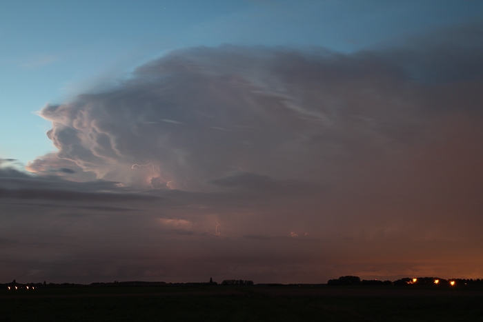
10/09/2011 2055 NNW. Cloud-to-air discharge at distance >40 km.
|
 |
|
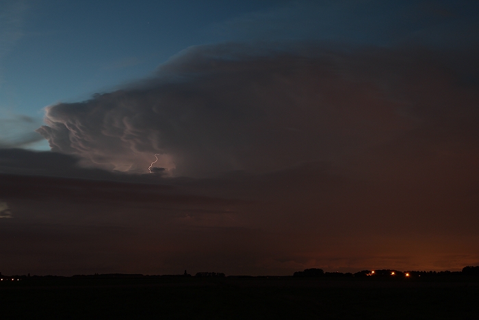
10/09/2011 2058 NNW. Cloud-to-cloud discharge at distance >40 km.
|
 |
|
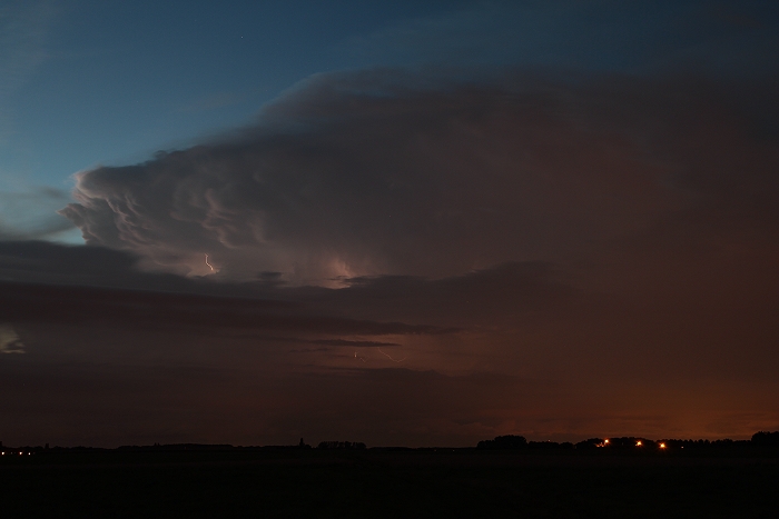
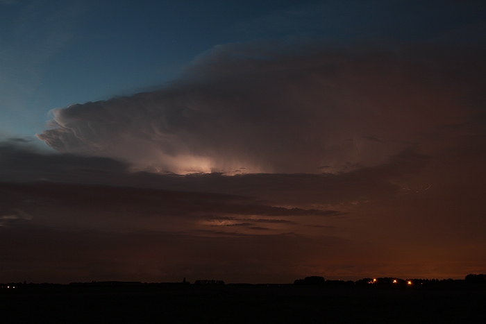
10/09/2011 2058 NNW. Cloud-to-cloud discharge at distance >40 km.
|
 |
|
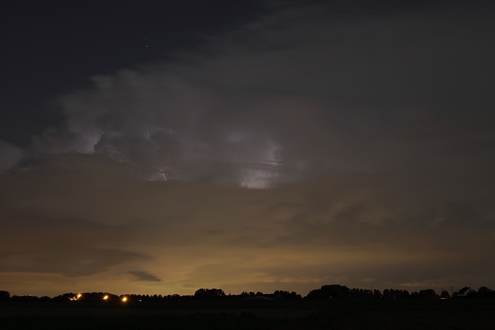
10/09/2011 2059 NNW. Intra cloud discharge at distance >40 km.
|
 |
|
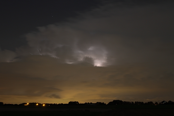
10/09/2011 2137 N. Intra cloud discharge at distance >40 km.
|
 |
|
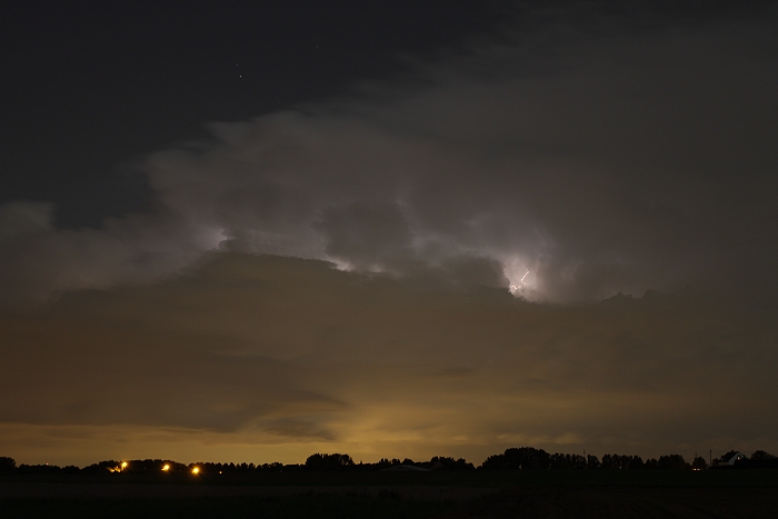
10/09/2011 2138 N. Intra cloud and cloud -to-air discharges at distance
>40 km.
|
 |
|
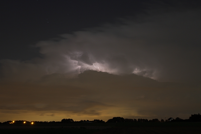
10/09/2011 2140 N. Intra cloud and cloud -to-cloud discharges at distance
>40 km.
|
 |
|
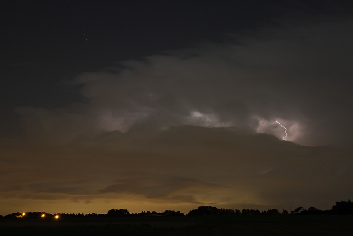
10/09/2011 2143 N. Intra cloud and cloud -to-cloud discharges at distance
>40 km.
|
 |
|
10/09/2011 2145 N. Intra cloud and cloud -to-cloud discharges at distance
>40 km.
|
|
10/09/2011 2050 NNW. Short video in real time showing the activity of
electricity.
|
|
Supercell storm in a time-lapse between 2052-2148 CET captured with a 20
second exposure time and an interval of 3 seconds speeded up to 15 frames per seconds. The
almost horizontal stripes are landing aircraft at Brussels
Airport.
|