| Weather pictures & report of August 26 2011 |
| MCS thunderstorm along thermal trough |
| Synopsis: at 500 hPa, east of a sharp but relaxing trough near the British Isles, our area in a moderate to strong SSW'ly flow of warm and humid potentially unstable air. During the morning passage of a thermal trough advecting a decaying MCS thunderstorm. No severe damage was noted in Belgium (later over Holland it did due to diurnal heating), but at my location it briefly gave some nice structures in the cloudiness. All pictures taken at Kampenhout (central Belgium) with hours in local time (CET). |
 |
|
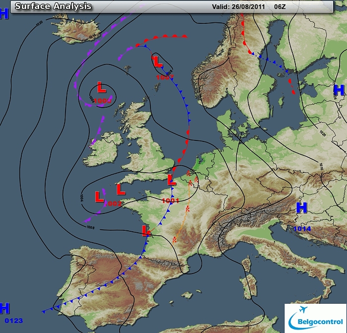
Surface analysis of August 26 2011 at 0800 CET. Related to a complex depression
between England and France, a thermal trough crossing Belgium during the
morning - early forenoon. (Source chart: Belgocontrol)
|
|
Loop of 8 surface analyses of each hour starting from August 26 at 0500 CET with
weather plots showing the thundery outbreak and showers afterwards. (Source: meteocentre.com)
|
 |
|
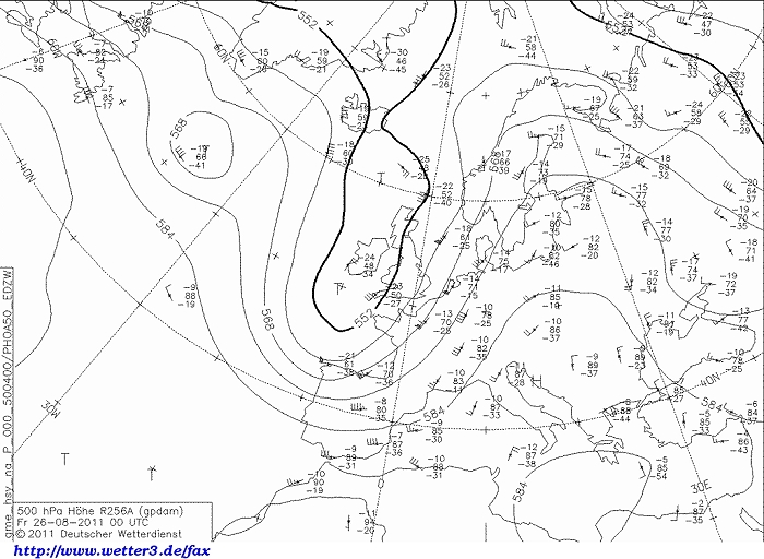
Upper air analysis 500 hPa of August 26 2011 at 0200 CET. A sharp but relaxing upper trough extending from Iceland towards western France. On the
eastern flank a ridge over the Balkan. It resulted
over our area in a moderate to strong SSW'ly flow. (Source chart: DWD via wetter3)
|
 |
|
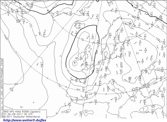
Upper air analysis 850 hPa of August 26 2011 at 0200 CET. Between the
low near Ireland. and anticyclone over western Russia, our area in a
moderate S'ly flow of rather warm air. (Source chart: DWD via wetter3)
|
 |
|
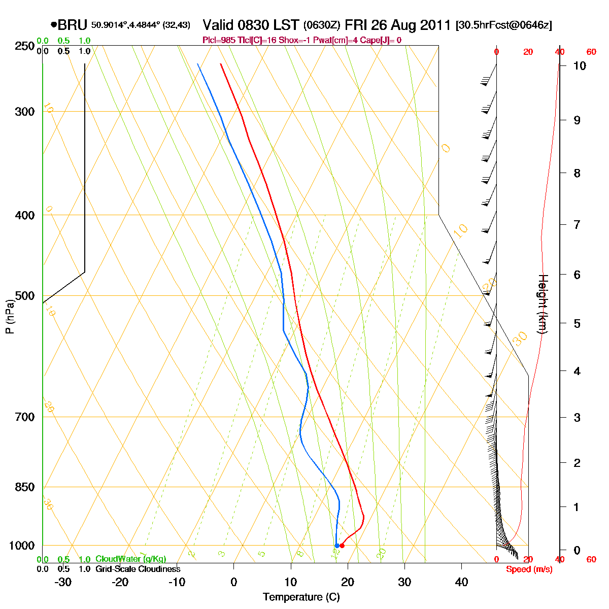
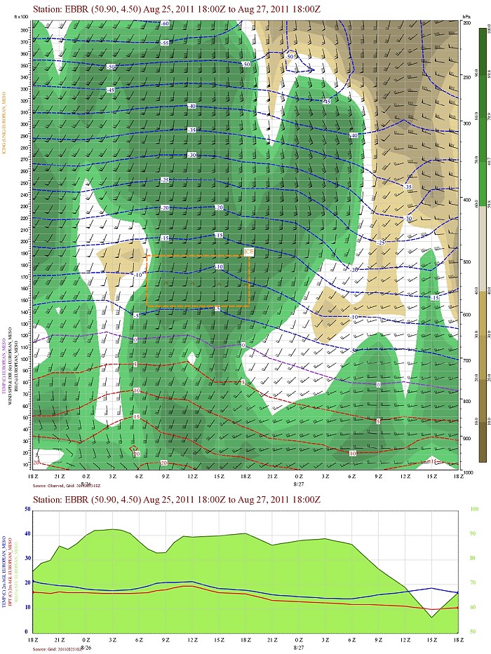
Loop of forecasted soundings for Brussels of August 26 2011 between
0830-2000 CET. During the morning hours a so called CAP (or inversion)
was present below 3000ft. Nevertheless due to passage of a thermal
troughline the potentially instability was released during the morning in form of an
incoming MCS
thunderstorm. Also detectable in the morning is is a pronounced directional windshear
but mainly below 1 km height (above the cloudbase level) (Source: RASP)
|
|
Another loop of forecasted soundings for a 18 hours period (in steps of
three hours) of Brussels from August 26 2011, 0200 CET onwards. Included
are some thunderstorms indices: surface based CAPE was during the night
barely above 0 J/kg, but the most unstable one went up to a few hundred J/kg (which
could be released
with a trigger), KI 33-35, TT 47-50, LI -1/-3 = moderate convective
potential which may lead to occasional
thunderstorms, risk isolated severe. Directional shear was moderate with
194
m²/s², low level shear was 35 kt, deep layer shear 40 kt. Due to the
weak to moderate CAPE and moderate shear, multicells (risk MCS with
squall-line) with small risk supercells could be expected. (Source: weatheronline.co.uk).
|
 |
|
Forecasted vertical profile and surface temperature for Brussels Airport of August 25 from 2000 CET and the following 48 hours. Legend of upper map: green-brown-white
is humidity in steps of 10% with darkest green being 90% or more, wind
in kt, temperatures each 5°C. Humid air at the begin of the period well towards the
upper levels (200 hPa). Furthermore a slight fall of the upper air
temperatures (but warmer in lower levels !) during the morning with passage of
the thermal trough. Also clearly detectable is a weak to moderate wind shear
first 12hours in the lowest 6000ft. (Source: Belgocontrol)
|
 |
|
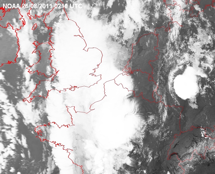
Satellite image of 26/08/2011 at 0410 CET in the infra-red channel with
a MCS near Paris moving northwards. (Source sat
picture: NOAA and University of Bern).
|
 |
|
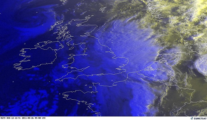
Satellite image of 26/08/2011 at 0700 CET in the visual RGB channel with
a MCS with overshooting top over the south of Belgium. (Source sat
picture: Metsat).
|
|
26/08/2011 0745-1045 CET. Satellite loop in the visual channel. The
mature and gradually decaying MCS
thunderstorm overhead Belgium migrated quite quickly towards Holland.
More (smaller) cells were formed behind, in the afternoon further
exploding to MCS over mid - northeast Holland and northwest Germany. (Source sat
picture: Eumetsat via Sat24.com)
|
Radar loop (rain fall rate in mm) of August 26 2011 between 0615-1145 CET. In the morning a mature (but decaying) MCS on a squall line moved into western and central parts of Belgium. Behind more showers were formed mainly over the eastern parts of Belgium (Source radar picture: Belgocontrol)
|
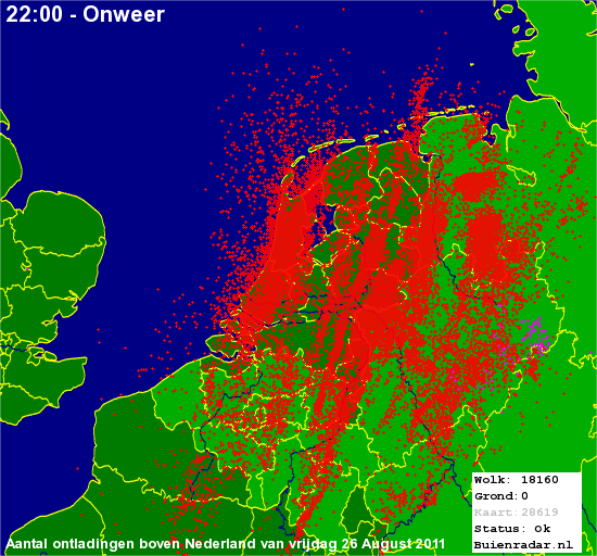 |
Corresponding discharges of August 26 2011 (in two waves) with mainly the central and later eastern parts of Belgium. Holland was affected more intense, especially on the showers in the afternoon over the eastern parts (Source lightning picture: Buienradar)
|
Metars of Brussels Airport (EBBR) (hours in UTC). Translation: copy
paste each obs via
metar-decoder EBBR 260420Z 11010KT 080V140 8000 NSC 18/16 Q1002 NOSIGEBBR 260450Z 11011KT 8000 FEW014 19/17 Q1002 BECMG FM0600 VRB23G40KT 1500 +TSRA BKN008 BKN014CBEBBR 260520Z 14008KT 8000 FEW014CB 18/17 Q1002 BECMG FM0600 VRB23G40KT 1500 +TSRA BKN008 BKN014CBEBBR 260550Z /////KT 7000 R25R///// TSRA FEW014CB 17/16 Q1004 NOSIGEBBR 260620Z 16004KT 9999 R25R///// FEW014TCU 18/17 Q1003 RETSRA NOSIGEBBR 260650Z 13006KT 9999 R25R///// FEW020TCU 19/17 Q1002 NOSIGEBBR 260720Z 16007KT 130V210 9999 R25R///// FEW020TCU 19/17 Q1002 TEMPO VRB20G45KT 2500 TSRA BKN014CBEBBR 260750Z 23009KT 7000 SHRA FEW020CB 19/17 Q1002 TEMPO VRB20G35KT 2500 TSRA BKN014CBEBBR 260820Z 23006KT 9999 FEW020CB 18/16 Q1004 RESHRA TEMPO 4000 SHRA BKN014CBEBBR 260850Z 14004KT 110V190 9999 -SHRA FEW025CB 18/16 Q1003 NOSIG
Metars of Beauvechain (EBBE) (hours in UTC) EBBE 260414Z 09008KT 4000 BR FEW100 BKN220 17/17 Q1003 GRN GRN TEMPO YLOEBBE 260425Z 09009KT 4000 BR BKN230 17/17 Q1003 GRN GRN TEMPO YLOEBBE 260525Z 11007KT 5000 BR BKN145 BKN240 18/17 Q1002 WHT GRN TEMPO YLOEBBE 260538Z 14005KT 4000 -TS FEW015CB SCT130 BKN145 18/17 Q1003 GRN YLO TEMPO AMBEBBE 260625Z 24006KT 9999 FEW013 SCT024 BKN035 18/17 Q1004 RETS WHT BLU TEMPO GRNEBBE 260704Z VRB02KT 9999 FEW024 BKN040 18/17 Q1003 BLU WHT TEMPO GRNEBBE 260725Z 14005KT 9999 FEW024 BKN040 OVC049 18/16 Q1003 BLU WHT TEMPO GRNEBBE 260746Z 14006KT 9999 FEW012 BKN040 19/17 Q1003 BLU WHT TEMPO YLOEBBE 260801Z 24009KT 5000 -SHRA SCT010 BKN025 19/18 Q1004 GRN WHT TEMPO YLOEBBE 260806Z 25010KT 3000 TSRA SCT010CB BKN025 18/18 Q1004 YLO GRN BECMG WHTEBBE 260818Z 23007KT 5000 -TSRA SCT010CB BKN025 18/18 Q1004 GRN WHT TEMPO GRNEBBE 260825Z 23005KT 9999 FEW010CB SCT020 BKN040 18/18 Q1004 RETS WHT BLU TEMPO GRN |
 |
|
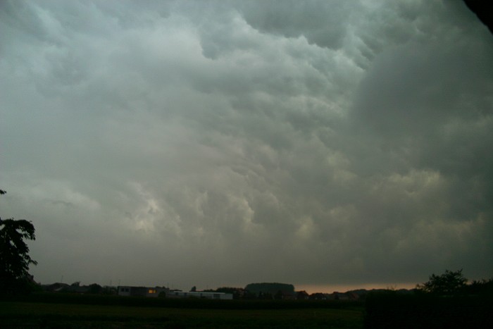
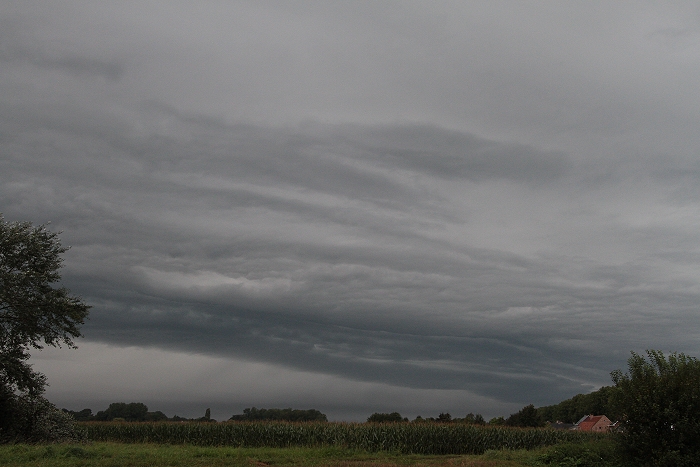
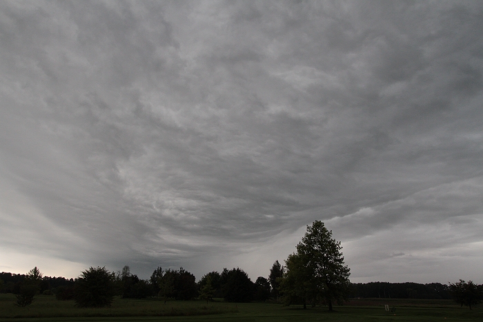
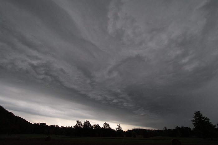
26/08/2011 0743 N. On passage of the squall-line there was presumable a
weak shelf cloud present. When ready to take pictures it already was
overhead giving this nice whales mouth effect.
|
 |
|
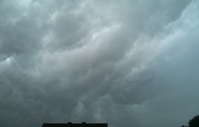
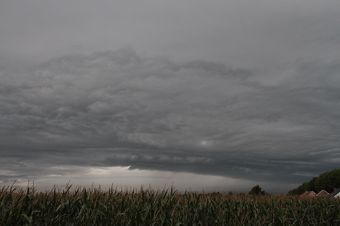
26/08/2011 0744 S. Opposite side also the whales mouth effect.
|
 |
|
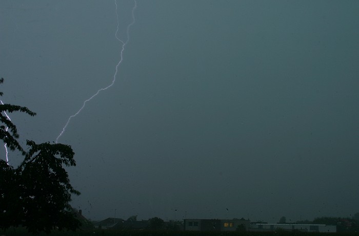
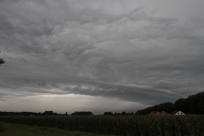
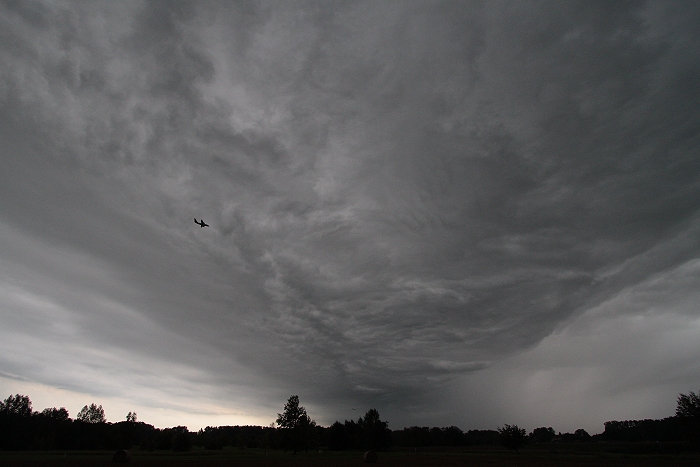
26/08/2011 0750 N. Some near by vertical strikes were observed, only one
could be taken on the edge of the frame. Its distance was less than 2
km, according SAFIR even right in my street a few houses away but this
was certainly not the case.
|
 |
|
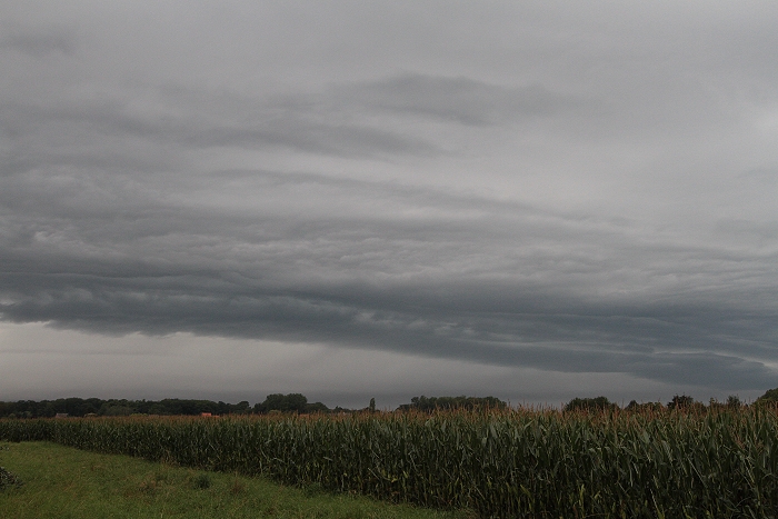
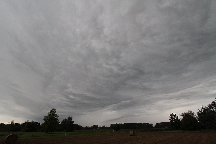
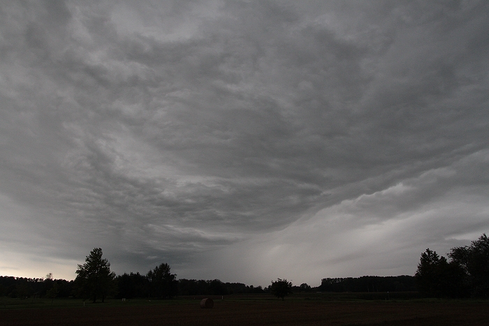
26/08/2011 0920 WNW. Next line of showers gave a weak shelf cloud.
|
 |
|
26/08/2011 0921 WNW.
|
 |
|
26/08/2011 0923 WNW.
|
 |
|
26/08/2011 0926 WNW.
|
 |
|
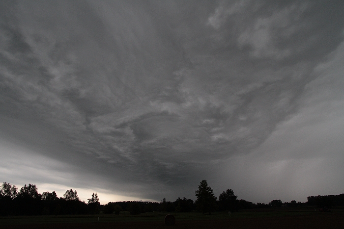
26/08/2011 0928 SW. Weak shelf moved overhead.
|
 |
|
26/08/2011 0930 SW.
|
 |
|
26/08/2011 0931 SW.
|
 |
|
26/08/2011 0932 SW.
|
 |
|
26/08/2011 0935 SSW.
|
 |
|
26/08/2011 0936 SSW. Jupiter alike structures.
|
|
The weak shelf cloud was between 0929-0937 also captured on film
and speeded up to 18 frames per
second.
|