| Weather pictures & report of December 4 2010 |
| Snow related to occlusion and warm front ending a five day cold wave. |
| Synopsis: at 500 hPa a sharpening Atlantic trough veered over the Low Countries the airflow to the southwest with milder air on its way. A first occluded front gave 1 cm of fresh snow, a second one (warm front) was temporary preceded by blowing snow adding another 3 cm giving a maximum snow cover of 8 cm at my location (Kampenhout). All pictures were taken at Steenokkerzeel (5 km from Kampenhout). Hours in local time (CET). |
 |
|
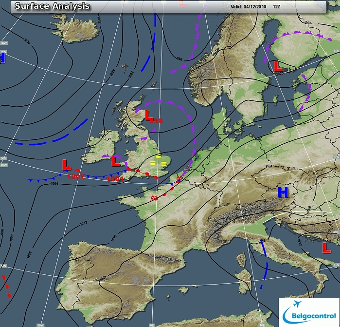
Surface analysis of December 4 2010 at 1300 CET. A first occluded
frontal system moved in from the SW. (Source chart: Belgocontrol)
|
 |
|
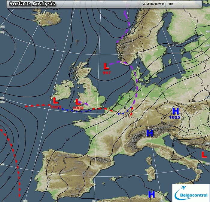
Surface analysis of December 4 2010 at 1900 CET. During the evening a
warm front gave prefrontal still some intense snow, but postfrontal
became rapid rain making an end of the snow story in Low and Mid Belgium. (Source chart: Belgocontrol)
|
|
Loop of 14 surface analyses of December 4 between 1000-2300 CET
with the weather plots. (Source: meteocentre.com)
|
 |
|
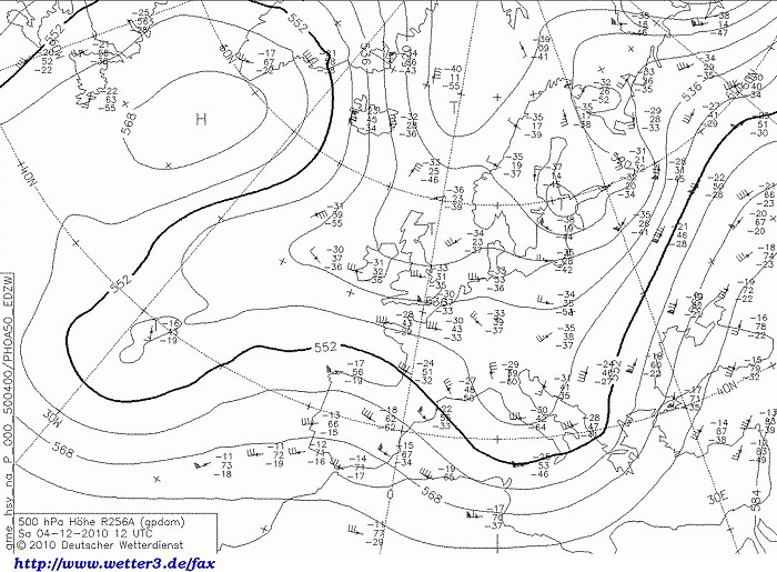
Upper air analysis 500 hPa of December 4 2010 at 1300 CET. Sharpening
trough over the Atlantic Ocean with over the Low Countries a W'ly flow
in which another short wave relaxing trough is approaching from the U.K. (Source chart: DWD via wetter3)
|
 |
|
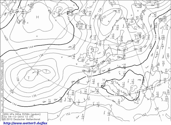
Upper air analysis 850 hPa of December 4 2010 at 1300 CET. In a SW'ly
flow, the minus 8 degrees is retreating over Germany and over northwest France
the minus 1 degrees is approaching. (Source chart: DWD via wetter3)
|
 |
|
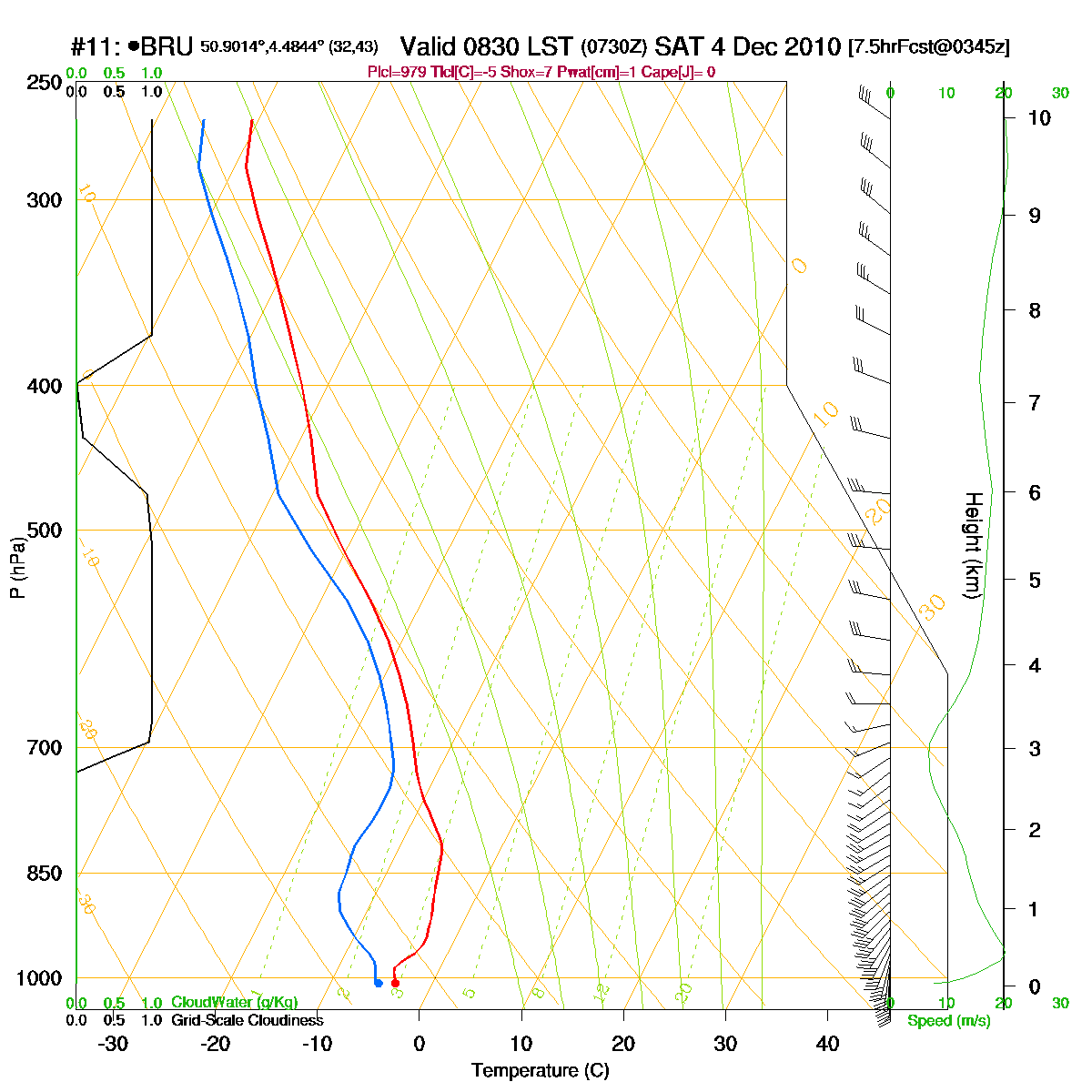
Loop of forecasted soundings for Brussels of December 4 2010 between
0830-1900 CET. Temperature over the entire layer is negative remained
just negative when the first front crossed, but became positive from
1800-1900 onwards in layer 300-1000 m introducing liquid
precipitation with risk of temporary freezing. (Source: RASP)
|
|
Another loop of forecasted soundings for Brussels between December 4 1000 CET and
December 5 1300 CET. Layer SFC till 1500m became positive from 2000 CET
onwards. It approached again the freezing level from 0600 CET onwards,
but only some wet snow was observed at Brussels. On the other hand snow
did fall the entire day in regions with altitude of 100 m or higher giving
5 tot 20 cm. (Source: weatheronline.co.uk)
|
|
04/12/2010 1000-1545 CET. Satellite loop in the visual channel. Thick
cloudiness related to the occluded front and waving warm-cold front
behind. Also notifying is the snow cover over 3/4 of France, Germany,
Swiss and Austria. (Source sat picture: Eumetsat via Belgocontrol)
|
 |
|
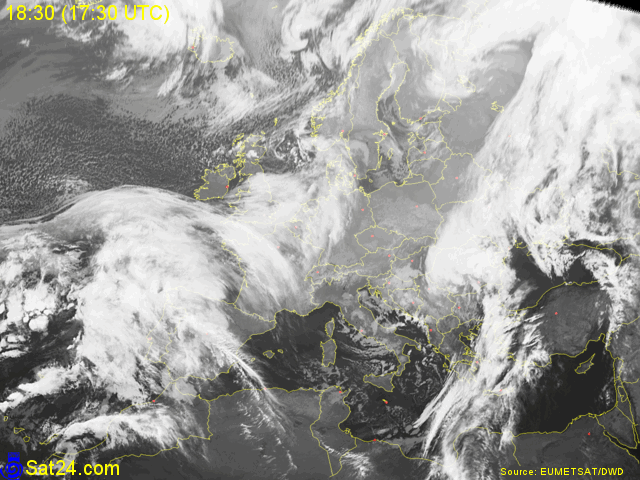
04/12/2010 1830-0000 CET. Satellite loop in the infra-red channel.
Massive cloudiness related to the waving frontal system that led to the
thaw in Low and Mid Belgium. (Source sat picture: Eumetsat via
Sat24.com)
|
Radar loop (reflectivity in dBZ) between December 4 1000 CET and December 5 0100 CET. Around noon a quite intensive precipitation of the occluded front giving temporary moderate falls of snow (see pictures taken at Steenokkerzeel below). During the evening followed by another intensive precipitation belt of the warm (thaw) front. Transformation solid to liquid form did occur at Brussels around 1930Z. (Source radar picture: Belgocontrol)
|
Some metars (hours in UTC) of Brussels Airport (EBBR). Translation: copy paste each obs via
metar-decoder
|
|
Time lapse of webcam images between 1200-1346 CET showing how some snow added
1 cm to the already present 5 cm. It was one of very few occasion some
descent falling snow could be captured during daylight.
|
 |
|
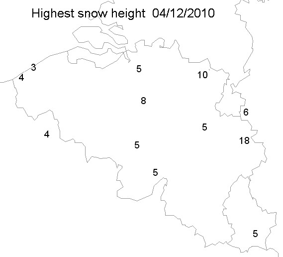
04/12/2010. Snow height in cm taken from the synops of 1200, 1500, 1800
& 2100 UTC.
|
 |
|
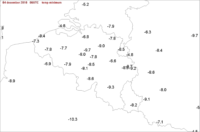
Min temperatures of December 4 were the lowest for
the center, in fact it was reached the late evening of December 3.
(Gardens Tmin was also -9,7°C).
|
 |
|
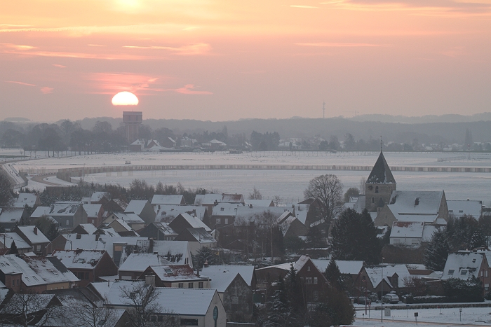
04/12/2010 0832 SE. In fact these were the first real rays of sunshine during
the cold wave, here shining on the village Humelgem.
|
 |
|
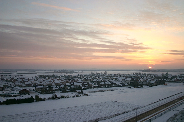
04/12/2010 0834 SE. Wider view.
|
 |
|
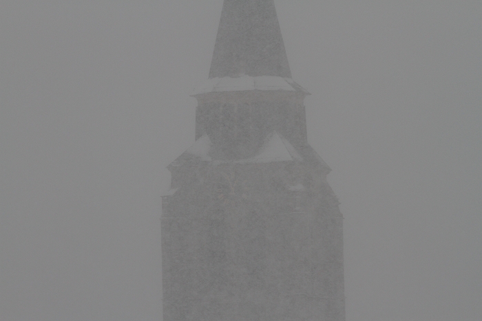
04/12/2010 1256 NE. First snow belt passed by around noon with church of
Steenokkerzeel almost obscured by the snow.
|
 |
|
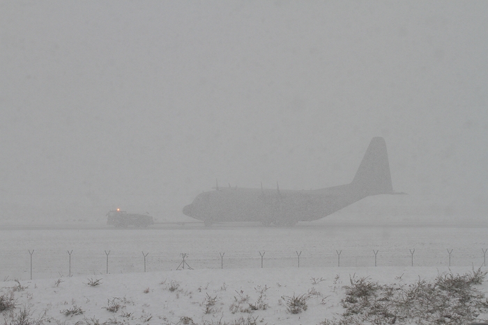
04/12/2010 1259 W. An Hercules is towed to a location where it can
perform engine run tests.
|
 |
|
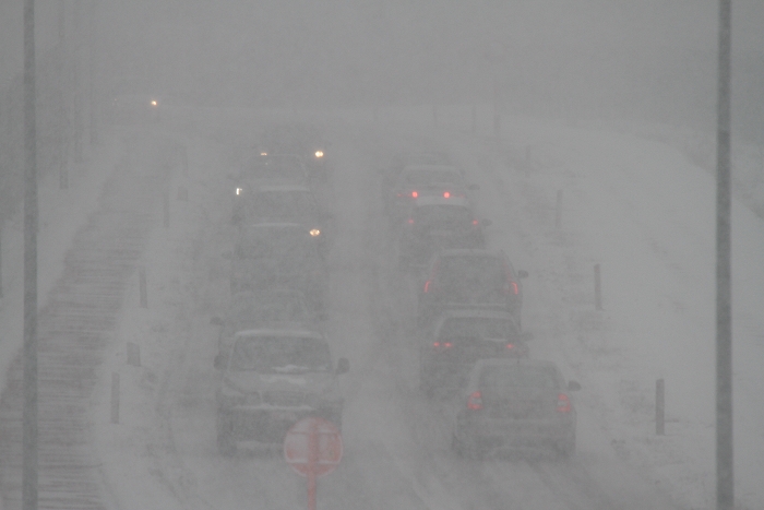
04/12/2010 1301 N. Road traffic began to jam a bit.
|
 |
|
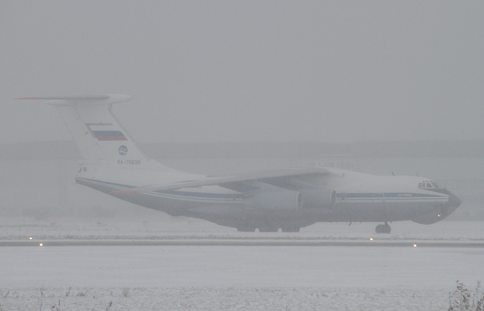
04/12/2010 1435 W. Surely this Russian Ilyushin 76 must felt home when
it arrived at Brussels Airport as part of cargo transport on an upcoming
visit of the president of Russia. Six hours later, the winter landscape
gradually disappeared under loads of rain.
|