| Weather pictures & report of November 29 - December 4 2010 |
| Cold wave after occluded front. |
| Synopsis: at 500 hPa sharpening upper trough crossed our area. Related occlusion produced some light snow and was followed by very cold continental air introducing a 5 day cold wave. On December 1 milder air tried from the south to counter the cold spell which led to widespread snowfall. On December 4 another attack of the mild air was succesfull, is was briefly preceded by blowing snow. All pictures were taken at Kampenhout (central Belgium), hours in local time (CET). |
 |
|
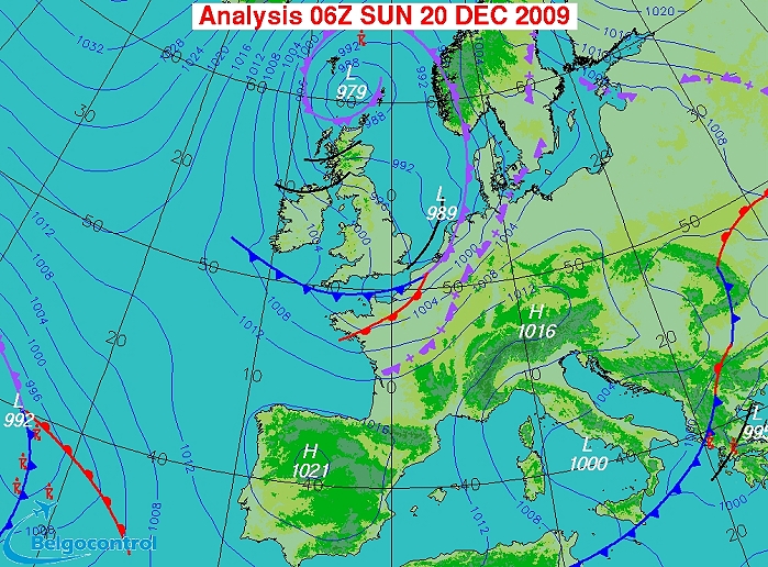
Surface analysis of December 20 2009 at 0700 CET. Occluded frontal
system entering the Low Countries and moving eastwards. It is followed
by a trough line (Source chart: Belgocontrol)
|
|
Loop of 5 surface analyses (of 08, 09, 10, 12 and 13 CET) with weather
plots showing the movement of the depression and associated wintry
precipitation belt. (Source: meteocentre.com)
|
 |
|
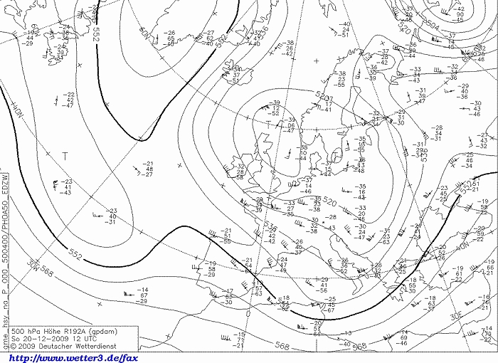
Upper air analysis 500 hPa of December 20 2009 at 1300 CET. Our region
close to a cut-off low of which the axis of a trough crossed the
Benelux. (Source chart: DWD via wetter3)
|
 |
|
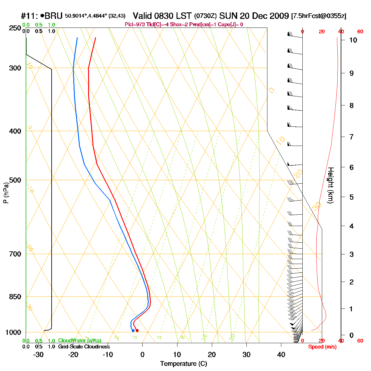
Loop of forecasted soundings for Brussels of December 20 2009 between
0830-1900 CET. Temperature from noon onwards at the bottom layer tempo
slightly positive, but all above subzero values. Indication that the
first precipitation is 100% under solid form, at the end (of the front)
a wet component could be possible as well. Furthermore: first part of the period passage front with temporary warmer air (= stable) at certain heights (= warm occlusion giving the appearance of a "nose" on the sounding). From 1300-1400 CET onwards the curve becomes steeper to the left (= unstable) as colder air is advected (due to passage upper trough). (Source: RASP)
|
|
Another loop of forecasted soundings for Brussels of December 20 2009 on
a larger time scale between 0100-1900 CET. (Source: weatheronline.co.uk)
|
 |
|
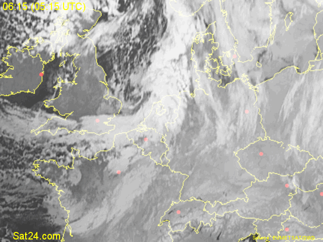
20/12/2009 0615-0800 CET. Satellite loop in the infra-red channel. The
stratiform layer entering the Benelux. (Source sat picture: Eumetsat via
Sat24.com)
|
20/12/2009 1130-1245 CET. Satellite loop in the visible channel. Layered stratiform cloudiness over the eastern parts of the Benelux. On the western side, besides low stratiform clouds, also indication of cumuliform cloudiness. Over the U.K. the cover of snow is clearly visible. (Source sat picture: Eumetsat via Sat24.com)
|
Radar loop (reflectivity in dBZ) of December 20 2009 between 0400-1555 CET. A rather huge precipitation belt crossing the area which is composed of two parts: the first one induced by an weakening upper front, the second active belt was the due to the occluding front. Afterwards, during the afternoon, on passage upper trough also some wintry showers. (Source radar picture: Belgocontrol)
|
Some metars (hours in UTC) of Brussels Airport (EBBR). Translation: copy paste each obs via
metar-decoder
|
|
Time lapse of webcam images between 0832-1549 CET showing how the
(blowing) snow added 8 cm to the already present 10 cm. The largest
snowflakes did occur on the wintry showers.
|
 |
|
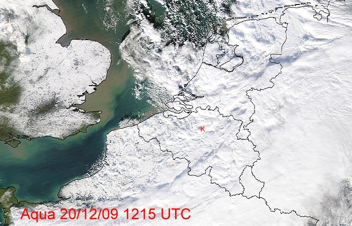
The Aqua satellite giving a view about the snow deposit
over Northwest-Europe. My location at red "K" where some pics were
taken, see below. (Source: Image courtesy of MODIS Rapid
Response Project at NASA/GSFC)
|
 |
|
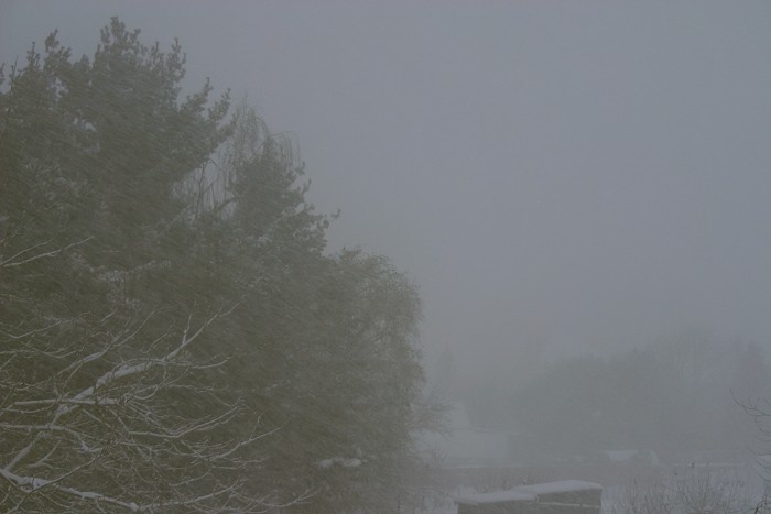
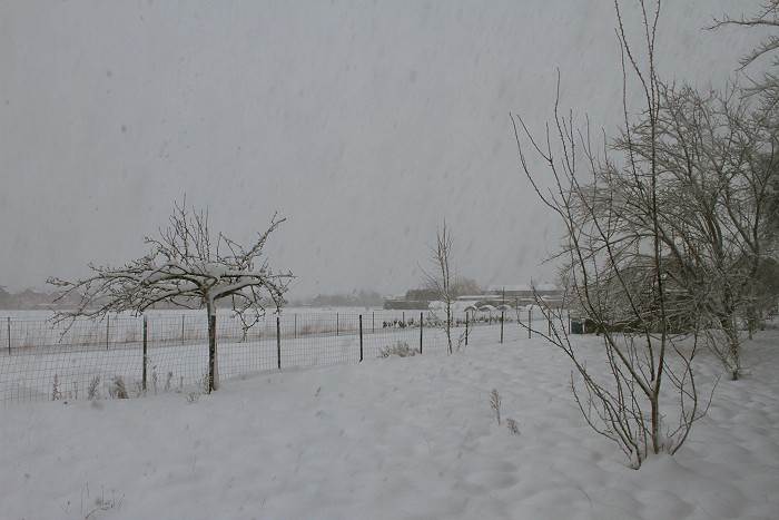
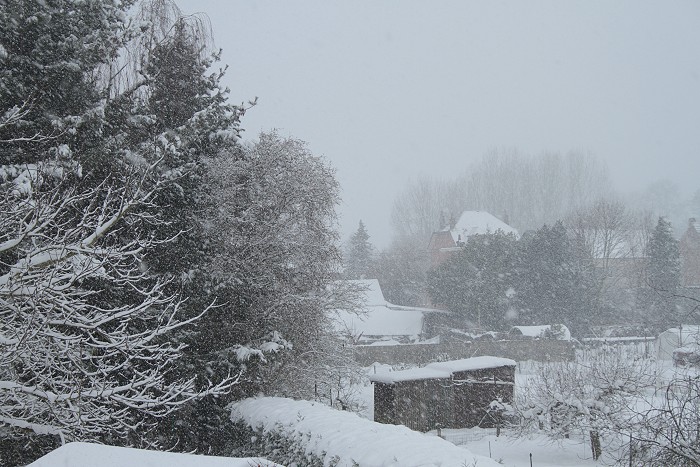
20/12/2009 0914 W. Wind & snow, the most intense part was passing by
with poor visibilities.
|
 |
|
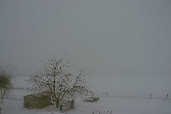
20/12/2009 0915 WNW.
|
 |
|
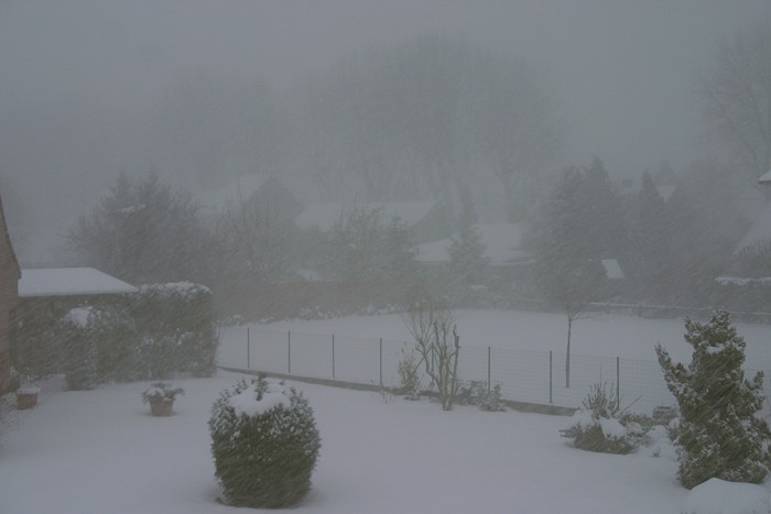
20/12/2009 0918 S.
|
 |
|
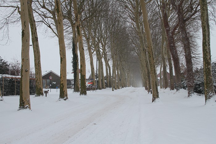
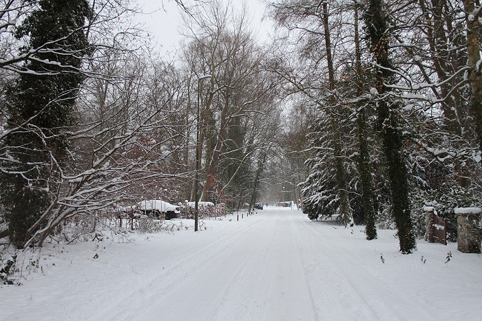
20/12/2009 1046. Afterwards, a walk in "Den Dreef".
|
 |
|
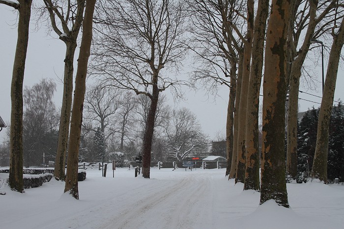
20/12/2009 1049. Opposite view.
|
 |
|
20/12/2009 1052 NE. Due to the wind, the snow cover on the trees was
unexpected tumbling down.
|
 |
|
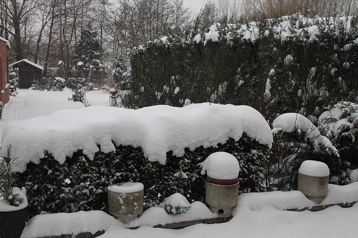
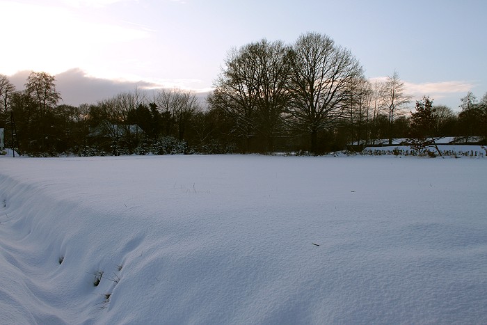
20/12/2009 1125. This is how 18 cm of snow looks like. It was almost 28
years ago to find such amount.
|
 |
|
20/12/2009 1343 W. After a brief dry spell, a couple snow showers
turned up.
|
 |
|
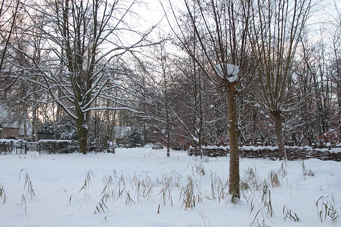
20/12/2009 1452. After these showers, out again for a walk in the park.
|
 |
|
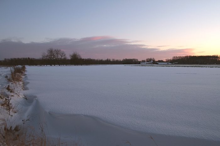
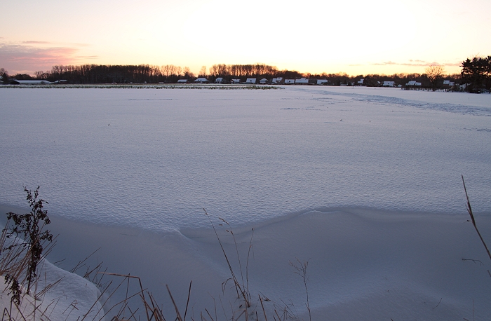
20/12/2009 1500. Somewhere below is a (frozen) water pool.
|
 |
|
20/12/2009 1526 SW.
|
 |
|
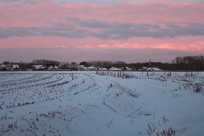
20/12/2009 1636 SSW. Sun was setting.
|
 |
|
20/12/2009 1638 NE. Opposite view, nice red colours.
|
 |
|
20/12/2009 1639 SW. Final salute to this thick pack of snow. In the
pouring rain a wet cover of 3 cm was left on Xmas day, thus making it
officially a white Xmas, but surely we had another dream about it.
|