| Weather pictures & report of October 7 2009 |
| Multi-cell (MCS alike) thunderstorms along waving frontal system. |
| Synopsis: at 500 hPa an approaching relaxing upper trough from the west. Ahead advection of warm ( T850 hPa 12°C) and potentially unstable air. A waving frontal system just southeast of the polar cold front triggered the instability leading to MCS alike thunderstorms during late afternoon and evening. Lightning rate was quite high for the season, rain did fall in abundant amounts over the centre and northeast of Belgium. All pictures were taken at Steenokkerzeel (central Belgium), hours in local time (CET). |
 |
|
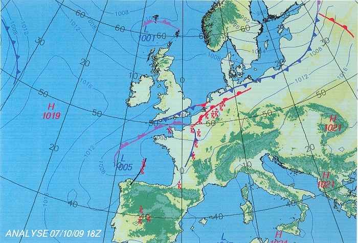
Surface analysis of October 7 at 2000 CET. Polar cold front over the
south of the UK, via northern Holland towards the Baltic States moving
very slowly southeastwards. Furthermore a waving frontal system over
northern France moving northeastwards inducing major thundery outbreaks. The trippelpoint of this system moved
during the late evening over the southeast of
Belgium. (Source chart: Belgocontrol)
|
 |
|
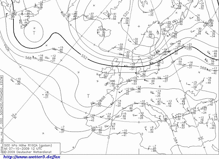
Upper air analysis 500 hPa of October 7 at 1400 CET. Our region in a
southwesterly flow. Just west of the U.K. a relaxing long wave
trough which moved slowly northeastwards. Its axis passed overhead 24
hours later. (Source chart: DWD via wetter3)
|
|
Loop of forecasted soundings for Brussels of October 7 between 1200-2000
CET. Potential instability (not very pronounced) was present between 700 hPa (3 km) and 300 hPa (10 km)
in a quite strong deep layer shear (unidirectional) environment. A trigger (dynamical of nature
like by an incoming front or low)
was needed to release this instability. (Source:
RASP)
|
07-08/10/2009 1900-0100 CET. Satellite loop in the infra-red channel. Exploding multi-cells over the centre of Belgium and northern France. (Source sat picture: Eumetsat via Sat24.com)
|
 |
|
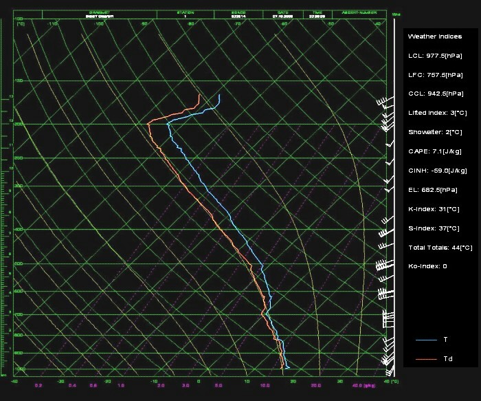
Observed sounding which was released at Beauvechain around 2400 CET. At that time, the trippelpoint of the frontal system just edged
southeast of the balloon trajectory. Recognizable are an unstable
layer between 820-700 hPa and from 500 hPa up 200 hPa in a furthermore
saturated airmass. (Source Belgocontrol)
|
Radar loop (reflectivity in dBZ) between 1745-0155 CET. Tops of showers went up to around 10 km. During the early evening a line of active thundery showers formed over the centre of Belgium. For a relative long time, they trailed over the same locations leading to excessive rainfall. Later on, over the Ardennes, a cyclonic feature becomes recognizable, this being the trippelpoint of the frontal system. (Source radar picture: Belgocontrol)
|
 |
|
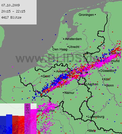
07/10/2009. Lightning sequence between 2015-2215. A line of showers
moved northeastwards with slow progress to the southeast. Over the south
a new active cell is on its way to Belgium which would principally
affect the Ardennes. For Belgium around 4000 cloud-to-ground discharges were
counted out of a total of 7300, quite high values for the season. (Source: blids)
|
Some metars (hours in UTC) of Brussels Airport (EBBR). Translation: copy paste each obs via metar-decoder
EBBR 071320Z 21005KT 9999 -SHRA FEW018 SCT025 19/17 Q1011
NOSIG |
 |
|
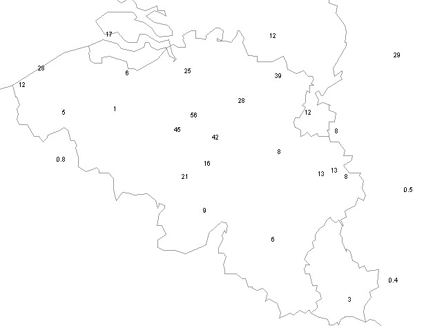
07-08/10/2009. Amount of precipitation (in mm) between 2000-0200 hr. Top
was Zaventem: during the first thunderstorm rainfall rate was briefly 77
mm/h. This shower produced a total of around 40 mm in less than an hour.
|
 |
|
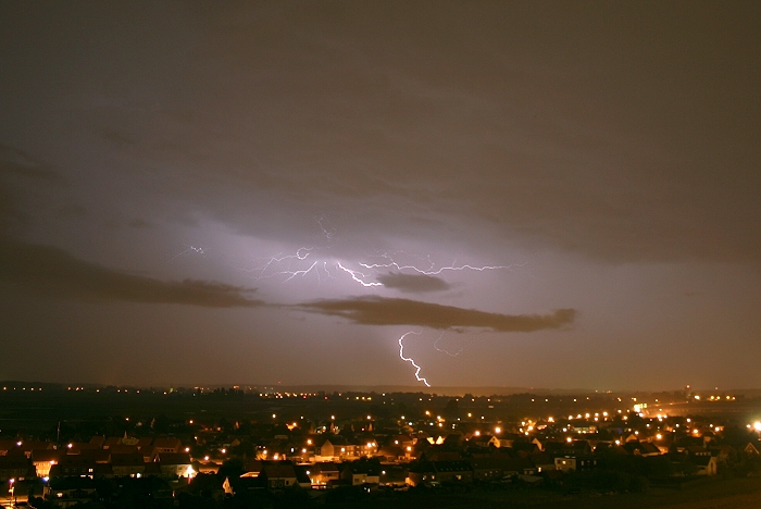
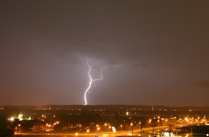
07/10/2009 2108 SE. Lightning with impacts less than 5 km from the
airport started around 1947. Rate was quite high with between 2015-2040
even three discharges on the airfield self, however at that time not in
position to make pictures. Afterwards I could give it a try with here a
first cloud-to-ground discharge at a distance of around 25 km.
|
 |
|
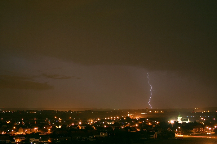
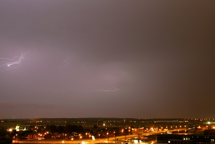
07/10/2009 2109 SE. A rather faint cloud-to-ground discharge, distance
around 30 km.
|
 |
|
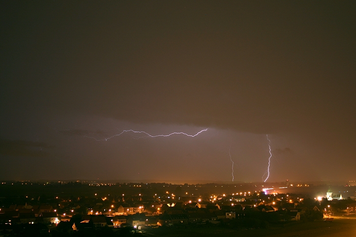
07/10/2009 2112 SE. Couple faint cloud-to-ground discharges, distance 25
km and the faintest at 32 km.
|
 |
|
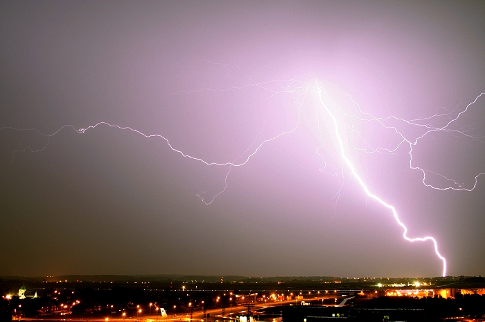
07/10/2009 2142 SSE. Bold cloud-to ground discharge, in this cropped
picture distance was around 21 km.
|
 |
|
07/10/2009 2156 S. Closest discharge captured, distance of impact was
11 km (at St-Pieters Woluwe).
|
 |
|
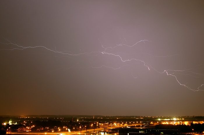
07/10/2009 2158 S. Long forked cloud-to-air discharge, at a distance
between 14 and 18 km.
|
 |
|
07/10/2009 2208 S. One of the last discharges that could be captured,
cloud-to-air, distance around 12 km
|
 |
|
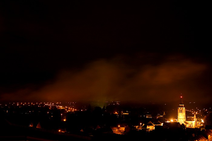
07/10/2009 2222 NE. Formation of some fragments of Stratus seemed to be
harmless at that moment, but an hour later things turned out
differently.
|
 |
|
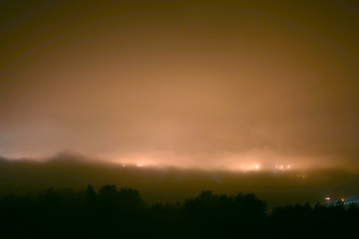
07/10/2009 2353 SW. Due to backing winds to the north, fog invaded the
airport around 2345, leading to this spooky effect. It came in a certain
way as a surprise, it was formed over the woody fields due to slight
cooling (by the turning winds) of the almost saturated lowest layer (due
to the rain). It made further photography
(sadly) impossible of some nearby discharges over the south of a second (edging) thunderstorm. Half an hour later with
the veering wind, the fog
drifted back northwards and also dissipated due to the falling rain, but by then the thunderstorm had drifted too far.
|