| Weather pictures & report of January 5-11 2009 |
| Snow related to cold front resulted in a week old fashion winter weather |
| Synopsis: at 500 hPa: on January 5, a sharpening upper trough with its related waving cold front passed Belgium from north to south giving light to moderate falls of snow for more than 12 hours. With slightly subzero temperatures, snow accumulated between 1 and 12 cm over entire Belgium except for the extreme western parts. Afterwards temperatures remained subzero for almost a week. Below a pictorial report, all pics have been taken at Kampenhout or Steenokkerzeel in local time (CET). |
|
|
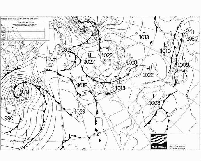
Analysis of the mean sea level pressure with fronts of 05/01/2009 at 0100 CET: a waving cold front over mid Holland moved southwards. (Source chart: Met Office - UKMO)
|
Radar sequence between 0540-0820 CET. It shows the movement of the most intense belt of wintry precipitation. (Source radar picture: Belgocontrol)
|
|
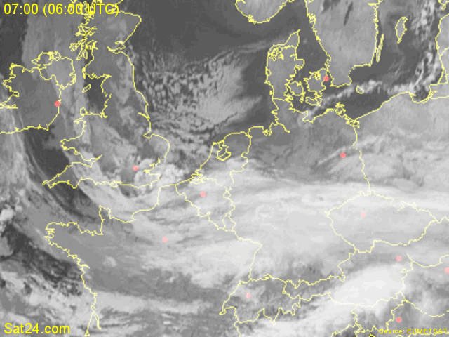
Satellite sequence (infra-red channel) between 0700-0845 CET. The entire country covered by thick cloudiness, while breaks appear over northern Holland. (Source: Meteosat via Sat24.com)
|
 |
|
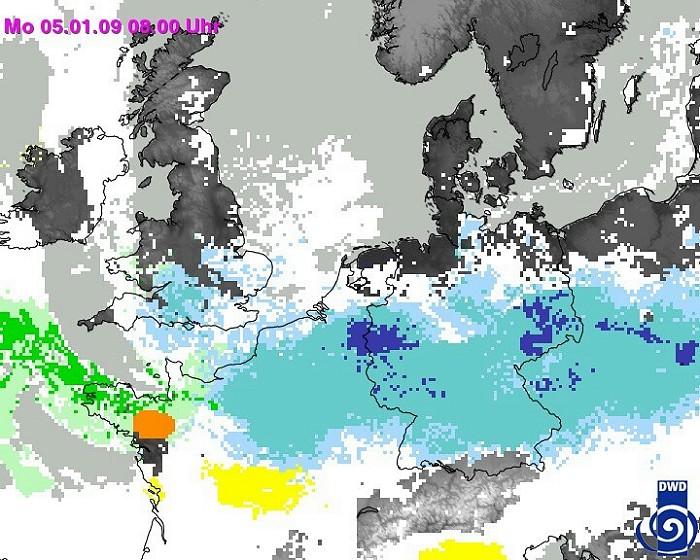
Satellite combined with radar images of 0800 CET, with calculation of type of precipitation. Clearly visible over the eastern parts of Belgium more intense precipitation was falling. (Source: DWD)
|
|
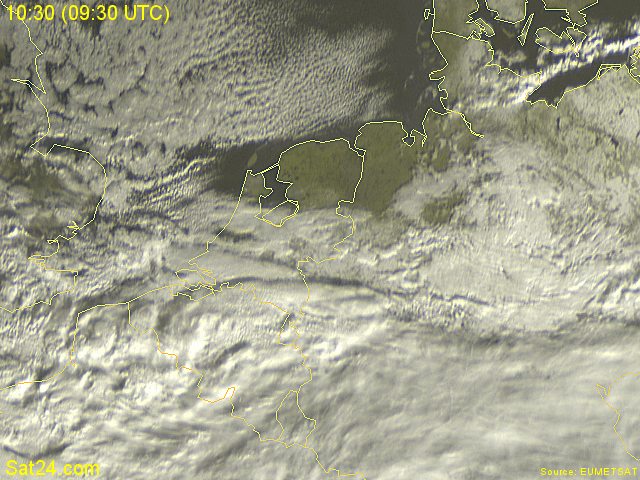
Satellite sequence (visible channel) between 1030-1230 CET. The breaks reached southern parts of Holland, giving a first glimp of the snow on the ground over this part of Holland. (Source: Meteosat via Sat24.com)
|
 |
|
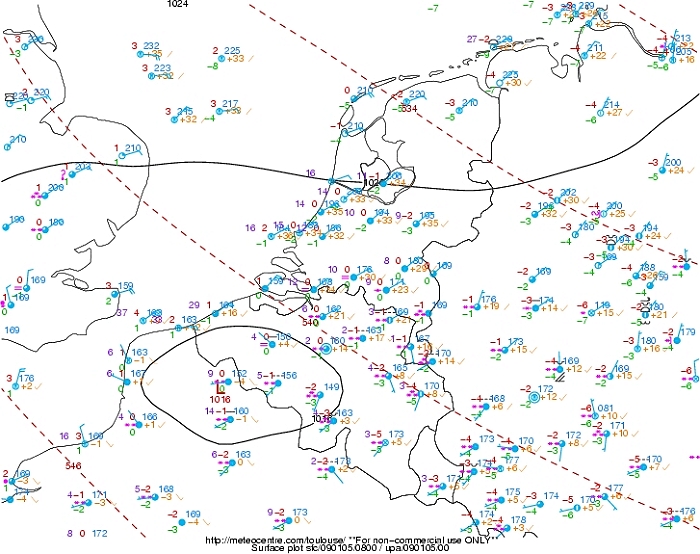
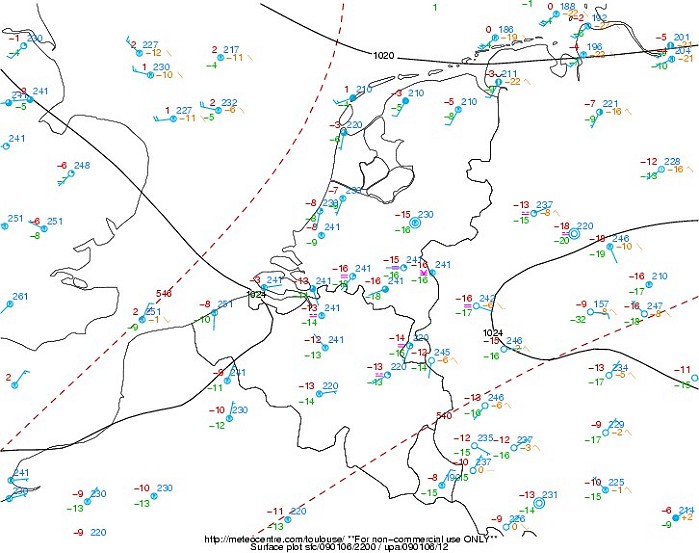
Observed mean sea level surface chart of 0900 CET with the so called
'plots': the small low (waving cold front), induced wintry
precipitation for hours.
(Source map: Meteocentre).
|
 |
|
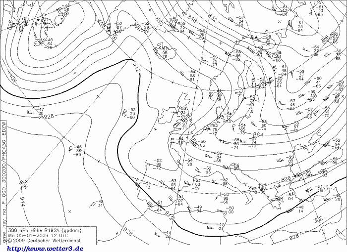
Observed upper air chart at 300 hPa of 1300 CET, airflow veered to the NE.
(Source map: DWD).
|
 |
|
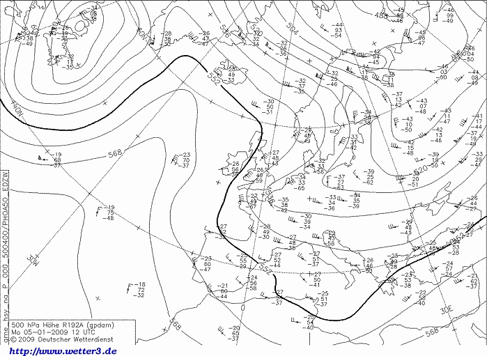
Observed upper air chart at 500 hPa of 1300 CET, axis of the trough
passed Belgium. Furthermore a classic Omega pattern for severe winter
weather: ridge axis over the Atlantic and trough axis over the
continent. (Source map: DWD).
|
 |
|
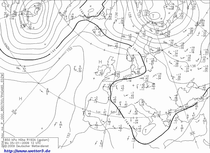
Observed upper air chart at 850 hPa of 1300 CET, also here the airflow veered to the NE
introducing temperatures of -10°C and below.
(Source map: DWD).
|
 |
|
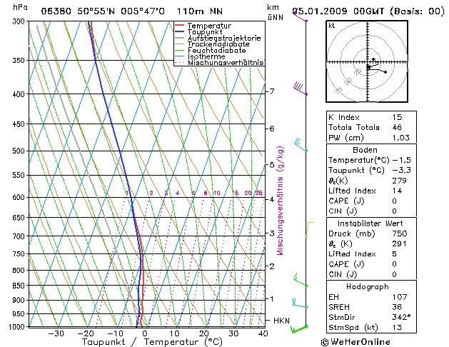
Forecasted sounding of Maastricht at 0100 CET. This was the best
representative sounding to describe the vertical profile of the
prefrontal air: an (almost) saturated layer starting from a height of
around 900 m (= 950 hPa), reaching up around 10 km (= 300 hPa). Attention
must be paid to the fact that the temperature was in the
entire sounding below zero, so 100% chance of the occurrence of snow.
Prefrontal, the winds below 700 hPa were still coming from the SW. (Source sounding:
WetterOnline).
|
 |
|
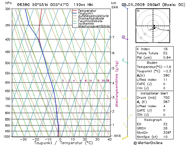
Forecasted sounding of Maastricht at 0700 CET. The saturated layer now starting from
almost the ground up around 7 km (= 400 hPa). Entire sounding still well below zero, so 100% chance of the occurrence of snow.
Gradually the winds began to veer, only below 850 hPa still westerlies. (Source sounding:
WetterOnline).
|
 |
|
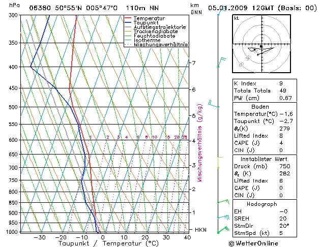
Forecasted sounding of Maastricht at 1300 CET. A saturated layer between
970-900 hPa and 700-500 hPa could only be responsible for light
precipitation, the entire sounding still well below zero, so 100% chance of the occurrence of snow.
The wind veered over the entire layer. (Source sounding:
WetterOnline).
|
 |
|
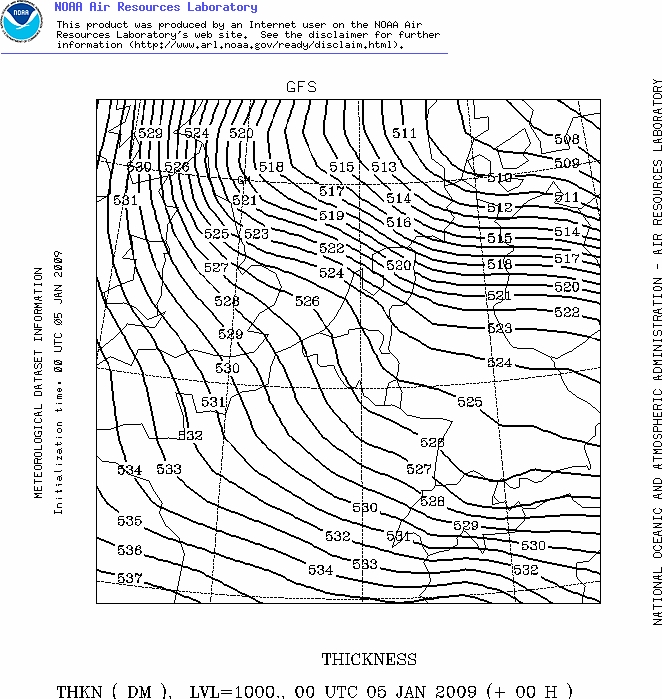
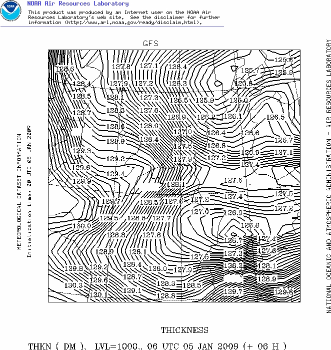
Forecasted thickness map (in dam) between 1000-500 hPa of 05/01/2009 at
0100 CET. This calculation (or measurement) gives an idea on the kind of
precipitation (solid or not). Usually in areas below 300 m, values below
528 dam produces (wet) wintry precipitation. (Source map: NOAA web
server).
|
 |
|
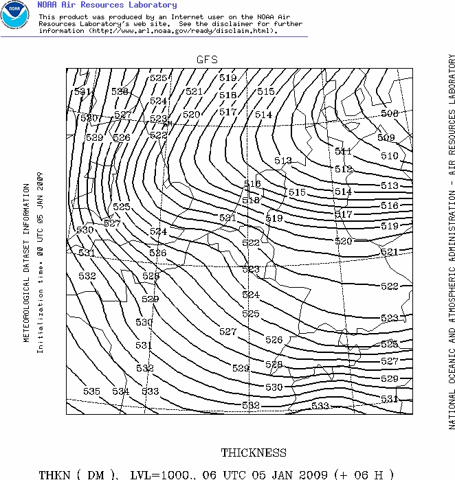
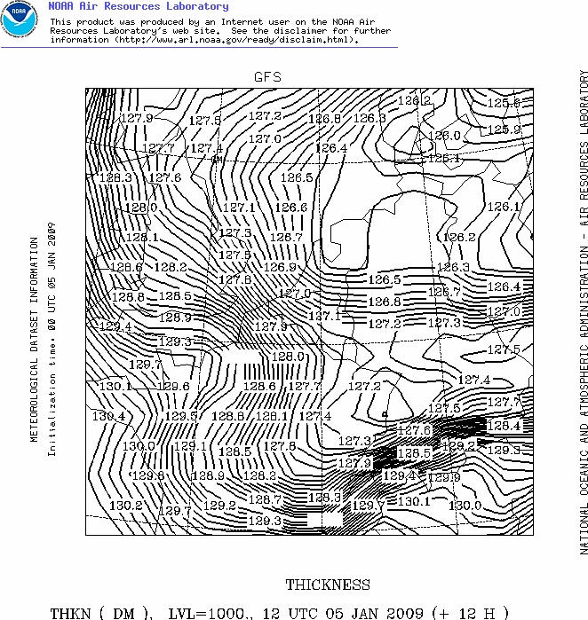
Forecasted thickness map (in dam) between 1000-500 hPa of 05/01/2009 at
0700 CET. Colder air is migrating southwards. Usually in areas below 300
m, values below 522 dam produces dry wintry precipitation. (Source map:
NOAA web server).
|
 |
|
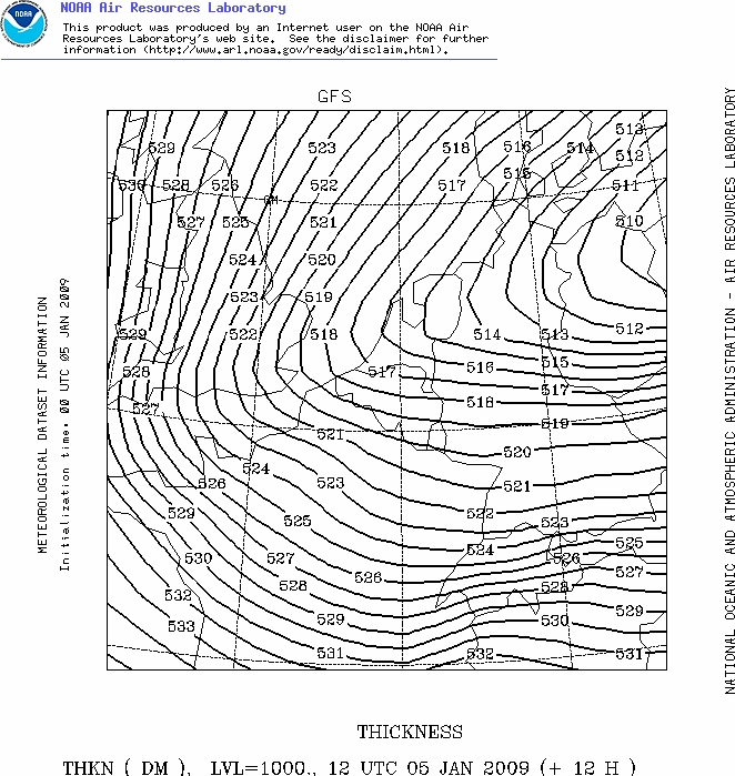
Forecasted thickness map (in dam) between 1000-500 hPa of 05/01/2009 at
1300 CET. If precipitation is expected, only under form of dry solid
form. (Source map: NOAA web server).
|
 |
|
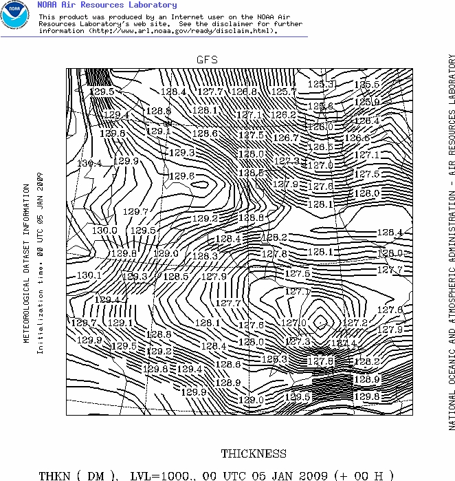
Forecasted thickness map (in dam) between 1000-850 hPa of 05/01/2009 at
0100 CET. This calculation (or measurement) gives one of the best ideas
on the kind of precipitation, as this is done below 1500 m so the
maritime component in the boundary layer is well weighted. Using the
snow predictor of Boyden, which takes account of pressure and height,
this tool gives an idea about the expectations of solid precipitation.
In this case, with a pressure of 1010 hPa at height of 50
m, values of 128,5 dam or less give a probability of snow of 90 % or
higher. On the other hand values of 129,0 or and higher give a probability
of snow of less than 80 %. Clearly visible: over the western parts
of Holland slightly warmer air is present, and moved further southwards.
It was responsible for the fact that over extreme western parts of
Belgium the light wintry precipitation mostly fell as a wet feature. (Source map: NOAA web server).
|
 |
|
Forecasted thickness map (in dam) between 1000-850 hPa of 05/01/2009 at
0700 CET. Warmer air touching western parts of Belgium. (Source map:
NOAA web server).
|
 |
|
Forecasted thickness map (in dam) between 1000-850 hPa of 05/01/2009 at
1300 CET. Entire Belgium now in the freezing cold air with a chance dry
solid precipitation, however by then, it remained dry over the extreme
west of Belgium. (Source map: NOAA web server).
|
Below the observation sequence at Brussels Airport in UTC between 04/2150-05/1720, most recent one on top. EBBR 051720Z 06010KT
9999 SCT016 SCT028 M03/M06 Q1022 R57/290174 R02/290176 NOSIG
|
 |
|
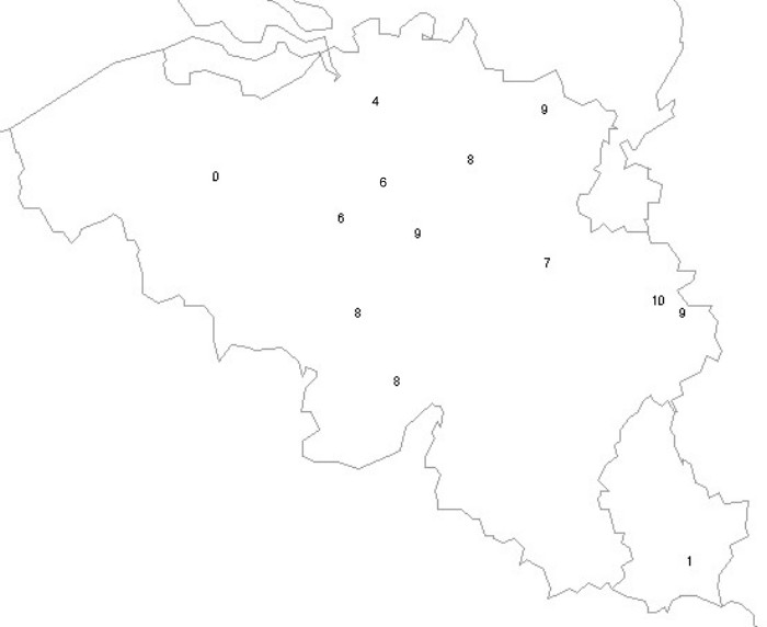
Snow depth in cm of 06/01 at 1000 CET gives a good idea about the
coverage on regional scale. Over western parts 1 cm or less was measured, at
Mont Rigi even 12 cm the day before (but here already 'collapsed').
|
 |
|
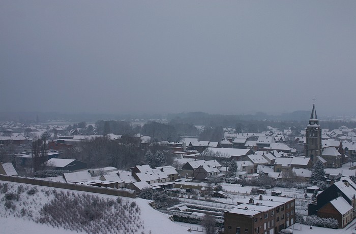
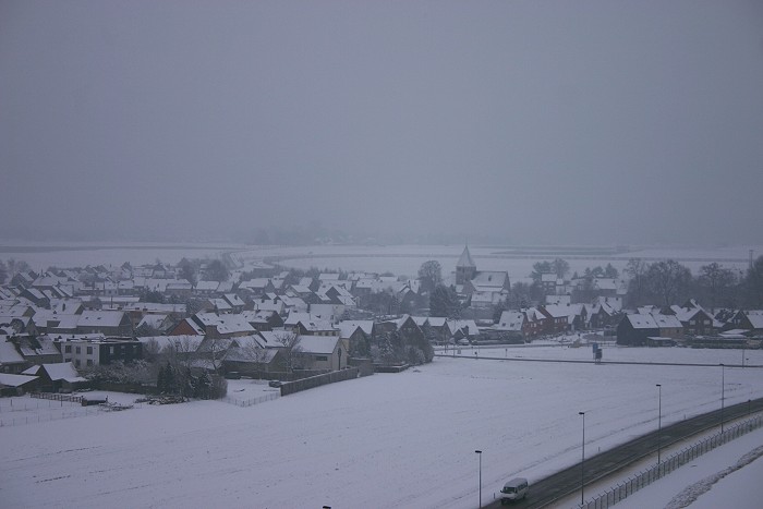
05/01/2009 1056 NE. Village of Steenokkerzeel under a snow cover of 7
cm, still overcast with some light flurries.
|
 |
|
05/01/2009 1152 SE. Other side, the village of Humelgem, of course also under
the same snow cover of 7
cm.
|
 |
|
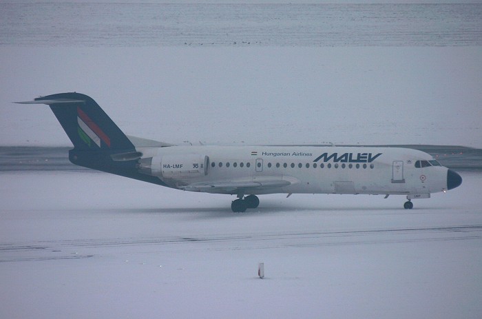
05/01/2009 1102. An aircraft taxiing trough the snow, must be ages ago.
|
 |
|
05/01/09 1341. Same conditions at Kampenhout, the secondary roads still
under that magnificent wintry carpet.
|
 |
|
05/01/09 1342. Not too much wind, so the trees & boughs also under this white blanket.
|
 |
|
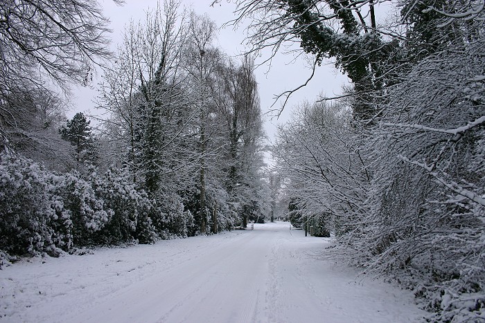
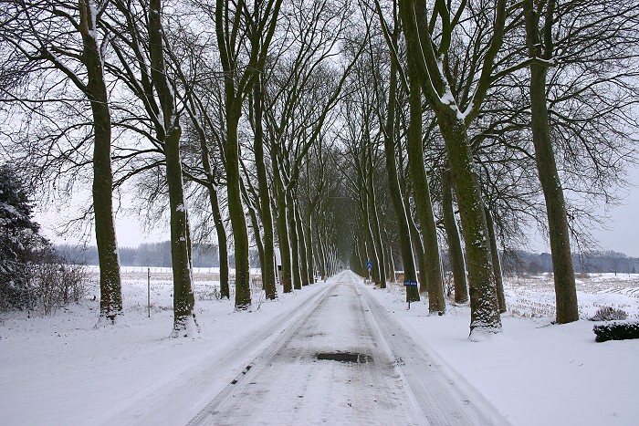
05/01/09 1347. Classic view on 'Den Dreef".
|
 |
|
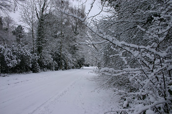
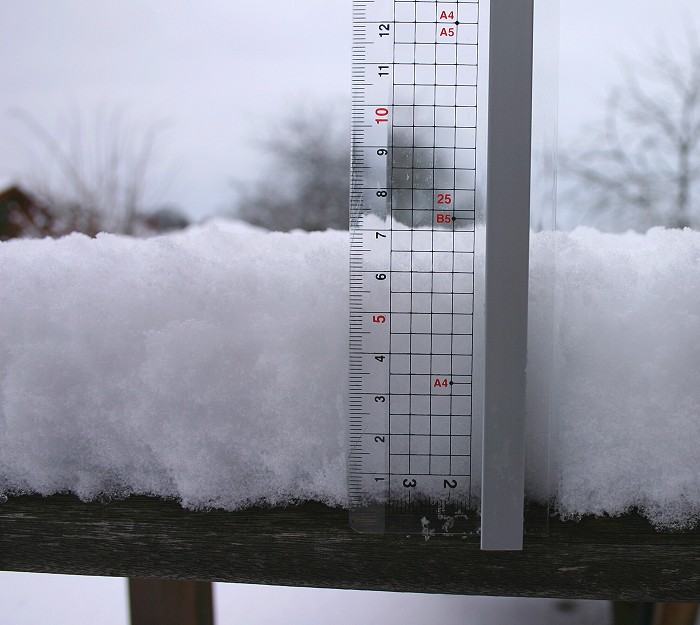
05/01/09 1355. Proof of the 7 cm 'white gold'.
|
 |
|
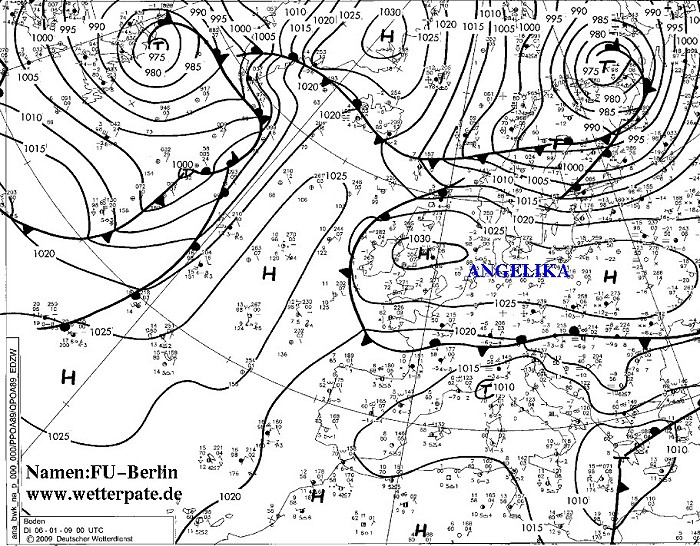
Analysis of the mean sea level pressure with fronts and 'plots' of 06/01/2009 at
0100 CET. High pressure cell 'Angelika' moved into the direction of
Belgium. The skies became clear giving superb & bitterly cold wintry
conditions on the second day.
(Source chart: DWD)
|
 |
|
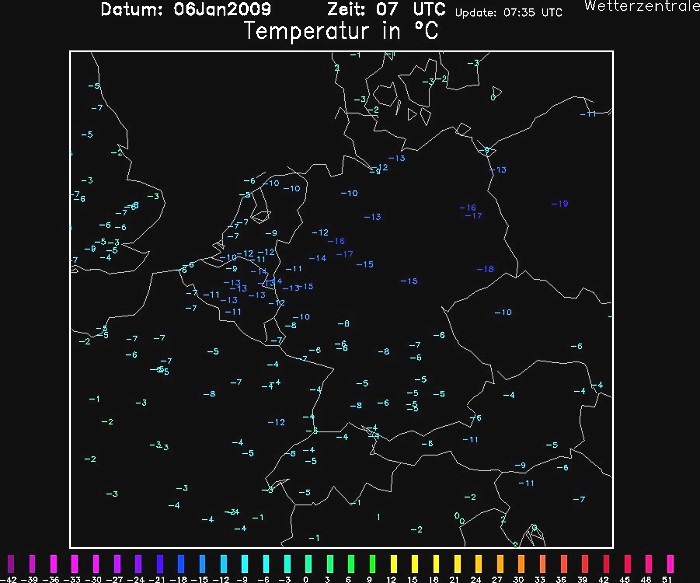
Temperature of 06/01/2009 at
0800 CET. So just before sunset, this kind of deep frost didn't occur since
January 1997.
(Source chart: Wetterzentrale)
|
 |
|
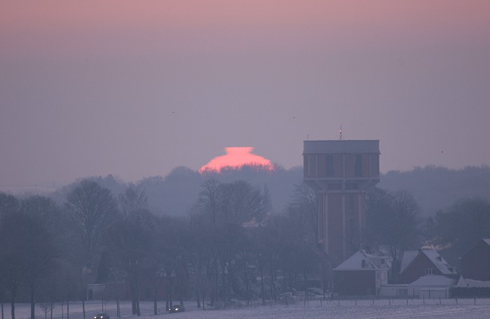
06/01/2009 0845 SE. Again at Steenokkerzeel: under bitterly cold conditions,
catching the first rays of a rising sun.
|
 |
|
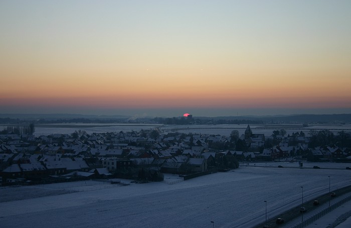
06/01/2009 0846 SE. Wider view.
|
 |
|
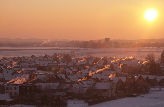
06/01/2009 0904 SE. Interesting to see I was not
alone having cold.
|
 |
|
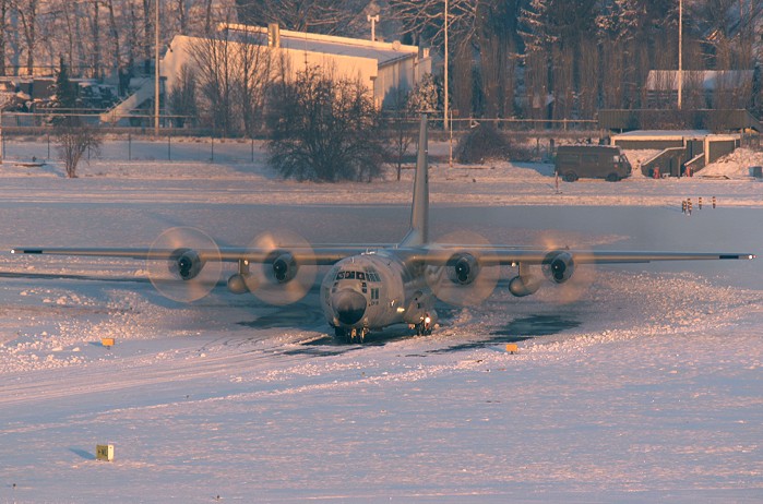
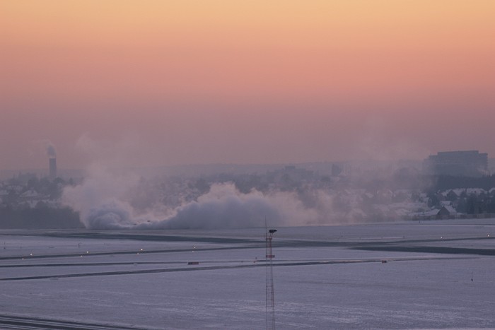
06/01/2009 0918. The contrast couldn't be bigger with this smoking C130
against the white carpet as background.
|
 |
|
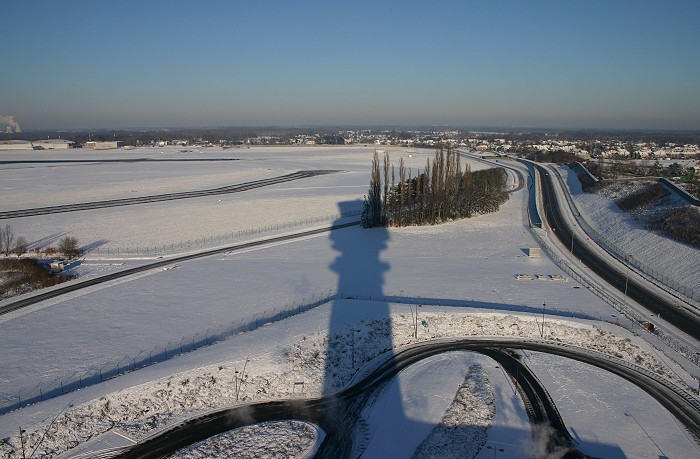
06/01/2009 1100 NW. Mighty shadow of the tower.
|
 |
|
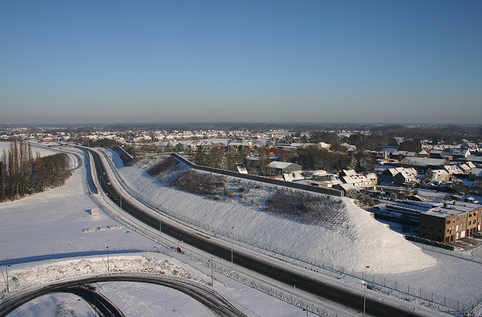
06/01/2009 1101 NNE. The 'sound wall' with behind
the village Steenokkerzeel.
|
 |
|
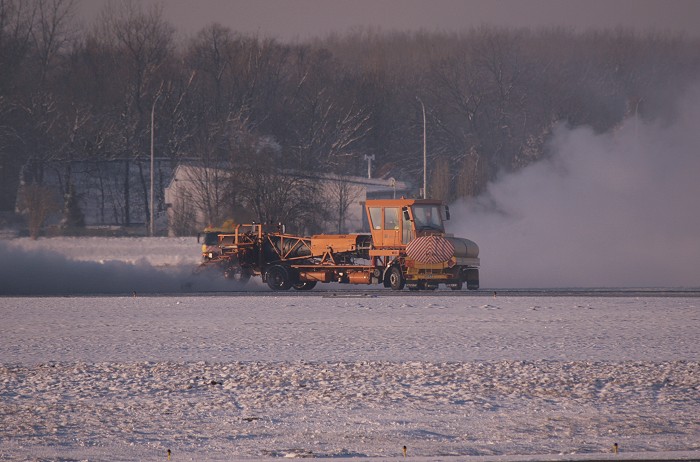
06/01/2009 1523 SW. Cleaning of the runways/taxiways
is done with this machine which literally blows away the snow with warm
air.
|
 |
|
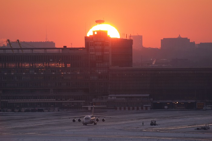
06/01/2009 1648 SW. After a beautiful day the sun was
setting at the old control tower.
|
 |
|
06/01/2009 1650. Meanwhile the cleaning process of
the runways & taxiways continued.
|
 |
|
06/01/2009 1705 NE. The pink horizontal band in the
sky referred as 'Belt of Venus', with below a darker band which is
nothing else than the (rising) shadow of the Earth).
|
 |
|
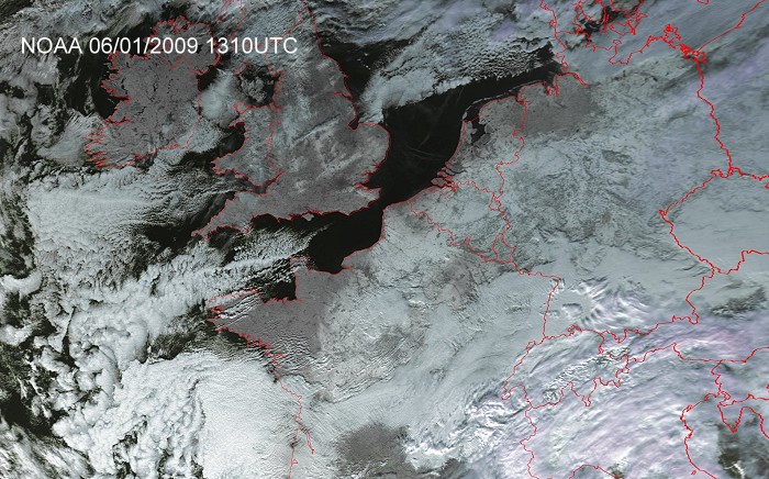
The crystal clear day gave the opportunity to have a view on Earth from
space: clearly visible is a relative large area with snow on the ground.
(Source: NOAA & University of Bern)
|
 |
|
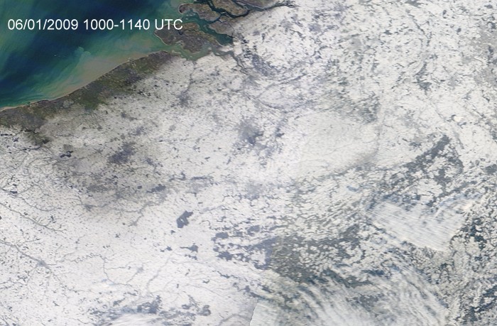
The Terra satellite gave a closer inspection on the situation over
Belgium. (Source: Image courtesy of MODIS Rapid Response Project at
NASA/GSFC)
|
 |
|
Observed mean sea level surface chart of 2300 CET with the so called
'plots': one of the coldest nights in years was on its way.
(Source chart: Meteocentre)
|
 |
|
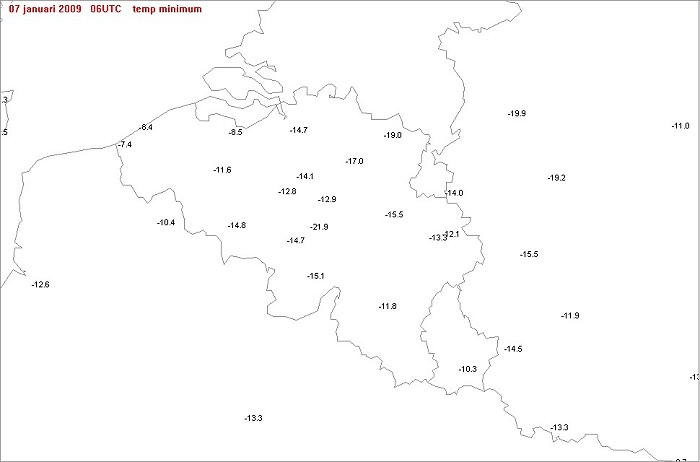
Observed minimum temperatures at 0700 CET of the night between 06-07/01:
coldest spot was Ernage with -21,9°C. In my garden -17,6°C was measured.
Soon after the sky was invaded with clouds and locally some slight
wintry precipitation did fall.
|
 |
|
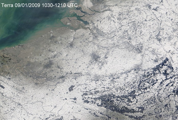
The couple days afterwards widespread freezing fog did occur, on January
9 it finally lifted resulting in a beautiful rimed landscape. The Terra
satellite shows over western pars of Belgium white spots, induced
by so called 'industrial snow'. (Source: Image courtesy of MODIS Rapid Response Project at
NASA/GSFC)
|
 |
|
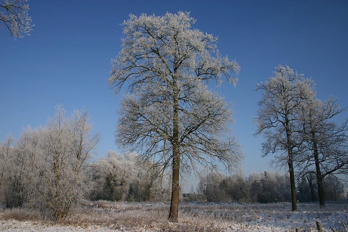
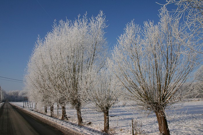
09/01/09 1118. At Kampenhout: every tree & bough covered by thick rime.
|
 |
|
09/01/09 1126. Same comment.
|
 |
|
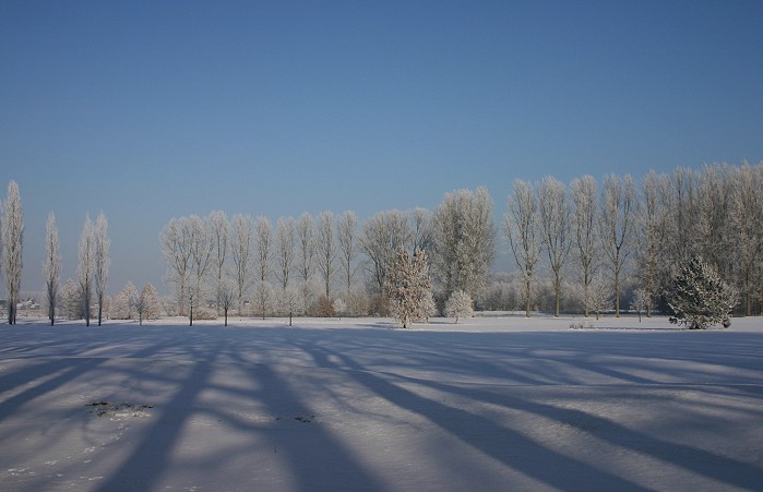
09/01/09 1132. Play of light & shadow.
|
 |
|
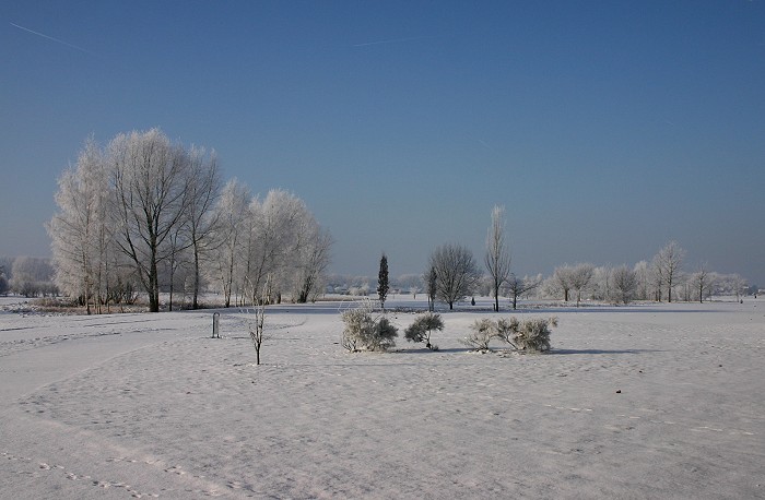
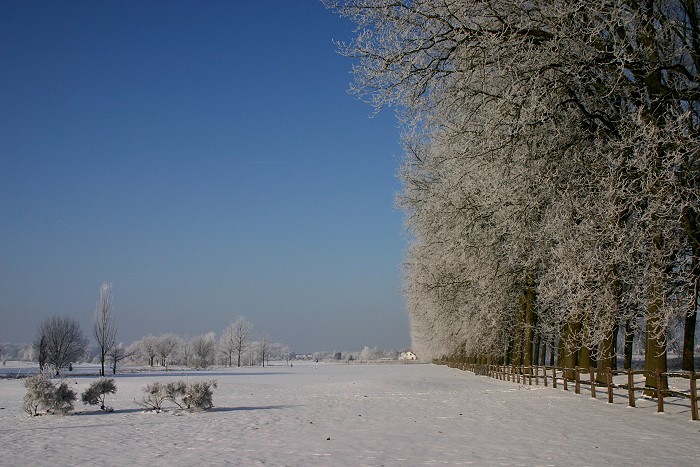
09/01/09 1134. Snow and rime.
|
 |
|
09/01/09 1134. Same comment.
|
 |
|
09/01/09 1156. "Het Kanaal" between Mechelen and Leuven, not
frozen yet.
|
 |
|
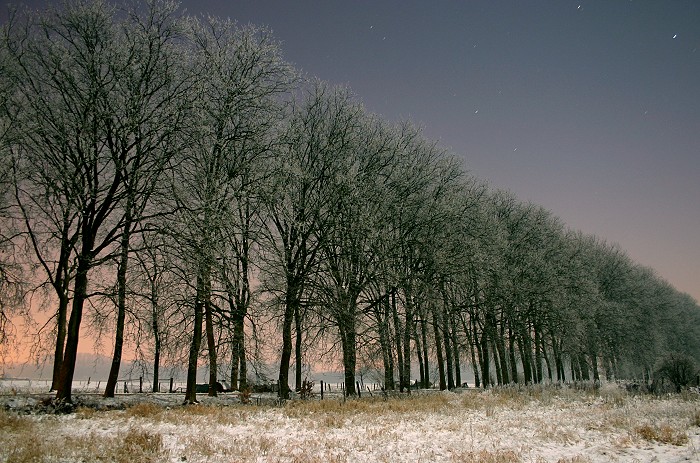
09/01/09 2340. Under an almost full Moon, a long exposure shot of "Den Dreef".
The temperature was -13°C.
|
 |
|
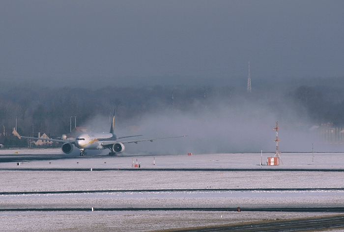
11/01/09 1122. At Steenokkerzeel. An alternative and cheap way of
cleaning a runway: a departing aircraft.
|
 |
|
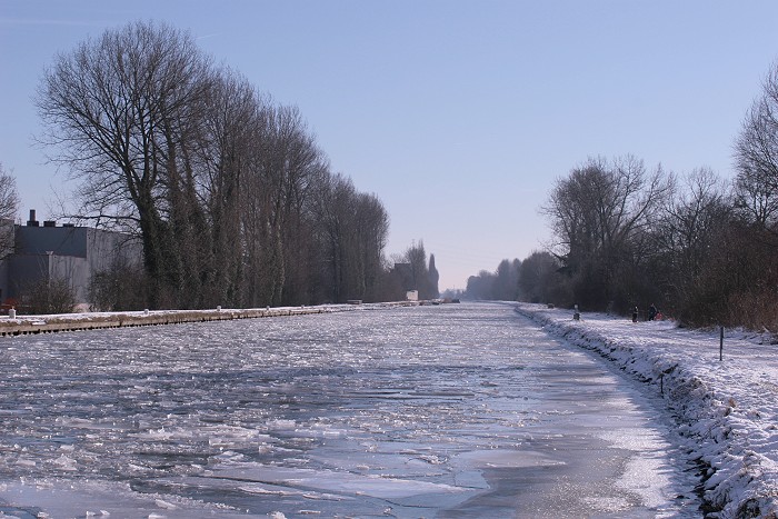
11/01/09 1249. At Kampenhout: after a couple of days, "Het Kanaal" showed more signs of
being almost frozen. Even an ice breaker had gone trough, however this was the last day of very cold
temperatures.
|
 |
|
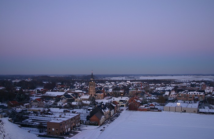
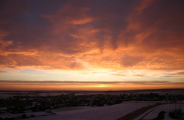
12/01/09 0835 SE. Again at Steenokkerzeel: the next day, after a magnificent sunrise, it was all
over.
|