| Weather pictures & report of August 12 2008 |
| Splitting-cell thunderstorms deviating in right moving mini-supercells. |
| Synopsis: at 500 hPa between a cut-off low over the British Isles and a ridge over eastern Europe, the Low Countries in a strong SW'ly airflow of potentially unstable air. During the afternoon, just behind a waving frontal system and just ahead of a trough line, instability was enhanced due to diurnal heating. Several isolated cells were formed and they did splits into dissipating left movers and dominant right movers which showed characteristics of mini-supercells, but with non-severe thunderstorm activity. Pics taken at Steenokkerzeel (last one at Kampenhout) in local time (CET). |
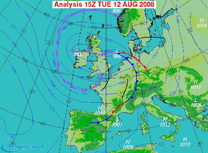 |
| Surface analysis at 1700 CET. Belgium is situated behind the cold front
and ahead of an incoming troughline.
(Source chart: Belgocontrol)
|
 |
|
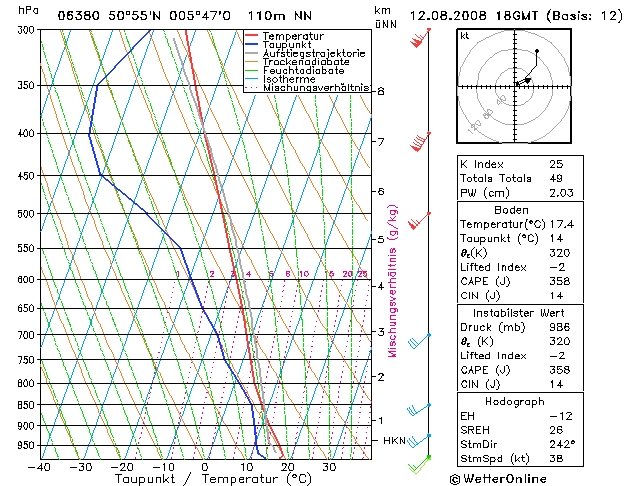
Forecasted sounding of Maastricht at 2000 CET. This was the best representative sounding to describe
the vertical profile: an unstable layer starting from an altitude of
around 1300 m (= 875 hPa), reaching up to around 7 km (= 400 hPa). The shear and CAPE would suggest the formation
of multi-cell thunderstorms. In this case the deep
layer shear (0-6 km) was >35 kt and almost unidirectional, so there was also an
increased risk for splitting storms with deviated supercells. (Source sounding: wetteronline).
|
 |
|
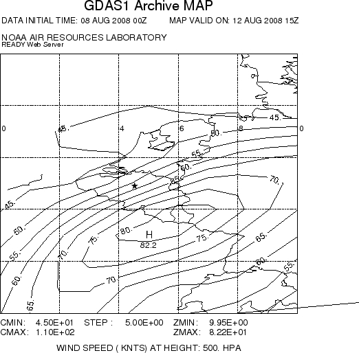
Forecasted windspeed map (in kt) of 500 hPa at 1700 CET to get a better
overview on the deep layer shear. Windspeed at surface was around 10 kt, so
the deep layer shear was the strongest over SE Belgium with 70 kt.
However over there, due to the dry upper air, no showers were formed. In
the center of Belgium some showers did occur and the deep layer shear was
around 50 kt. According theoretical models initial cells could splits
into a pair, evolving to supercells or not. Later during the evening the
windspeed at 500 hPa decreased by 10 to 20 kt, so theoreticly only
multi-cells would be possible. (Source map: NOAA web server).
|
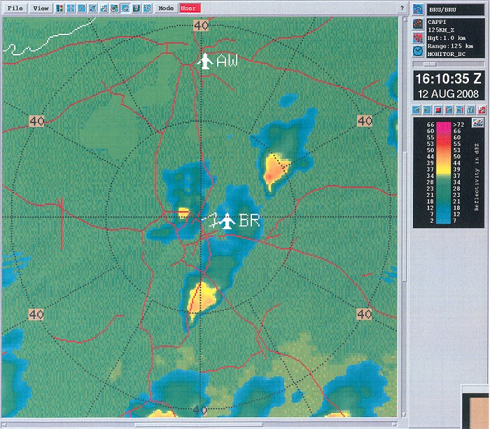
Radar sequence between 1700-2150 CET. My location was near "BR". The first hours some isolated cells were formed, most of them started to split in a pair with dominant right movers and this could be a first sign of the occurence of supercells. The two right moving cells with an arrow are described in detail below. Later in the period the trough line passed by with some multi-cells. Precipitation tops were maximum 8 km. (Source radar picture: Belgocontrol)
|
 |
|
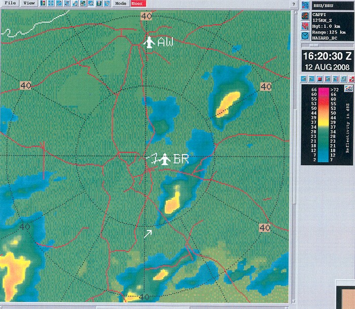
Radar picture (intensity in dBZ) taken at 1810 CET. My location near
"BR". The radar picture shows three cells of which two have a distinct
hook echo, another typical characteristic of a supercell. The cells just south and just west of "BR" was
original one cell which splitted.
(Source radar picture: Belgocontrol)
|
 |
|
Radar picture (intensity in dBZ) taken at 1820 CET.
My location near "BR". A closer look at the pointed cell which
was a so-called "right mover" with a slightly deviated course to the
right comparing with the mean winds. Calculations showed that the main
steering wind (between 0-6 km) was around 230°, but the cell moved
245°. (Source radar picture: Belgocontrol)
|
 |
|
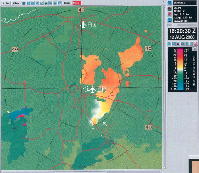
Radar picture (velocity in m/s) taken at 1820 CET.
My location near "BR". The same cell with in the SE quadrant briefly a weak mesocyclone,
so this would be a third characteristic of a potential supercell. Also the
upcoming cell in the SW corner of this pictures began to split and the
right mover showed
a bit later the same characteristics in the velocity spectrum. (Source radar picture: Belgocontrol)
|
 |
|
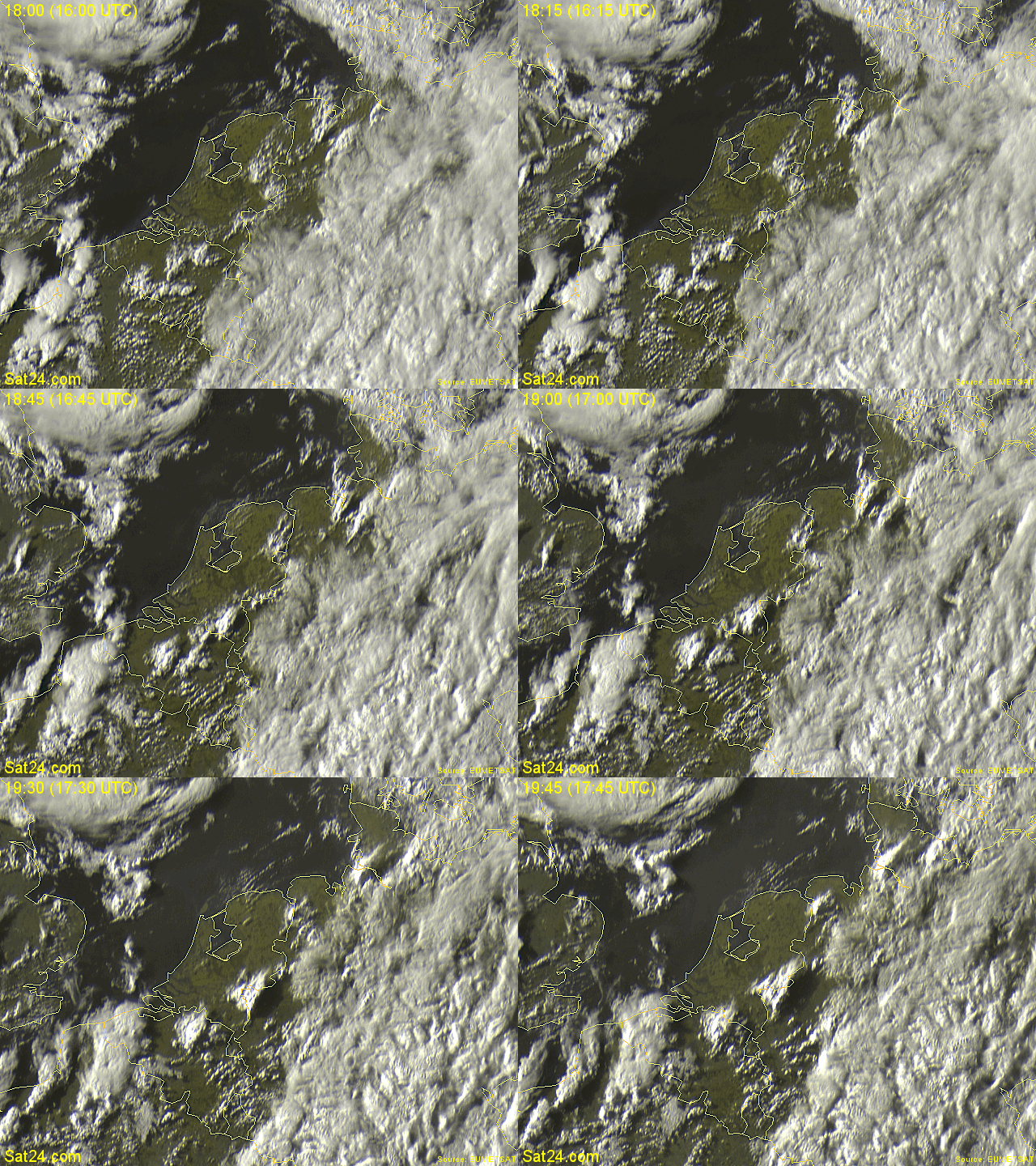
12/08/2008 0615-0800 CET.
My location in the center of Belgium. The picture in the visible
spectrum shows in the center of Belgium some isolated cells with long
anvils, a typical sign of strong upper winds. More to the
SW, Cb cloudiness of the upcoming trough.
(Source sat picture: Eumetsat via Sat24.com)
|
 |
|
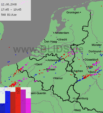
12/08/2008 1745-1945 CET. My location near "Brüssel". Cloud-to-ground discharges over a two
hour period with some thin trails. (Source picture: Blids)
|
 |
|
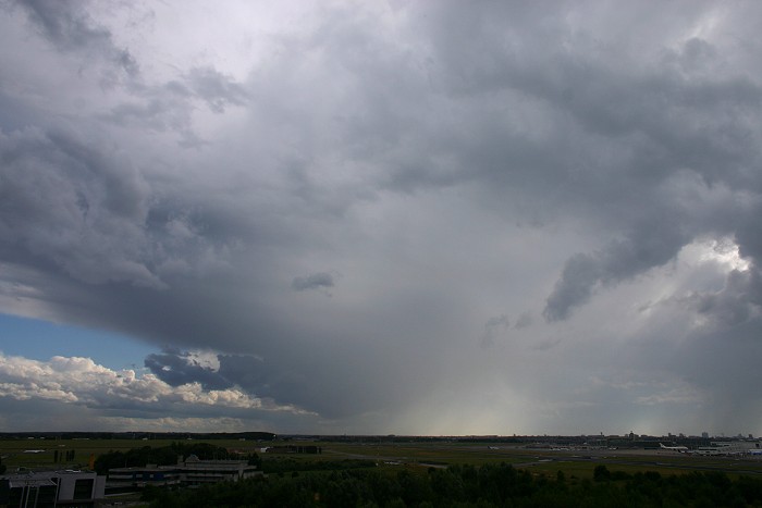
12/08/2008 1801 SSW.
Incoming shower, the one that is pointed on the radar
picture of 1820 CET.
|
12/08/2008 1817-1834 S-SE. Motion picture of 15 minutes shortened to a time-lapse of 14 seconds showing the dynamics of this small right moving cell which seems to have a clockwise (anti-cyclonic) rotatory potential in the updraft. This seems in contradiction with the theory that right-movers are supposed to rotate anti-clockwise (cyclonic). Most probable the time-lapse gives a wrong impression due to the bad angle and above all this cell was decaying.
|
 |
|
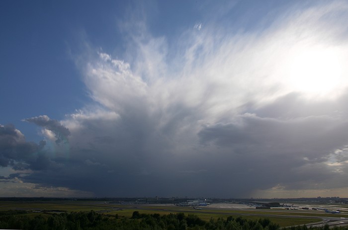
12/08/2008 1836 SW. Approaching anvil of a "slightly" bigger cell.
It is
pointed with an arrow as second one on the motion radar images.
|
 |
|
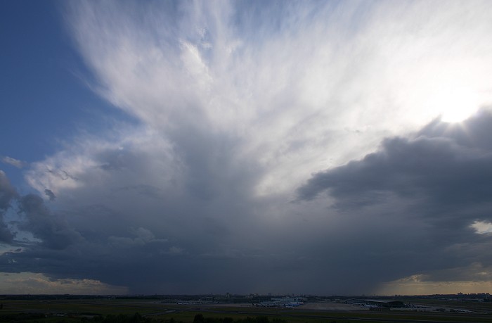
12/08/2008 1839 SW. Bit later.
|
 |
|
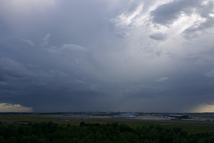
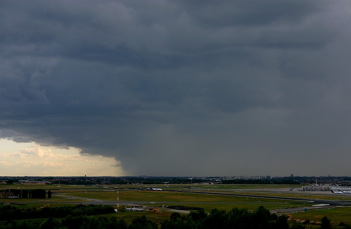
12/08/2008 1843 SW. A couple of moments later, in the middle first signs
of the splitting process.
|
 |
|
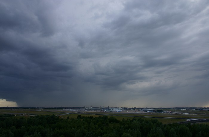
12/08/2008 1850 SSW. A closer look at the southern edge with strong rain
shaft.
|
 |
|
12/08/2008 1850 SW. Splitting proces continues.
|
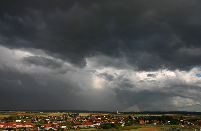
| 12/08/2008 1854-1903 SSW.
Motion picture of 9 minutes shortened to a
time-lapse of 8 seconds showing the approach of the right moving cell. A couple CG strikes did occur but none
were captured on sensor. With some goodwill, just ahead of the strong
rain shaft on the left side, a weak mesocyclone (this time cyclonic !) could be
recognized.
|
 |
|
12/08/2008 1924 SE. Back-side with lots of low clouds making it
impossible to have a good view on an eventually rotating updraft.
|
 |
|
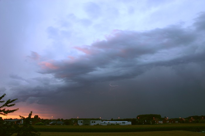
12/08/2008 2106 N. Later on, the showers belonging to the trough
produced some lightning, exactly one weak one was captured on the
sensor.
|