| Weather pictures & report of July 27 2008 |
| Multi-cell thunderstorms along thermal troughline. |
| Synopsis: at 500 hPa a long wave trough over the Atlantic and a ridge over Central-Europe extending towards Scandinavia. The Low Countries in a weak airflow from the SE in which a thermal trough was present. Initially it was to be found over the extreme western parts of Germany, but later during the late evening it entered large parts of Belgium, with main activity over the north and east. Along this line an exploding thunderstorm was formed, at giving at some locations in provinces Limbourg and Antwerp damaging effects like microbursts and flooding. At my location, a rather small cell with moderate lightning activity passed overhead, later the exploding cell over NE Belgium gave continuous lightning for almost two hours.All pics taken at Kampenhout in local time (CET). |
 |
|
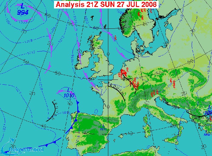
Surface analysis at 2300 CET. The thermal trough over NE Belgium.
(Source chart: Belgocontrol)
|
 |
|
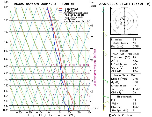
Forecasted sounding of Maastricht at 2300 CET. An unstable and moist
profile in which the shear and CAPE would suggest the formation of
multi-cell thunderstorms with a high cloudbase of around 6000 ft.
Checking the indices these storms would have a coverage of scattered to
numerous. (Source picture: WeerOnline)
|
Radar sequence between 2100-0140 CET. My location was near "BR". Some precipitation tops went up to 16 km. (Source radar picture: Belgocontrol)
|
 |
|
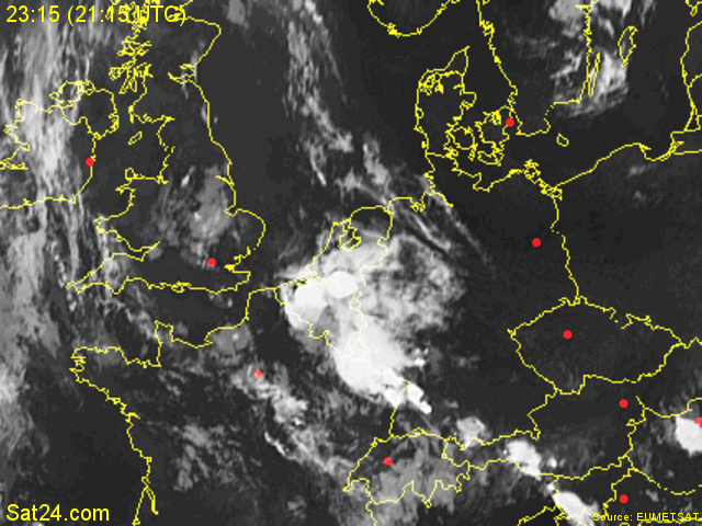
27/07/2008 2315-0100 CET. My location in the center of Belgium, near the
red dot. The exploding cell in northern Belgium is quite obvious.
(Source sat picture: Eumetsat via Sat24.com)
|
 |
|
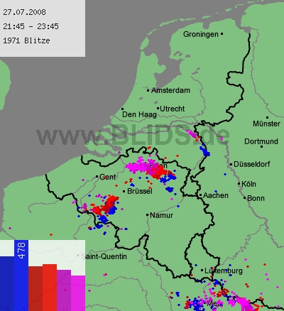
27/07/2008 2145-2345 CET. Lightning sequence of a two hour period. Main
lightning did occur over northern parts, with also a weaker cell over
the south. Source picture: Blids.
|
 |
|
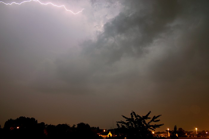
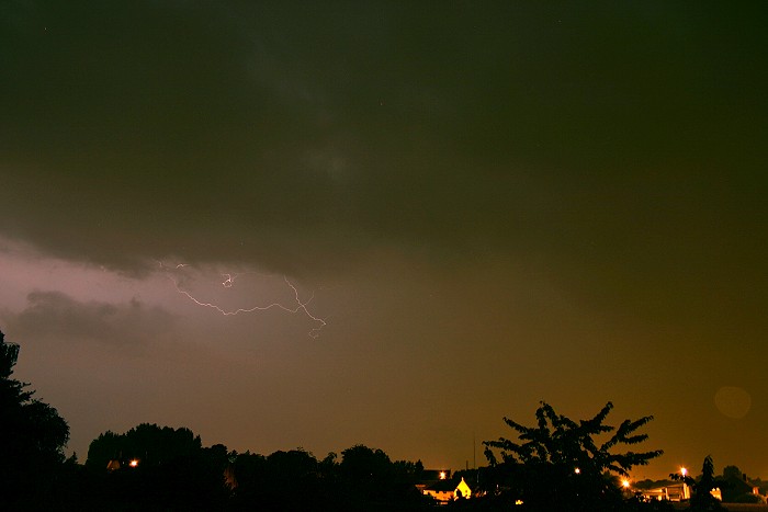
27/07/2008 2242 NW. Passage of the rather small cell which was relative
active concerning lightning rate with each five seconds or so a discharge.
Beside one bold CG strike which had its impact less then one km away (so
way overexposed), lightning was limited to cloud-to-cloud, cloud-to-air or
intra-cloud. Here and below some examples of the first two types.
|
 |
|
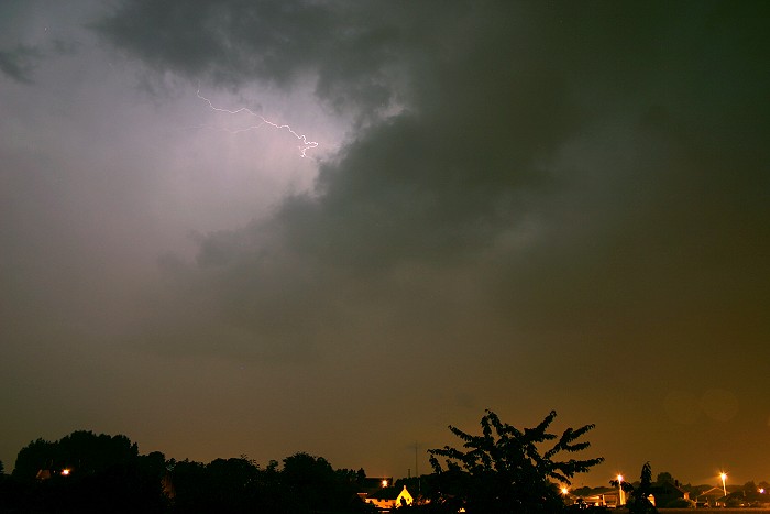
27/07/2008 2244 NW.
|
 |
|
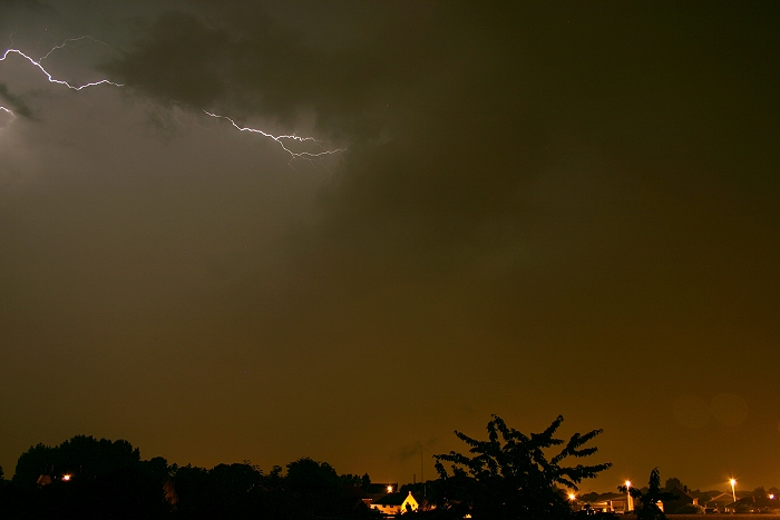
27/07/2008 2245 NW.
|
 |
|
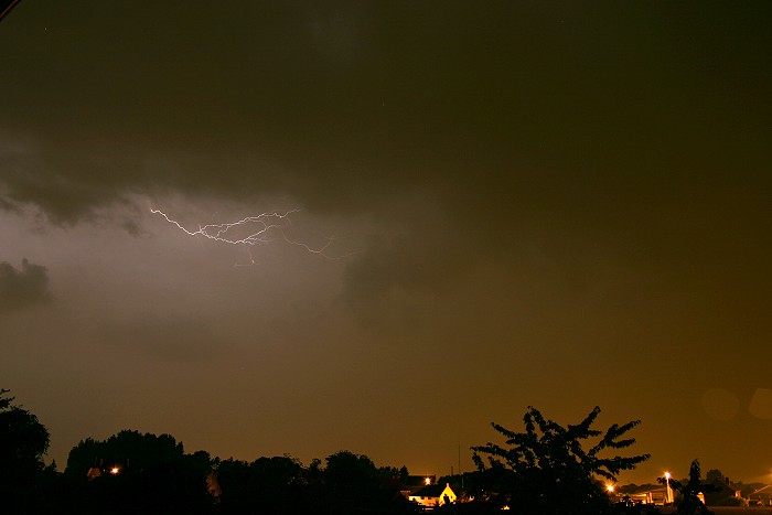
27/07/2008 2249 NW.
|
 |
|
27/07/2008 2252 NW.
|
27/07/2008 2322-2346 NE. Motion picture of 22 minutes shortened to a time-lapse of 12 seconds. The cell over NE Belgium was very active concerning rate of lightning. Every second or so I could count a discharge, but also here all intra-cloud, cloud-to-air or cloud-to-cloud ones. |