| Weather pictures & report of June 2 2008 |
| Multi-cell thunderstorms along convergence line and cold front. |
| Synopsis: at 500 hPa a relaxing upper trough SW of the Low Countries and a ridge over Central Europe with extension towards Scandinavia. In between over the South of the Low Countries potentially deep unstable air. In this airmass convection was triggered by: the orography of the Ardennes, diurnal heating, and a convergence line ahead of an upcoming cold front. Thus from noon on exploding multi-cell thunderstorms were formed along the convergence line over the Ardennes, moving slowly NW-wards. At a later stage the cold front amalgamated with the convergence line giving a broad zone of thunderstorms. These storms were at some locations quite severe: large hail with a diameter of a couple of cm was observed, the entire amount of discharges was 93.183 (of which 36.573 cloud-to-ground strikes) and flash flooding did occur in several places. Officially Diest (NE of province Vlaams-Brabant) had the honor of receiving more than 80 mm. At my location: late afternoon a first burst (moderate thunderstorm with tempo some heavy rain) gave 17 mm, between 2000-2300 more (weak thundery) showers passed by leaving another 11 mm. Cloudiness was not that interesting as below the broad anvil rather boring grey skies turned up, however a couple of nice discharges were captured. All pics taken at Kampenhout in local time (CET). |
 |
|
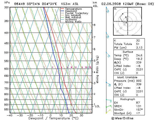
Forecasted sounding of Charleroi at 1400 CET. A very unstable and moist
profile in which the shear and CAPE would suggest the formation of
multi-cell thunderstorms with a cloudbase of around 3000 ft. Checking
the indices these storms would have a coverage of scattered to numerous.
(Source picture: WeerOnline)
|
 |
|
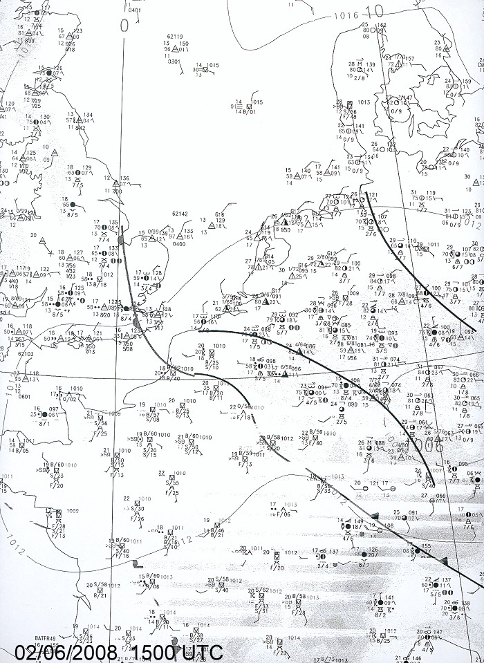
Mean sea level pressure chart of Western Europe at 1700 CET: the black
solid line over southern Belgium held the convergence line, just south
of it the coldfront. Both moved slowly northwestwards, clearing the
postfrontal humid (dewpoints around 17°C) and very warm (temperature
around 29°C) air.
(Source picture: Belgocontrol)
|
Radar sequence between 1330-2120 CET. My location was near "BR". Precipitation tops went up to 17 km. North of the massive thunderstorm a few isolated showers were formed with a slightly deviated course and below a couple pictures can be found. (Source radar picture: Belgocontrol)
|
Satellite sequence between 1345-1915 CET. My location in the center of Belgium. The exploding thunderstorms (with overshooting tops of 17 km) on a NW-SE orientated convergence line over the Ardennes moved slowly NW-wards. (Source sat picture: Eumetsat via Sat24.com)
|
Lightning sequence (CG only) between 1400-2115 CET. My location = "Brussel". (Source lightning picture: Blids)
|
 |
|
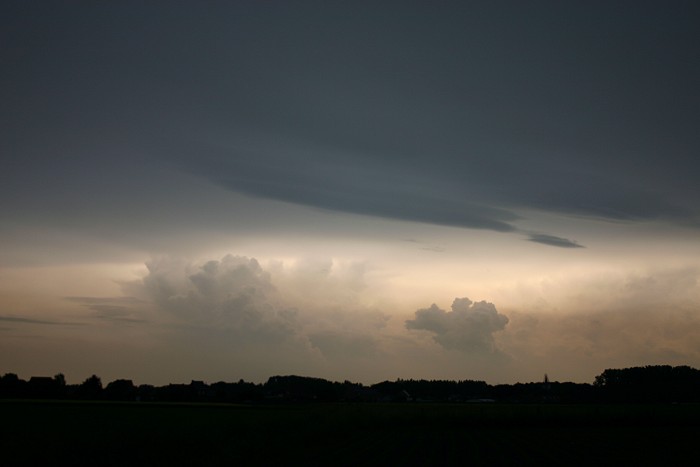
02/06/2008 1717 NNE. The enormous anvil showed besides some weak mamma features not much exciting things. On the north of it a few isolated showers boiled up.
|
 |
|
02/06/2008 1718 NE. Bit further to the east.
|
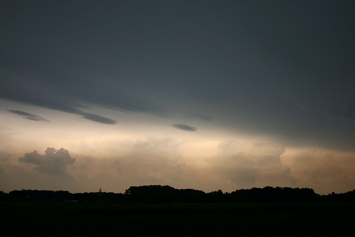
02/06/08 1727-1744 NNE. Motion picture (time-lapse) showing the showers in the far distance. A bit closer, some Ac lenticularis at the edge of the massive thunderstorm which approached from the SE and darkening the entire sky.
|
 |
|
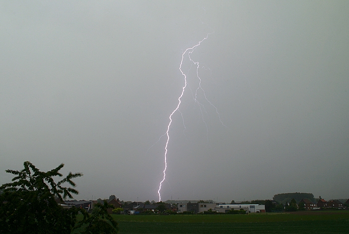
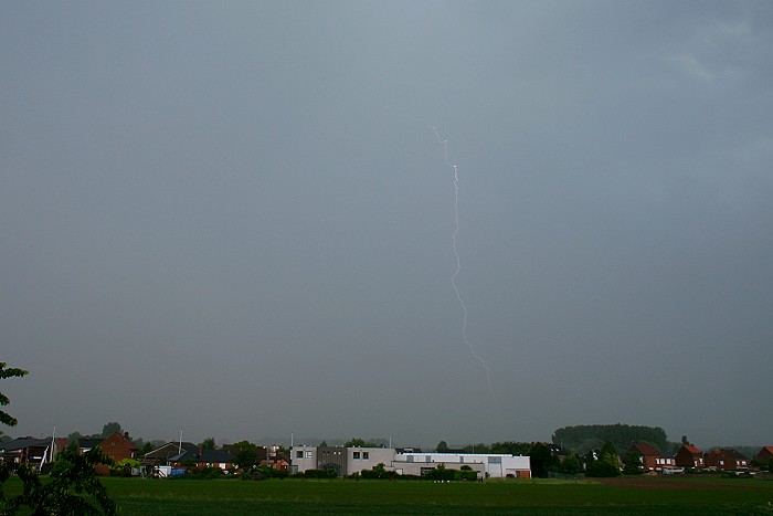
02/06/2008 1818 N. Light circumstances for lightning photography were far
from ideal due to the rather "overwhelming bright" daylight conditions. However a few shots
(of more than hundred lightning I saw) came out on my cams sensor, starting with
this bright forked cloud-to-ground (CG) strike.
|
 |
|
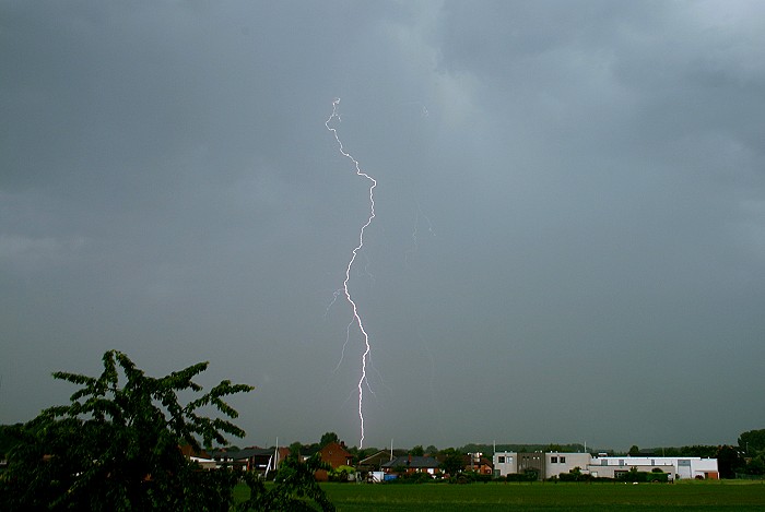
02/06/2008 1819 N. Due to precipitation a fainter CG.
|
 |
|
02/06/2008 1839 N. The massive storm moved on, hence lightning became
weaker.
|
 |
|
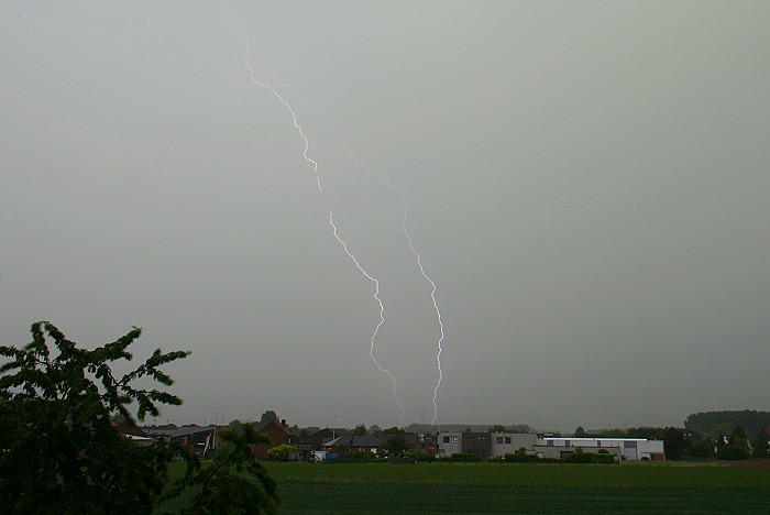
02/06/2008 2102 N. Some luck came by, as on its southeastern edge some smaller cells were born, giving the opportunity to make more
lightning pictures. Light conditions slowly improved, but still more
than half an hour before sunset.
|
 |
|
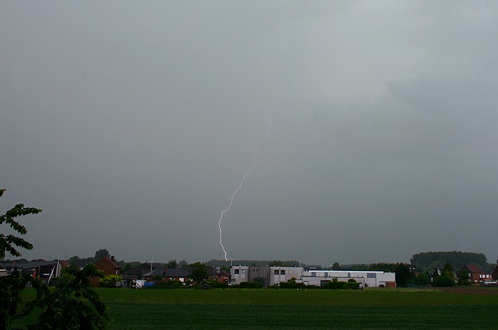
02/06/2008 2104 N. Due to the sometimes heavy precipitation, a rather
faint CG.
|
 |
|
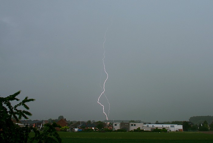
02/06/2008 2108 N. Nicely single forked CG .
|
 |
|
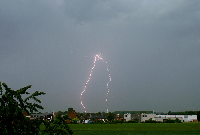
02/06/2008 2112 N. Final salute with a kind of dancing monster on long
legs.
|