| Weather pictures & report of May 13 2007 |
| Multi-cell thunderstorms (squall-line) along convergence line |
| Synopsis: advection of potentially unstable air from SW. Warm front crossed Belgium in early afternoon, later followed by cold front with just ahead a convergence line. At surface windspeed was 5-10 kt, at 500 hPa approaching 60 kt, so deep layer shear was around 50-55 kt with formation of several multi-cell thunderstorm evolving to a squall-line of the "leading stratiform" type. Some cells contained severe thunderstorm features like large hail or severe gusts. Below are some pictures during a brief encounter with one of these cells near Brussels. All pics taken at Steenokkerzeel in local time (CET). |
|
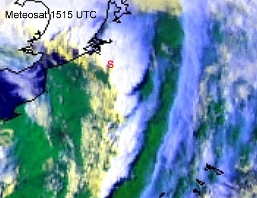
Satellite picture (RGB) of 13/05/2007 taken at 1715 CET. Multi-cell thunderstorms in form of squall-line over northern France & Belgium. Note the small gap near my location at the red "S", enough to make an interesting time lapse of the SE-ern edge of this cell. (Source satpicture: Meteosat and Spacetec)
|
Radar sequence between 1600-1830 CET. My location was near "BR". Multi-cell thunderstorm moving NE with speed of 50KT and precipitation tops up to 12 km. It also reveals a weaker precipitation belt far ahead of the main line with bright echo's, thus also called a leading stratiform squall-line. The severe cell in the extreme SE quadrant of this picture produced golf size hail stones at Monceau en Ardenne (Bièvre) in province Namur (Source radar picture: Belgocontrol)
|
|
|
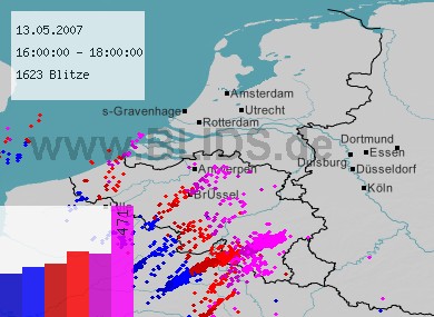
13/05/2007 1600-1800 CET. Lightning sequence of a two hour period with a handful active thunderstorms on the squall-line. Source picture: Blids.
|
|
|
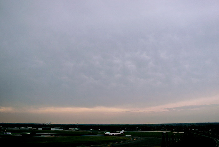
13/05/2007 1648 NW. Due to the strong upper winds, lots of high and medium level cloudiness was pushed forwards ahead of the main part of the storm. Some weak mamma features can be recognized.
|
|
|
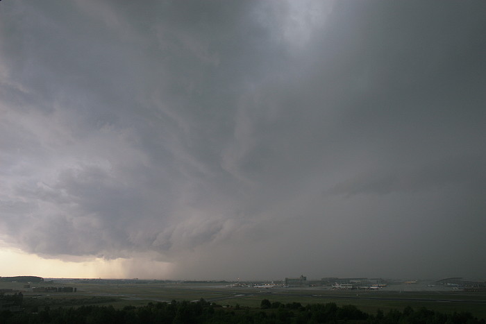
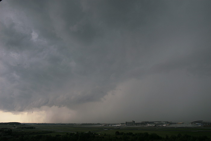
13/05/2007 1722 SW. After some weak precipitation, a more active part was approaching with just ahead formation of an arcus.
|
 |
|
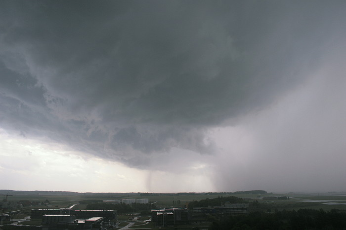
13/05/2007 1724 SW. Approaching.
|
|
|
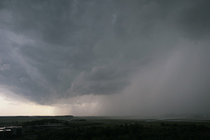
13/05/2007 1726 SW. Parts of airport becomes invisible due to strong rain shaft.
|
 |
|
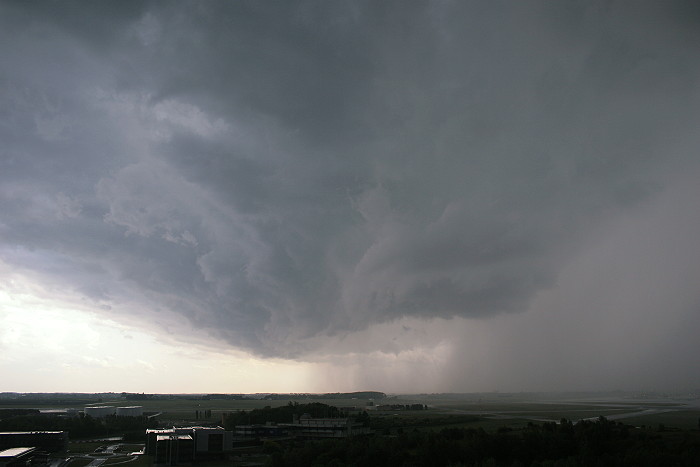
13/05/2007 1726 SW. Arcus is almost overhead.
|
|
|
13/05/2007 1729 SSW. Seconds later wind speed picked up from a few knots to 43 knot (micro burst) and veered from SE to W. Heavy rain came down with at the rear of the shower also some hail stones with diameter between 0,5-1 cm
|
|
13/05/2007 1720-1727 SW. Motion picture of pre-thunder zone weather elements of 7 minutes captured in time lapse of 7 seconds: rolling cloudiness (arcus), rain shaft pushed forwards by blustery winds (microburst). Below the METAR & SPECI reports for Steenokkerzeel 1717-1750 CET: wind speed finally peaked to 43KT. SPECI EBBR 131517Z 12004KT 090V160 9999 -TSRA SCT028CB
19/15 Q0999 TEMPO 20020G38KT 4000 TSRAGR BKN020CB=
|
|
|
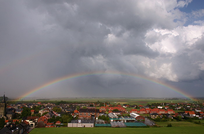
13/05/2007 1737 E. Backside of squall-line with last rain falling and nice low rainbow.
|
|
|
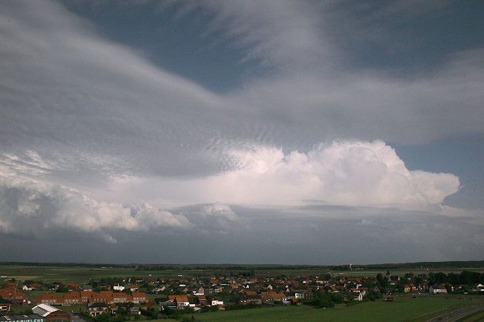
13/05/2007 1747 NW. Further towering Cumulus on SE quadrant of squall-line.
|
|
13/05/2007 1741-1749 E. Motion picture of post thunder zone weather elements of 8 minutes captured in time lapse of 8 seconds: still some rolling low cloudiness and the play of sun and shadow, but lots of invading stratiform cloudiness spoiled a real nice view. |