| Weather pictures & report of August 29 2006 |
| Multi-cell thunderstorms in unstable airmass |
| Synopsis: advection of potentially unstable air from WNW. Cold upper air, with at 500 hPa around -24°C and the closeness of a left exit region of the jet caused easy development of showers. The thunderstorms were mostly multi-cells on a line. Some of them were quite severe with heavy bursts of rain, hail up to 1 cm and around 1300 at Tubize even a brief touchdown of a weak tornado. All pics taken at Kampenhout in local time (CET). |

|
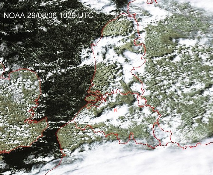
Satellite picture at 1229 CET. Multi-cell thunderstorms over central Belgium. My location was at the red "K". (Source satpicture: NOAA and University of Bern)
|
Radar sequence between 1200-1350 CET. My location was near "BR". Multi-cell thunderstorm on a line moving ESE with tops of around 7 km. (Source radar picture: Belgocontrol)
|
|
|
|
29/08/2006 1205. The passage of a moderate thunderstorm was for moments accompanied with heavy rain and hail of around 0,5 cm diameter. A total of 21 mm within 45 minutes was collected.
|
|
29/08/2006 1348-1357 SW. The line of showers trailed quite long over the
south. It produced frequently mammatus features.
|
|
|
|
29/08/2006 1621 WSW. More mamma.
|
|
|
|
29/08/2006 1626 SW. And once more mammamia.
|

|
|
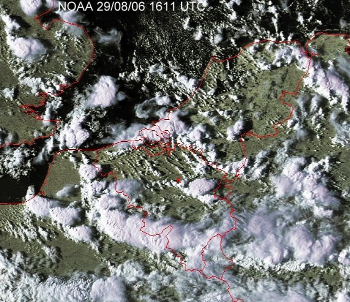
Satellite picture at 1811 CET. Multi-cell thunderstorms over the Benelux. My location was at the red "K". Check with the three pictures below. (Source satpicture: NOAA and University of Bern)
|
|
|
|
29/08/2006 1759 SW. A strange looking Cumulus cloud, resembling to a
corkscrew.
|
|
|
|
29/08/2006 1807 ESE. Bit later, on the right side a nice updraft still with corkscrew, on the left a slowly decaying Cb capillatus.
|
|
|
|
29/08/2006 1812 E. A view of the decaying Cb, the Cumulus gave a nice shadow on the downside part of the Cb.
|
|
|
|
29/08/2006 1953 NW. Towards sunset still some updraft activity: in front a developing Cumulus congestus, on the right of it and in the back a mature Cb capillatus with praecipitatio trails. This Cb produced a bit later some rumbles of thunder as well.
|
|
|
|
29/08/2006 2014 E. The narrow band of Cumulus passed overhead and began to produce some precipitation which gave over the east some nice twilight moments.
|
|
|
|
29/08/2006 2015 E. Another shot of a quite spectacular sight. Previous shots were two vertically stitched pictures.
|
|
|
|
29/08/2006 2017 ESE. Intensifying precipitation illuminated by a setting sun.
|
|
|
|
29/08/2006 2032 SE. A nice pair: on the right a rising cumulus, on the left a Cb calvus bringing down its rain.
|
|
29/08/2006 2032-2037 SE. A motion picture of the pair, clearing my area with setting sun. When sun was gone, the Cumulus collapsed as well.
|