| Weather pictures & report of July 22 2006 |
| MCS thunderstorms along thermal convergence lines. |
| Synopsis: advection of deep unstable air from SW on which a couple of thermal convergence lines passed Belgium: the first one in the forenoon with the most active part over eastern Belgium, the second one during the evening with most activity over SW and central parts. On the latter system some severe multi-cell thunderstorms (MCS) developed and produced at some locations (including my observation point) a magnificent shelf cloud + whale's mouth. Lightning intensity within the clouds was huge, rain and wind were most of the time modest, but at some isolated spots in Belgium the rain turned out to be severe. All pics taken at Kampenhout in local time (CET). |
|
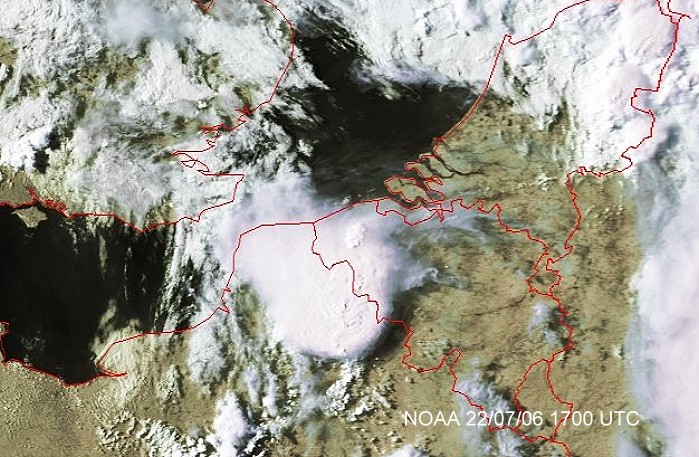
Satellite picture at 1900 CET. Developing multi-cell thunderstorm over NW France with huge Cirrus shield. (Source satpicture: NOAA and University of Bern)
|
|
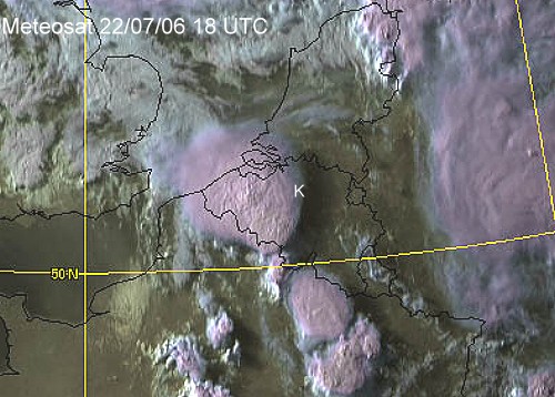
Satellite picture at 2000 CET. Further multi-cell development on an SE-NW orientated thermal convergence line slowly moving NE-wards. The one over western Belgium approached my observation point, called "K". (Source satpicture: NOAA and Wokingham Weather)
|
Radar sequence between 1950-2340 CET. My location was near "BR", and the thunderstorm had tops up to 14 km. Compare with the pictures below. (Source radar picture: Belgocontrol)
|
|
|
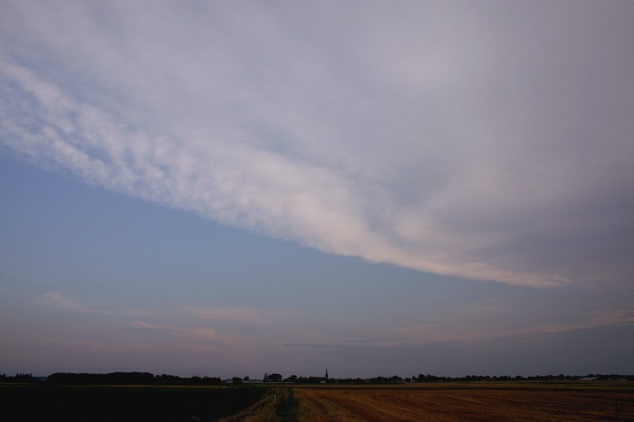
22/07/2006 2032 S. Incoming Cirrostratus and Altostratus of the Cb anvil.
|
 |
|
22/07/2006 2100 S. Below temporary some Altocumulus castellanus as well.
|
|
|
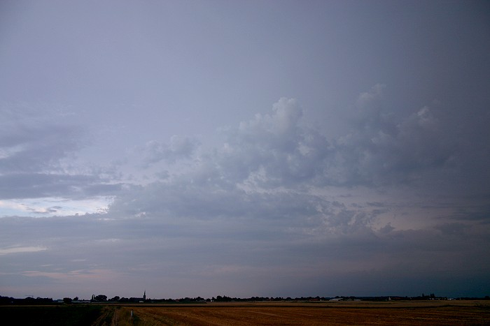
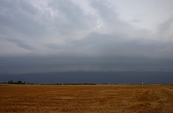
22/07/2006 2107 WSW. At some distance the first signs of an incoming shelf, adrenaline started to rise.
|
|
22/07/2006 2116-2119 WSW. Animation of 26 pictures of the approaching shelf.
|
|
|
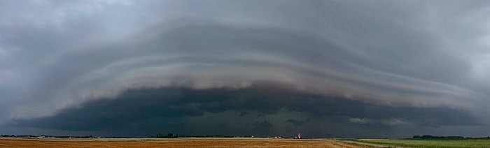
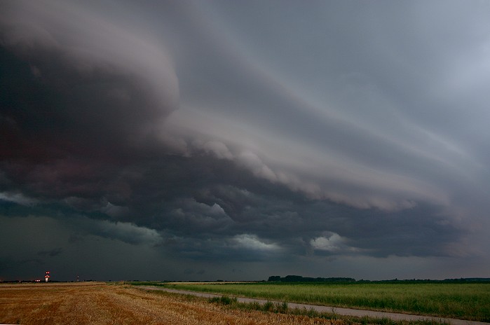
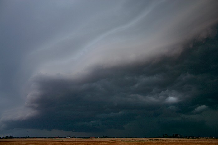
22/07/2006 2122 WSW. Horizontal panorama of 3 pictures, giving an impression of its length.
|
 |
|
22/07/2006 2123 W. Detail of northern side of the shelf. On the bottom
left: the control tower at Steenokkerzeel
|
|
|
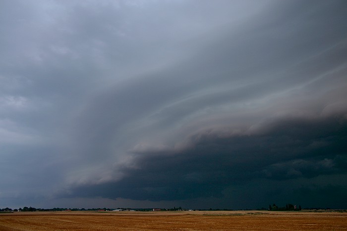
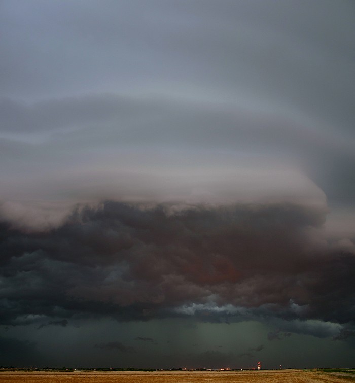
22/07/2006 2123 SSW. Southern edge.
|
 |
|
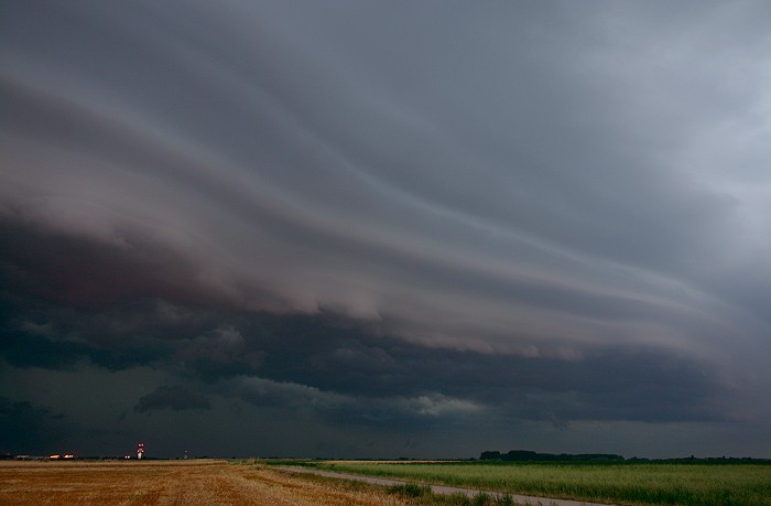
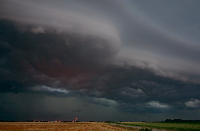
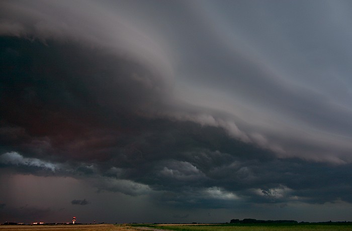
22/07/2006 2124 WSW. Central part with whale's mouth and "scud"
clouds.
|
|
|
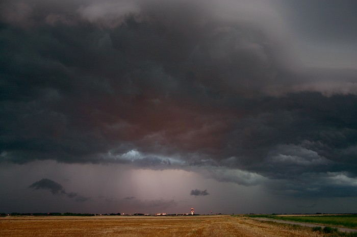
22/07/2006 2124 WSW. Vertical panorama of two pictures. Rain shaft was continuous brightened up by lightning. Below the clouds, in a further darkening sky, a red shine starts to appear which was created by the airports lights.
|
 |
|
22/07/2006 2125 W. Another inspection of the northern
side.
|
|
|
22/07/2006 2125 W. Bit further W-wards, 6 seconds later.
|
 |
|
22/07/2006 2125 SSW. Southern edge.
|
|
|
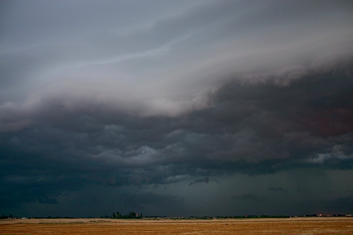
22/07/2006 2125 W. Northern edge another 30 seconds later.
|
|
|
22/07/2006 2126 WSW. Central part: in this shot the rain curtain was once more brightened up by flashes of lightning and accentuated the contrast with the dark and fast moving scud clouds just ahead. A roaring noise of thunder and wind came closer, seconds later these wind picked up to gusty proportions of around 30KT and a few large raindrops fell down, sign to seek shelter.
|
 |
|
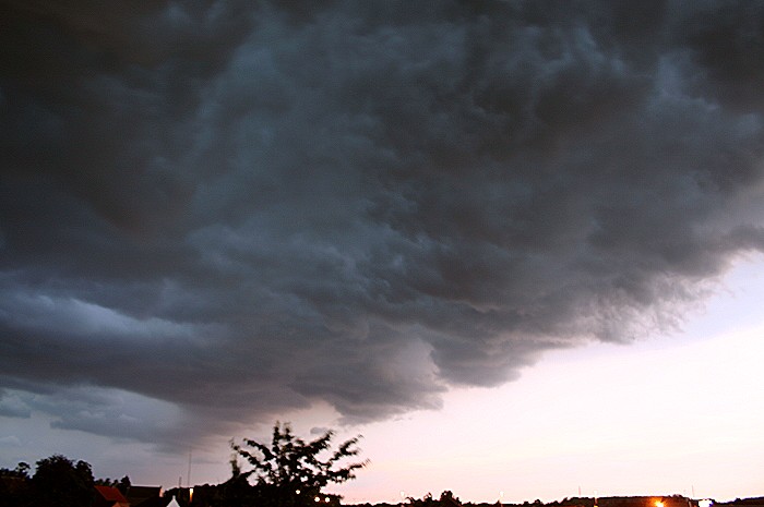
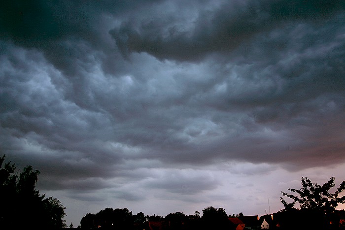
22/07/2006 2135 NNW. Whale's mouth passing the zenith with gusty
winds.
|
|
|
22/07/2006 2139 W. Boiling cloudiness, soon moderate rain came down.
|
 |
|
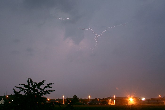
22/07/2006 2208 N. Only one shot of a lightning flash was captured, the rest
was behind the rain curtain or too high in the sky. After the rain eased
off, lightning activity ended too.
|