| Weather pictures & report of June 3 2005 |
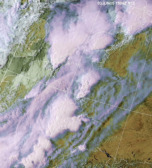
| Multicell thunderstorms with bow echo on convergence line & upper cold front. |
| Synopsis: advection of deep unstable air from SW. During the day thunderstorms developed on incoming prefrontal convergence line & upper cold front from W. Over eastern and western parts of Belgium severe thunderstorms, including a bow echo, developed. My area escaped from the real firework: only one thunder was heard and 2 mm of rain was collected. All pics taken at Kampenhout in CET. |

|
Satellite picture taken at 17:24 CET. Over east Benelux & France several MCS thunderstorms on convergence line. Over the west of Belgium a multi-cell thunderstorm with bow echo on an upper cold front. The surface cold front with smaller showers can be seen over the U.K. (Source: Wokingham weather)
|
| Radar sequence between 1615-1900 CET. Bow echo
over West Belgium, with precipitation tops = 16km, but fading when
moving eastwards (Source:
Belgocontrol)
|
|
18:15 NW. A row of TCu & Cb clouds in the distance.
|
|
18:17 N. Sometimes pileus & velum features were briefly visible, in this case a velum in the middle of the pic.
|
|
18:44 W. Straight falls of precipitation beneath the thunderclouds.
|
|
18:49 W. Fading Cb anvil in Cs cloudiness. The sun came out briefly, but
within half an hour the showery system passed my area with lots of non
photogenic low clouds and one "bang".
|